Browse Items (1442 total)
- Tags: aerial photograph
Sort by:
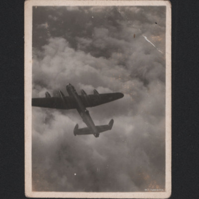
Lancaster in the Air
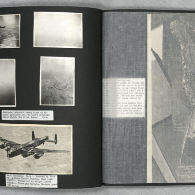
Photo 1 is a side view of a Lancaster flying above clouds.
Photo 2 and 3 are predicted anti-aircraft fire explosions.
Photo 4 is an oblique image of the Rhine.
Photo 5 is the port side of Lancaster VN-N viewed from slightly above and to the front.
Photo 2 and 3 are predicted anti-aircraft fire explosions.
Photo 4 is an oblique image of the Rhine.
Photo 5 is the port side of Lancaster VN-N viewed from slightly above and to the front.
Lancaster over Lincoln
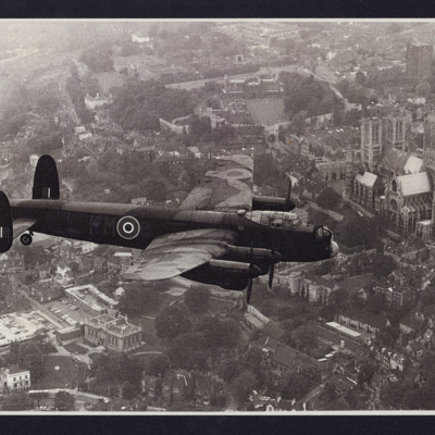
Air to air view of Lancaster PM-R. In the background Lincoln Cathedral, Lincoln Castle and Bailgate area.
Tags: 103 Squadron; aerial photograph; Lancaster
Lancaster over RAF St Mawgan
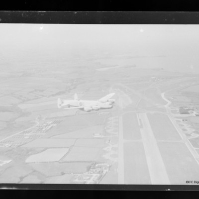
Air-to-air view of Lancaster TL-B in light paint scheme flying right over an airfield with runway running from middle right to bottom.
Lancaster over river Tamar estuary
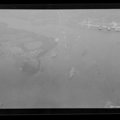
Air-to-air view of Lancaster flying over river Tamar estuary, south of Saltash looking west up the Lynher river. Several ships below.
Tags: aerial photograph; Lancaster
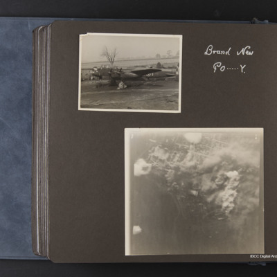
Lancaster PO-Y
Lancaster PO-Y captioned 'Brand new PO-Y' is parked on taxiway on edge of airfield, wheel covers on, chocks in. Second item is a target photograph with identifying information removed.
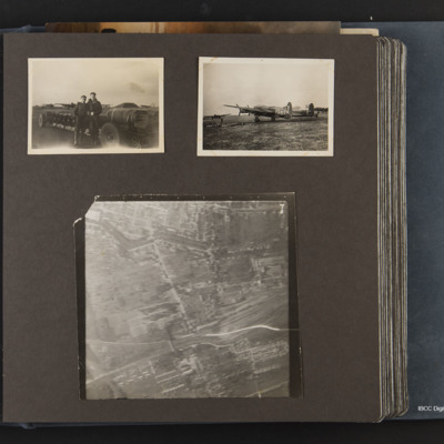
Lancaster PO-Y and bombs
Three photographs, one shows a loaded bomb trolley with two ground personnel with four dispersed Lancasters in background. Second shows Lancaster PO-Y on it's dispersal, row of bombs on grass, two dispersed Lancasters in background. Third is a target…
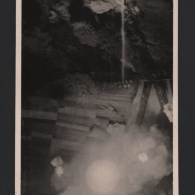
Lancaster under attack from anti-aircraft fire
Vertical aerial photograph of unnamed location. A Lancaster is silhouetted under the photo aircraft. It has dropped bombs and is now under attack from ant-aircraft fire which can be seen heading towards the aircraft.
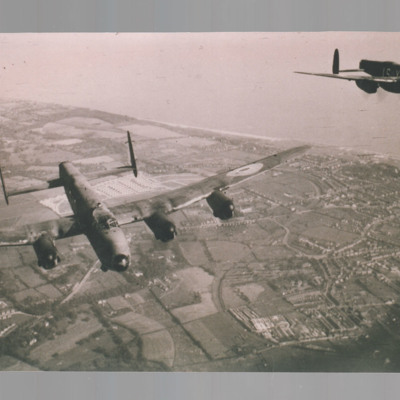
Lancasters in flight
Three air-to-air photographs of Lancaster.
#1 is a view looking down on a Lancaster in flight.
#2 is a view of an airfield across the starboard engines starboard side.
#3 is a view of two Lancasters.
#1 is a view looking down on a Lancaster in flight.
#2 is a view of an airfield across the starboard engines starboard side.
#3 is a view of two Lancasters.
Tags: aerial photograph; Lancaster
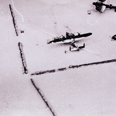
Lancasters in snow
Air to ground view of two Lancasters parked on snow covered ground.
Tags: aerial photograph; Lancaster
Lancasters over Lowestoft
An air-to-air view of two Lancasters in formation taken from the rear turret of a third. Both have fared over front turrets and no mid upper turrets. They are over Lowestoft on the Suffolk coast. White prefabs on the Gunton estate and Eastern Coach…
Tags: 15 Squadron; aerial photograph; air gunner; aircrew; Lancaster
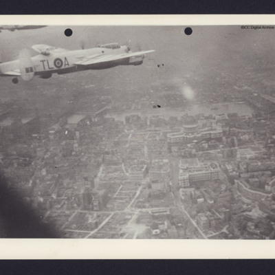
Lancasters over Saint Paul's Cathedral
Top left two Lancasters in light paint scheme flying to the right. Below London with St Paul's Cathedral dome and river Thames beyond.
Tags: 35 Squadron; aerial photograph; Lancaster
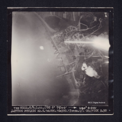
Lanveoc Poulmic
Target photograph of Lanveoc Poulmic. Port area with quays a breakwater and industrial structures clearly visible. Captioned '7B', '739 SKELL.8/9.5.44.//NT 8" 7500' [arrow] 280° 0001 LANVEOC POULMIC RD.E.1X4000.16X500.17secs.S/L CHADWICK E.50'. On…
Lanveoc Poulmic
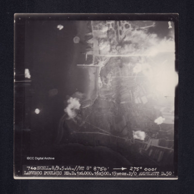
Target photograph of Lanveoc Poulmic. Coastline with piers and quays clearly visible. Partially obscured by light, but bomb explosions on land and water are visible. Captioned '8B', '740 SKELL.8/9.5.44.//NT 8" 8750' [arrow] 275° 0001 LANVEOC POULMIC…
Laon, Edward King's 5th operation of his tour
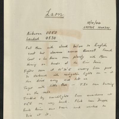
Six items, Edwards description of the operation to the Laon marshalling yards, comments that it was Easter Monday, there was a full moon, little anti-aircraft fire. Edwards navigation plot, two press photographs showing the damage to the yards on…
Latisana railroad bridge
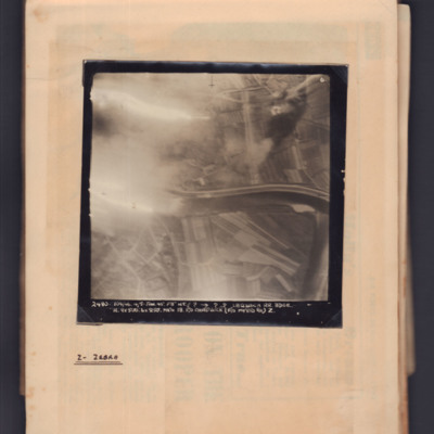
Target photograph showing river running left to right in centre with flare on left side. Captioned '6' and '2480, 104/46, 4/5 Jan 45, F8, NT, ?,→ ??, Latisana RR Bdge, H, 9x500:6x250 Mk IV, 18, F/O Chadwick (F/O Myers B.A.) Z'. Annotated on page…
Le Culot Airfield
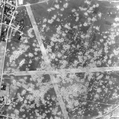
A vertical aerial photograph showing bomb damage to runways and surrounding area of airfield, submitted with caption; “Le Culot airfield in Belgium”.
Le Havre
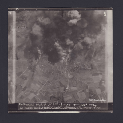
Target photograph of Le Havre. Partially obscured by smoke and dust, rural area,roads clearly visible. Captioned '5°F', '6B', '2631 SKELL 10.9.44 // 8"" 12000' [arrow] 128° 1724 LE HAVRE RD T.11X1000,4X500.C29secs.S/L STUBBS T.50'. On the reverse…
Le Havre
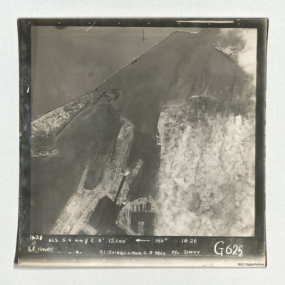
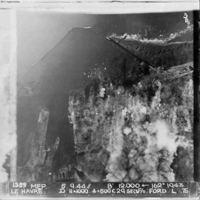
Target photograph of Le Havre taken during an operation. The right side is obscured by smoke. The left and top are clear and show the harbour, docks and breakwater. One vessel can be seen at an angle within the dock, bottom centre, but otherwise no…
Le Havre
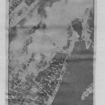
Article includes target photograph of dock area with smoke and explanatory text - Round the area of the Bassin du Commerce at Le Havre, explains level of damage assessed.
Le Havre
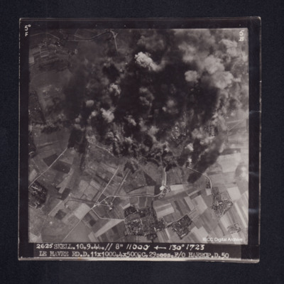
Target photograph of Le Havre. Rural area, centre of photograph obscured by smoke and dust, craters and one dropping bomb visible. Captioned '5° F', '5B', '2625 SKELL. 10.9.44. // 8" 11000' [arrow] 130° 1723, LE HAVRE RD. D. 11x1000. 4x500. …
Le Havre
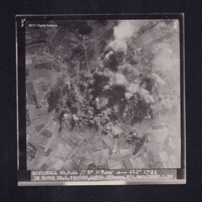
Target photograph of Le Havre. Rural area, centre of photograph obscured by smoke and dust, craters visible. Captioned '5°F', '5B', '2652 SKELL 10.9.44 // 8" 11500' [arrow] 122° 1722 LE HAVRE RD. L. 11X1000. 4X500. C29secs. F/S McEACHEARN. L.…
Le Havre
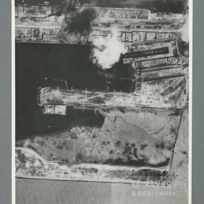
Reconnaissance photograph showing a damaged port area with a basin orientated left right with a pier in the centre. Caption 'Le Havre K2491(IMMED)'. On the reverse 'Date 11.7.44, Unit WS, Neg No. G103, 51:53'. Dock area has been heavily bombed, with…
Le Havre
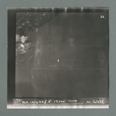
Target photograph showing land top left with bomb explosions on left edge just above centre. Caption '731, KLS, 14.6.44, 8", 19500, U, U625, Attack on Le Havre taken by Lancaster U of 625 squadron. Attack marked by Leonard Cheshire. On the reverse…
Le Havre
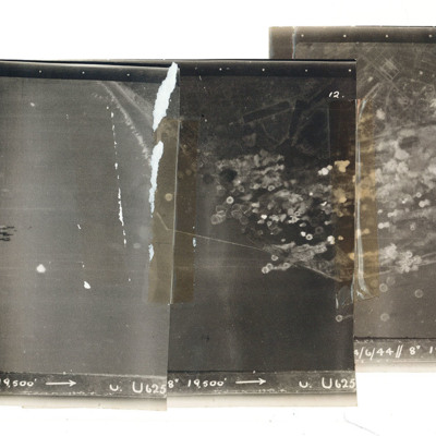
A mosaic of three target photographs of attack on Le Havre. Shows sea and cluster of bombs in the centre of left photograph and port area in the centre and right photograph. Caption '723, KLS, 14/6/44, 8", 1`9500, U. U625' Taken by Lancaster U of…
Le Havre
A vertical aerial photograph of Le Havre during bombing operations. The land is mainly obscured by explosions but breakwaters and docks are visible. Digue Augustin Normand is shown at the top of the image, with Bassin de la Manche and Le Havre port…

