Browse Items (1459 total)
- Tags: aerial photograph
Sort by:
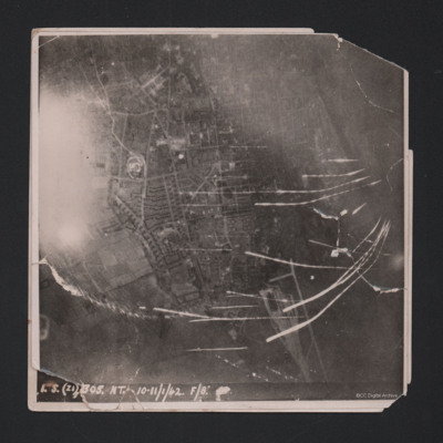
Wilhelmshaven
Target photograph showing built up area of Wilhelmshaven. Photograph is orientated with north to the left. Ems-Jade-Kanal is running from top to middle right of photograph. Railway goods yard towards bottom. Streaks of light and anti-aircraft fire…
Ivor Cole's Wireless Course Notes
A notebook completed by Ivor during his training. At the end are eight pages of newspaper cuttings of operations that Ivor took part in.
Tags: aerial photograph; aircrew; B-17; B-24; bombing; Halifax; Lancaster; Me 262; Mosquito; P-51; Spitfire; target indicator; training; wireless operator
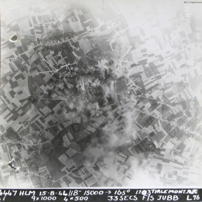
Tirlemont airfield
Target photograph taken during daylight attack on Tirlemont (Goetsenhoven) airfield. Patchwork of fields with aircraft dispersal hardstands to left and right of explosions and smoke centred on airfield itself. Village of Bost is to the bottom left…
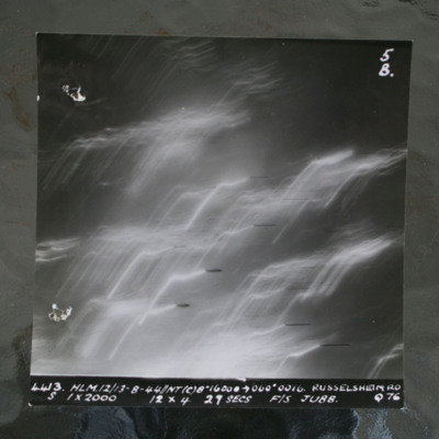
Rüsselsheim
Night target photograph showing tracer lines. Captioned '4413 HLM12/13-8-44//NT8" 16000 >060 degrees 0016. Russelsheim RD, S 1x2000 12x4 29 Secs F/S Jubb Q76'.This item was sent to the IBCC Digital Archive already in digital form. No better…
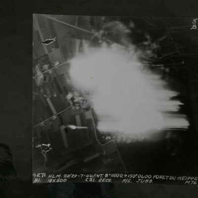
Foret Du Neippe
Night target photograph showing roads and glare in centre. Captioned '4271 HLM.28/29-7-44//NT8" 10000 >150.0400.Foret Du Neippe. B1. 18x500 c21secs F/S Jubb M76'.
This item was sent to the IBCC Digital Archive already in digital form. No better…
This item was sent to the IBCC Digital Archive already in digital form. No better…
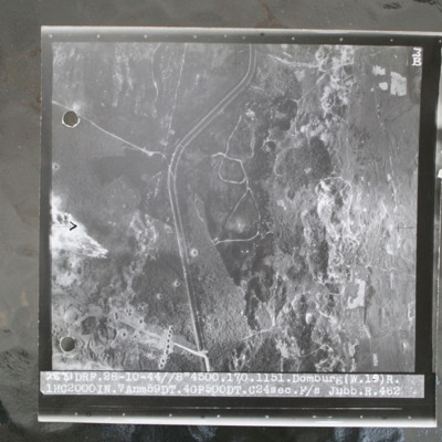
Domburg
Target photograph of open heathland with canalised ditch running top to bottom. The ditch has tracks either side and several crossing points. Craters are visible, particularly in lower left with one row crossing ditch with one crater visible within…
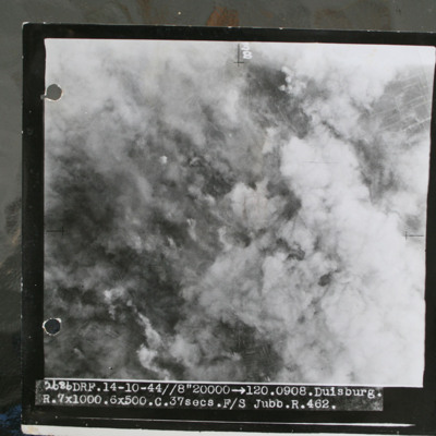
Duisburg
Target photograph showing smoke from bomb explosions and fires. Captioned '2686 DRF.14-10-44//8" 20000 >120.0908.Duisburg, R.7x1000.6x500.C.37 secs.F/S Jubb.R.462.".
This item was sent to the IBCC Digital Archive already in digital form. No better…
This item was sent to the IBCC Digital Archive already in digital form. No better…
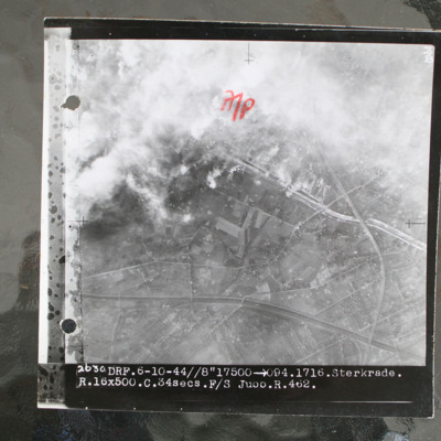
Sterkrade
Target photograph showing built up area in top half with road and railway running left to right. Smoke from bomb explosions top left. Captioned '2630 DRF.6-10-44//8"17500 >094.1716.Sterkrade. R.16x500.C.34 secs.F/S Jubb.R.462.'.
This item was sent…
This item was sent…
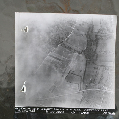
Route National 158
Image shows open countryside with Route National 158 between Caen and Falaise. Captioned '4425HLM.14-8-44//8" 6000 >140 degrees 1444 Tractable 22 RD, B16x500 c 23 secs F/S Jubb M76'.
Identification kindly provided by Ray Moroney of the Finding the…
Identification kindly provided by Ray Moroney of the Finding the…
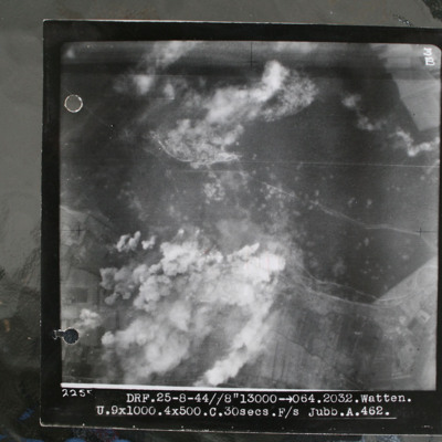
Watten V2 bunker
Target photograph showing forest area in top half with smoke from bomb explosions. Many craters are visible in this wooded area. Cleared area where tracks converge in this wooded area top centre, just edged by clouds. Bunker itself is just below and…
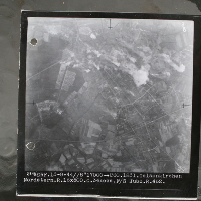
Gelsenkirchen
Target photograph showing built up area top right with smoke from bomb explosions. Captioned '2391.DRF.13-9-44//8" 17000.1831.Gelsenkirchen.Nordstern.R.16x500.C.34secs.F/S Jubb.462'.
This item was sent to the IBCC Digital Archive already in…
This item was sent to the IBCC Digital Archive already in…
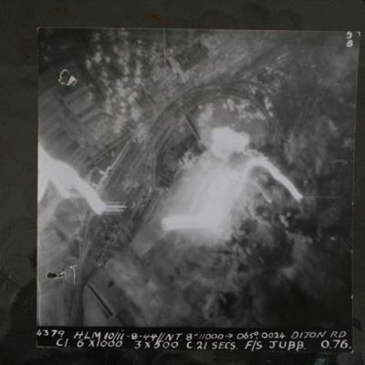
Dijon
Night target photograph showing railway with marshalling yard, glare in centre and tracer. captioned '4379.HLM 10/11-8-44//NT 8" 11000 >065degrees.0024. Dijon RD.C1 6x1000 3x500 C 21 secs F/S Jubb 0 76'.
This item was sent to the IBCC Digital…
This item was sent to the IBCC Digital…
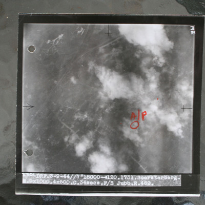
Soesterberg
Target photograph showing airfield with smoke from bomb explosions. Aiming pint in annotated in red ink. Captioned 'DRF.3-9-44//7"18000 >120.1731.Soersterberg.R.9x1000.4x500.C.34secs.F/S Jubb.R.462'.
This item was sent to the IBCC Digital Archive…
This item was sent to the IBCC Digital Archive…
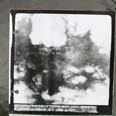
Homberg
Target photograph showing clouds and smoke from bomb explosions. Captioned 'DRF.27-8-44//8"19000 >085.1403.Homberg.16x500.C.36secs Jubb.A.462'.
This item was sent to the IBCC Digital Archive already in digital form. No better quality copies are…
This item was sent to the IBCC Digital Archive already in digital form. No better quality copies are…
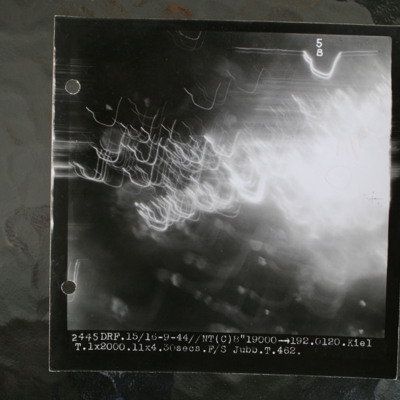
Kiel
Night target photograph showing glare and anti-aircraft tracer. Captioned 'DRF.15/16-9-44//NT(C) 8"19000 >192.0120.Kiel.1x2000.11x4.30secs.F/S Jubb.T.462'.
This item was sent to the IBCC Digital Archive already in digital form. No better quality…
This item was sent to the IBCC Digital Archive already in digital form. No better quality…
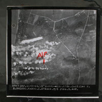
Le Havre
Target photograph showing coastline to top left and rural area behind with several villages and connecting roads. Annotated with "A/P" aiming point in red ink. Obscured by target markers and smoke. Captioned '3B 2347 DRF.11-9.44//8" 10000 >110.0750.…
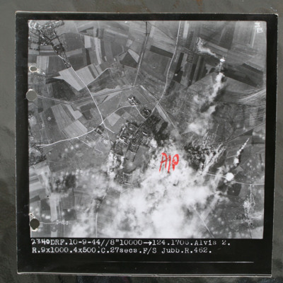
Alvis 2 target area
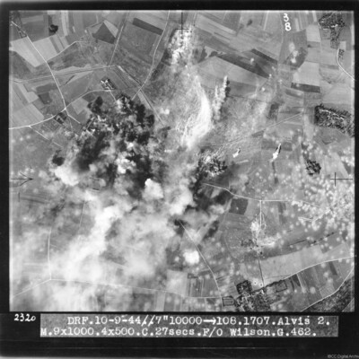
Target photograph of rural area with villages visible top left and centre with connecting roads and tracks. Annotated with "A/P" aiming point in red ink to right of centre which is obscured by smoke and target marker flares. Tank ditch zig zags…
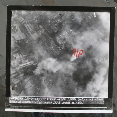
Gelsenkirchen
Target photograph show bombs on built up area. Annotated with aiming pot in red ink. Captioned 'DRF.12-9-44//8" > 168.1335. Gelsenkirchen. Buer.R.16x500.C.35secs.F/ Jubb.R.462'. Note: this was an attack on the synthetic oil plant at Scholven/Buer…
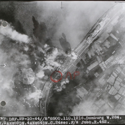
Domburg
Target photograph of sea wall with sea on left and land on right. Many bomb explosions visible. Annotated with aiming point in red ink. Captioned '2871 DRF 29-10-44//8"8,500. 110.1216. Domburg W.284, R.9 ANM59DN.4AMN64DN.C.24sec.F/S Jubb.R.462'.…
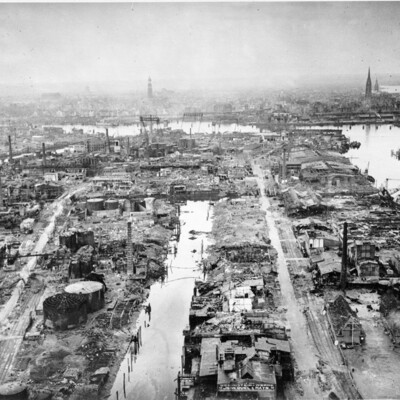
Hamburg Norderelbe
Oblique aerial photograph of Hamburg docks showing a destroyed port area with almost all buildings and facilities damaged. The spire of St Michels church is to left of centre and that of St Nikolai is to the right. In front of these, the large…
Tags: aerial photograph; bombing
Calais Batterie Oldenburg and Batterie Waldam
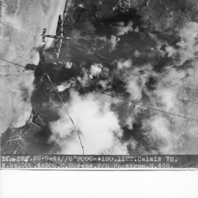
Target photograph of coastline and Batterie Oldenburg and Batterie Waldam. Port of Calais is just to bottom of the photograph Bomb explosions, smoke and target markers obscure the target. The beach is visible with many obstructions. Two Halifax III…
Alvis 2 target area
Target photograph of bombs exploding and obscuring target. Many bomb craters on the right side of image. Captioned 'DRF 10.9.44//7" 10000 > 108.1707.Alvis 2, M.9x1000.4x500.C. 27 secs. F/O Wilson G.462'.
This item was sent to the IBCC Digital…
This item was sent to the IBCC Digital…
Cologne cathedral
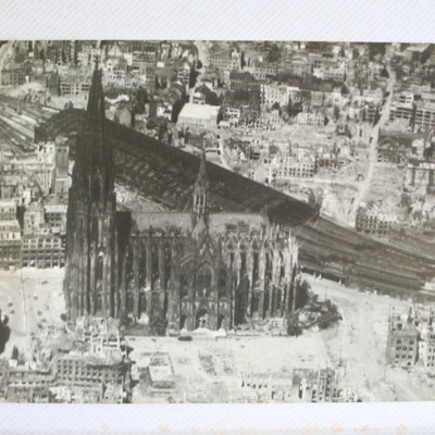
Air to ground view of a twin spired cathedral with railway station on the far side, all surrounded by many destroyed buildings.
This item was sent to the IBCC Digital Archive already in digital form. No better quality copies are available.
This item was sent to the IBCC Digital Archive already in digital form. No better quality copies are available.
Tags: aerial photograph; Cook’s tour
Goldene Meile camp
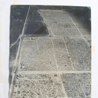
Air to ground of the Goldene Meile camp camp with roads in grid pattern and holes.
Identification kindly provided by Gianluca Mazzanti of the Air War Italy 1943-45 Facebook group.
This item was sent to the IBCC Digital Archive already in…
Identification kindly provided by Gianluca Mazzanti of the Air War Italy 1943-45 Facebook group.
This item was sent to the IBCC Digital Archive already in…
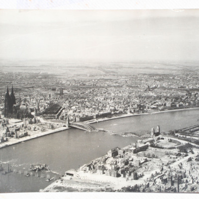
Cologne
Image from the air of a river running left to right through city with two destroyed bridges and many damaged buildings on both sides. Twin spired cathedral on far bank. Two copies of this image.
This item was sent to the IBCC Digital Archive…
This item was sent to the IBCC Digital Archive…
Tags: aerial photograph; Cook’s tour

