Browse Items (120 total)
- Conforms To is exactly "Geolocated (cumulative polygon)"
Sort by:
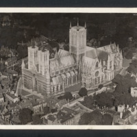
Lincoln Cathedral
Aerial oblique photograph of Lincoln Cathedral, low angled, taken at very low altitude, camera pointing north east. Minster Yard, Priory Gate, Exchequer Gate are visible, no pedestrians or traffic visible except a bus, trees in full leaf, a group of…
Tags: aerial photograph
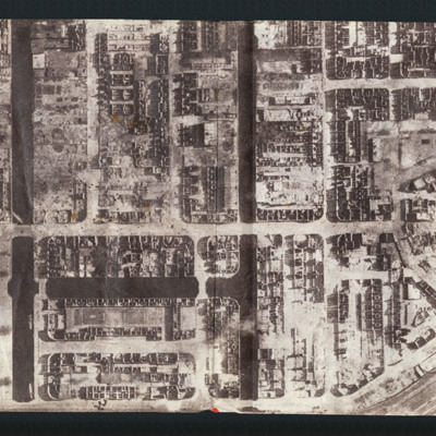
Das war Hamburg
Propaganda leaflet featuring an aerial vertical photograph of Hamburg after a Royal Air Force operation. Buildings are either completely destroyed or gutted, light falling through the gaping windows. Text describes fronts closing in, the Royal Air…
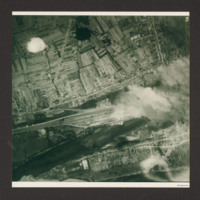
Südbrücke in Cologne and marshalling yard
Two aerial photographs.
The first is a target photograph taken at high level. Bombs are visible falling to centre left. A railway is seen running left to right in the bottom half, with marshalling yard in the centre. Below the railway is a river…
The first is a target photograph taken at high level. Bombs are visible falling to centre left. A railway is seen running left to right in the bottom half, with marshalling yard in the centre. Below the railway is a river…
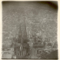
Cologne in ruins
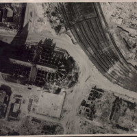
Oblique aerial photograph of Köln cathedral and surrounding area all showing heavy bomb damage. Photograph is looking west with railway station in the right hand corner.
Tags: aerial photograph; bombing; Cook’s tour
Cologne cathedral
Low altitude aerial reconnaissance photograph showing damage to and around Cologne cathedral: the railway station is partially visible on the right with extensive damage to canopy and some track damage. Rubble has been cleared, several tramcars can…
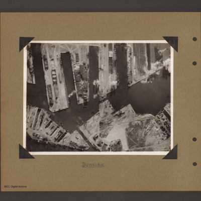
Dunkirk Docks
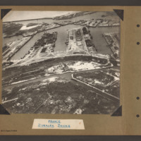
Oblique aerial photograph at low level showing docks, waterways, buildings and other port facilities. No vessels are visible. Across the centre four wide moles numbered 1 to 4 from right to left. The area has been heavily damaged with bomb craters,…
Dunkirk Docks
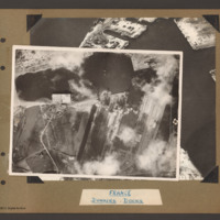
Target photograph of docks at Dunkirk. A body of water stretches from the left side to the top middle with a tidal flats at the left end. From the middle bottom up to the lower bank of the waters is Mole 6 with multiple railway sidings on the left…
Dunkirk Docks
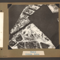
Oblique aerial photograph of Dunkirk docks. The entire area has been extensively bomb damaged. In the bottom half, a triangular shaped area of dockland with roads and railway lines. There are several damaged buildings without roofs and destroyed…
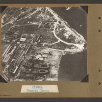
Dunkirk Docks
Oblique aerial photograph of docks. On the left side, docklands covered with buildings. On the right the land converges to a peninsular with water above and below. In the bottom centre a shipyard with two incomplete cargo ships with raised forecastle…
Tags: aerial photograph
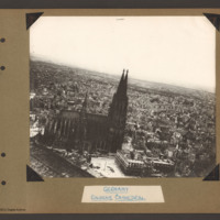
Cologne Cathedral
Aerial inclined photograph of Cologne Cathedral looking south. At the bottom left is part of the roof of the railway station. In the foreground a small open area with a tram in the centre. The cathedral is surrounded on all sides by multistory…
Tags: aerial photograph; bombing; Cook’s tour
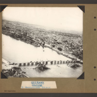
Cologne Hohenzollern bridge
Oblique aerial photograph of the Hohenzollern bridge over the Rhine at Cologne. The river Rhine runs from left diagonally to the right, On the far bank a narrow parallel canal, the Rheinauhafen, beyond which is a city landscape of multistory…
Tags: aerial photograph; bombing; Cook’s tour
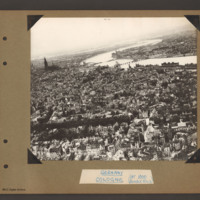
Cologne
Aerial inclined photograph of the city of Cologne looking north. The river Rhine goes from left to right with one large meander. Three bridges cross the river as to turns back to the right. The furthest bridge is destroyed with the right hand two…
Tags: aerial photograph; bombing; Cook’s tour
Essen
Aerial inclined photograph showing snow covered, mostly industrial landscape. In the foreground multistory town buildings with some showing signs of damage. One quarter way up, just left of centre is a church with damaged tower and roof. Beyond this…
Tags: aerial photograph; bombing; Cook’s tour
Essen
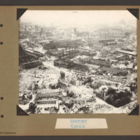
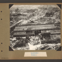
Aerial inclined photograph showing industrial buildings in a city landscape. At the bottom long factory buildings go from left to right with areas of damaged roofs on the nearside. Above this area another damaged industrial complex is orientated…
Tags: aerial photograph; bombing; Cook’s tour
Essen
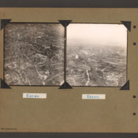
On the left an aerial inclined photograph showing a city landscape with many multistory buildings. In the foreground several scattered damaged multistory buildings surrounded by rubble. In the centre buildings are more contiguous and intact but…
Tags: aerial photograph; bombing; Cook’s tour
Cologne and Essen
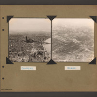
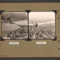
On the left an aerial inclined photograph looking north showing a city with a river on the right. In the centre Cologne Cathedral with the railway station just beyond. In the foreground several damaged multistory buildings and areas of rubble. In the…
Tags: aerial photograph; bombing; Cook’s tour
Cologne
On the left an aerial inclined photograph showing a wide river flowing right to left through the centre of a city of Cologne, In the centre the Hohenzollern railway bridge with the centre spans collapsed into the river. On the far side the railway…
Tags: aerial photograph; bombing; Cook’s tour
Hamburg
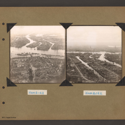
On the left an aerial inclined photograph of a city on two sides of a river. The river flows from centre right to left with three inlets leading to two waterways on the far side. The whole land area is covered with buildings with some in the…
Tags: aerial photograph; bombing; Cook’s tour
Bremen
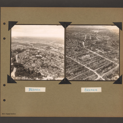
On the left an aerial inclined photograph of a city on the left bank of a river. At the bottom left a park with trees and lakes. To the right of the park a road curves around a large built up area with a twin spire church at its centre. There is a…
Tags: aerial photograph; bombing; Cook’s tour
Dry dock at Brest
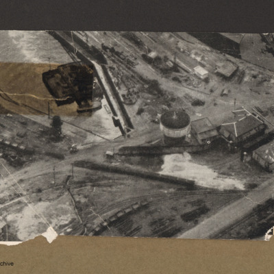
Aerial incline view of railway lines and dock. Top left is a dock basin containing a large floating object with a small boat alongside the bottom side. Three railway lines go from left to right each with lines of goods wagons.Right centre is tower…
Scharnhorst and Gneisenau
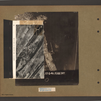
On top an aerial inclined photograph of a warship inside a dock with moles either side. Title 'Seeking the raider in his lair'. Underneath an aerial vertical photograph of a coastline lined with dock facilities and buildings running top to bottom. At…
Scharnhorst and Gneisenau
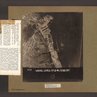
An aerial vertical photograph of a coastline lined with docks and buildings. At the top and inlet with docks and town buildings to its left. Below a peninsular are three docks pointing down and left. A large warship is moored in the bottom dock. Just…
Scharnhorst and Gneisenau
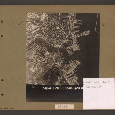
Aerial vertical photograph showing a coastal town with docks on the coast and a river running through the middle. On the right open water with a breakwater in the top right corner pointing down. Above the river on the four large jetties point into…
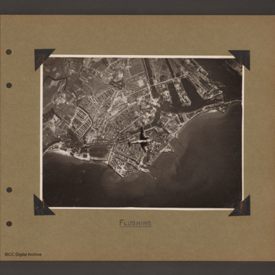
Ventura over Flushing
Aerial vertical photograph of coastline with town and docks. Coastline runs from mid left to right with a broad peninsular in the centre on which is a large town with docks. There are five jetties/piers running out into the sea. There is a Ventura…
Tags: aerial photograph; bombing; Ventura
Dunkirk docks
Aerial vertical photograph of docks. Along the top four moles below which an interconnected water way. Below is land with a narrow water passage slanting down towards the centre bottom. The moles and land have various scattered dockyard…

