Browse Items (687 total)
- Conforms To is exactly "Geolocated"
Sort by:
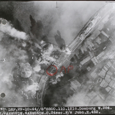
Domburg
Target photograph of sea wall with sea on left and land on right. Many bomb explosions visible. Annotated with aiming point in red ink. Captioned '2871 DRF 29-10-44//8"8,500. 110.1216. Domburg W.284, R.9 ANM59DN.4AMN64DN.C.24sec.F/S Jubb.R.462'.…
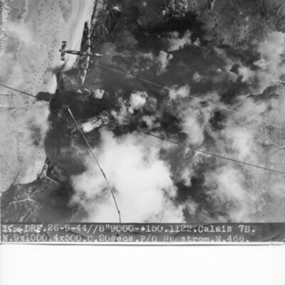
Calais Batterie Oldenburg and Batterie Waldam
Target photograph of coastline and Batterie Oldenburg and Batterie Waldam. Port of Calais is just to bottom of the photograph Bomb explosions, smoke and target markers obscure the target. The beach is visible with many obstructions. Two Halifax III…
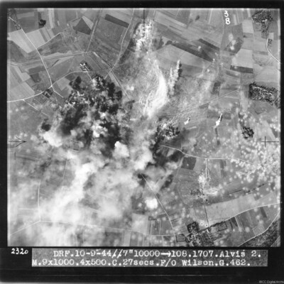
Alvis 2 target area
Target photograph of bombs exploding and obscuring target. Many bomb craters on the right side of image. Captioned 'DRF 10.9.44//7" 10000 > 108.1707.Alvis 2, M.9x1000.4x500.C. 27 secs. F/O Wilson G.462'.
This item was sent to the IBCC Digital…
This item was sent to the IBCC Digital…
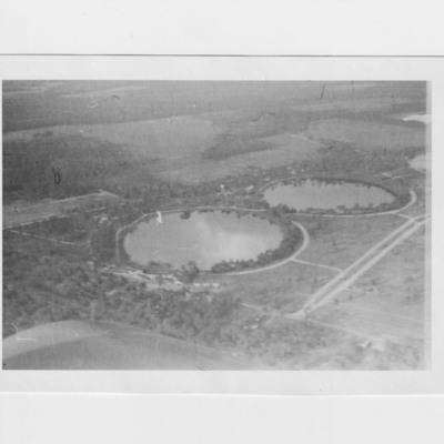
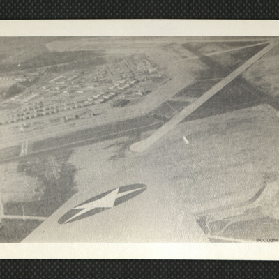
Moody Field
An aerial photograph showing runways and apron at Moody Field, as annotated on the reverse.
Tags: aerial photograph; runway
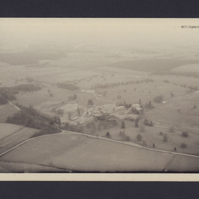
Milton Keynes
View of the junction of Park road and Bullington End Road, Milton Keynes. Open countryside and fields with site in the centre consisting huts and multi-storey buildings. Annotated 'M1'.
Tags: aerial photograph
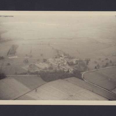
Milton Keynes
View of the junction of Park road and Bullington End Road, Milton Keynes. Open countryside and fields with site in the centre consisting huts and multi-storey buildings.
Tags: aerial photograph
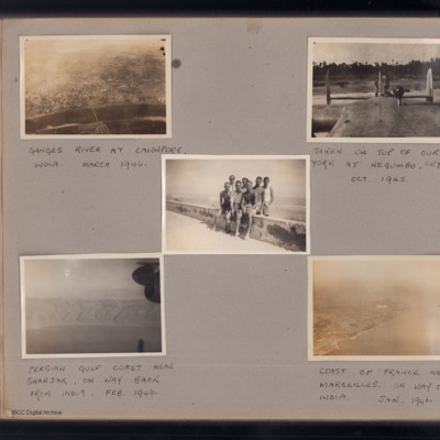
Trip to India
Top left - view from air of river with city on far side and bridge in the centre. Captioned 'Ganges river at Cawnpore, India, March 1946'. [actually downstream from Cawnpore (Kanpur) at Allahabad (Prayagraj)]. Top right - view along the top of the…
Tags: York
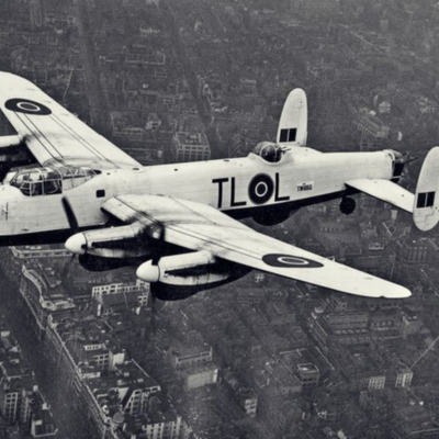
35 Squadron Lancaster over London
Top front quarter view of Lancaster TW892 with white upper paintwork, squadron code 'TL-L' flying over Regent Street, London.
Identification kindly provided by Liam Moore of the Unidentified photos of the British Isles Group.
Identification kindly provided by Liam Moore of the Unidentified photos of the British Isles Group.
Tags: 35 Squadron; Lancaster
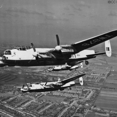
Three Lancasters in formation over Fairlop, Ilford, Essex
Three Lancasters (leader registration 'TW878') airborne in echelon formation. Below is a town and open countryside
Tags: 35 Squadron; Lancaster
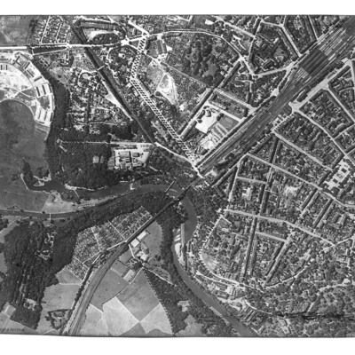
Görlitz
Reconnaissance photograph of Görlitz. In the centre is the Neisse Viaduct railway crossing the Neisse River. The main railway station is to the right, with St Jakobus Cathedral just above and to its left. Tree-lined boulevards are also well…
Tags: aerial photograph
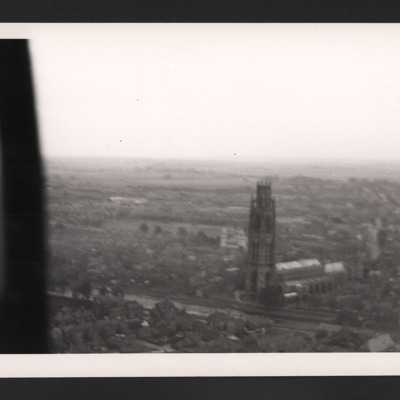
Boston Stump
A low level aerial oblique photograph of Boston St Botolph's Church, universally known as the Boston Stump.
Tags: aerial photograph
Avonmouth
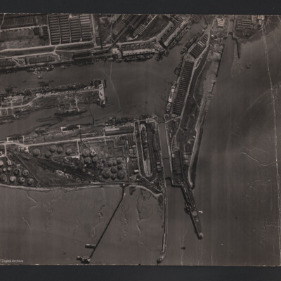
An aerial vertical photograph of Avonmouth docks. To the bottom of the photograph is the Bristol Channel, stretching up to the right of the photo. Three jetties protrude into the channel. Two tidal locks can be seen, one in the centre and one to the…
Tags: aerial photograph
RAF Breighton
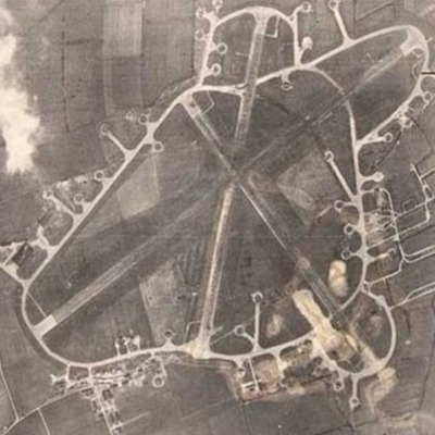
Reconnaissance photograph of an airfield with three runways, perimeter track, dispersals and buildings. Submitted with caption 'Aerial view of wartime RAF Breighton'.
This item was sent to the IBCC Digital Archive already in digital form. No…
This item was sent to the IBCC Digital Archive already in digital form. No…
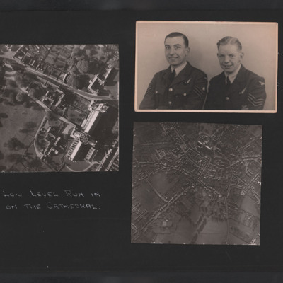
Ely Cathedral, Ray Wells and colleague
Photo 1 is a vertical close up of Ely Cathedral.
Photo 2 is Ray Wells and a navigator.
Photo 3 is a vertical view of the cathedral and surrounding streets.
Photo 2 is Ray Wells and a navigator.
Photo 3 is a vertical view of the cathedral and surrounding streets.
Tags: aerial photograph; aircrew; flight engineer; navigator
Courtrai
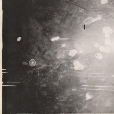
Target photograph showing bomb bursts in built up area and the silhouette of a Lancaster below. Caption '2775 CON 20/21-7-44//NT 8" 15000, 225, COURTRAI. BB, 5X1000, 23SECS. F/O LASH[...]'.
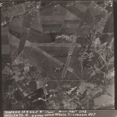
Deelen airfield
Target photograph showing an airfield with triangle of runways with buildings bottom and right. Bomb bursts are visible across the airfield. Caption '3248 CON. 15.8.44// 8" 17600, 080, 1208, DEELEN A/D Q., 11x1000, 4x500C35secs. F/Lt LASHAM, Q97'.
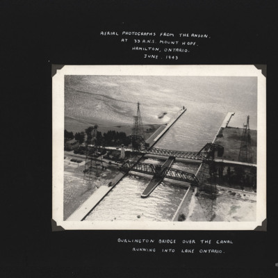
Burlington Bridge
Photograph shows two bridges spanning a canal which leads to open water. Also four large pylons. Captioned 'Aerial photographs from the Anson at 33 A.N.S. Mount Hope, Hamilton, Ontario. June 1943.' and 'Burlington Bridge over the canal running into…
Tags: aerial photograph; Anson; training
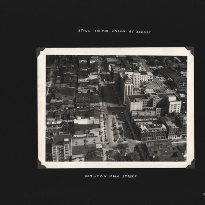
Hamilton Main Street
Built up area showing mixture of buildings arranged around grid pattern streets. Captioned 'Hamilton Main Street.' and 'Still in the Anson at 300feet'.
Tags: aerial photograph; aircrew; Anson; training
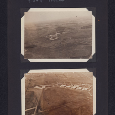
Paulson airfield
Top - view from the air of concrete hardstanding and buildings on an airfield in the distance. Bottom - closer view showing triangular runways, hardstanding and buildings. Captioned '7 B & G Paulson'.
Tags: aerial photograph; hangar; runway; taxiway; training
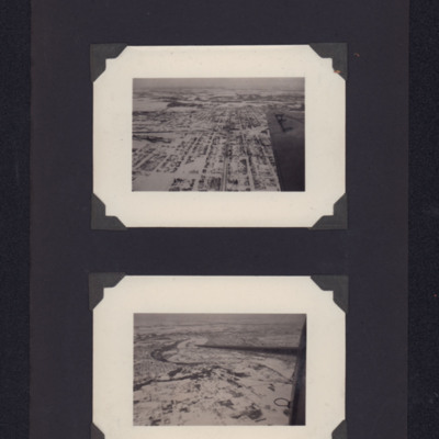
Edmonton
The upper photo is of 82 Ave facing West. Centre left, the Canadian Pacific Railway station Irvine; in the distance the North Saskatchewan River.
The lower photo is of North Saskatchewan River. The Low Level Bridge, the High Level Bridge, the…
The lower photo is of North Saskatchewan River. The Low Level Bridge, the High Level Bridge, the…
Tags: aerial photograph
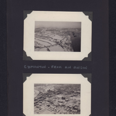
Edmonton
The upper photo is an oblique aerial photographs of Low Level Bridge facing south. In the distance, the Old Walterdale Bridge, the High Level Bridge and the Alberta Legislature Building.
The lower photo is of Alberta Legislature Building, next to…
The lower photo is of Alberta Legislature Building, next to…
Tags: aerial photograph; Anson
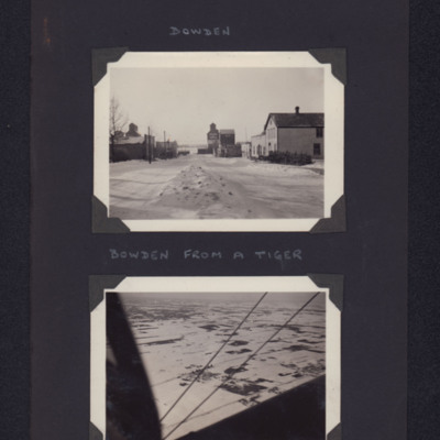
Bowden
Top - town street scene with buildings either side. Captioned 'Bowden'.
Bottom - view of town in snow from airborne aircraft. Captioned 'Bowden from a Tiger'.
Bottom - view of town in snow from airborne aircraft. Captioned 'Bowden from a Tiger'.
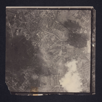
West Bromwich
A vertical aerial photograph of West Bromwich. Canals and railway branches are clearly visible.
Identification kindly provided by Richard Evans of the Unidentified photos of the British Isles Group.
Identification kindly provided by Richard Evans of the Unidentified photos of the British Isles Group.
Tags: aerial photograph
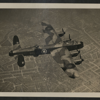
Lancaster
Air-to-air view of the top of a Lancaster registration 'RE172' flying over over the south Manchester areas of Withington, Fallowfield and Ladybarn. On the reverse 'Lancaster BIII, made A.V.Roe (Yeadon) Merlin 224 (March/June 45)'.
Tags: Lancaster; Lancaster Mk 3

