Browse Items (1459 total)
- Tags: aerial photograph
Sort by:
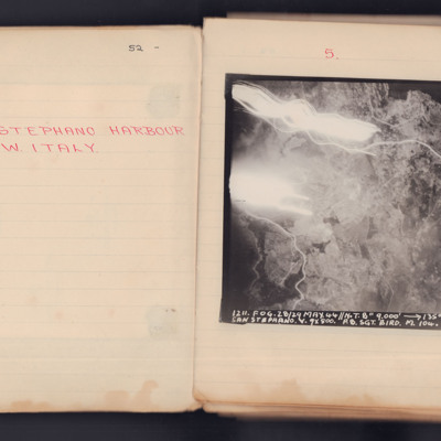
Santo Stefano Harbour
A vertical aerial photograph taken during an operation. The top left of the image is obscured by explosions and light flashes but much ground detail is visible on the image.
It is captioned '1211. Fog. 28/29 May 44 // N.T. 8" 9000' -> 135° 00.12…
It is captioned '1211. Fog. 28/29 May 44 // N.T. 8" 9000' -> 135° 00.12…
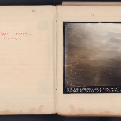
Viterbo Roads
A vertical aerial photograph taken during an operation. Most of the top of the image is obscured by light flashes.
It is captioned '1171 Fog 25/26 May 44 // NT 8" 9000' -> 330° 00.33 Viterbo. D.9x500 P8. Sgt Bird L 104'.
It is captioned '1171 Fog 25/26 May 44 // NT 8" 9000' -> 330° 00.33 Viterbo. D.9x500 P8. Sgt Bird L 104'.
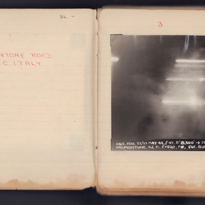
Valmontone Road
A vertical aerial photograph taken during an operation. No detail is visible of the ground, the image is obscured by explosions and light flashes.
It is captioned '1165. Fog.22/23 May 44 // NT 8" 8200 -> 120° 23.26 Valmontone. Rd. D 5 x 500 PO Sgt…
It is captioned '1165. Fog.22/23 May 44 // NT 8" 8200 -> 120° 23.26 Valmontone. Rd. D 5 x 500 PO Sgt…
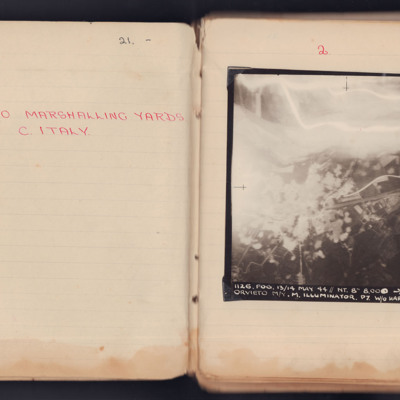
Orvieto Marshalling Yards
A vertical aerial photograph taken during an operation at Orvieto. The left and top are obscured by explosions and anti-aircraft flashes.
It is captioned '1126. Fog. 13/14 May 44 // NT. 8" 8.000-> 160° 23.18 1/2 Orvieto M/Y M. Illuminator. P7 W/O…
It is captioned '1126. Fog. 13/14 May 44 // NT. 8" 8.000-> 160° 23.18 1/2 Orvieto M/Y M. Illuminator. P7 W/O…
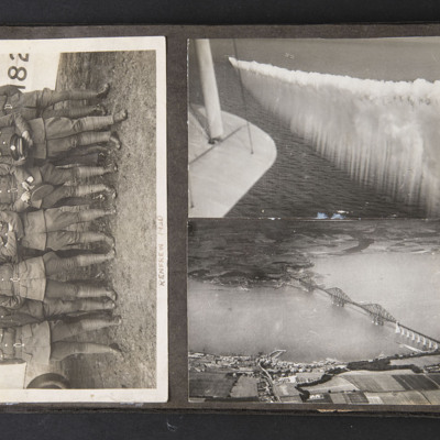
Airmen and Forth Bridge
Three photographs, first of 12 airmen standing in front of an aircraft captioned 'Renfrew 1930'.
Second is of two aircraft in the distance, one trailing large amount of smoke, wing tip of camera aircraft in foreground left.
Third is of air to…
Second is of two aircraft in the distance, one trailing large amount of smoke, wing tip of camera aircraft in foreground left.
Third is of air to…
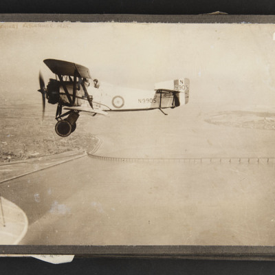
Fairey Flycatcher in flight
Air-to-air view of an aircraft flying over the Tay Bridge, wingtip of camera aircraft in bottom left corner, captioned 'Fairey Flycatcher 1929'. Aircraft serial is N9905
Tags: aerial photograph
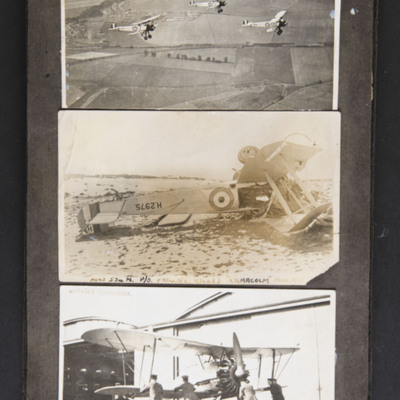
Aircraft in Scotland
Three photographs, first is an air-to-air view of three Avro 504N biplanes flying near RAF Leuchars with River Eden estuary in distance.
Second is of a crashed aircraft, with the serial H 2975, captioned 'Avro 504N P/O Phillips killed "Kilmacolm"…
Second is of a crashed aircraft, with the serial H 2975, captioned 'Avro 504N P/O Phillips killed "Kilmacolm"…
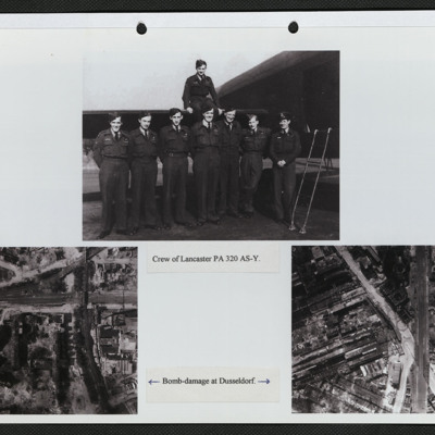
Aircrew and bomb damage
Three photographs mounted on a page.
Top: Eight aircrew in battledress, seven standing in a line by the open rear door of a Lancaster and one seated on the tailplane. It is captioned: 'Crew of PA 320 AY-S'.
Bottom left: Vertical aerial photograph…
Top: Eight aircrew in battledress, seven standing in a line by the open rear door of a Lancaster and one seated on the tailplane. It is captioned: 'Crew of PA 320 AY-S'.
Bottom left: Vertical aerial photograph…
Tags: 166 Squadron; aerial photograph; aircrew; bombing; Lancaster
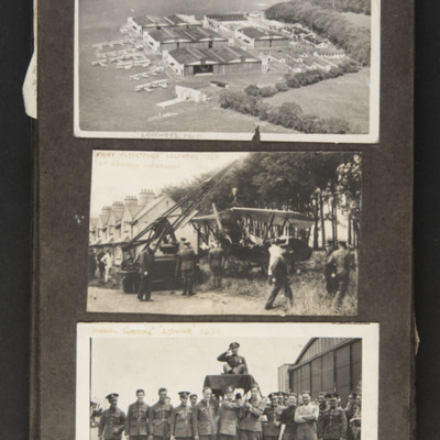
Leuchars 1928
Three photographs, first is an oblique aerial photograph of RAF Leuchars from the air showing the hangars, parked biplane aircraft of several types and part of the airfield, captioned 'Leuchars 1928'.
Second shows an aircraft surrounded by…
Second shows an aircraft surrounded by…
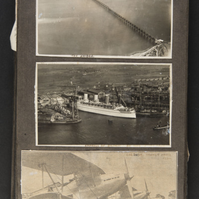
Scotland
Three photographs, the first shows the Tay bridge from the air, captioned 'Tay Bridge'.
Second shows a large white ship moored in a dockyard, captioned 'Empress of Britain Browns Clydebank'.
Third is a newspaper clipping of four biplanes lined up…
Second shows a large white ship moored in a dockyard, captioned 'Empress of Britain Browns Clydebank'.
Third is a newspaper clipping of four biplanes lined up…
Tags: aerial photograph
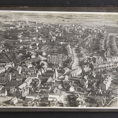
Kilmacolm
Oblique aerial photograph of a small town on the banks of the Clyde on the outskirts of Glasgow in the 1930s, captioned 'Kilmacolm'.
Tags: aerial photograph
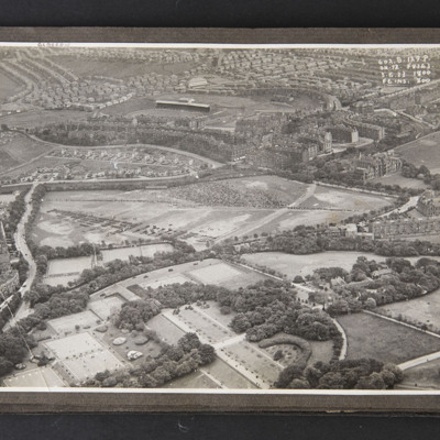
Glasgow
Aerial photograph of Glasgow with Queens Park with a crowd and many motor vehicles, and Hampden football ground towards the top of the photograph, caption '602.B.129.P. Sn.72.F8343. 3.6.33 1800.F6ins.800
Tags: aerial photograph
Taj Mahal, Niagara and Patrick's wife and child
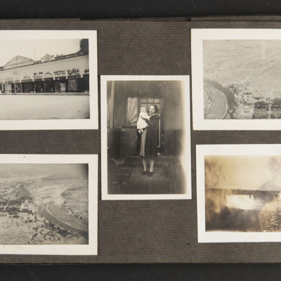
Five photographs.
1) A row of shops.
2) An aerial photo of the Taj Mahal.
3) An aerial photo of the Taj Mahal.
4) Niagara Falls
5) Patrick's wife and one of his children.
1) A row of shops.
2) An aerial photo of the Taj Mahal.
3) An aerial photo of the Taj Mahal.
4) Niagara Falls
5) Patrick's wife and one of his children.
Tags: aerial photograph
Prince Albert
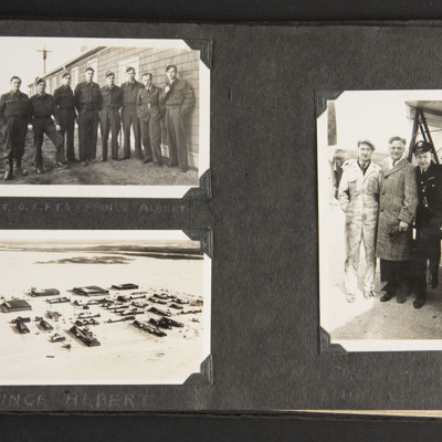
First photograph shows eight airmen including Patrick standing outside a building, captioned 'A Flight 6 EFTS, Prince Albert'.
Second shows three men standing by an aircraft wing, one in overalls one in an overcoat and one in uniform.
Third is an…
Second shows three men standing by an aircraft wing, one in overalls one in an overcoat and one in uniform.
Third is an…
Tags: aerial photograph; aircrew; training
Lincoln Cathedral and airmen
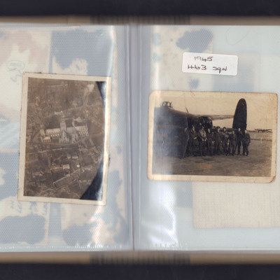
Left page - Oblique aerial photograph of Lincoln cathedral.
Right page - nine airmen standing in front of the rear turret of a Lancaster with another Lancaster in the background. Captioned '1945 463 sqn'.
Right page - nine airmen standing in front of the rear turret of a Lancaster with another Lancaster in the background. Captioned '1945 463 sqn'.
Tags: 463 Squadron; aerial photograph; aircrew; ground crew; Lancaster
Ludwigshafen
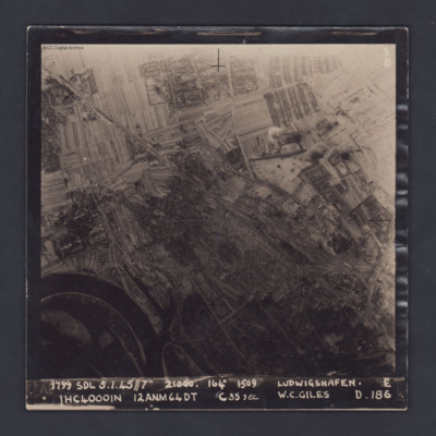
A vertical target photograph of Ludwigshafen, orientated with the south west at the top. In the lower left corner is a bend in the River Rhine and the entrance to Kaiserworthhafen docks. Just visible at the bottom edge is the end of Luitpoldhafen…
Neuss
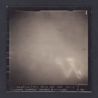
An aerial photograph of cloud-covered Neuss, near Düsseldorf. The cloud obscures all detail and all that can be seen through the cloud is a large glow, probably from the ground, and the wavy trace of a flare.
The photograph is captioned:
'1814…
The photograph is captioned:
'1814…
Saarbrucken
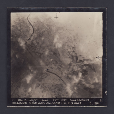
A vertical aerial photograph of the centre of Saarbrücken, orientated with south-east at the top and clearly showing the River Saar. Cloud and/or smoke covers parts of the town but residential areas, the railway and other details can still be seen.…
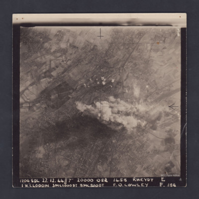
Rheydt
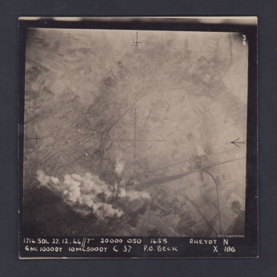
A vertical aerial photograph of Rheydt, near Mönchengladbach. The railways clearly stand out, one entering the image at lower right, branching out into a marshalling yard and another sweeping in from the upper right corner of the image. The centre…
Trier
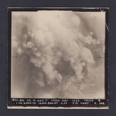
A vertical aerial photograph taken during a bombing operation at Trier. Much of the detail is obscured by bomb explosions but in the bottom right corner are fields and roads.
It is captioned :
'1654 SDL 23.12.44 // 7" 17000 097 1433 Trier B
1…
It is captioned :
'1654 SDL 23.12.44 // 7" 17000 097 1433 Trier B
1…
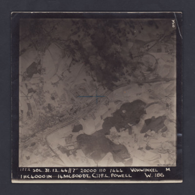
Vohwinkel
A vertical aerial photograph of Vohwinkel, near Wuppertal, orientated so that the top edge is roughly south. The multi-track railway is obvious and runs from the lower left corner to a large marshalling yard at the mid-right edge. A branch line joins…
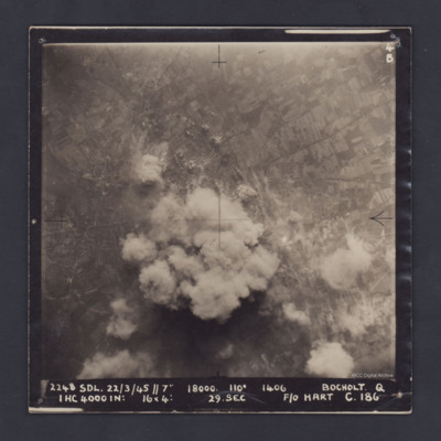
Bocholt
A vertical aerial photograph of Bocholt. On the left side is the distinctive diamond shape of Friedhof Bocholt cemetery and on the middle left edge is the artificial lake, the Bocholter Aasee. The upper left quarter of the image shows open…
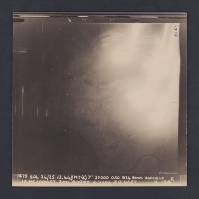
Hangelar
A vertical aerial photograph of Hangelar (Bonn) airfield taken during a bombing operation. The image is orientated with south-east at the top edge. A large, bright glare obscures most of the ground detail but the River Seig is visible, meandering…
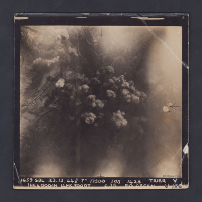
Trier
A vertical aerial photograph taken during a bombing operation at Trier. Some industrial buildings can be seen on the left. Details in the central area are obscured by smoke from explosions.
The photograph is captioned:'1659 SDL 23.12.44 // 7" 17500…
Rheydt
A clear, vertical, aerial photograph taken during a bombing operation at Rheydt, a borough of Mönchengladbach, orientated with south-east at the top edge. There are open fields visible in the upper left, upper right and the lower right corners of…

