Browse Items (1442 total)
- Tags: aerial photograph
Sort by:
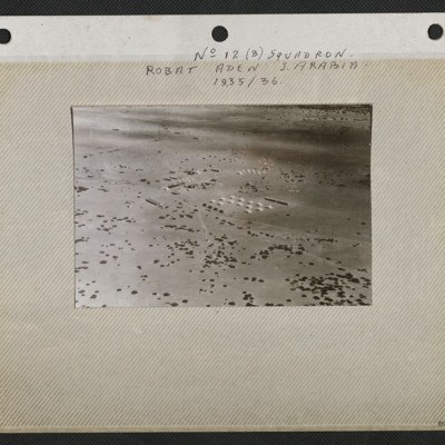
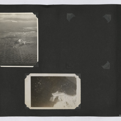
Aerial View of Robat
An aerial view of the airstrip and camp at Robat. It is captioned 'No 12 (B) Squadron Robat Aden S Arabia 1935/36'.
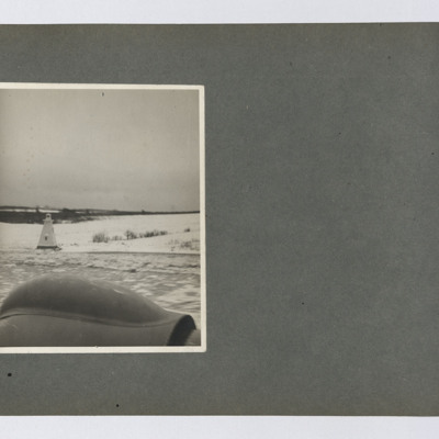
Canadian Lighthouse
A lighthouse seen from a low flying aircraft. The style of lighthouse is typically Canadian.
Tags: aerial photograph
Bielefeld Viaduct
Oblique aerial photograph of a railway with damaged viaduct and many bomb craters. Caption submitted by donor 'Bielefeld Viaduct Cooks tour'.
This item was sent to the IBCC Digital Archive already in digital form. No better quality copies are…
This item was sent to the IBCC Digital Archive already in digital form. No better quality copies are…
Tags: aerial photograph; bombing; Cook’s tour
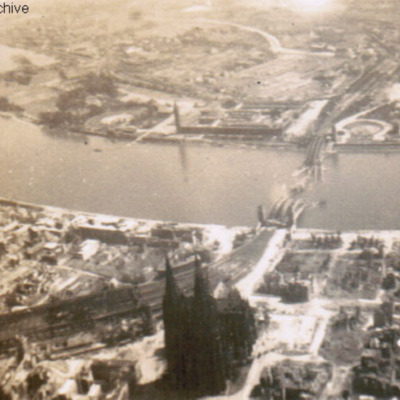
Cook's tour Cologne
Oblique aerial photograph of a city with river running left to right with destroyed bridge. Cathedral and railway station on near bank. Submitted with caption 'Cologne Cooks tour'. River is river Rhine, destroyed and collapsed railway bridge is the…
Tags: aerial photograph; bombing; Cook’s tour
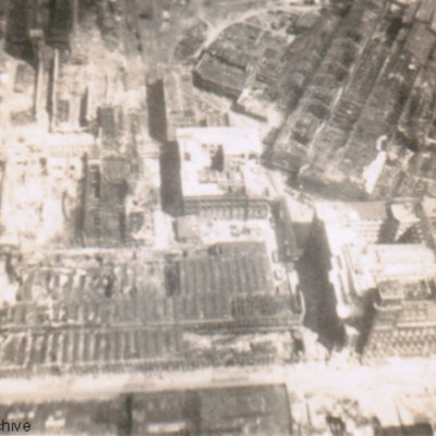
Essen (Krupps Works) Cooks tour
Oblique aerial photograph of an industrial area with much bomb damage. Submitted with caption 'Essen (Krupps Works) Cooks tour'.
Tags: aerial photograph; bombing; Cook’s tour
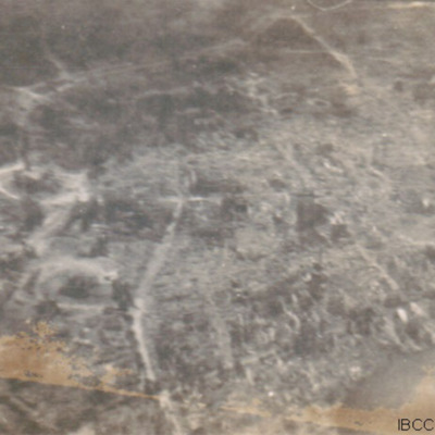
Wesel Cooks tour
Oblique aerial photograph of a city with much bomb damage. Submitted with caption 'Wesel Cooks tour'. Willibrordi Cathedral is to far left centre.
Tags: aerial photograph; bombing; Cook’s tour
Aerial Photographs, Montreal
Four oblique aerial photographs from an album. #1 is a city with a bridge crossing a frozen river and another bridge leading to a small island. #2 is two bridges, Honor Mercier, crossing the St Lawrence river. #3 is the Jacques Cartier bridge leading…
Tags: aerial photograph
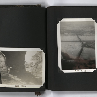
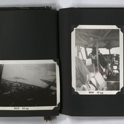
Aerial Photographs, Canada
Four aerial photographs from an album.
#1 is a view across forests and a town.
#2 is a city, islands and bridges.
#3 is a pilot at the controls of an aircraft.
#4 is a grid street with a river under the wing of an aircraft.
Captioned 'MAR 1942'…
#1 is a view across forests and a town.
#2 is a city, islands and bridges.
#3 is a pilot at the controls of an aircraft.
#4 is a grid street with a river under the wing of an aircraft.
Captioned 'MAR 1942'…
Tags: aerial photograph; aircrew; pilot; training
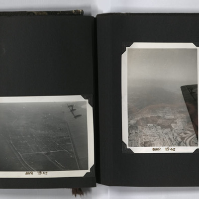
Aerial Photographs, Canada
Four aerial photographs from an album.
#1 is a city with a river.
#2 is looking south along the Richelieu River, to the right is Saint-Jean-sur-Richelieu, Quebec, Canada.
#3 is a city with a regular grid street pattern and a river under the wing…
#1 is a city with a river.
#2 is looking south along the Richelieu River, to the right is Saint-Jean-sur-Richelieu, Quebec, Canada.
#3 is a city with a regular grid street pattern and a river under the wing…
Tags: aerial photograph; training
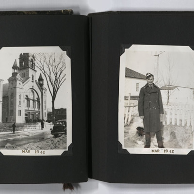
St Johns Airfield, Cathedral, Ron Ridings and No 9 Air Observer's School Sign
Four photographs from an album. #1 is an oblique aerial photograph of St Johns airfield, Saint-Jean-sur-Richelieu. #2 is Cathedral of Saint-Jean-l'Évangéliste at Saint-Jean-sur-Richelieu. #3 is Ron in trainee uniform and greatcoat. #4 is a sign for…
Tags: aerial photograph; aircrew; observer; perimeter track; runway; taxiway; training
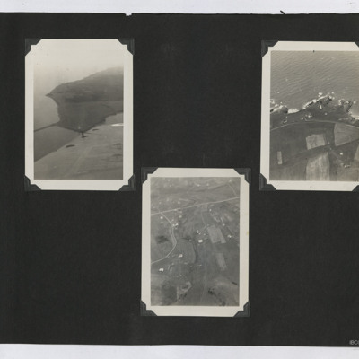
Aerial Photographs
Three oblique aerial photographs from an album.
#1 is a view of a coast with a causeway.
#2 is a rocky coast with a lighthouse.
#3 is scattered settlements with small fields.
#1 is a view of a coast with a causeway.
#2 is a rocky coast with a lighthouse.
#3 is scattered settlements with small fields.
Tags: aerial photograph
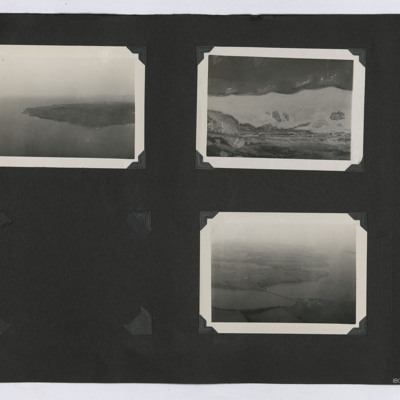
Aerial Photographs
Three oblique aerial photographs from an album. From left to right:
1. Oblique aerial view of a peninsula or island with the coastline visible.
2. Aerial view of the ground. A road cuts through the topography in the lower part of the image.
3.…
1. Oblique aerial view of a peninsula or island with the coastline visible.
2. Aerial view of the ground. A road cuts through the topography in the lower part of the image.
3.…
Tags: aerial photograph
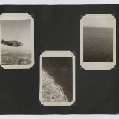
Aerial Photographs of a Lockheed Hudson, Coastline and Sea
Three photographs in an album. From left to right:
1. Air to air view of Hudson L3 in flight.
2. Aerial photograph of some unidentified coastline.
3. Oblique aerial view of an area of sea.
1. Air to air view of Hudson L3 in flight.
2. Aerial photograph of some unidentified coastline.
3. Oblique aerial view of an area of sea.
Tags: aerial photograph; Hudson
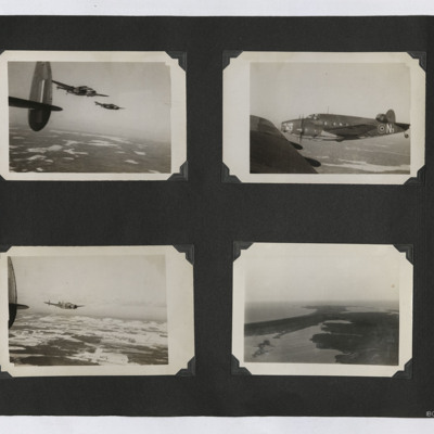
Hudsons and a Coastal View
Four photographs in an album. From top left:
1. Air to air photograph of two Hudsons in flight, taken from a third. The ground is visible.
2. Air to air photograph of Hudson N3 in close formation. Taken from another Hudson.
3. Air to air…
1. Air to air photograph of two Hudsons in flight, taken from a third. The ground is visible.
2. Air to air photograph of Hudson N3 in close formation. Taken from another Hudson.
3. Air to air…
Tags: aerial photograph; Hudson
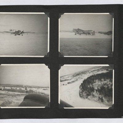
Hudsons and Aerial Photographs
Four photographs from an album.
#1 is a starboard/front view of a Hudson in the snow. Behind a second Hudson is flying by, low level.
#2 is two Hudsons parked on the snow.
#3 is an aerial view of hangars in the snow. Part of the aircraft is in the…
#1 is a starboard/front view of a Hudson in the snow. Behind a second Hudson is flying by, low level.
#2 is two Hudsons parked on the snow.
#3 is an aerial view of hangars in the snow. Part of the aircraft is in the…
Tags: aerial photograph; Hudson
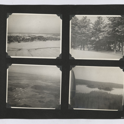
Aerial Photographs and Snow Scenes
Four photographs from an album.
1. An aerial oblique view of a a settlement on a snow covered hill side.
2. A view of some snow-covered trees.
3. An oblique aerial view of an airfield and surrounding farms.
4. An oblique aerial view of a lake set…
1. An aerial oblique view of a a settlement on a snow covered hill side.
2. A view of some snow-covered trees.
3. An oblique aerial view of an airfield and surrounding farms.
4. An oblique aerial view of a lake set…
Tags: aerial photograph
Aerial Photographs
Two aerial photographs from an album.
1. An oblique aerial image of a farm with orchards.
2. A near vertical image of some coastline.
1. An oblique aerial image of a farm with orchards.
2. A near vertical image of some coastline.
Tags: aerial photograph
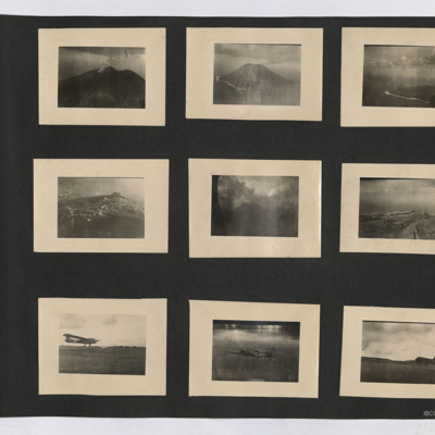
Aerial views, CG4A Glider, Baltimore and C-47
Nine photographs from an album. Starting at top left:
#1 is a view of a volcano with a smoke plume.
#2 is an oblique aerial view of Stromboli.
#3 is an oblique aerial view of an island. A beach with surf can be seen, as can the outline of the…
#1 is a view of a volcano with a smoke plume.
#2 is an oblique aerial view of Stromboli.
#3 is an oblique aerial view of an island. A beach with surf can be seen, as can the outline of the…
Tags: aerial photograph; C-47
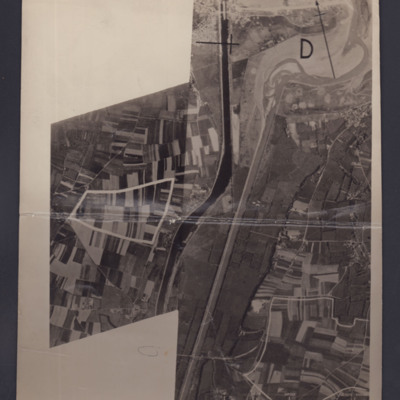
Ouistreham and Port de L'Orne
Two reconnaissance photographs of the area to the south and east of Ouistreham and Port de L'Orne. The two photographs overlap.
#1 which is marked "Neg No 38858" shows the Ouistreham Estuary at the top with the Canal de Caen a la Mer running top to…
#1 which is marked "Neg No 38858" shows the Ouistreham Estuary at the top with the Canal de Caen a la Mer running top to…
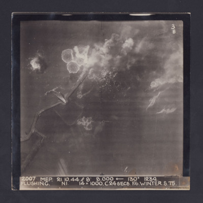
Flushing
Target photograph taken during an operation to Flushing, Netherlands. Several bomb splashes in the water and smoke from explosions on the ground. Water is flowing through the sea wall at one point. The photograph is captioned:
2007 MEP 21.10.44 //…
2007 MEP 21.10.44 //…
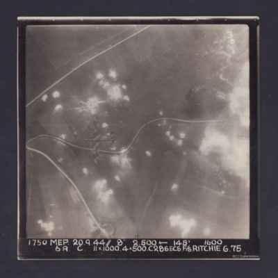
Pas de Calais
Target photograph. Fields and several minor roads visible. Much of the image is dotted with smoke from bomb bursts or Anti-aircraft fire and glare obscures right hand side. A Lancaster can be seen flying below. Annotated '3B' and captioned '1750 MEP…
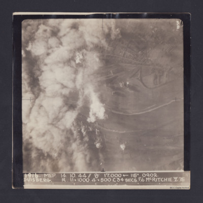
Duisberg
Target photograph taken on an operation to Duisberg. Left hand side is obscured by smoke or cloud and several bomb explosions can be seen. The Rhine river runs across the image, just below half height and there is built up area towards top of…
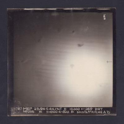
Neuss
Target photograph of an operation to Neuss. Only a large area of glare, roughly in the middle, is visible. It is annotated '5B' and captioned:
'1787 MEP 23/24.9.44//NT 8" 19,000 ← 055 º 2127
NEUSS. H1. 11 x 1000. 4 x 500. 31 SECS. F/S…
'1787 MEP 23/24.9.44//NT 8" 19,000 ← 055 º 2127
NEUSS. H1. 11 x 1000. 4 x 500. 31 SECS. F/S…
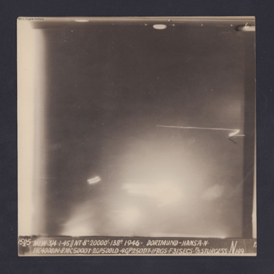
Dortmund-Hansa
Target photograph for an operation to Dortmund - Hansa. An area of glare occupies the lower part of the image and there is another down the left side. The rest is in darkness and n ground detail is visible. The photograph is annotated '6' and…

