Browse Items (1442 total)
- Tags: aerial photograph
Sort by:
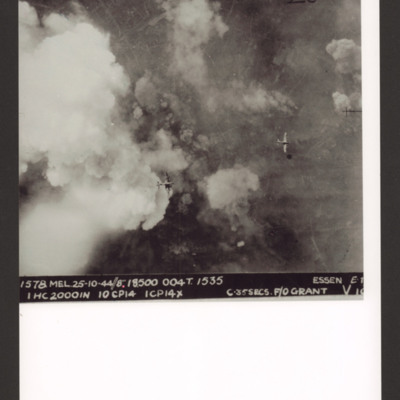
Essen
Target photograph of Essen partly obscured by clouds and explosions. Streets and buildings are partly visible. There are two Halifaxes flying at a lower level. It is annotated 'Essen 25 Oct'. Captioned '1578 MEL. 25-10-44//8” 18500 004T. 1535ESSEN…
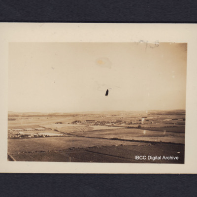
RAF Dyce from the air
Oblique aerial photograph of a runway In the distance running from lower left to middle of the image, surrounded by fields with a village in the centre. On the reverse 'Dyce airfield near Aberdeen, from low flying Lancaster'.
Tags: aerial photograph; Lancaster; RAF Dyce; runway
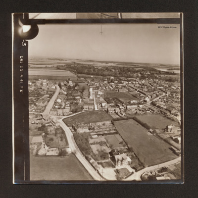
Heacham
Oblique aerial photograph of Heacham surrounded by fields and with woods in the distance.
Tags: aerial photograph
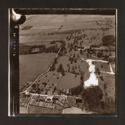
Flitcham
Oblique aerial photograph Flitcham. There is a country house with formal garden and estate in the top right quadrant with lake below and village in the bottom left quadrant. A road runs from bottom left to top centre.
Tags: aerial photograph
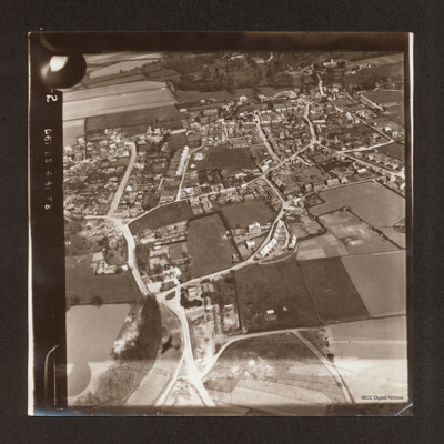
Heacham
Oblique aerial photograph of Heacham with houses along roads. In the background open fields and woods.
Tags: aerial photograph
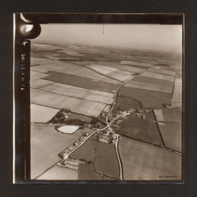
Shernborne
Oblique aerial photograph of Shernborne, roads running from bottom left to top right cross with road running from bottom centre to top right. Most of the view is of open fields.
Tags: aerial photograph
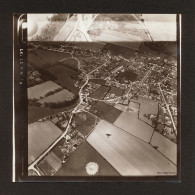
Heacham
Oblique aerial photograph of Heacham surrounded by fields. There is the shadow of a Hampden one quarter way up from centre bottom. There is part of another exposure at the top.
Tags: aerial photograph; Hampden
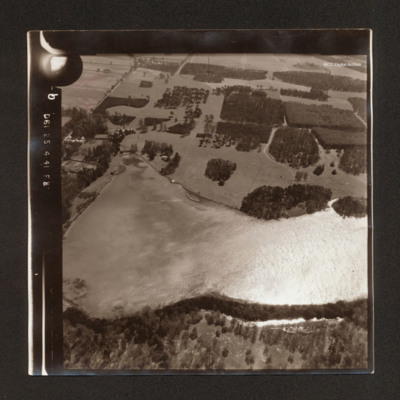
Narford Lake and Narford Hall
Oblique aerial photograph showing Narford Lake in the bottom half. To the top left of the lake is Narford Hall. Above the lake tree plantations in estate.
Tags: aerial photograph
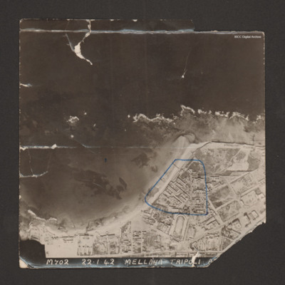
Tripoli (motor transport dump)
Reconnaissance photograph with a shoreline running from bottom left to middle right with sea at top and land below. Buildings cover the land; military storehouses near Via Cannizzaro e Via Giuseppe Colombo are outlined in blue. Captioned 'M702…
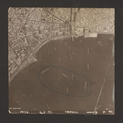
Tripoli
Reconnaissance photograph of harbour area. There are many ships, some of them identified as Anna Maria, Ariosto, Atlas, Bengasi, Beppe, Bosforo, Delia, and Pisani. Five ships have been enclosed by blue line. There is a breakwater along right side.…
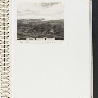
Isle of Man
Oblique aerial photograph showing countryside and a cloud formation. Captioned 'T2147', '4F42', '66007', '517/6' and 'July 1945', 'Isle of Man'.
Tags: 517 Squadron; aerial photograph
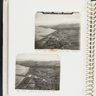
Ramsey, Isle of Man
Top, an aerial photograph of coastline, small town, river estuary, two breakwaters and a pier. Captioned 'T2148 STD 3rd JULY 45//A/C 517/6 F6 3/8 RAMSEY - ISLE OF MAN' and '3 July Ramsey Isle of Man HT 1000 FT'.
Bottom, an aerial photograph of…
Bottom, an aerial photograph of…
Tags: 517 Squadron; aerial photograph
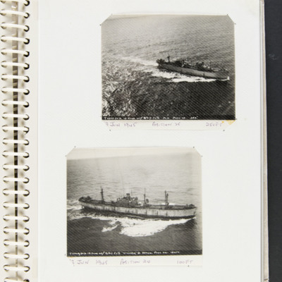
Merchant ships at sea
Top a merchant vessel at sea captioned 'T2070 STD 13 JUNE 45// 13/517 F6 3/8 M.V. POSN 25 250' and '13 June 1945 Position 25 250 FT'.
Bottom a merchant vessel at sea captioned 'T2069 STD 13 JUNE 45// 13/517 F6 3/8 'WILLIAM D BYRON' POSN 24 100FT'…
Bottom a merchant vessel at sea captioned 'T2069 STD 13 JUNE 45// 13/517 F6 3/8 'WILLIAM D BYRON' POSN 24 100FT'…
Tags: 517 Squadron; aerial photograph
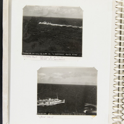
HMS Newcastle and Hospital ship
Top, a battleship at sea captioned 'T2014 STD 22.5.45 // A/C LC380 6 3/8 [CRUISER HMS ] NEWCASTLE POST 8 HT 300' and '22 May 1945 position 8 HT 300 FT Cruiser HMS Newcastle’
Bottom, a picture of a hospital ship at sea captioned 'T2077 STD' and '6…
Bottom, a picture of a hospital ship at sea captioned 'T2077 STD' and '6…
Tags: 517 Squadron; aerial photograph
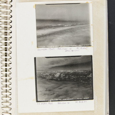
Cloud formations
Two aerial photographs of cloud formations.
Top, captioned ' T2017 STD 22.5.45 // A/C LG 380 6 3/8 CLOUD FORMATION POST 15 HT 18250' and 22 May 1945 position is HT 18,250 Ft approx. 1600 GMT'.
Bottom captioned 'T2019 STD 22.5.45 // A/C LG 380 6…
Top, captioned ' T2017 STD 22.5.45 // A/C LG 380 6 3/8 CLOUD FORMATION POST 15 HT 18250' and 22 May 1945 position is HT 18,250 Ft approx. 1600 GMT'.
Bottom captioned 'T2019 STD 22.5.45 // A/C LG 380 6…
Tags: 517 Squadron; aerial photograph
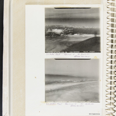
Cloud formations
Two aerial photographs of cloud formations. Top, captioned 'T2018 STD 22.5.45 // A/C LC 380 6 3/8 CLOUD FORMATION POST 15 HT 18250' and '22 May 1945 position is HT 18,250 Ft approx. 1600 GMT'.
Bottom captioned 'T2017 STD 22.5.45 // A/C LC 380 6 /38…
Bottom captioned 'T2017 STD 22.5.45 // A/C LC 380 6 /38…
Tags: 517 Squadron; aerial photograph
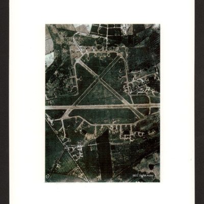
RAF Skellingthorpe
Vertical aerial photograph of RAF Skellingthorpe. Aircraft are visible on the dispersals.
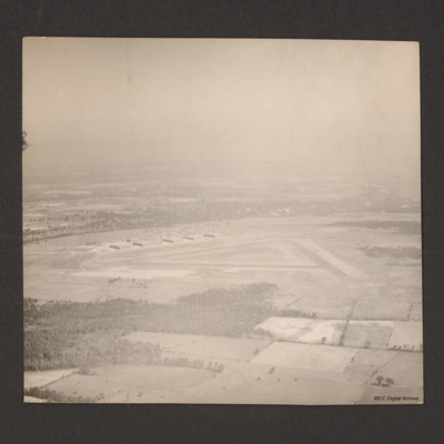
RCAF Picton from the air
Shows airfield, runways and hangars. On the reverse 'Picton station 1500ft'. Captioned 'Royal Canadian Air Force Picton Ontario Canada. Near Lake Ontario, Picture taken from 1500ft.'
Tags: aerial photograph; hangar; runway
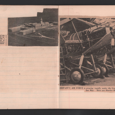
RAF Cranwell and Hawker Harts
Cutting 1 is an aerial view of RAF Cranwell, the RAF's Officer training college.
Cutting 2 is a photograph of a line of Hawker Harts captioned 'Britain's Air Force is growing rapidly under the Government's two-year expansion programme announced…
Cutting 2 is a photograph of a line of Hawker Harts captioned 'Britain's Air Force is growing rapidly under the Government's two-year expansion programme announced…
Tags: aerial photograph; RAF Cranwell; training
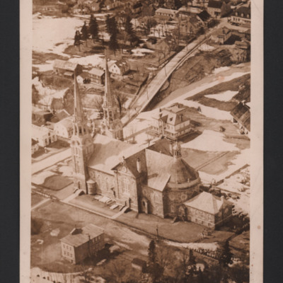
Ancienne Lorette Church
A low oblique aerial photograph of a church. There is snow in gardens and parks. On the reverse 'Ancienne Lorette Church P.Q. Each spire has a permanently lighted cross.'
Tags: aerial photograph
Bomb in sea
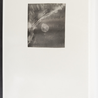
Target photograph showing coast running bottom left to top right with sea to the right. In the centre a bomb explosion in the sea.
Westkapelle
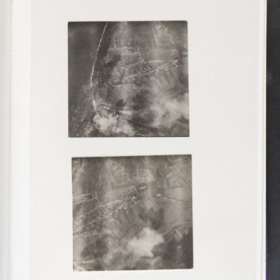
Top - coastline curving from top left to bottom centre. Some bomb explosions are visible bottom left on coast. Bottom - open ground with a built up area centre left. Bomb explosions bottom right quadrant.
Westkapelle
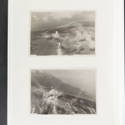
Top - coastline curving from top left to centre left and then bottom centre. Bomb explosions visible in centre just inland of coast. Bottom - coastline juts out from bottom to centre with bomb explosion on coastline at centre.
Tags: aerial photograph; bombing
Target photographs
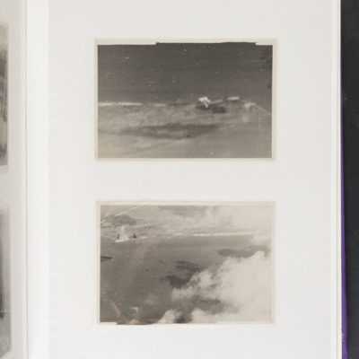
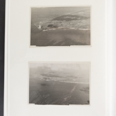
Top - indistinct coastline from left to right centre. Buildings at right end. Bottom - sea at bottom with coastline in the distance, left to right at top. Possible explosions on coastline at left.
Tags: aerial photograph; bombing
Target photographs
Top land juts out from right to centre left, Bomb explosions visible left centre on coast. Bottom coastline runs from left to right centre, sea at bottom. Bomb explosions visible left side on coast.

