Browse Items (700 total)
- Conforms To is exactly "Geolocated"
Sort by:
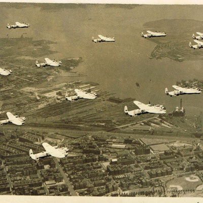
12 Lancasters of 35 Squadron in flight
12 Lancasters from 35 Squadron flying over New York. North Brother Island and Rikers Island can be seen in the top left of the photograph.The aircraft are in the post-war black and white colour scheme.
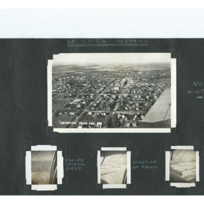
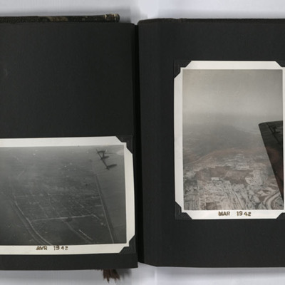
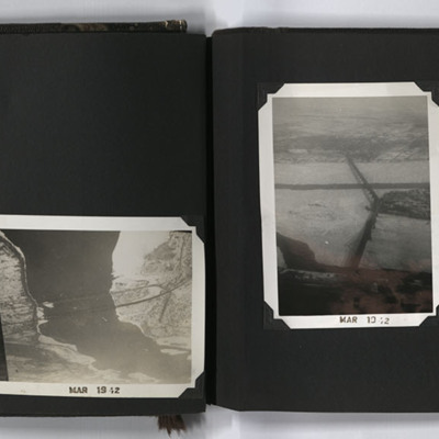
35 EFTS Neepawa
Four photographs from an album.
Photo 1 is a postcard captioned 'Neepawa from the air'. It is a grid of houses with a small shopping area. It is further captioned 'Not winter'.
Photo 2 is fields captioned 'Forced Landing Field'.
Photo 3 and 4 are…
Photo 1 is a postcard captioned 'Neepawa from the air'. It is a grid of houses with a small shopping area. It is further captioned 'Not winter'.
Photo 2 is fields captioned 'Forced Landing Field'.
Photo 3 and 4 are…
Tags: aircrew; Flying Training School; training
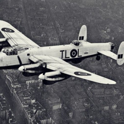
35 Squadron Lancaster over London
Top front quarter view of Lancaster TW892 with white upper paintwork, squadron code 'TL-L' flying over Regent Street, London.
Identification kindly provided by Liam Moore of the Unidentified photos of the British Isles Group.
Identification kindly provided by Liam Moore of the Unidentified photos of the British Isles Group.
Tags: 35 Squadron; Lancaster
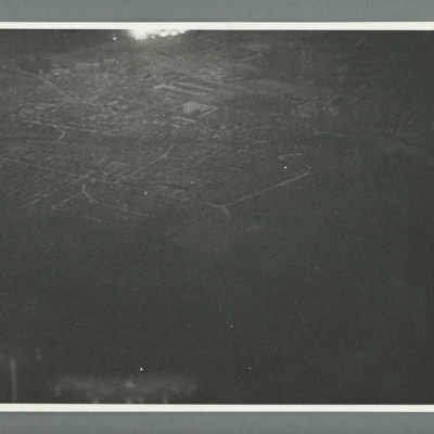
617 squadron attack on St Cyr
Night oblique aerial photograph showing a town with flares top centre. On the reverse 'Cam 1, Neg 1, 10.4.44, 150, St Cyr Airpark, 617,S/Lfr Munro, Lancaster, 0200,orbiting,10000/6000'.
Tags: 617 Squadron; aerial photograph; bombing; Lancaster
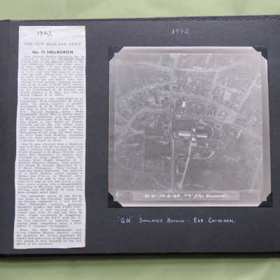
75 Squadron News Story
Two items from a photo album.
Item 1 is a newspaper cutting about 75 Squadron, dated 1943.
Item 2 is a vertical aerial photograph taken during a training exercise, annotated ' C.1. N.U. 10-3-45 F7" F/Lt Guinane' and captioned ' "G.H." Simulated…
Item 1 is a newspaper cutting about 75 Squadron, dated 1943.
Item 2 is a vertical aerial photograph taken during a training exercise, annotated ' C.1. N.U. 10-3-45 F7" F/Lt Guinane' and captioned ' "G.H." Simulated…
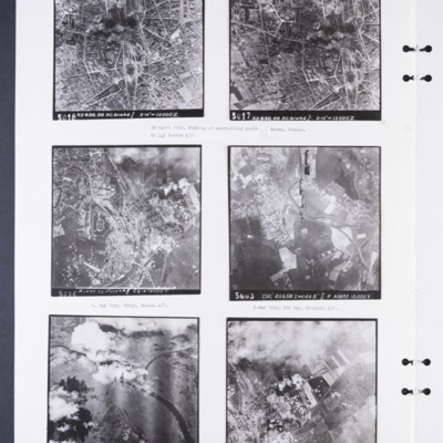
88 and 226 Squadron aerial photographs
Photograph 1 and 2 are sequential vertical aerial photographs of the marshalling yards at Arras. They are partly obscured by smoke. They are numbered 5018 and 5017 and captioned 'RS 636 88 30.APR44//D14" → 10,000'Z'. Captioned: '30 April 1944,…
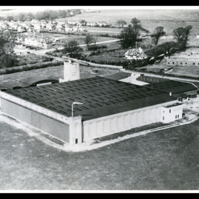
A V Roe & Co Ltd Experimental station
Oblique aerial photograph of a hangar with buildings attached and tower behind. In the distance behind houses. On the reverse 'A. V. Roe & Co Ltd, Experimental Station, Hamble, 1917 - 28, Crescent Studios, Fareham Hants, Neg No 21103 [...] 4,…
Tags: aerial photograph; hangar
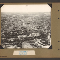
Aachen
Oblique aerial photograph of Aachen. The Stadtpark is in the foreground and the circular Roland Plasse in the bottom right. The Cathedral is centre right. A third of the way up a tree line boulevard runs from left to right with some large detached…
Tags: aerial photograph; Cook’s tour
Aachen
Oblique aerial photograph of the town of Aachen with a large number of multistory buildings, the majority of which are damaged and without roofs. A railway runs from top left to centre top with some wagons on the left end, Two streets run slightly…
Tags: aerial photograph; bombing; Cook’s tour
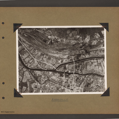
Abbeville
Aerial vertical photograph of town with canals and marshalling yard. A river/canal runs from mid left slanting down initially and then right across to the right hand side. In the middle another canal splits off upwards then goes right to middle right…
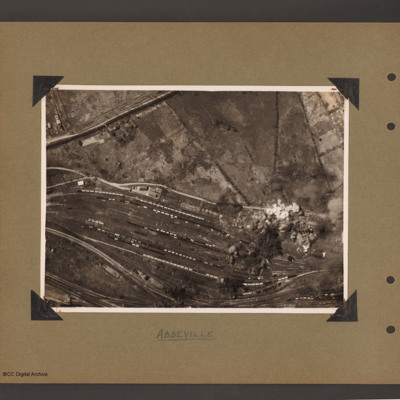
Abbeville marshalling yard
Aerial vertical photograph of a marshalling yard running from left slanting down to the right. The yard has a large number of goods wagons and locomotives spread throughout. To the top right is open countryside. There are bomb explosions at the…
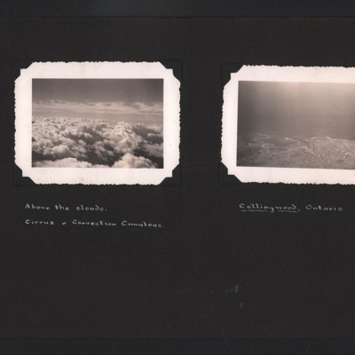
Above the Clouds and Collingwood
The first photograph is an aerial photograph looking at cirrus and convection cumulous clouds. Captioned ' Above the clouds. Cirrus & Convection Cumulous'. The second is a low angle aerial photograph of Collingwood, Ontario. The town and its docks…
Tags: aerial photograph
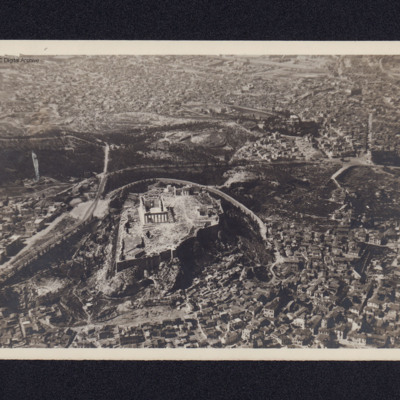
Acropolis, Athens
An oblique aerial photograph of the Acropolis.
On the reverse 'The acropolis at Athens en route from Bari to Cyprus'.
On the reverse 'The acropolis at Athens en route from Bari to Cyprus'.
Tags: aerial photograph
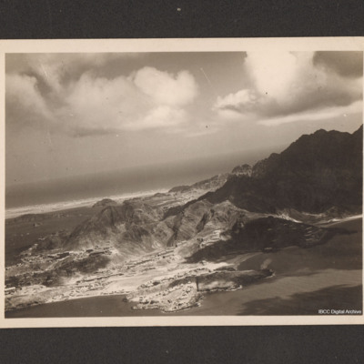
Aden
An oblique aerial photograph of Aden. On the reverse 'Aerial view of Aden, showing the NAAFI Lido and Sapper's Bay.'
Aerial Photographs, Canada
Four aerial photographs from an album.
#1 is a city with a river.
#2 is looking south along the Richelieu River, to the right is Saint-Jean-sur-Richelieu, Quebec, Canada.
#3 is a city with a regular grid street pattern and a river under the wing…
#1 is a city with a river.
#2 is looking south along the Richelieu River, to the right is Saint-Jean-sur-Richelieu, Quebec, Canada.
#3 is a city with a regular grid street pattern and a river under the wing…
Tags: aerial photograph; training
Aerial Photographs, Montreal
Four oblique aerial photographs from an album. #1 is a city with a bridge crossing a frozen river and another bridge leading to a small island. #2 is two bridges, Honor Mercier, crossing the St Lawrence river. #3 is the Jacques Cartier bridge leading…
Tags: aerial photograph
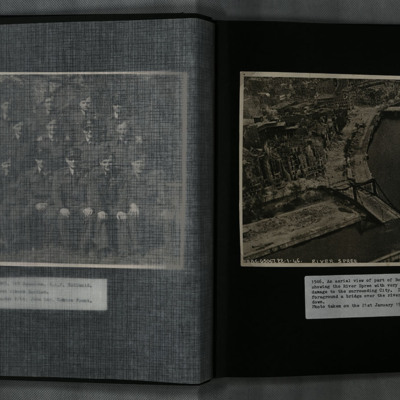
Aerial View of Berlin
A low level oblique aerial photograph of Berlin and the River Spree, showing extensive damage to the city and Hugo-Preuß-Brücke.
Tags: aerial photograph; bombing
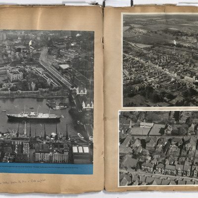
Aerial views
Left page: a view of central London including the Tower of London, Tower Bridge and the royal yacht Britannia, annotated 'All photographs taken from the air and Bob as pilot'. Right page: top, Berkhamsted.Bottom, Park View Road, Berkhamsted.
Tags: aerial photograph; aircrew; pilot
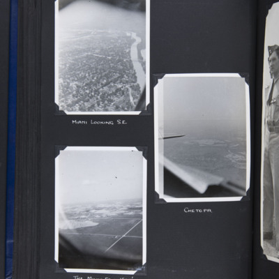
Airborne views around Miami Oklahoma
Top left - oblique aerial photograph of a town with river running from bottom to top right. Captioned 'Miami looking S.E.'.
Middle right - oblique aerial photograph of a town in middle distance with part of cockpit coaming and tailplane visible.…
Middle right - oblique aerial photograph of a town in middle distance with part of cockpit coaming and tailplane visible.…
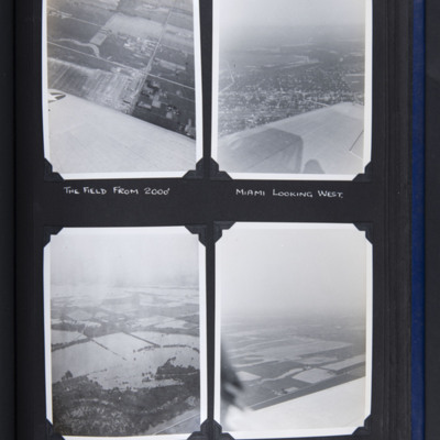
Airborne views round Miami Oklahoma
Top left - oblique aerial photograph of fields with buildings bottom right. Part of wing visible at bottom. Captioned 'The field from 2000''.
Top right - oblique aerial photograph of town in middle with open countryside beyond. Part of wing visible…
Top right - oblique aerial photograph of town in middle with open countryside beyond. Part of wing visible…
Aircraft factory at Albert
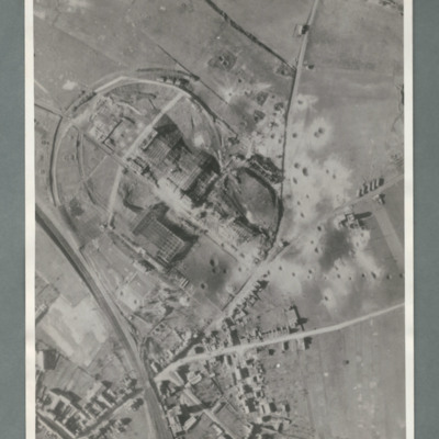
Reconnaissance photograph showing a railway line bottom left and an industrial area circled by a road in the centre. There are a number of craters to the right side of the industrial area. On the reverse 'Secret, Con G.412'
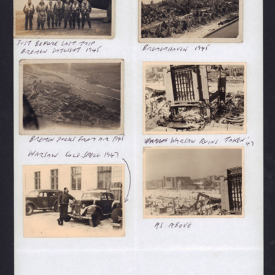
Aircrew, Bremerhaven, Bremen and Warsaw
Top left: Seven RAF aircrew in full flight gear in front of a Lancaster. Captioned 'Just before last trip Bremen daylight, 1945'.
Top right: oblique aerial photograph of a city. In centre a high-spired church amongst part ruined houses. There is a…
Top right: oblique aerial photograph of a city. In centre a high-spired church amongst part ruined houses. There is a…
Tags: aircrew; bombing; Cook’s tour; Lancaster
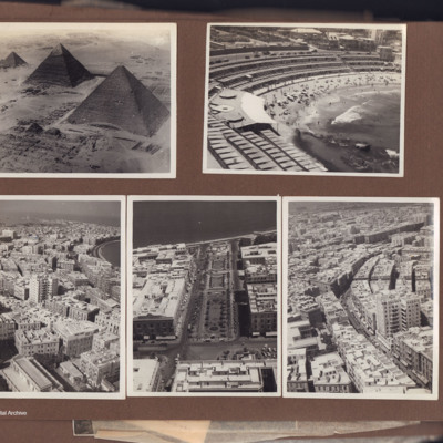
Alexandria and Giza
Five aerial photographs from an album.
Photo 1 is the three pyramids at Giza.
Photo 2 is of Stanley Bay, Alexandria with tiers of beach cabins.
Photo 3 is a of Alexandria city centre with a eleven story building. In the distance is a bay and a…
Photo 1 is the three pyramids at Giza.
Photo 2 is of Stanley Bay, Alexandria with tiers of beach cabins.
Photo 3 is a of Alexandria city centre with a eleven story building. In the distance is a bay and a…
Tags: aerial photograph
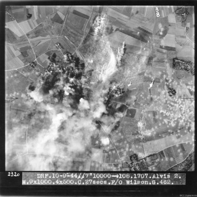
Alvis 2 target area
Target photograph of bombs exploding and obscuring target. Many bomb craters on the right side of image. Captioned 'DRF 10.9.44//7" 10000 > 108.1707.Alvis 2, M.9x1000.4x500.C. 27 secs. F/O Wilson G.462'.
This item was sent to the IBCC Digital…
This item was sent to the IBCC Digital…
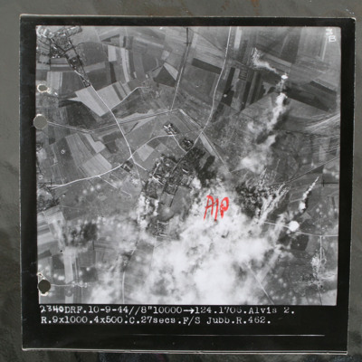
Alvis 2 target area
Target photograph of rural area with villages visible top left and centre with connecting roads and tracks. Annotated with "A/P" aiming point in red ink to right of centre which is obscured by smoke and target marker flares. Tank ditch zig zags…

