Browse Items (103 total)
- Contributor is exactly "Andy Fitter"
Sort by:
Nordstern
The three navigation sheets give details of the planned routes out and back as well as observations and events during the operation. The map plots the routes to be flown.
Note from the Navigation Officer 'Satisfactory. Why not use 40[degree] method…
Note from the Navigation Officer 'Satisfactory. Why not use 40[degree] method…
Interview with Frank Page
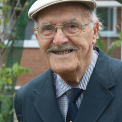
Frank Page grew up near Teddington Locks and was working for an engineering firm when the war started. His house was bombed and he remembers recovering bodies from the ruins and says he joined the RAF to get his revenge on the Germans. His pilot…
9 Squadron and Marignane
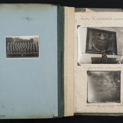
Three photographs arranged in an album.
On the left page is a formal photograph of of 47 trainee airmen and one officer, arranged in 4 rows.
The righthand page is entitled '3rd DEC 1943 "9" SQUADRON 22ND MAY 1944'. It holds two…
On the left page is a formal photograph of of 47 trainee airmen and one officer, arranged in 4 rows.
The righthand page is entitled '3rd DEC 1943 "9" SQUADRON 22ND MAY 1944'. It holds two…
Coastal bombing
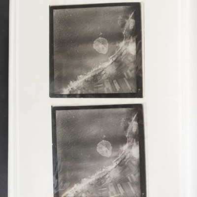
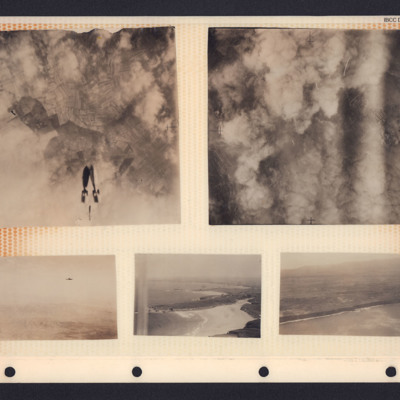
Two almost identical target photographs showing the sea to the upper left and the coast and fields to the lower right. There are several bomb craters along the dunes and one in a field. There is also the splash from a bomb impact in the sea. There is…
Bombs, hills and coastline
A collection of photographs in an album. From top left to bottom right:
1. Target photograph showing three bombs falling towards cloud and fields. There is no caption to identify the target.
2. Target photograph. The ground is mostly obscured by…
1. Target photograph showing three bombs falling towards cloud and fields. There is no caption to identify the target.
2. Target photograph. The ground is mostly obscured by…
Bombing and people
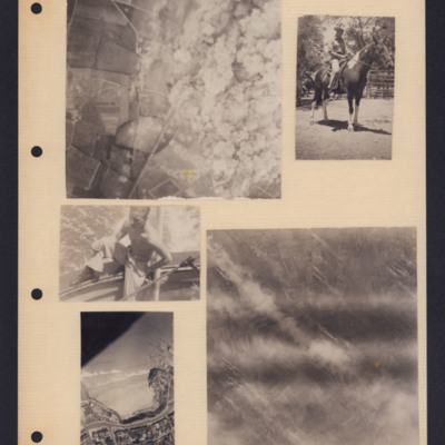
Five photographs from an album page. From top left to bottom right:
1. A target photograph showing open countryside. On the left is a line of bomb craters in fields. Roads are also visible here as is a railway line. On the right, the ground is…
1. A target photograph showing open countryside. On the left is a line of bomb craters in fields. Roads are also visible here as is a railway line. On the right, the ground is…
Tags: aerial photograph; animal; bombing; target photograph
Hamburg Residential and Industrial Area
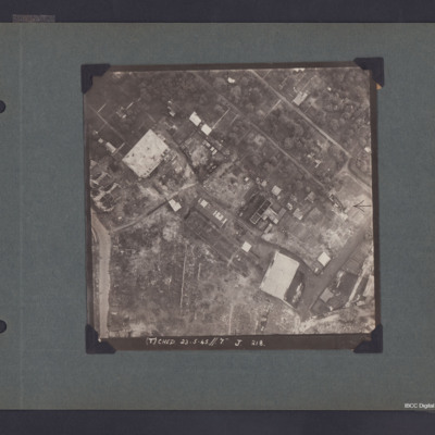
Vertical aerial photograph of part of Hamburg showing bomb damage. Two large buildings and some smaller ones remain standing while most have been either destroyed completely or gutted. The upper, right area appears to be residential, though few…
Aerial photograph with a Lancaster
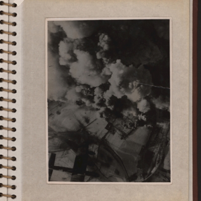
Vertical aerial photograph showing explosions and smoke coming up from what seems to be a power station or oil storage facility. There are two round towers or tanks partially visible through the smoke and the plant is surrounded by bomb-cratered open…
Schweinfurt
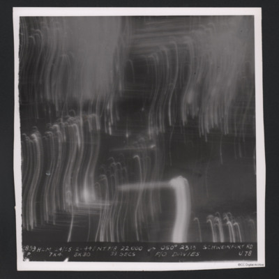
Target photograph on an operation to Schweinfurt. Many light trails from tracer are visible but there is no ground detail. The photograph is captioned:
'2839 HLM 24/25.2.44//NT F/8 22000 → 050 º 2313, SCHWEINFURT RD
7x4 8x30 33 SECS, F/O…
'2839 HLM 24/25.2.44//NT F/8 22000 → 050 º 2313, SCHWEINFURT RD
7x4 8x30 33 SECS, F/O…
Stuttgart
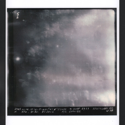
Target photograph for an operation to Stuttgart. Light traces and glare cover most of the image but no ground detail is visible. It is annotated '5B' and is captioned:
2983 HLM. 15/16-3-44 //NT 8" 20,000. → 008º 2323 STUTTGART RD
N. 5x4.…
2983 HLM. 15/16-3-44 //NT 8" 20,000. → 008º 2323 STUTTGART RD
N. 5x4.…
Gnome et Rhône aero-engine factory
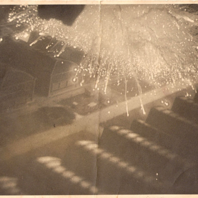
An oblique aerial photograph showing target indicators showering over the rows of workshop buildings at the Gnome et Rhône aero-engine factory. The photograph is taken at very low level.
Aerial Photographs
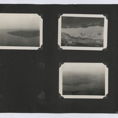
Three oblique aerial photographs from an album. From left to right:
1. Oblique aerial view of a peninsula or island with the coastline visible.
2. Aerial view of the ground. A road cuts through the topography in the lower part of the image.
3.…
1. Oblique aerial view of a peninsula or island with the coastline visible.
2. Aerial view of the ground. A road cuts through the topography in the lower part of the image.
3.…
Tags: aerial photograph
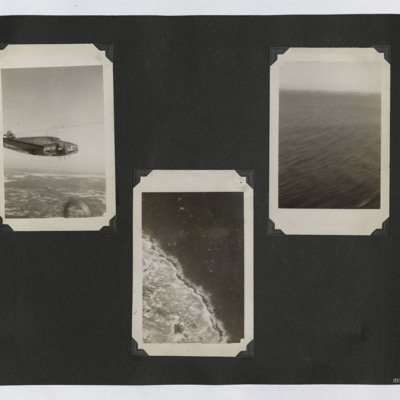
Aerial Photographs of a Lockheed Hudson, Coastline and Sea
Three photographs in an album. From left to right:
1. Air to air view of Hudson L3 in flight.
2. Aerial photograph of some unidentified coastline.
3. Oblique aerial view of an area of sea.
1. Air to air view of Hudson L3 in flight.
2. Aerial photograph of some unidentified coastline.
3. Oblique aerial view of an area of sea.
Tags: aerial photograph; Hudson
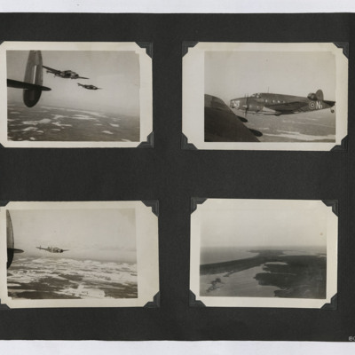
Hudsons and a Coastal View
Four photographs in an album. From top left:
1. Air to air photograph of two Hudsons in flight, taken from a third. The ground is visible.
2. Air to air photograph of Hudson N3 in close formation. Taken from another Hudson.
3. Air to air…
1. Air to air photograph of two Hudsons in flight, taken from a third. The ground is visible.
2. Air to air photograph of Hudson N3 in close formation. Taken from another Hudson.
3. Air to air…
Tags: aerial photograph; Hudson
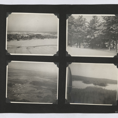
Aerial Photographs and Snow Scenes
Four photographs from an album.
1. An aerial oblique view of a a settlement on a snow covered hill side.
2. A view of some snow-covered trees.
3. An oblique aerial view of an airfield and surrounding farms.
4. An oblique aerial view of a lake set…
1. An aerial oblique view of a a settlement on a snow covered hill side.
2. A view of some snow-covered trees.
3. An oblique aerial view of an airfield and surrounding farms.
4. An oblique aerial view of a lake set…
Tags: aerial photograph
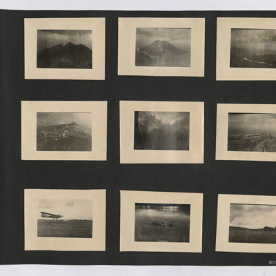
Aerial views, CG4A Glider, Baltimore and C-47
Nine photographs from an album. Starting at top left:
#1 is a view of a volcano with a smoke plume.
#2 is an oblique aerial view of Stromboli.
#3 is an oblique aerial view of an island. A beach with surf can be seen, as can the outline of the…
#1 is a view of a volcano with a smoke plume.
#2 is an oblique aerial view of Stromboli.
#3 is an oblique aerial view of an island. A beach with surf can be seen, as can the outline of the…
Tags: aerial photograph; C-47
Flushing
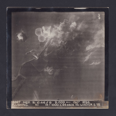
Target photograph taken during an operation to Flushing, Netherlands. Several bomb splashes in the water and smoke from explosions on the ground. Water is flowing through the sea wall at one point. The photograph is captioned:
2007 MEP 21.10.44 //…
2007 MEP 21.10.44 //…
Pas de Calais
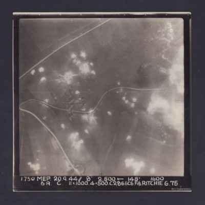
Target photograph. Fields and several minor roads visible. Much of the image is dotted with smoke from bomb bursts or Anti-aircraft fire and glare obscures right hand side. A Lancaster can be seen flying below. Annotated '3B' and captioned '1750 MEP…
Duisberg
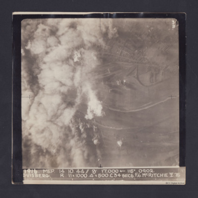
Target photograph taken on an operation to Duisberg. Left hand side is obscured by smoke or cloud and several bomb explosions can be seen. The Rhine river runs across the image, just below half height and there is built up area towards top of…
Neuss
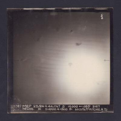
Target photograph of an operation to Neuss. Only a large area of glare, roughly in the middle, is visible. It is annotated '5B' and captioned:
'1787 MEP 23/24.9.44//NT 8" 19,000 ← 055 º 2127
NEUSS. H1. 11 x 1000. 4 x 500. 31 SECS. F/S…
'1787 MEP 23/24.9.44//NT 8" 19,000 ← 055 º 2127
NEUSS. H1. 11 x 1000. 4 x 500. 31 SECS. F/S…
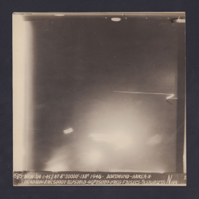
Dortmund-Hansa
Target photograph for an operation to Dortmund - Hansa. An area of glare occupies the lower part of the image and there is another down the left side. The rest is in darkness and n ground detail is visible. The photograph is annotated '6' and…
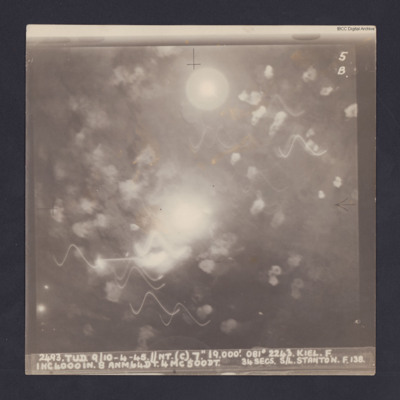
Kiel
Target photograph for an operation to Kiel. It shows light trails and smoke, including multiple Flax bursts but no ground detail. It is annotated '5B' and captioned:
'2493. TUD. 9/10-4-45. //NT. (C). 7". 19,000'. 081 º 2243. KEIL. F.
1HC4000IN. 8…
'2493. TUD. 9/10-4-45. //NT. (C). 7". 19,000'. 081 º 2243. KEIL. F.
1HC4000IN. 8…
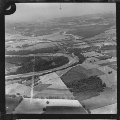
Bridge across Maitland River
Two aerial photographs showing the River Maitland at Benmiller, Ontario. One is taken obliquely and shows several large bends in the river with the community of Benmiller at centre right. The sencond is a vertical aerial photograph showing the road…
Tags: aerial photograph
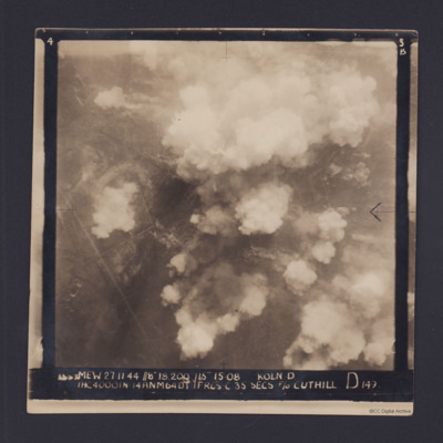
Cologne
Target photograph for an operation to Cologne. It shows clouds of smoke rising up from several locations on the ground. Residential areas and roads are visible, as are some bomb craters in the fields. It is annotated '3B' and captioned:
'[…
'[…
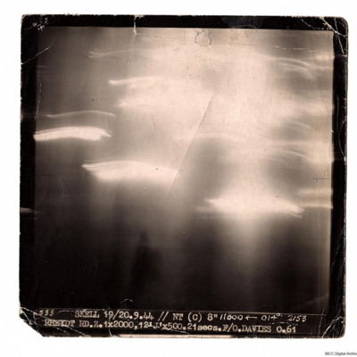
Rheydt
A target photograph taken on an operation to Rheydt. The ground detail is obscured by glare and light trails. Photograph is captioned:
'2533 SKELL 19/20.9.44 // NT (C) 8" 11000 ← 014° 2153
RHEYDT RD.Z. 1x2000, 12 'J' x 500. 21 secs. F/O.…
'2533 SKELL 19/20.9.44 // NT (C) 8" 11000 ← 014° 2153
RHEYDT RD.Z. 1x2000, 12 'J' x 500. 21 secs. F/O.…

