Browse Items (12 total)
- Spatial Coverage is exactly "France--Morlaix"
The Offensive Phase
Tags: 1 Group; 100 Group; 101 Squadron; 109 Squadron; 141 Squadron; 169 Squadron; 171 Squadron; 192 Squadron; 199 Squadron; 214 Squadron; 218 Squadron; 223 Squadron; 239 Squadron; 3 Group; 4 Group; 462 Squadron; 5 Group; 617 Squadron; 8 Group; aircrew; B-17; B-24; Beaufighter; Bennett, Donald Clifford Tyndall (1910-1986); Chamberlain, Neville (1869-1940); crash; Defiant; Do 217; Fw 190; Gee; Gneisenau; Goering, Hermann (1893-1946); H2S; Halifax; Halifax Mk 3; Hampden; Harris, Arthur Travers (1892-1984); He 111; Hitler, Adolf (1889-1945); Hudson; Ju 88; Lancaster; Me 110; Me 410; mine laying; Morse-keyed wireless telegraphy; Mosquito; navigator; Oboe; Operational Training Unit; P-51; Pathfinders; radar; RAF Defford; RAF Downham Market; RAF Farnborough; RAF Foulsham; RAF Little Snoring; RAF North Creake; RAF Northolt; RAF Oulton; RAF Prestwick; RAF Sculthorpe; RAF St Athan; RAF Swannington; RAF Tempsford; RAF Upper Heyford; RAF Uxbridge; RAF West Raynham; RAF Wittering; Scharnhorst; Stalin, Joseph (1878-1953); Stirling; Tirpitz; training; Typhoon; V-1; V-2; V-weapon; Wellington; Window
The Radio War Waged by the RAF Against Germany 1940-1945
Tags: 100 Group; 101 Squadron; 109 Squadron; 214 Squadron; 218 Squadron; Anson; B-17; B-24; Blenheim; bombing; Churchill, Winston (1874-1965); Do 217; Gee; Gneisenau; Goering, Hermann (1893-1946); ground personnel; H2S; Harris, Arthur Travers (1892-1984); He 111; Hitler, Adolf (1889-1945); Hudson; Ju 52; Ju 88; Morse-keyed wireless telegraphy; Oboe; P-51; Pathfinders; Photographic Reconnaissance Unit; radar; RAF Biggin Hill; RAF Boscombe Down; RAF Defford; RAF Martlesham Heath; RAF Oulton; RAF St Athan; RAF Waddington; RAF Wyton; Scharnhorst; V-1; V-2; V-weapon; Wellington; Whitley; Window; Women’s Auxiliary Air Force
Gordon Mills observer's and air gunner's log book
Tags: 149 Squadron; 1651 HCU; 1653 HCU; 1657 HCU; 218 Squadron; 26 OTU; 44 Squadron; 50 Squadron; 75 Squadron; 83 Squadron; Advanced Flying Unit; air gunner; aircrew; Anson; bombing; Cook’s tour; crash; Heavy Conversion Unit; incendiary device; Lancaster; Lancaster Finishing School; Lincoln; Martinet; mine laying; Normandy campaign (6 June – 21 August 1944); Operation Exodus (1945); Operation Manna (29 Apr – 8 May 1945); Operational Training Unit; RAF Binbrook; RAF Feltwell; RAF Hemswell; RAF Leconfield; RAF Lindholme; RAF Little Horwood; RAF Mepal; RAF Methwold; RAF Mildenhall; RAF North Luffenham; RAF Penrhos; RAF Shallufa; RAF Stradishall; RAF Waddington; RAF Wing; RAF Wratting Common; Stirling; take-off crash; training; Wellington
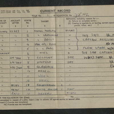
Gordon Mills sortie record sheet no 1
Tags: 149 Squadron; 218 Squadron; 75 Squadron; air gunner; aircrew; Lancaster; mine laying; Stirling
Evidence in Camera Vol 3 No 10
F A Robinson’s flying log book for pilots. One
Tags: 543 Squadron; aircrew; Anson; Blenheim; bombing; Flying Training School; Gneisenau; gremlin; Harvard; Lysander; Magister; Meteor; Operational Training Unit; Oxford; Photographic Reconnaissance Unit; pilot; Proctor; RAF Benson; RAF Cranwell; RAF Hatfield; RAF Hendon; RAF Odiham; RAF St Eval; Scharnhorst; Spitfire; Tiger Moth; Tirpitz; training; Wellington
Dennis Denton's log book
Tags: 13 OTU; 139 Squadron; 17 OTU; 2 Group; 21 Squadron; 226 Squadron; air gunner; Air Gunnery School; aircrew; Anson; anti-aircraft fire; B-25; Blenheim; Botha; C-47; Defiant; Dominie; Operational Training Unit; Proctor; RAF Bicester; RAF Evanton; RAF Hartford Bridge; RAF Methwold; RAF Oulton; RAF Swanton Morley; RAF Upwood; RAF Watton; RAF West Raynham; RAF Yatesbury; training; Ventura; Whitley; wireless operator / air gunner
Jack Warner’s navigator's, air bomber's and air gunner's flying log book
Tags: 1659 HCU; 1664 HCU; 408 Squadron; 428 Squadron; aircrew; anti-aircraft fire; bombing; bombing of the Normandy coastal batteries (5/6 June 1944); C-47; flight engineer; Gneisenau; Halifax; Halifax Mk 2; Halifax Mk 5; Heavy Conversion Unit; mine laying; Normandy campaign (6 June – 21 August 1944); RAF Croft; RAF Leeming; RAF Middleton St George; RAF St Athan; RAF Topcliffe; Scharnhorst; training; Window
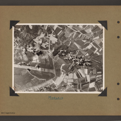
Morlaix [place]
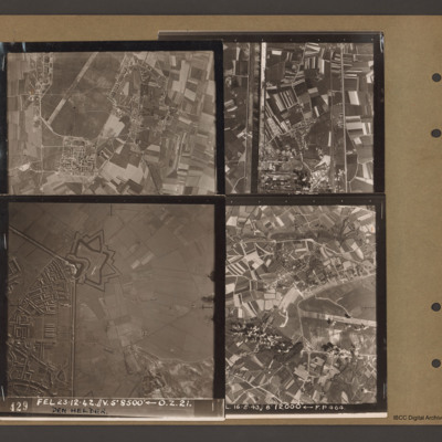
Caen-Carpiquet, Den Helder, Morlaix and unidentified canal
Top right an…

