Rotterdam and Zeebrugge
Title
Rotterdam and Zeebrugge
Description
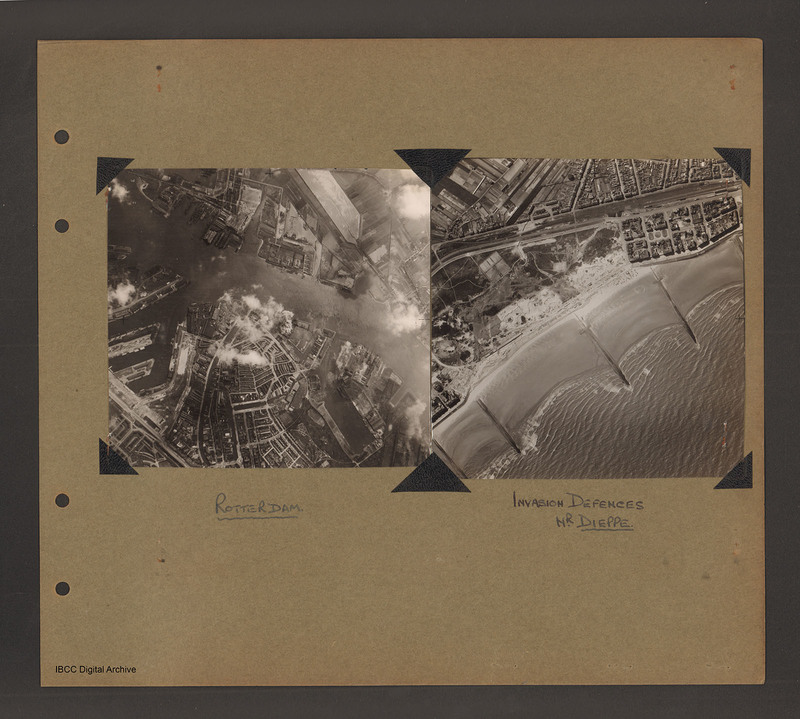
On the left an aerial vertical photograph showing a city with a river running through from left to right with port facilities on both sides. On the far side of the river towards the left is a small indented water basin with a few ships moored. Leading off from the near side of the river on the left is a large basin with three docking areas divided by two moles. On the same side of the river to the right is a large basin leads off the river then down towards the bottom right. Captioned 'Rotterdam'.
On the right an aerial vertical photograph of a beach with small town. The shore runs from bottom left diagonally towards top right. An open beach with four groynes and part of a fifth leads to open ground on the left and a built up area with a sea wall on the right. The open area has sand dunes and signs of construction. Behind both of these is a narrow strip, possibly a canal beyond which are more built up areas and open fields. Captioned 'Invasion Defences near Dieppe' [sic]
Description kindly amended by Stephen Fisher of the Unidentified photos of the British Isles Facebook Group
Spatial Coverage
Coverage
Type
Format
Two b/w photograph mounted on an album page
Conforms To
Publisher
Rights
This content is available under a CC BY-NC 4.0 International license (Creative Commons Attribution-NonCommercial 4.0). It has been published ‘as is’ and may contain inaccuracies or culturally inappropriate references that do not necessarily reflect the official policy or position of the University of Lincoln or the International Bomber Command Centre. For more information, visit https://creativecommons.org/licenses/by-nc/4.0/ and https://ibccdigitalarchive.lincoln.ac.uk/omeka/legal.
Identifier
PBanksP15010039
Collection
Citation
“Rotterdam and Zeebrugge,” IBCC Digital Archive, accessed July 26, 2024, https://ibccdigitalarchive.lincoln.ac.uk/omeka/collections/document/1450.
Item Relations
This item has no relations.

