Browse Items (1442 total)
- Tags: aerial photograph
Sort by:
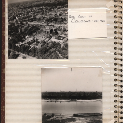
Two views of Cologne - May 1945
Top - oblique aerial photograph of a city with roads running left to right, the nearest one being tree lined and many damaged buildings
Bottom - oblique aerial photograph with the river Rhine running left to right and buildings including chimneys…
Bottom - oblique aerial photograph with the river Rhine running left to right and buildings including chimneys…
Tags: aerial photograph; bombing; Cook’s tour
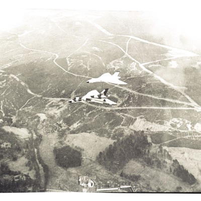
Two Vulcans near Bower
Air-to-air view looking down at two Vulcans in formation flying over Northumberland National Park near Bower.
Tentative identification kindly provided by Chris Clarke of the Unidentified photos of the British Isles Group.
Tentative identification kindly provided by Chris Clarke of the Unidentified photos of the British Isles Group.
Tags: aerial photograph
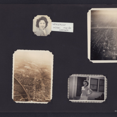
Two women and two aerial city views
Four photographs from an album.
#1 is a head and shoulders portrait of a women. An attached note states 'Werwaguk Indian. Our pet waitress'.
#2 s Miami, Oklahoma, looking North across the Neosho River showing the railway junction area.
#3 is an…
#1 is a head and shoulders portrait of a women. An attached note states 'Werwaguk Indian. Our pet waitress'.
#2 s Miami, Oklahoma, looking North across the Neosho River showing the railway junction area.
#3 is an…
Tags: aerial photograph; First nation
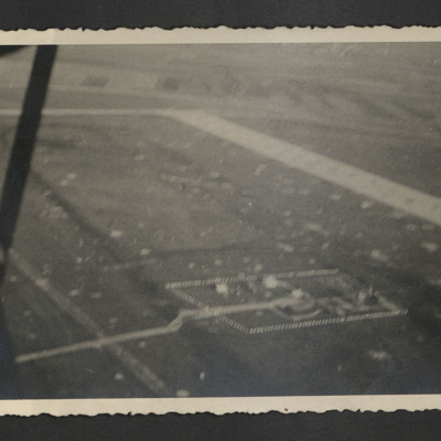
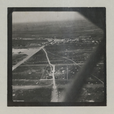
Udine airfield
Oblique aerial views of Udine Campoformido airfield. On the reverse ' "My Domain from the Air" while still under construction. Udine Feb 1946'.
Tags: aerial photograph; control tower; RAF Udine
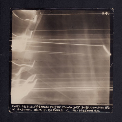
Udine main aerodrome
Vertical aerial photograph of Udine main aerodrome, taken during bombing operations. No detail is visible on the photograph due to anti-aircraft fire. It is captioned '2483 37/323 17/18 Nov 44. F8"//NT. 7500' -->345° 2059. UDINE MAIN A/D W. 9x500lbs…
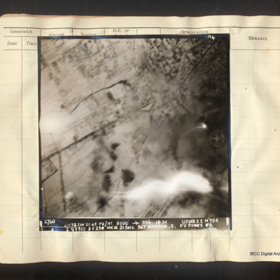
Udine marshalling yards
Vertical aerial photograph of Udine marshalling yards, centered on Porta Aquileia. The image is clear with the exception of an explosion in the lower right. Detail of the town and roads is visible. Captioned 'A4 2760 40/54 Jan 20 45 F8/NT 8000'…
Udine Signal Square and Control Tower
Oblique aerial views of the signal square and control tower at Udine airfield. Two C-47s can be seen on the hard standing. Airfield marking reads "LIGHT AIRCRAFT".
In the background, the 'caserma avieri', the 'Voisin' hangars, the main road, and the…
In the background, the 'caserma avieri', the 'Voisin' hangars, the main road, and the…
Tags: aerial photograph; C-47; control tower; hangar; RAF Udine; taxiway
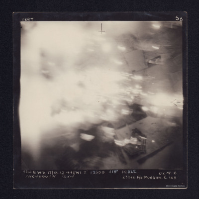
Ulm
A vertical aerial photograph taken during an operation at Ulm. Most of the image is obscured by cloud or explosions. It is annotated '4710 EWS 17/18.12.44//NT 7" 12500 118° 1932½ ULM C 1HC 4000IN 15X4 23SEC F/O MORGAN C 103'.
Unknown damaged town
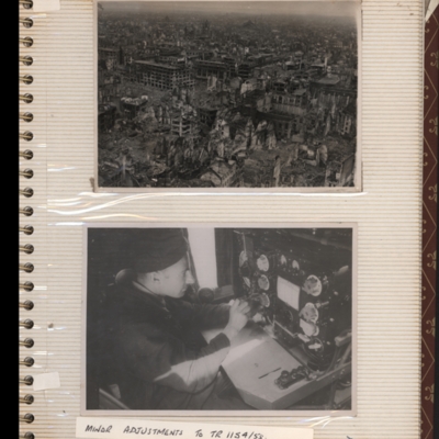
Top - oblique aerial photograph of a town with damaged multi-story buildings. Submitted with description 'Oblique "Cook's tour" aerial photo of unknown town showing bomb damage. Ministry No. CL 2173'.
Bottom - a man sitting in front of a wireless…
Bottom - a man sitting in front of a wireless…
Tags: aerial photograph; bombing; Cook’s tour
Unknown town
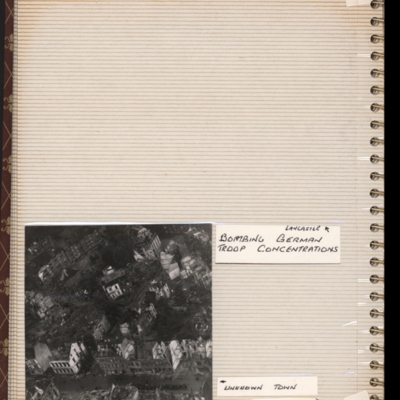
Bottom left - oblique aerial photograph of a town with destroyed and damaged buildings. Captioned 'Unknown town'. Submitted with description 'Oblique "Cook's tour" aerial photo of unknown town showing bomb damage'.
Tags: aerial photograph; bombing; Cook’s tour
Urban area
Aerial inclined photograph of a built up area, with a rectangular grid plan of streets. A large open space is visible in the top-right quadrant.
Tags: aerial photograph
Urban area
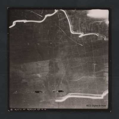
Vertical aerial photograph of unnamed location. The image is largely clear, only a few lines of tracer are visible with street patterns and buildings clearly visible. At the bottom it is captioned ‘A B (x7) 12 NT. 29/30/4/42 F/8” [arrow]…
Uzice
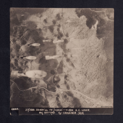
Four vertical aerial photographs taken during the bombing of Uzice, numbered 2603, 2604, 2605 and 2606. On 2603 bombs are seen dropping. Bomb explosions obscure part of the image. It is captioned '2603/2604/2605/2606. 37/329 23.Nov.44 F8//10,200'…
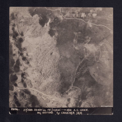
Uzice
A vertical aerial photograph showing a hill, roads and some settlement in a valley. It is captioned '2604. 37/329 23.Nov.44 F8//10,200' --> 1501 A.C. UZICE. Maj BAYFORD Sgt CROUCHER (B/A)'
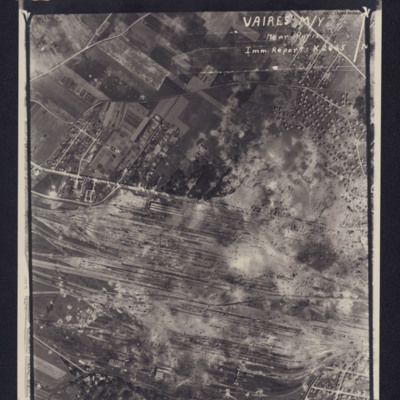
Vaires marshalling yard
Photograph of a marshalling yard. Inverted caption: 'VAIRES M/Y Near Paris Imm Report K2665' includes directional arrow pointing north. Caption at top of photograph: '4063 106G.1316.8.JULY.44. F/36"//542SQDN←'.
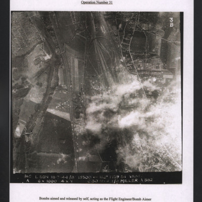
Vaires marshalling yard
Target photograph showing railways running top to bottom with marshalling yard centre right. Bomb explosions over yard. A Lancaster is visible bottom left flying to the left. Titled 'Vaires marshalling yard (14 miles east of Paris) 18 July 1944,…
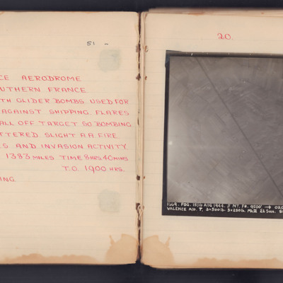
Valence Aerodrome Southern France
Target photograph for an operation to Valance Aerodrome. A road is visible, running diagonally top to bottom, surrounded by fields. The photograph is annotated 'A4' and captioned:
'1669. FOG. 15/16 AUG 1944. //NT. F8. 9500'. -> 020° 23.38.
VALENCE…
'1669. FOG. 15/16 AUG 1944. //NT. F8. 9500'. -> 020° 23.38.
VALENCE…
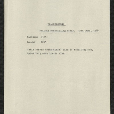
Valenciennes, Edward King's 16th operation of his tour
Five items, Edward's brief description of the operation their bomb aimer was sick so took replacement, quiet trip. Edward's navigation plot, and an indication of the H2S plot when over the target. There are two press clippings, the first has a…
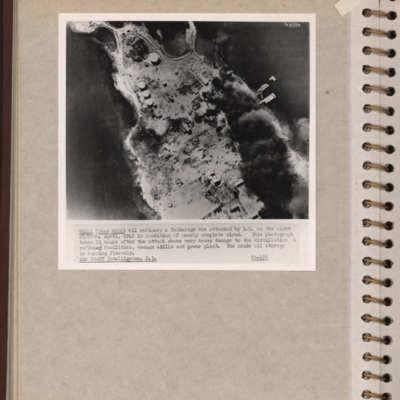
Vallo-Taneberg oil refinery
Reconnaissance photograph of an oil refinery on a peninsular with large plume of smoke from damaged oil tanks upper right area. Oslofjord is to the left with Prinds Christians Batterie just visible on the edge top left. Explanatory note underneath…
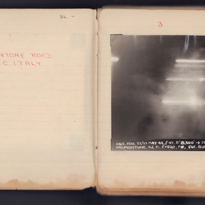
Valmontone Road
A vertical aerial photograph taken during an operation. No detail is visible of the ground, the image is obscured by explosions and light flashes.
It is captioned '1165. Fog.22/23 May 44 // NT 8" 8200 -> 120° 23.26 Valmontone. Rd. D 5 x 500 PO Sgt…
It is captioned '1165. Fog.22/23 May 44 // NT 8" 8200 -> 120° 23.26 Valmontone. Rd. D 5 x 500 PO Sgt…
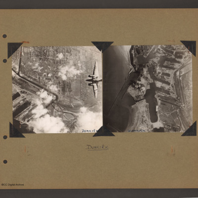
Ventura over Dunkirk and Dunkirk docks
On the left an aerial vertical photograph of town, canal and docks. A canal zigzags from top left down, right and the left back towards dockyard in the bottom left. A town with dwellings and industrial areas lies mostly to the right of canal. The…
Tags: aerial photograph; bombing; target photograph; Ventura
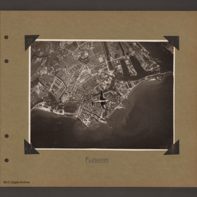
Ventura over Flushing
Aerial vertical photograph of coastline with town and docks. Coastline runs from mid left to right with a broad peninsular in the centre on which is a large town with docks. There are five jetties/piers running out into the sea. There is a Ventura…
Tags: aerial photograph; bombing; Ventura
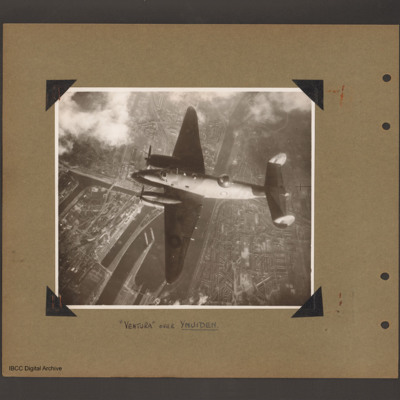
Ventura over Ijmuiden
Aerial vertical photograph of Ventura flying over canals and town. A Ventura coded YH of 21 squadron flies from right to left. Below is a canal which splits into a number of channels and a branch goes up into the town on the left side. Town buildings…
Tags: 21 Squadron; aerial photograph; Ventura
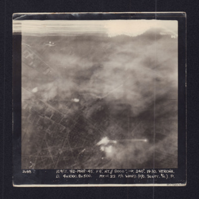
Verona
Target photograph showing town streets and explosions centre and bottom centre. Captioned '2698 104/71 11/12 Mar 45 F8 NT//8000 ft 240 degrees Verona, D 4x1000, 8x500 Mk III 22 F/O Ward (F/O Scott B/A) P.'.
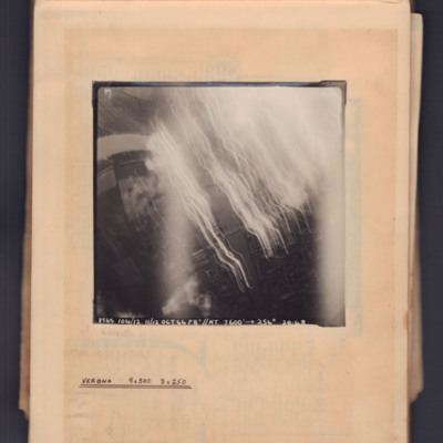
Verona
Target photograph showing river running top left curving to bottom right. Tracer and flares on right side. Captioned '1965, 104/12.11/12 Oct 44, F8, NT, 7600 ft→, 254 degrees, 20.48' . Annotated 'Verona 9x500 3x250'.

