Browse Items (1442 total)
- Tags: aerial photograph
Sort by:
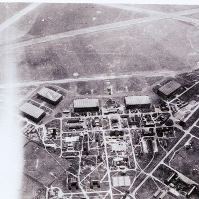
RAF Waddington
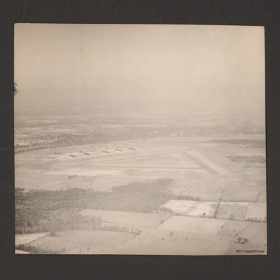
Air-to-ground view of a standard lay out RAF airfield with buildings on the left and runways to the right,
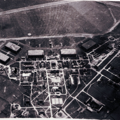
RAF Waddington
Air-to-ground image of an airfield with hangars and other buildings in bottom half and airfield with part of runway in top third of image.
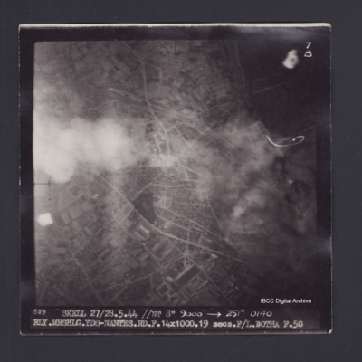
Railway Marshalling Yards Nantes
Target photograph of Railway Marshalling Yards Nantes. Urban area, some smoke and dust. street patterns and buildings visible but no clear detail. Captioned '7B', '889 SKELL 27/28.5.44 //NT 8" 9000' [arrow] 251° 0140…
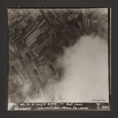
Raimbert
Vertical aerial photograph of Raimbert V-2 storage site. The bottom right of the image is obscured by cloud.
Captioned '6051 Bin. 31-8-44//8" 8,800'
Captioned '6051 Bin. 31-8-44//8" 8,800'
Rambouillet
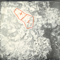
Reconnaissance photograph taken at high altitude showing fields and woods with Rambouillet and the Jardin Anglais in the top right-hand corner. The settlements of Gazeran, Saint-Hilarion, Orcemont and Orphin are also visible. Two areas are outlined…
Ramsey
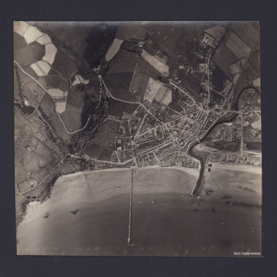
Vertical aerial photograph of Ramsey, Isle of Man. Queen’s Pier is in centre of photograph, with Sulby River and Ramsey Harbour to the right. On the reverse is handwritten 'B/A Allen Nav Beyak 15/5/43'.
Ramsey, Isle of Man
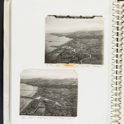
Top, an aerial photograph of coastline, small town, river estuary, two breakwaters and a pier. Captioned 'T2148 STD 3rd JULY 45//A/C 517/6 F6 3/8 RAMSEY - ISLE OF MAN' and '3 July Ramsey Isle of Man HT 1000 FT'.
Bottom, an aerial photograph of…
Bottom, an aerial photograph of…
Tags: 517 Squadron; aerial photograph
RCAF Picton from the air
Shows airfield, runways and hangars. On the reverse 'Picton station 1500ft'. Captioned 'Royal Canadian Air Force Picton Ontario Canada. Near Lake Ontario, Picture taken from 1500ft.'
Tags: aerial photograph; hangar; runway
RCAF Rivers
Six photographs of RCAF Rivers, No 1 Air Navigation School. First, third, fourth and fifth are from the air. The second is of a Harvard alongside a hangar and the sixth is of a row of Cornell aircraft and an Anson in the background.
Tags: aerial photograph; Anson; Cornell; Harvard; RCAF Rivers; runway; training
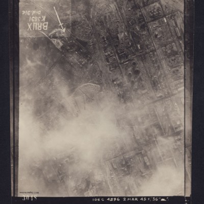
Reconnaissance photograph, post bombing, of Brux industrial plant, Czechoslavakia
Reconnaissance photograph of heavily industrialised area. Approximately one third of the area is obscured by cloud. There is considerable cratering across the area, and extensive damage to the industrial buildings and railway is visible. Caption in…
Reconnaissance photographs
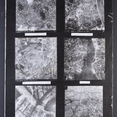
Photograph 1 is a vertical aerial photograph of the city of Aachen. There are numbered and arrowed points of interest on the image plus a north arrow. It is annotated 'R405 B/218.3.PRU 22.14.7.41 28" ' Captioned '14th July 1941 Archen [sic],…
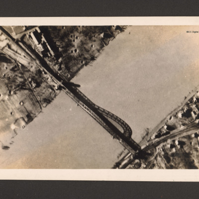
Remagen bridge
Reconnaissance photograph of bridge. A river runs bottom left to top right and a metal arch bridge from top left to bottom right. There are a few buildings in the top left along with bomb craters. Ther are a few buildings and a railway line at the…
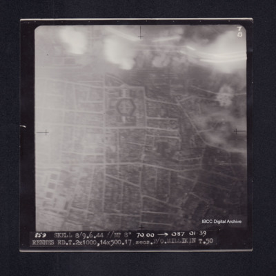
Rennes
Target photograph of Rennes. Smoke and light streaks partially obscure top quarter of photograph. Railway marshalling yard top centre, prison just below it. Captioned '7B', '859 SKELL 8/9.6.44 //NT 8" 7000' [arrow] 087 0139 RENNES RD.T.2X1000,…
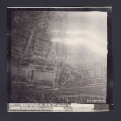
Rennes
Target photograph of Rennes. Top right obscured by smoke and light streaks, urban area, street pattern and buildings visible. Captioned '5', '865 SKELL 8/9.6.44 //NT 8" 4000 [arrow] [track and time censored] RENNES RD.B.2X1000.14X500.[exposure…
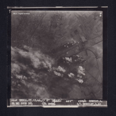
Rheydt
Target photograph of Rheydt. Partially obscured by bomb explosions, smoke and dust. Where visible mainly rural, roads and field patterns visible. Captioned '3°F', '4B', '4043 SKELL.27.12.44.// 8" 16250' 055[degrees 15041/2 RHEYT.L. 14 MC 1000 DT.…
Rheydt
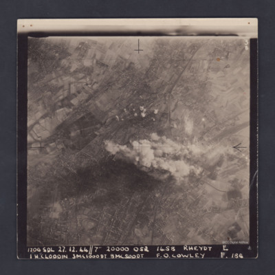
A clear, vertical, aerial photograph taken during a bombing operation at Rheydt, a borough of Mönchengladbach, orientated with south-east at the top edge. There are open fields visible in the upper left, upper right and the lower right corners of…
Rheydt
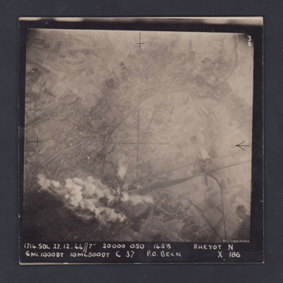
A vertical aerial photograph of Rheydt, near Mönchengladbach. The railways clearly stand out, one entering the image at lower right, branching out into a marshalling yard and another sweeping in from the upper right corner of the image. The centre…
Rheydt
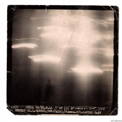
A target photograph taken on an operation to Rheydt. The ground detail is obscured by glare and light trails. Photograph is captioned:
'2533 SKELL 19/20.9.44 // NT (C) 8" 11000 ← 014° 2153
RHEYDT RD.Z. 1x2000, 12 'J' x 500. 21 secs. F/O.…
'2533 SKELL 19/20.9.44 // NT (C) 8" 11000 ← 014° 2153
RHEYDT RD.Z. 1x2000, 12 'J' x 500. 21 secs. F/O.…
Rheydt
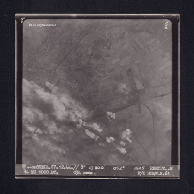
Target photograph of Rheydt. Partially obscured by smoke, dust and bomb explosions, visible area is mainly rural, railway lines, field patterns and houses visible. Captioned '3°F', '5B', '4058 SKELL.27.12.44.// 8" 17500' 052° 1505 RHEYDT. M 14 MC…
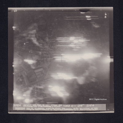
Rheydt
Target photograph of Rheydt. Large area obscured by light streaks but roads and open spaces in an urban area visible. Captioned '5°F', '6B', '2524 Skell.19/20.9.44//NT.8" 11000 [arrow] 015° 2154 RHEYDT RD.S.1X2000.12'J'X500.21secs.F/O MARRIS.O.50'.…
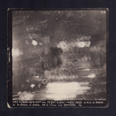
Rimini
A vertical aerial photograph taken during the bombing of Rimini. Most of the image is obscured by bomb explosions and anti-aircraft fire. It is captioned 'Sgt CROUCHER (AIR BOMBER)' on LH side. At bottom: '2187.37/263. 18/19 Sept.44.F8"//NT.…
River
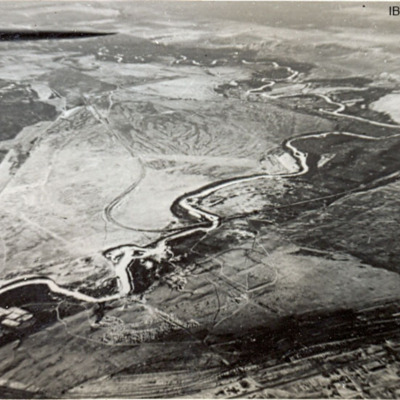
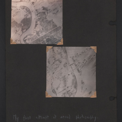
Two vertical aerial photographs of a river, annotated 'My first attempt at aerial photography'.
Top is the bend in the Assiniboine River , Winnipeg, Manitoba, Canada, adjacent to the Glendale golf and country club.
Bottom is the Assiniboine River,…
Top is the bend in the Assiniboine River , Winnipeg, Manitoba, Canada, adjacent to the Glendale golf and country club.
Bottom is the Assiniboine River,…
Tags: aerial photograph
Rivers and Winnipeg
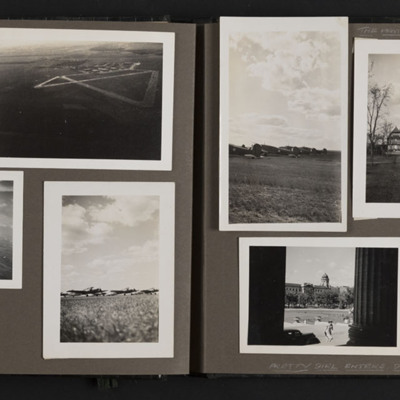
Ten photographs from an album.
Photo 1 and 3 are aerial views of Rivers.
Photo 2 is an aerial view of the base at Rivers.
Photo 4, 5 and 6 are Ansons at the airfield.
Photo 7 is the Pavilion at Assiniboine Park, Winnipeg.
Photo 8 is a view of…
Photo 1 and 3 are aerial views of Rivers.
Photo 2 is an aerial view of the base at Rivers.
Photo 4, 5 and 6 are Ansons at the airfield.
Photo 7 is the Pavilion at Assiniboine Park, Winnipeg.
Photo 8 is a view of…
Tags: aerial photograph; aircrew; Anson; RCAF Rivers; training
Rly. Mrshlg Yds-Nantes
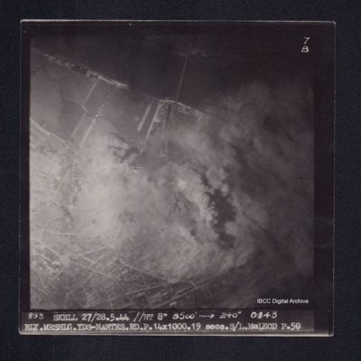
Target photograph of Nantes railway marshalling yards. Partially obscured by smoke and dust, river Loire and bridge visible. Lower third of photograph urban area, street patterns visible. Captioned '7B', '893 SKELL 27/28.5.44 //NT 8" 8500' [arrow]…

