Browse Items (120 total)
- Conforms To is exactly "Geolocated (cumulative polygon)"
Sort by:
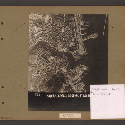
Scharnhorst and Gneisenau
Aerial vertical photograph showing a coastal town with docks on the coast and a river running through the middle. On the right open water with a breakwater in the top right corner pointing down. Above the river on the four large jetties point into…
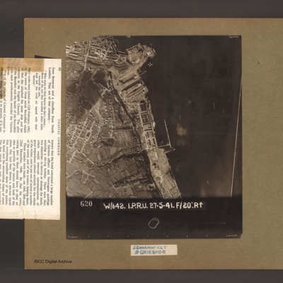
Scharnhorst and Gneisenau
An aerial vertical photograph of a coastline lined with docks and buildings. At the top and inlet with docks and town buildings to its left. Below a peninsular are three docks pointing down and left. A large warship is moored in the bottom dock. Just…
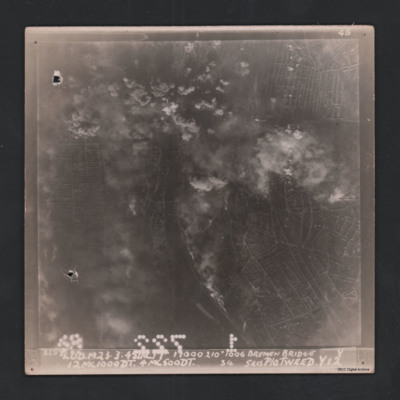
Bremen bridge
Vertical aerial photograph of Bremen bridge. Street patterns and a river with bridges are visible but central top of the image is obscured by bombs and smoke. Captioned at top right ‘4B 4B’. Captioned along the bottom ‘‘3258 Lud.M 23.3.45 …
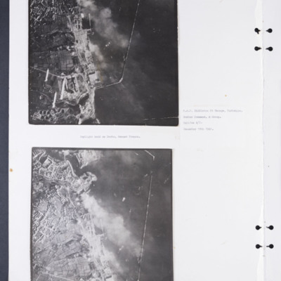
Daylight attack on Brest docks
Two vertical aerial photographs of the docks at Brest. The upper photographs shows some of the bombs being dropped. Captioned: 'Daylight raid on Docks, Breast [sic] France. R.A.F. Middleton St George, Yorkshire. Bomber Command, 4 Group. Halifax A/C.…
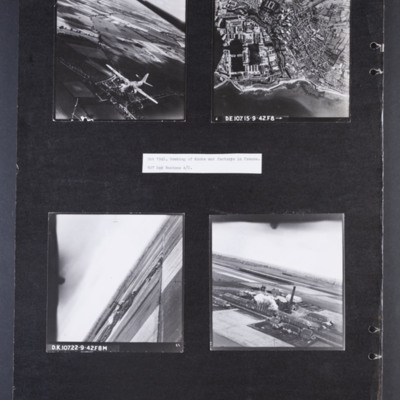
Bombing of docks and factories in France
Photograph 1 is an air-to-air photograph of a Boston in flight, taken from above and to the front.
Photograph 2 is a vertical photograph of docks and coastline with Cherbourg behind. Captioned 'D.E.107 15-9-42.F8➝'
Photograph 3 and 4 are aerial…
Photograph 2 is a vertical photograph of docks and coastline with Cherbourg behind. Captioned 'D.E.107 15-9-42.F8➝'
Photograph 3 and 4 are aerial…
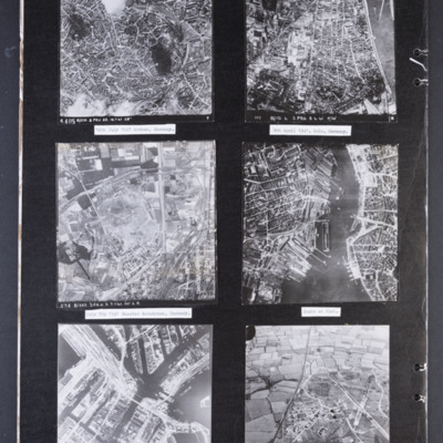
Reconnaissance photographs
Photograph 1 is a vertical aerial photograph of the city of Aachen. There are numbered and arrowed points of interest on the image plus a north arrow. It is annotated 'R405 B/218.3.PRU 22.14.7.41 28" ' Captioned '14th July 1941 Archen [sic],…
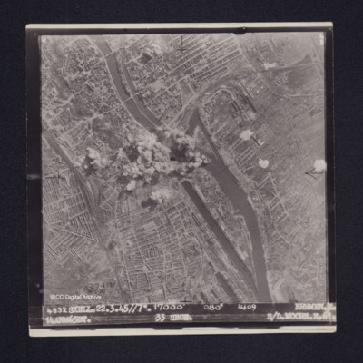
Bremen
Target photograph of Bremen. Explosions in the middle of the frame obscure the road and railway bridges over the river Weser. The photograph covers a largely built-up area: gas works, Bremen Hauptbahnhof and Bremen Neustadt stations are visible, the…
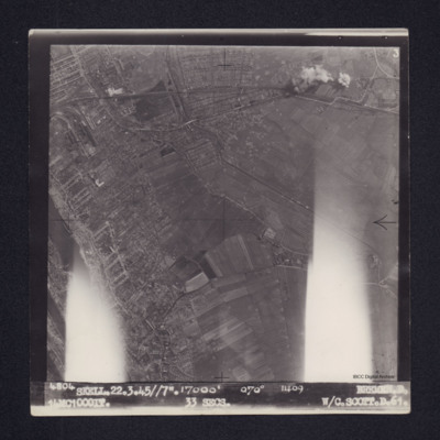
Bremen
Target photograph of Bremen. Edge of city towards rural area. Explosions at top right, bomb craters below on fields. River on left and gas works top left. Flaring on left and right of the photograph. Captioned ' 4804 SKELL. 22.3.45//7". 17000' 070°…
Saint-Leu-d'Esserent
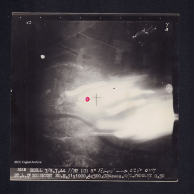
Target photograph of Saint-Leu-d'Esserent. Centre right of photograph obscured by light streaks, river Oise from left to right, red dot in centre. Top third appears rural. Captioned '5°F', '7B', '1228 SKELL 7/8.7.44 //NT (C) 8" 13000' [arrow] 025°…
St. L. D'Esserent
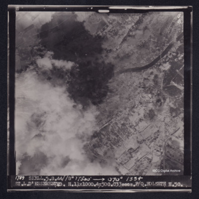
Target photograph of Saint-Leu-d'Esserent. Railway bridge crossing river Oise top right. Left side of photograph partially obscured by smoke and dust, very many craters. Captioned '5F', '5B', '1789 SKELL. 5.8.44//8" 17500' [arrow] 070° 1334…
Trossy St Maximin
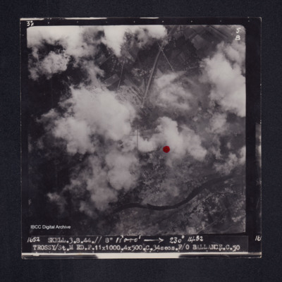
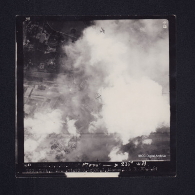
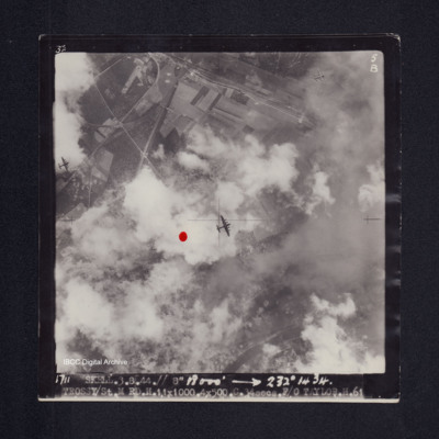
Target photograph of Trossy St Maximin. Both banks of the river Oise visible although partially obscured by smoke or cloud, red dot just right of centre. Very many craters. Captioned '3°F', '5B', '1652 SKELL.3.8.44// 8" 18000' [arrow] 230° 1432…
St. Leu D'Esserent
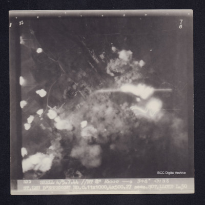
Target photograph of Saint-Leu-d'Esserent. Rural area, centre of photograph obscured by smoke and dust and a small area of light streaks. Roads visible. Captioned 3° F', '7B', '1213 SKELL 4/5.7.44 //NT 8" 16000 [arrow] 348° 0138 ST.LEU D'ESSERENT…
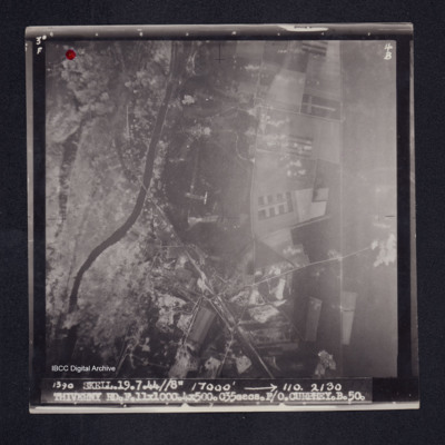
Thiverny
Target photograph of Thiverny. Red dot top left corner, Lancaster visible in centre. Rural area both banks of river Oise, roads and field patterns visible with craters, smoke and dust on left third of photograph. Captioned '3°F', '4B', '1390…
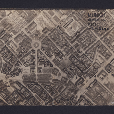
Munich
Vertical aerial reconnaissance photograph annotated 'Munich Report No K2091 Neg No 3090' and with a North arrow. No date. Photograph has been marked up to show bomb damage, with buildings outlined in black being those where the roof has been…
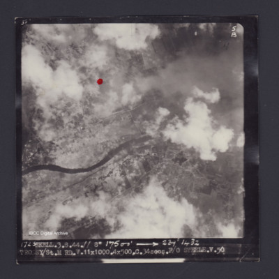
Trossy St Maximin
Target photograph of Trossy St Maximin. Red dot just left and higher than centre. Rural area, river Oise running across photograph, some smoke and dust, many craters. Captioned '3°F', '5B', '1723 SKELL.3.8.44.// 8" 17500' [arrow] 239° 1432…
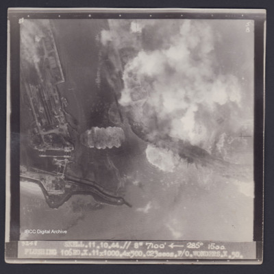
Flushing
Target photograph of Flushing. Partially obscured by smoke and dust. Port area, locks, quays, docks and moored ships clearly visible. Disturbed water from bomb explosions. Captioned '8°F', '5B', '3248 SKELL.11.10.44.// 8" 7100' [arrow] 285° 1500.…
Flushing
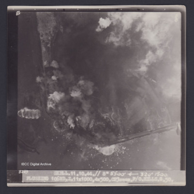
Target photograph of Flushing. Partially obscured by smoke and dust. Coastal area, little detail visible, disturbed water from bomb explosions. Captioned '8°F', '5B', '3269 SKELL.11.10.44.// 8" 5500' [arrow] 320° 1500. FLUSHING 106RD.…
Brest
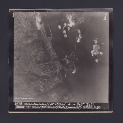
Target photograph of Brest. Port area, breakwaters, quays roads and buildings clearly visible. Bomb explosions in water. Captioned ' 3° F', '5B', '2075 SKELL.14.8.44.//.8" 15500' [arrow] 305° 2021. BREST 'B' RD.Q.11X100.4X500.C.33secs.P/O…
St.L.D'Esserent
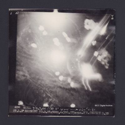
Target photograph of Saint-Leu-d'Esserent. Obscured by smoke, dust and light streaks. Captioned '5°F', '7B', '1230 SKELL 7/8.7.44 //NT 8" 14000' [arrow] 024° 0121 ST.L.D'ESSERENT RD.D.11X1000,4X500.C25secs.P/O CURPHEY D.50'. On the reverse…
St. L. D'Esserent
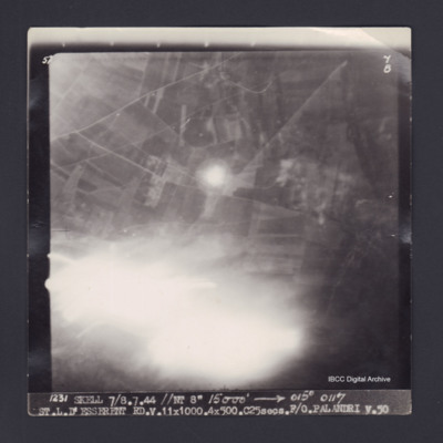
Target photograph of Saint-Leu-d'Esserent. Partially obscured by light streaks. Road and field patterns visible, but no clear detail. Captioned '5°F', '7B', '1231 SKELL 7/8.7.44 //NT 8" 15000' [arrow] 015° 0117 ST.L.D'ESSERENT…
Bremen
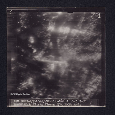
Target photograph of Bremen. No details clearly visible, a small number of light streaks and many pin points of light visible. Captioned '3° F', '6B', '3123 SKELL.6/7.10.44//NT.8" 16250' [arrow] 202° 2033. BREMEN RD.A.27X4.27secs.F/O BOON.A.61.'.…
Trossy St Maximin
Target photograph of Trossy St Maximin. Majority of photograph obscured by smoke and dust, in area not obscured roads, woods and field boundaries clearly visible. Two Lancasters flying below also visible. Captioned '3°F', '4B', '1681 SKELL.3.8.44.//…
Bremen
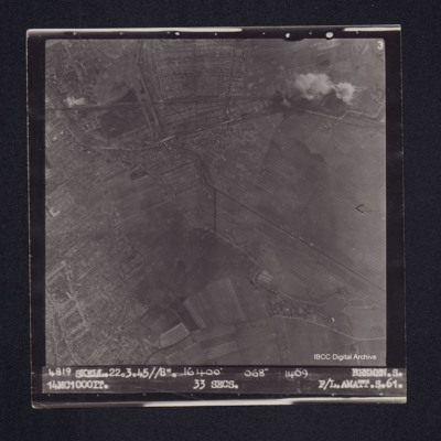
Target photograph of Bremen. Edge of the city visible but mainly open country, bomb craters, a rail line running across, a river or canal, streets and field boundaries all visible. Captioned '3', '4819 SKELL.22.3.45//8". 16400' 068° 1409 BREMEN.S…
Flushing
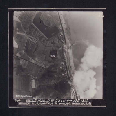
Target photograph of Flushing. Crossing coast line, craters, lakes, disturbed water, roads and field boundaries clearly visible. Captioned '11B2ND', '3190. SKELL. 7.10.44.// 8" 5500' [arrow] 055° 1358. FLUSHING RD.T.14X1000.C 21 secs.S/L…
Trossy St Maximin
Target photograph of Trossy St Maximin. Red dot left of centre. Three Lancasters flying below. River Oise bottom right. Partially obscured by cloud smoke and dust but bomb explosions, bomb craters roads and field patterns visible. Captioned '3°F',…

