Browse Items (681 total)
- Conforms To is exactly "Geolocated"
Sort by:
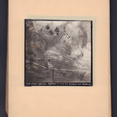
Sjenica Novi Pazar
Two prints of the same target photograph showing open countryside with road running bottom left to right. Captioned '2133, 104/27, 19 Nov 44, F8, 8000 ft,→ 1140, DS Sjenica Novi Pazar RD'.
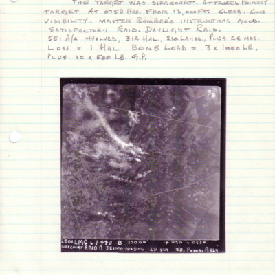
Siracourt
A vertical aerial photograph of Siracourt V-1 base. The entire image is filled with bomb craters. Above is a caption with details of the operation, aircraft taking part and bomb loads.
Under the image is a caption '2801 LMG 6.7.44//8" 13000' -->…
Under the image is a caption '2801 LMG 6.7.44//8" 13000' -->…
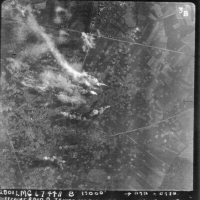
Siracourt
A vertical aerial photograph of Siracourt V-1 site. Smoke is rising from bomb explosions and the fields are littered with craters.
It is annotated '2801 LMG 6.7.44 // 8" 13000' --098° 0258 Siracourt Raid A 3 x 1000 10 x500 c 28secs WO Puskas A…
It is annotated '2801 LMG 6.7.44 // 8" 13000' --098° 0258 Siracourt Raid A 3 x 1000 10 x500 c 28secs WO Puskas A…
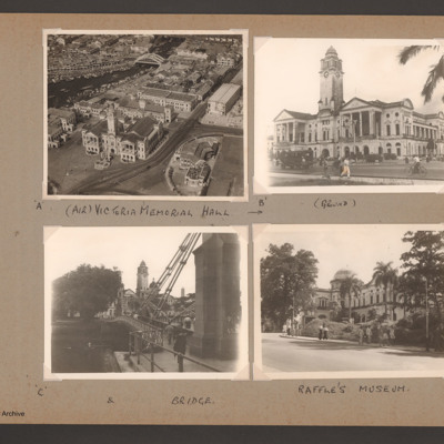
Singapore Victoria Memorial, bridge and Raffle's Museum
Photograph 1 is the Victoria Memorial Hall from the air, captioned '(Air) Victoria Memorial Hall'
Photograph 2 is the Hall from the ground, captioned '(ground)'.
Photograph 3 is the Hall and a bridge, captioned '& bridge'.
Photograph 4 is a…
Photograph 2 is the Hall from the ground, captioned '(ground)'.
Photograph 3 is the Hall and a bridge, captioned '& bridge'.
Photograph 4 is a…
Tags: aerial photograph
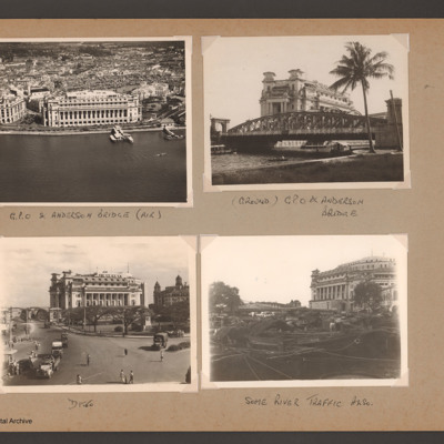
Singapore GPO and Anderson bridge
Photograph 1 is an oblique aerial photograph of a large building, captioned 'G.P.O. & Anderson bridge (air)'
Photograph 2 and 3 are ground views of the building captioned '(Ground) GPO & Anderson bridge'
Photograph 4 is the GPO building with boats…
Photograph 2 and 3 are ground views of the building captioned '(Ground) GPO & Anderson bridge'
Photograph 4 is the GPO building with boats…
Tags: aerial photograph
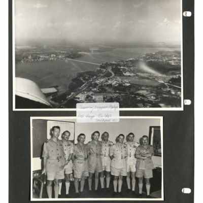
Singapore Causeway and Eight airmen
Two photographs from an album.
Photo 1 is an oblique aerial photograph of the Singapore-Malaya causeway.
Photo 2 is eight airmen including Peter in khaki and shorts.
They are captioned ' Causeway Singapore-Malaya
RAF Changi Stn [undecipherable]…
Photo 1 is an oblique aerial photograph of the Singapore-Malaya causeway.
Photo 2 is eight airmen including Peter in khaki and shorts.
They are captioned ' Causeway Singapore-Malaya
RAF Changi Stn [undecipherable]…
Tags: aerial photograph; aircrew; ground personnel; pilot
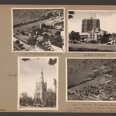
Singapore cathedral, cinema and dockside
Photograph 1 is an oblique aerial photograph of the cathedral, captioned '(Air) St Andrews Cathedral'.
Photograph 2 is a ground view of the cathedral, captioned '(Ground)'
Photograph 3 is the cinema, captioned 'Cathay Cinema see 16 top tight from…
Photograph 2 is a ground view of the cathedral, captioned '(Ground)'
Photograph 3 is the cinema, captioned 'Cathay Cinema see 16 top tight from…
Tags: aerial photograph
Ships-Moss
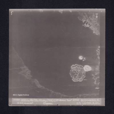
Target photograph of Shiping off Moss. Coastal area, bay or estuary, small area showing quays and docks, larger area showing coast line, but mainly water. Bomb explosions in water. Captioned '8°F', '7B', '4064 SKELL.28/29.12.44//NT(C)8" 8000' 340°…
Shernborne
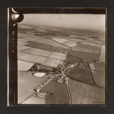
Oblique aerial photograph of Shernborne, roads running from bottom left to top right cross with road running from bottom centre to top right. Most of the view is of open fields.
Tags: aerial photograph
Scott Field
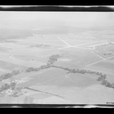
Air to ground view of Scott Field surrounded by open countryside.
Scott Field
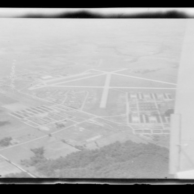
Air-to-ground view of Scott Field, Illinois, with several runways and buildings in the foreground.
Scott Field
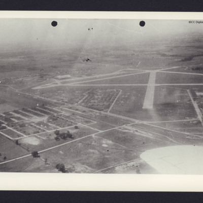
Air to ground view of Scott Field with runways left to right and running middle right to top. Buildings bottom left and left side.
School sports and an aerial view of Goderich
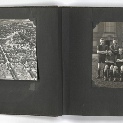
The left photograph shows an aerial view of Goderich, Ontario, Canada. The photo is taken facing east from just south of the town centre, towards the Maitland River; the geometric area of trees in the upper centre of the image is Courthouse Square.…
Tags: aerial photograph; sport; training
Schiedam docks
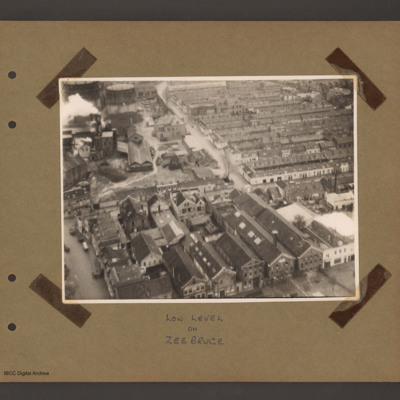
Aerial inclined photograph of a town. At the bottom several large multistory buildings orientated upwards and slightly left a factory with dwellings to the left. In the top right rows of single story residences. At the top left a factory with chimney…
Tags: aerial photograph
Schiedam docks
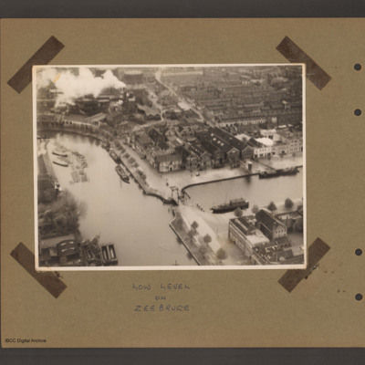
An aerial incline photograph of docks and town. At the bottom two dock basins are joined by a narrow passage with small lifting bridge. There are a number of barges moored in both basins. Top left is a factory with smoking chimneys and two gas…
Tags: aerial photograph
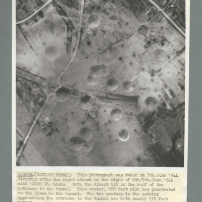
Saumur tunnel
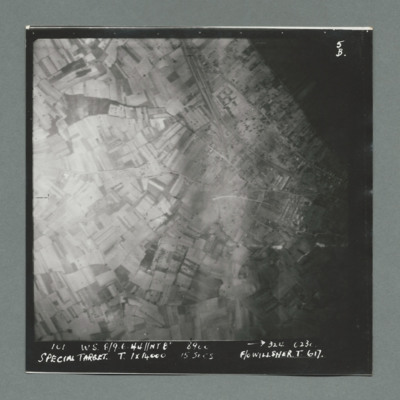
Target photograph shows open countryside. Railway line runs from top centre to middle right, with one leading the Saumur tunnel. Caption '101, W.W., 8/9.6.44, NT8", 324, 0230, Special Target, T, 1 x 14000, 15 secs, F/O Willsher, T, 617'. On the…
Saumur railway tunnel
Reconnaissance photograph of Saumur tunnel entrance and surrounding area taken on 9 June 1944 after attach with 12,000 lb bombs. Description notes direct hit on roof of entrance to tunnel and two other 100 foot craters on the approach to tunnel. On…
Saumur railway tunnel
Reconnaissance photograph showing entrance of railway tunnel one quarter way down in centre with large crater to right of entrance. Other craters to the left of entrance. three roads join top slightly left and run to left and right sides. On the…
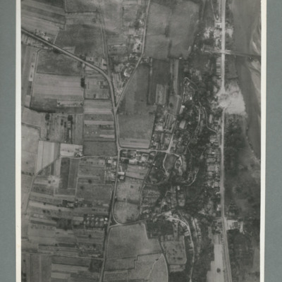
Saumur railway bridge and tunnel
Reconnaissance photograph showing road running top to bottom on the right side. To the right a river. Top right a railway bridge with rail line running into a tunnel just left of road. To the left of the road a built up area. A crater is visible on…
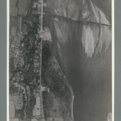
Saumur railway bridge
Reconnaissance photograph showing river running top to bottom on right and rail bridge running from right to left with entrance to tunnel top left. A road runs down the riverbank from top to bottom. Large crater visible on road just below bridge.…
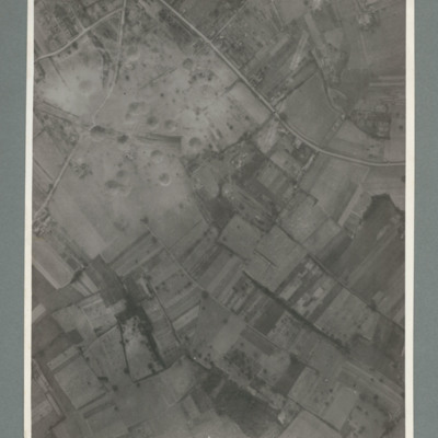
Saumur
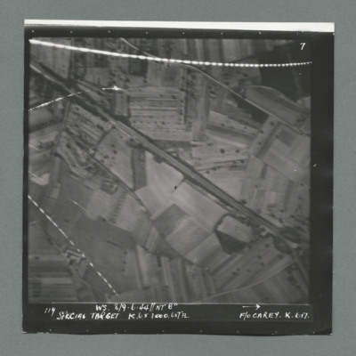
Target photograph showing open countryside south west of Samur with Rue du Pont Fouchard running from top left to bottom right. There are lines of tracer on top and bottom left. Caption '119, W.S. 8/9.6.44, NT 8", Special Target, K.6 x 1000. 6x7FL,…
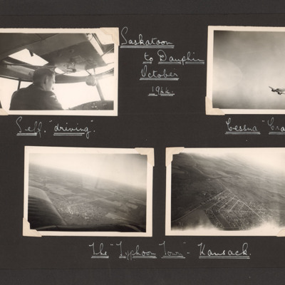
Saskatoon to Dauphin October 1944
Eight photographs from two pages of an album.
Page 28:
Photo 1 is an airman in the cockpit of an aircraft, captioned 'Self "driving" '.
Photo 2 is an air to air shot of a Cessna Crane, captioned 'Cessna Crane'.
Photo 3 and 4 are aerial views of a…
Page 28:
Photo 1 is an airman in the cockpit of an aircraft, captioned 'Self "driving" '.
Photo 2 is an air to air shot of a Cessna Crane, captioned 'Cessna Crane'.
Photo 3 and 4 are aerial views of a…
Tags: aerial photograph; aircrew; pilot; training
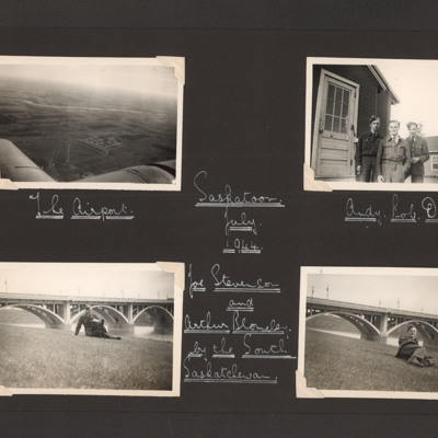
Saskatoon
Three vertical aerial photographs on two pages:
Photo 1 is a grain elevator, captioned 'Government Grain Elevator'.
Photo 2 is a bridge crossing a river, captioned 'Main rail bridge over S Sask R'.
Photo 3 is a railway and town, captioned…
Photo 1 is a grain elevator, captioned 'Government Grain Elevator'.
Photo 2 is a bridge crossing a river, captioned 'Main rail bridge over S Sask R'.
Photo 3 is a railway and town, captioned…
Tags: aerial photograph; training
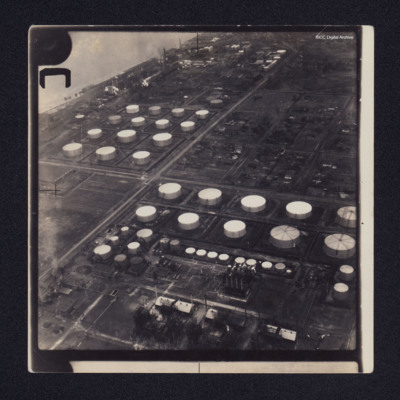
Sarnia oil refinery and St Clair River
Two low angle oblique aerial photographs of Sarnia oil refinery on the St Clair River. Photograph 1 is mostly storage tanks; photograph 2 is of tanks and production facilities.
Identification kindly provided by Richard Evans of the Finding the…
Identification kindly provided by Richard Evans of the Finding the…

