Browse Items (725 total)
- Tags: Normandy campaign (6 June – 21 August 1944)
Sort by:
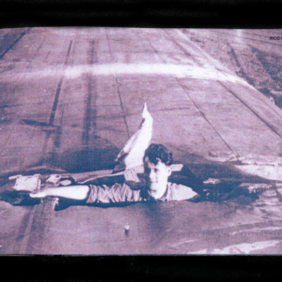
Man inside wing
A man inside left wing that has been damaged, the man is sticking out of the damaged wing with head and arm showing with no cap.
On the reverse 'LANCASTER PO-L WITTERING AFTER RAID ON V1 STORAGE SITE TROSSY ST MAVIN AUGUST 3 1944'.
On the reverse 'LANCASTER PO-L WITTERING AFTER RAID ON V1 STORAGE SITE TROSSY ST MAVIN AUGUST 3 1944'.
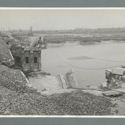
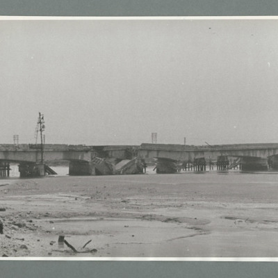
Bridge at Etaples
Looking along a railway bridge on the left of the image with a large section collapsed on the right of the bridge. River to the right and far bank left to right just above the middle. Shows damage to railway bridge at Etaples, France, following…
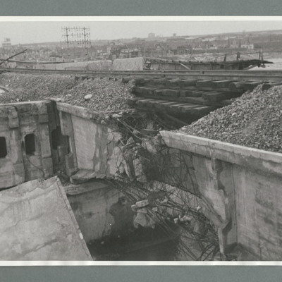
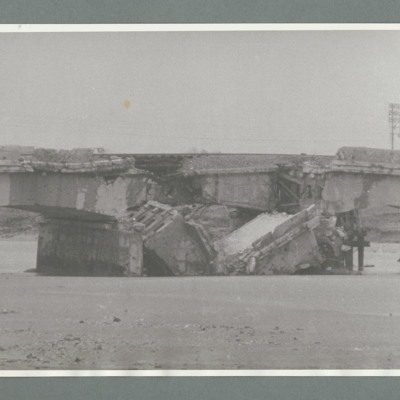
Bridge at Etaples
Shows close up of one arch of a railway bridge with a hole just right of centre. Shows damage to railway bridge at Etaples, France, following attack by 617 squadron on 4 August 1944. On the reverse Bridge at Etaples, '1-11.44, CB235, 51:62'.…
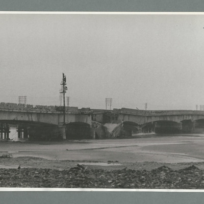
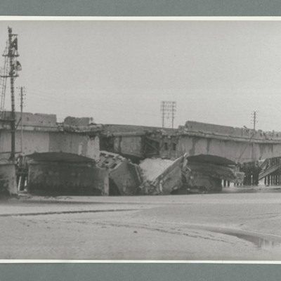
Bridge at Etaples
Shows a bridge with several piers and one section collapsed in the centre. Power line pole on the left side. Shows damage and repairs to railway bridge at Etaples, France, following attack by 617 squadron on 4 August 1944. On the reverse 'Bridge at…
Bridge at Etaples
In the middle distance a bridge with several piers and one section collapsed just to the left of centre. Shows damage and repairs to railway bridge at Etaples, France, following attack by 617 squadron on 4 August 1944. On the reverse 'Bridge at…
Bridge at Etaples
Shows bridge with collapsed section. One power line tower on the right. Shows damage and repairs to railway bridge at Etaples, France, following attack by 617 squadron on 4 August 1944. On the reverse 'Bridge at Etaples, 1-11-44, CB235, 51:59'.…
Bridge at Etaples
A bridge runs left to right with section collapsed in the centre. Three power line poles left, centre and right. Shows damage to railway bridge at Etaples, France, following attack by 617 squadron on 4 August 1944. On the reverse 'Bridge at Etaples,…
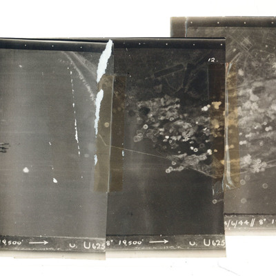
Le Havre
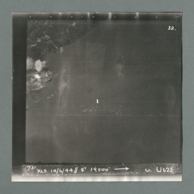
A mosaic of three target photographs of attack on Le Havre. Shows sea and cluster of bombs in the centre of left photograph and port area in the centre and right photograph. Caption '723, KLS, 14/6/44, 8", 1`9500, U. U625' Taken by Lancaster U of…
Le Havre
Target photograph showing land top left with bomb explosions on left edge just above centre. Caption '731, KLS, 14.6.44, 8", 19500, U, U625, Attack on Le Havre taken by Lancaster U of 625 squadron. Attack marked by Leonard Cheshire. On the reverse…
Le Havre
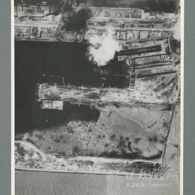
Reconnaissance photograph showing a damaged port area with a basin orientated left right with a pier in the centre. Caption 'Le Havre K2491(IMMED)'. On the reverse 'Date 11.7.44, Unit WS, Neg No. G103, 51:53'. Dock area has been heavily bombed, with…
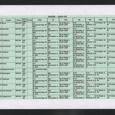
List of operations 1943-45
Printed list of 31 operations in which W Breckenbridge was pilot. W B Baker was mid-upper gunner on all but 10 of these operations. Hand-written note on the final sheet reads, 'Doc 115 - Recommendation for honours and awards, station diary 30/01/44'.
Mimoyecques
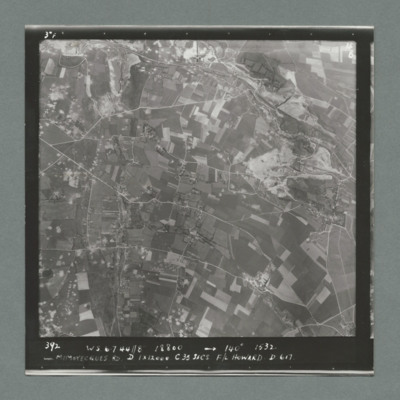
Target photograph showing open countryside with fields. Prominent roads run left to right. There are some craters scattered over the image. Caption '392, W.S., 6.7.44., 8", 18800, 140 degrees, 1532, Mimoyecques RD, D, 1 x 12000, C, 35 secs, F/L…
Mimoyecques
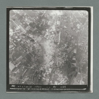
Target photograph showing open countryside with a large area with dense craters in the centre.Smoke can be seen in centre and top centre. Caption '387. W.S. 6.7.44, 8", 18200, 160 degrees, 1538, Mimoyecques RD, B, 1 x 12000, C, 35 secs, F/L Stanford.…
Mimoyecques
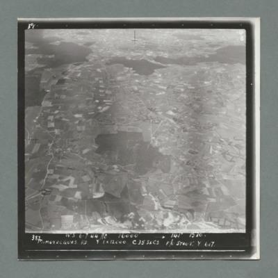
Target photograph showing open countryside with fields. There are forests in the centre and from left to right across the top. Caption '387, W.S., 6.7.44. 8", 16000, 141 degrees 1530, Mimoyecques RD, Y, 1 x 12000, C, 35 secs, F?L Stout, Y, 617'. On…
Mimoyecques
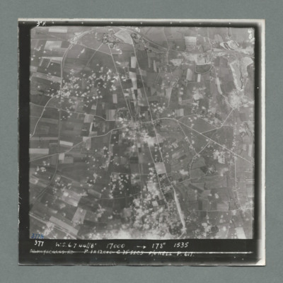
Target photograph showing open countryside with fields. Prominent road runs top centre to bottom and left centre to right. Craters are scattered over most of the image mostly left of centre line. Caption '377, W.S., 7.7.44, 17000, 178 degrees, 1535,…
Mimoyecques
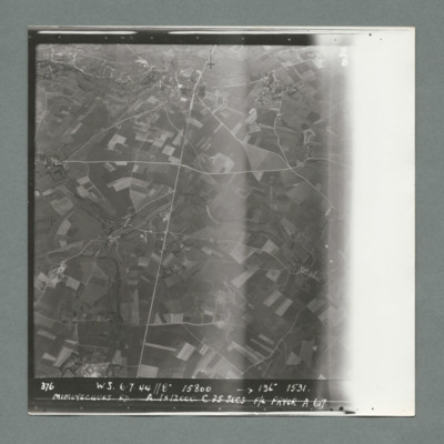
Target photograph showing open countryside with fields. Prominent roads run from top centre to bottom and left centre to right. Caption '376, W.S., 6.7.44, 8", 15800, 136 degrees, 1531, Mimoyecques RD, A, 1 x 12000, F/L Pryor, A, 617'. On the reverse…
Mimoyecques
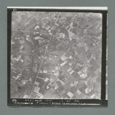
Target photograph showing open countryside with fields. There are prominent roads running bottom left to top centre and top right to left. Caption '372, W.S, 6.7.44, 8", 17000, 140 degree, 1530, Mimoyecques RD, T, 1 x 12000, C, 35 secs, F/L Willsher,…
Mimoyecques
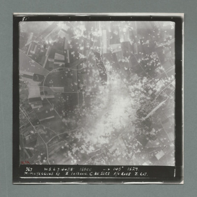
Target photograph showing open countryside with a large area on dense craters in the centre. Caption '367, W.S., 6.7.44, 8", 16800, 145 degrees, 1529, Mimoyecques RD, Z, 1 x 12000, C, 25 secs, F/O Ross, Z, 617'. On the reverse '51:97/7'.
Mimoyecques
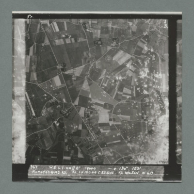
Target photograph showing open countryside with fields and roads. There is a large area with craters bottom right extending towards the top.There are other scattered craters throughout the image. Caption '367, W.S.,6.7.44, 8", 130 degrees, 1531,…
Mimoyecques
Target photograph showing open countryside with area covered in craters bottom right. There is an airfield on the left edge just below centre. Caption '367, W.S., 6.7.44, 8", 19000, 130 degrees, 1531, Mimoyecques RD, K1, 1 x 12000, C, 235 secs, F/L…
Mimoyecques
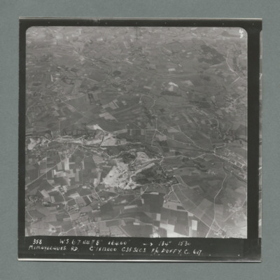
Target photograph showing open countryside with fields and roads. Village on the right side edge just below centre. Caption '358, W.S., 6.7.44, 8", 16400, 134 degrees, 1530, Mimoyecques RD, C, 1 x 12000, C35 secsa, F?O Duffy, C, 617' On the reverse…
Mimoyecques
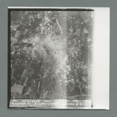
Target photograph showing open countryside with heavily cratered area in the centre. Caption '362, WS, 6.7.44, 8", 15600, [....], 1534, Mimoyecques RD, X, 1 x 12000, C, 35 secs, [..]earn, X, 617'. On the reverse '5:99/5, Photo 282'.
Mimoyecques
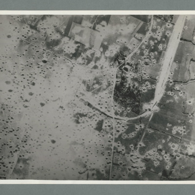
Reconnaissance photograph showing open countryside with fields. A railway runs from top right downwards then loops to the left, culminating in the centre, The left side is covered in multiple craters. Craters on the right side are less concentrated.…
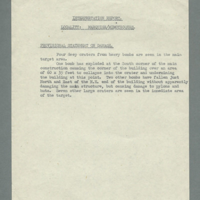
Interpretation report, locality, Marquise/Mimoyecques, provisional statement of damage
Reports four craters from heavy bombs in target area and details damage done by each.
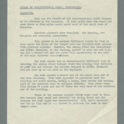
Attack on constructional works Mimoyecques, narrative
Reports that this was the fourth constructional works target for the squadron. One P-51, one Mosquito and 17 Lancasters were detailed. States it was another difficult target and describes marking efforts. Reports difficultly in finding aiming point…

