Browse Items (1442 total)
- Tags: aerial photograph
Sort by:
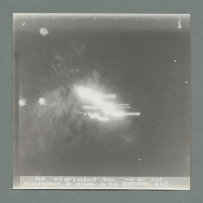
St Leu D'Esserent
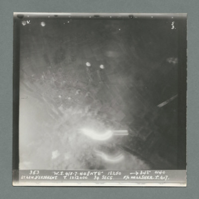
Target photograph showing large bright spot bottom centre. Caption '363, W.S. 4/5.7.44, NT 8", 18250, 348 degrees, 0140, St Leu D'Esserent, T, 1 x 12000, 34 secs, F/O Willsher, T., 617'. On the reverse '51:98/16, APoint'.
St Leu D'Esserent
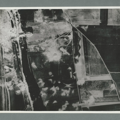
Reconnaissance photograph showing a wooded area running top to bottom on the left with a road, railway to its left. On the right two roads run from the bottom joining top centre. There are a large number of craters to the left of the river and top…
St Leu D'Esserent
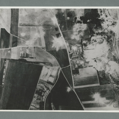
Reconnaissance photograph showing open countryside with fields. Road railway runs top right to bottom right. Road runs from bottom centre/right and splits, one going top top centre and the other to top left. There are a large number of craters on…
St Leu d'Esserent
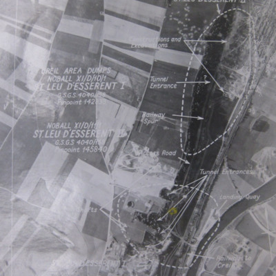
Six aerial photographs of St Leu d'Esseent.
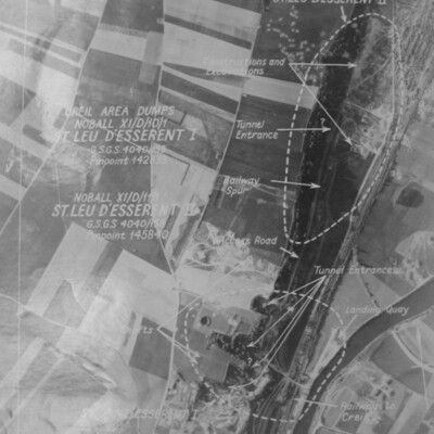
Photo 1 is a vertical target photograph with tunnels, railway and landing quay marked.
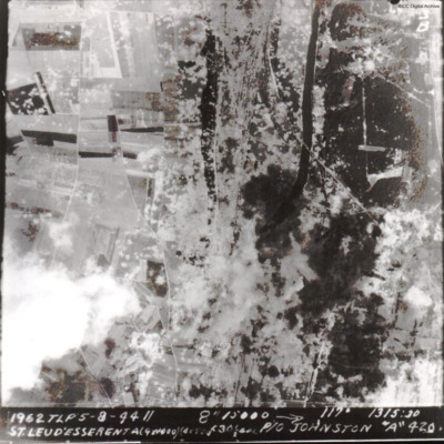
Photo 2 is a vertical aerial photograph taken during the operation. It is captioned '1962 TLP 5-8-44//8" 15000…
Photo 1 is a vertical target photograph with tunnels, railway and landing quay marked.
Photo 2 is a vertical aerial photograph taken during the operation. It is captioned '1962 TLP 5-8-44//8" 15000…
St Leu d'Esserent
Four photographs of St. Leau d'Esserent.
Photo 1 is a target aerial photograph with areas to be bombed. Tunnel entrances, constructions, excavations, railway and a landing quay are marked.
Photo 2 is a vertical aerial photograph taken during the…
Photo 1 is a target aerial photograph with areas to be bombed. Tunnel entrances, constructions, excavations, railway and a landing quay are marked.
Photo 2 is a vertical aerial photograph taken during the…
St Leu d'Esserent
A vertical aerial photograph of St Leu d'Esserent V-1 site during an operation.
The caption reads '1962 TLP 5-8-44 // 8" 15000 --> 117° 1315:30 St Leu d'Esserent A(9x1000)(4x500)f30sec P/O Johnston "A" 420'
The second image is identical.
The caption reads '1962 TLP 5-8-44 // 8" 15000 --> 117° 1315:30 St Leu d'Esserent A(9x1000)(4x500)f30sec P/O Johnston "A" 420'
The second image is identical.
St Leu d'Esserent
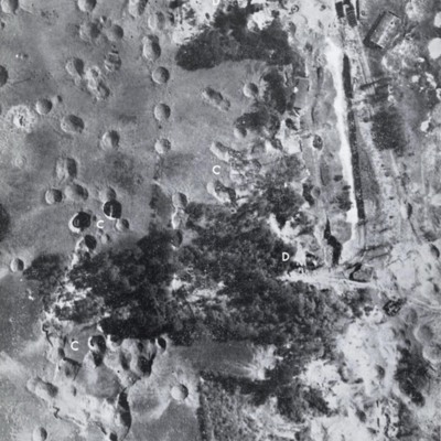
Three images of St Leu d'Esserent taken after the attack.
Photo 1 is a vertical image showing bomb craters. It is annotated with 'C' and 'D's.
Photo 2 shows an entrance to an underground store.
Photo 3 show an entrance to an underground store. It…
Photo 1 is a vertical image showing bomb craters. It is annotated with 'C' and 'D's.
Photo 2 shows an entrance to an underground store.
Photo 3 show an entrance to an underground store. It…
St Leu D'Esserent
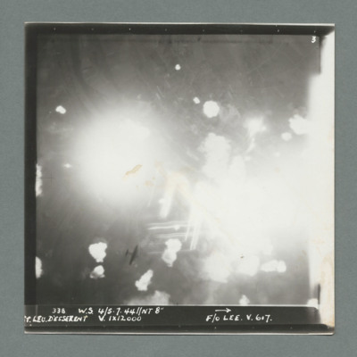
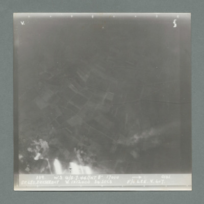
Target photograph showing large bright flashes centre left and right as well as other flashes. Caption '338, W.S., 4/5.7.44, NT 8", St Leu D'Esserent, V., 1 x 12000, F/O Lee, V., 617'. On the reverse '51:98/7'. A Lancaster at lower altitude can be…
St Leu D'Esserent
Target photograph showing open countryside with a bright area at the bottom left. Caption '339, W.S., 4/5.7.44,NT 8", 17000, 0141, St Leu D'Esserent, V. 1 x 12000, 34 secs, F/O Lee, V, 617'. On the reverse '51:98/8'.
St Leu D'Esserent
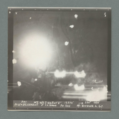
Target photograph showing a large flash centre left and other bright spots. Caption '341, W.S., 4/5.7.44, NT 8", 18500, 330 degrees, 0135, St Leu D'Esserent, J, 1 x 12000, 34 secs, P/O Gingles, L, 617'. On the reverse '51:98/9, AP'.
St Leu D'Esserent
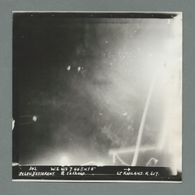
Target photograph showing bright areas bottom left and top right with tracer lines bottom left. Caption '342, W.S. 4/5 7.44, NT 8", St Leu D'Esserent, R, 1 x 120'51:98/10'.00, F/Lt Knilans, R., 617'. On the reverse
St Leu D'Esserent
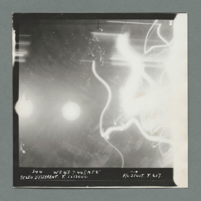
Target photograph showing bright spot left centre on edge and another to its right. Tracer lines on the right side. Caption '344, W.S., 4/5 .7.44, NT 8", St Leu D'Esserent, Y., 1 x 12000, F/O Stout, Y, 617'. On the reverse '51:98/11'.'
St Leu D'Esserent
Target photograph showing bright spot in the middle. Caption '346, W.S., 4/5.7.44, NT 8", 18500, 360 degrees, 0143, St Leu D'Esserent, D1, 1 x 12000, 34 secs, S/L McCarthy, Q., 617'. On the reverse '51:98/12'.
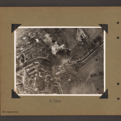
St Omer Canal
Aerial vertical photograph of a canal and town. A canal meanders from mid left to right. There is a road bridge on the left side leading to an industrial area and town below the canal. A railway runs from just above the canal on the left to top…
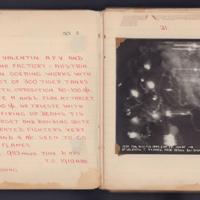
St Valentin
A target photograph for an operation to St. Valentin AFV and Tank Factory in Austria. Light trails and smoke obscure most of the ground but some roads are visible. It is annotated 'A5' and captioned:
'1678. FOG .20/21 AUG 1944. // NT. F8. 10400'.…
'1678. FOG .20/21 AUG 1944. // NT. F8. 10400'.…
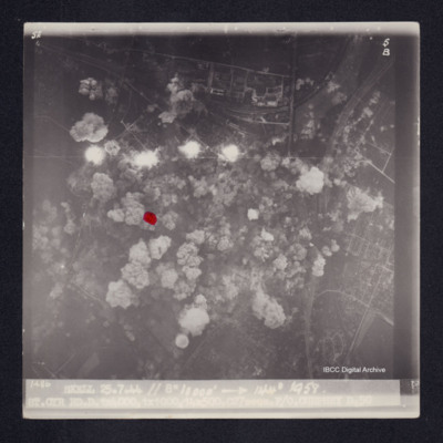
St. Cyr
Target photograph of St. Cyr, urban area, street patterns visible although largely obscured by smoke and dust from bomb explosions. Two sets of railway tracks from top right corner, four bomb explosions and many bomb craters. A red dot is visible on…
St. George Cathedral and surroundings
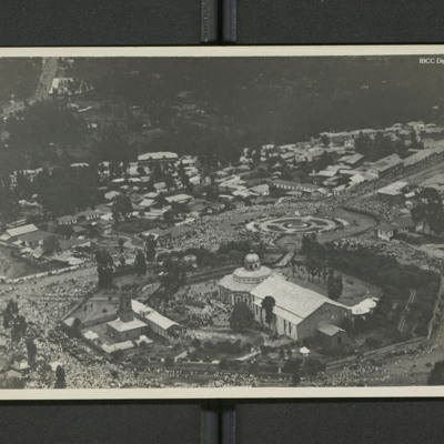
An aerial view of a domed church with large crowds visible.
On the reverse 'Adis Abbaba [sic] (Abyssinia)'.
On the reverse 'Adis Abbaba [sic] (Abyssinia)'.
Tags: aerial photograph
St. L. D'Esserent
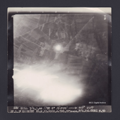
Target photograph of Saint-Leu-d'Esserent. Partially obscured by light streaks. Road and field patterns visible, but no clear detail. Captioned '5°F', '7B', '1231 SKELL 7/8.7.44 //NT 8" 15000' [arrow] 015° 0117 ST.L.D'ESSERENT…
St. L. D'Esserent
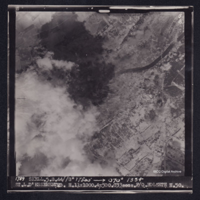
Target photograph of Saint-Leu-d'Esserent. Railway bridge crossing river Oise top right. Left side of photograph partially obscured by smoke and dust, very many craters. Captioned '5F', '5B', '1789 SKELL. 5.8.44//8" 17500' [arrow] 070° 1334…
St. Leu D'Esserent
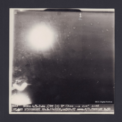
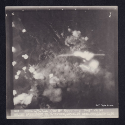
Target photograph of Saint-Leu-d'Esserent. Two large balls of light and a light streak. No clear details visible. Captioned '3°F', '6B CL', '1223 SKELL 4/5.7.44 //NT (C) 8" 17000 [arrow] 014° 0138 ST LEU D'ESSERENT RD.B.11X1000,4X500.27secs.W/C…
St. Leu D'Esserent
Target photograph of Saint-Leu-d'Esserent. Rural area, centre of photograph obscured by smoke and dust and a small area of light streaks. Roads visible. Captioned 3° F', '7B', '1213 SKELL 4/5.7.44 //NT 8" 16000 [arrow] 348° 0138 ST.LEU D'ESSERENT…
St.L.D'Esserent
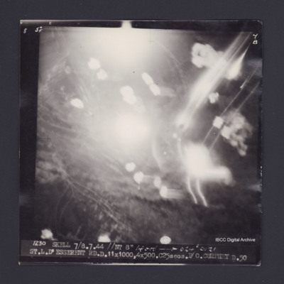
Target photograph of Saint-Leu-d'Esserent. Obscured by smoke, dust and light streaks. Captioned '5°F', '7B', '1230 SKELL 7/8.7.44 //NT 8" 14000' [arrow] 024° 0121 ST.L.D'ESSERENT RD.D.11X1000,4X500.C25secs.P/O CURPHEY D.50'. On the reverse…
Stadtgarten Essen and Hohenzollernstraße
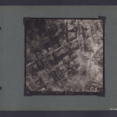
A vertical aerial photograph of Essen around Stadtgarten and Hohenzollernstraße. The photo is captioned '(T) Ched 23.5.45//7" J 218'.
On the reverse 'Crown Copyright Reserved' and 'Essen'.
On the reverse 'Crown Copyright Reserved' and 'Essen'.
Steamer Point
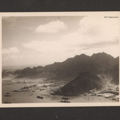
An oblique aerial photograph of Steamer Point. On the reverse 'Aerial view of Steamer Point, showing ships in harbour and oil storage tanks'.
Tags: aerial photograph
Steamer Point, Aden
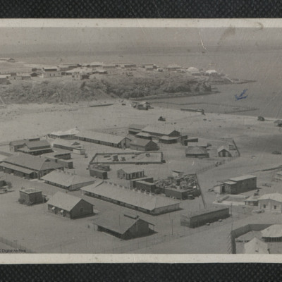
A view of Steamer Point taken from an elevated location. Numerous huts and buildings are visible. A section of the coast has been fenced off and marked in pen with a small arrow. On the reverse 'General view of Aden shore at Steamer Point. Note…
Tags: aerial photograph

