Browse Items (1442 total)
- Tags: aerial photograph
Sort by:
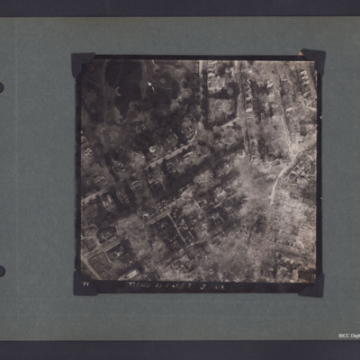
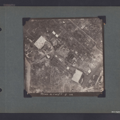
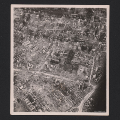
Stadtgarten Essen and Hohenzollernstraße
A vertical aerial photograph of Essen around Stadtgarten and Hohenzollernstraße. The photo is captioned '(T) Ched 23.5.45//7" J 218'.
On the reverse 'Crown Copyright Reserved' and 'Essen'.
On the reverse 'Crown Copyright Reserved' and 'Essen'.
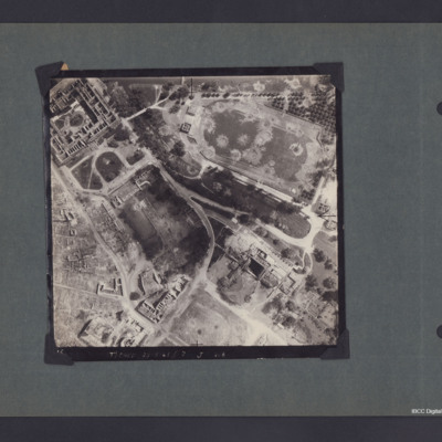
Kassel
A vertical aerial photograph of Kassel showing the football stadium and extensive damage. Captioned '(T) Ched 23.5.45//7" J 218'.
On the reverse 'Crown Copyright Reserved' and 'Kasel'.
On the reverse 'Crown Copyright Reserved' and 'Kasel'.
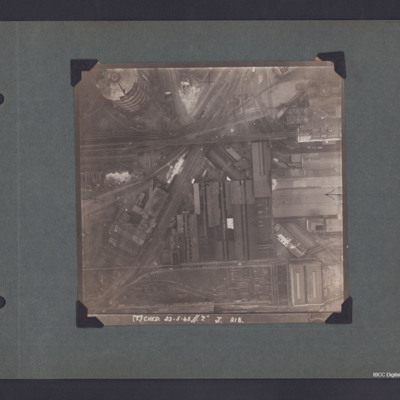
Dortmund Industrial Area
A vertical aerial photograph of Dortmund.
The photo is captioned '(T) Ched 23.5.45//7" J 218'.
On the reverse 'Crown Copyright Reserved' and 'Dortmund'.
The photo is captioned '(T) Ched 23.5.45//7" J 218'.
On the reverse 'Crown Copyright Reserved' and 'Dortmund'.
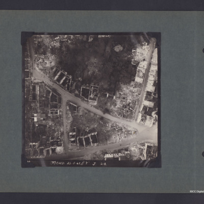
Bremen Industrial Area
A vertical aerial photograph of Bremen.
The photo is captioned '(T) Ched 23.5.45//7" J 218'.
On the reverse 'Crown Copyright Reserved' and 'Bremen'.
The photo is captioned '(T) Ched 23.5.45//7" J 218'.
On the reverse 'Crown Copyright Reserved' and 'Bremen'.
Hamburg Residential and Industrial Area
Vertical aerial photograph of part of Hamburg showing bomb damage. Two large buildings and some smaller ones remain standing while most have been either destroyed completely or gutted. The upper, right area appears to be residential, though few…
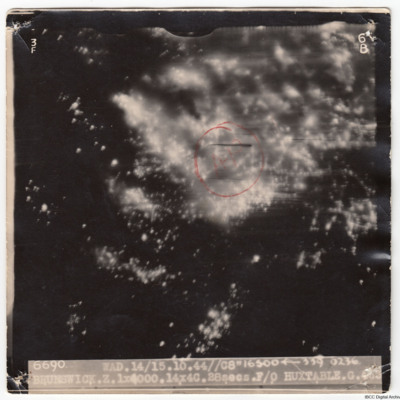
Brunswick
A vertical aerial photograph taken during an attack on Brunswick. It is a night photograph and much of the image is obscured by fires and explosions. An annotated red circle and 'AP' marks the aiming point. The image is captioned '6690 WAD…
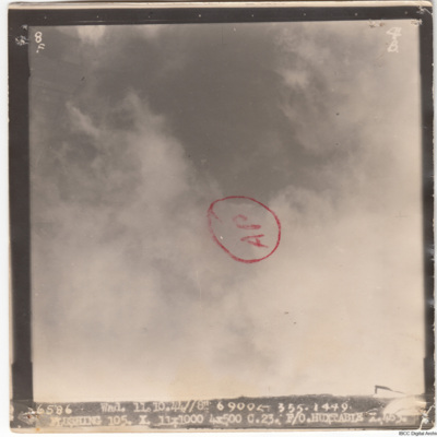
Flushing
A vertical aerial photograph of Flushing. Much of the image is obscured by cloud. The aimimg point has been annotated with a circle and 'AP'.
The image is captioned '6586 Wad.11.10.44//8" 6900
The image is captioned '6586 Wad.11.10.44//8" 6900
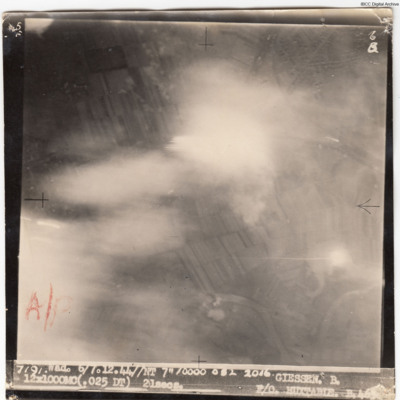
Giessen
A vertical aerial photograph of Giessen taken during an operation. Streets, houses, fields and river meanders can be seen. The aiming point is annotated in red 'A/P'.
The image is captioned '7191. Wad. 6/7.12.44//NT 7" 10000 082 21016 Giessen. B.…
The image is captioned '7191. Wad. 6/7.12.44//NT 7" 10000 082 21016 Giessen. B.…
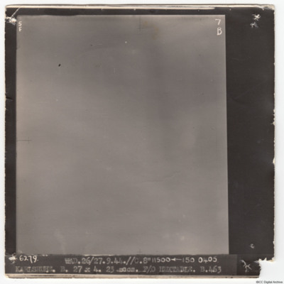
Karlsruhe
A vertical aerial photograph of Karlsruhe. No detail is visible due to cloud. It is captioned '6279 WAD. 26/27.9.44.//C.8" 11500
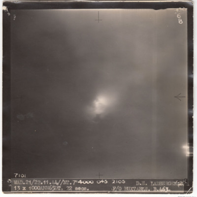
Ladbergen
A vertical aerial photograph of Ladbergen taken during an operation. The ground is obscured by cloud but an explosion is visible through the clouds.
It is captioned '7101 WAD. 21/22.11.44//NT. 7" 4000 o45 2105 D.E. Ladbergen 13x 1000 ANM 65 DT. 22…
It is captioned '7101 WAD. 21/22.11.44//NT. 7" 4000 o45 2105 D.E. Ladbergen 13x 1000 ANM 65 DT. 22…
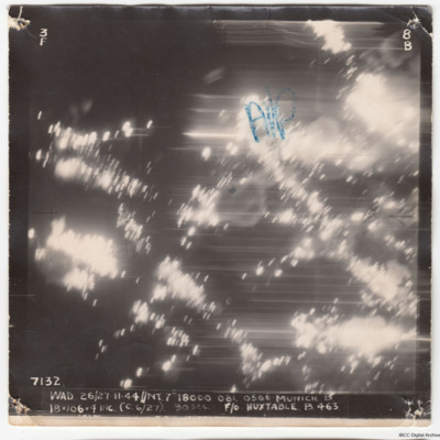
Munich
A vertical aerial photograph of Munich, taken during an operation. There is no detail visible but the aiming point is marked, 'A/P'.
The image is captioned '7132 WAD 26/27.11.44//NT 7" 18000 081. 0500 Munich B 18x106x4 inc (c 6/27) 30 sec F/O…
The image is captioned '7132 WAD 26/27.11.44//NT 7" 18000 081. 0500 Munich B 18x106x4 inc (c 6/27) 30 sec F/O…
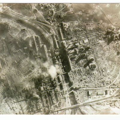
Bohlen Synthetic Oil Plant
A vertical aerial photograph of a severely damaged oil plant at Bohlen. On the reverse 'Synthetic oil plant at Bohlen taken by recce aircraft 20/2/1945'.
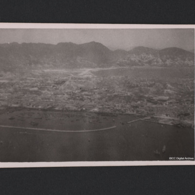
Hong Kong Mainland
Hong Kong mainland seen from the air. On the reverse 'Hong Kong mainland from the air with the drome just visible in the background. This part of the mainland is called Kowloon - Hong Kong itself is an island behind us when I took the photo.'
Tags: aerial photograph
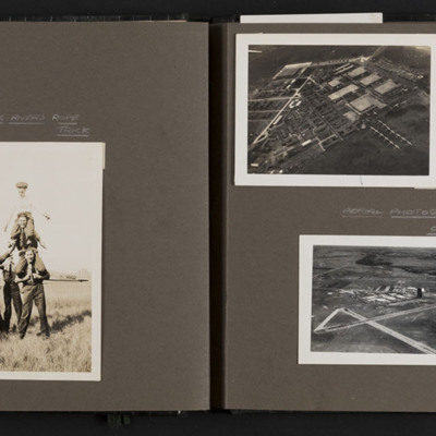
Airmen and Rivers Airbase
Six photographs from an album. Photo 1 is an airman standing to attention, captioned 'Tough boy Bailey'. Photo 2 is a tower of three airmen on shoulders, watched by two others and captioned 'The Rivers Indian rope trick'. Behind is an Anson. Photo 3,…
Tags: aerial photograph; aircrew; RCAF Rivers; training
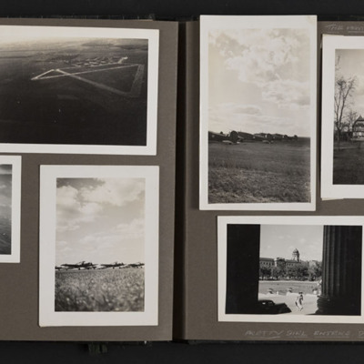
Rivers and Winnipeg
Ten photographs from an album.
Photo 1 and 3 are aerial views of Rivers.
Photo 2 is an aerial view of the base at Rivers.
Photo 4, 5 and 6 are Ansons at the airfield.
Photo 7 is the Pavilion at Assiniboine Park, Winnipeg.
Photo 8 is a view of…
Photo 1 and 3 are aerial views of Rivers.
Photo 2 is an aerial view of the base at Rivers.
Photo 4, 5 and 6 are Ansons at the airfield.
Photo 7 is the Pavilion at Assiniboine Park, Winnipeg.
Photo 8 is a view of…
Tags: aerial photograph; aircrew; Anson; RCAF Rivers; training
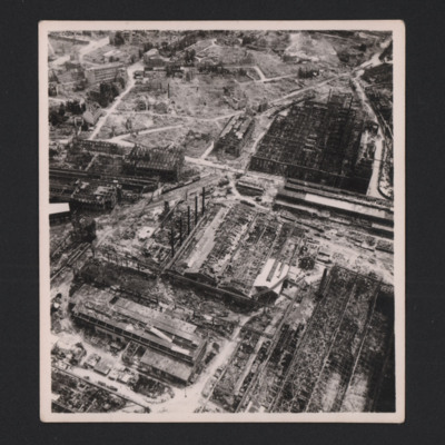
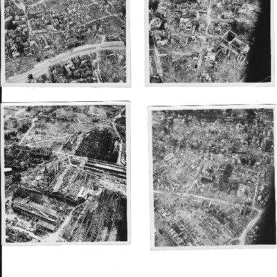
Dortmund
Three photographs of Dortmund residential areas. Only skeletons of buildings are remaining.
Identification kindly provided by Ludger Keiser of the Finding the location WW1 & WW2 Facebook group.
Identification kindly provided by Ludger Keiser of the Finding the location WW1 & WW2 Facebook group.
Tags: aerial photograph; bombing; Cook’s tour
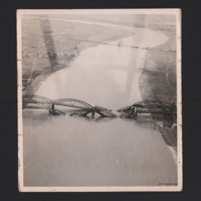
Hamm Railway bridge
In the foreground is the destroyed Südbrücke Hamm railway bridge with four spans over the Rhine. The Düsseldorf suburb of Hamm is partially visible. The Südbrücke is in the distance, also destroyed.
Identification kindly provide by Mariano…
Identification kindly provide by Mariano…
Tags: aerial photograph; bombing
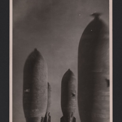
Bombs in Flight
Four photographs of a cluster of bombs in flight.
Photo 1 shows four bombs in flight. On the reverse is a stamp with
'F220 Neg 1 Geldern 9/2/45 98/180/320 Mitchell 16.00 W/Cdr Marshall 11,000' Not distributed as OP considered u/s from film…
Photo 1 shows four bombs in flight. On the reverse is a stamp with
'F220 Neg 1 Geldern 9/2/45 98/180/320 Mitchell 16.00 W/Cdr Marshall 11,000' Not distributed as OP considered u/s from film…
Tags: aerial photograph; bombing
Frankfurt
A sequence of two aerial photographs of Frankfurt, with an heavily bombed industrial area.
Identification kindly provided by Andrew Gordon of the Finding the location WW1 & WW2 Facebook group.
Identification kindly provided by Andrew Gordon of the Finding the location WW1 & WW2 Facebook group.
Tags: aerial photograph; bombing
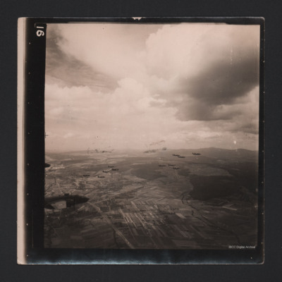
Fourteen Mitchells in Flight
An air-to-air photograph of 14 B-25 Mitchells in flight. They are flying over a cultivated valley, set between low hills.
Tags: aerial photograph; B-25
Bomb damage and aircraft
13 photographs showing bomb damage and aircraft.
Three photographs of Dortmund residential areas. Only skeletons of buildings are remaining.
Heavily bombed Krupp works
Four bombs in flight
Hamm Railway bridge. In the foreground is the destroyed…
Three photographs of Dortmund residential areas. Only skeletons of buildings are remaining.
Heavily bombed Krupp works
Four bombs in flight
Hamm Railway bridge. In the foreground is the destroyed…
Tags: aerial photograph; aircrew; B-25; bombing
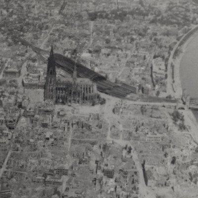
Cologne Cathedral
Shows bomb damage of area around the cathedral, railway station and bridge over the Rhine. The photograph taken from a 627 Squadron Mosquito.
Additional information about this item has been kindly provided by the donor.
Additional information about this item has been kindly provided by the donor.
Tags: 627 Squadron; aerial photograph; bombing; Cook’s tour; Mosquito
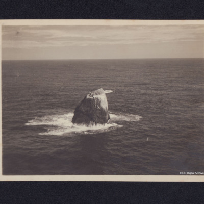
Rockall
An aerial photograph of Rockall taken during a training flight. Information supplied with the collection states 'Coastal Command; Nr. 6 OTU, RAF Silloth 1945. Training flight to Rockall'.
Helgoland
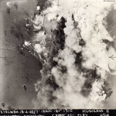
A vertical aerial photograph of the attack on Heligoland island. Most of the island is obscured by bomb explosions. Submitted with caption; “Actual photo taken over Heligoland submarine pens during 1000 bomber raid April 1945.”
The image is…
The image is…

