Browse Items (1459 total)
- Tags: aerial photograph
Sort by:
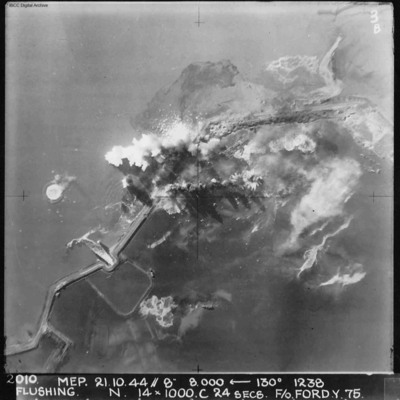
Flushing
A vertical aerial photograph of Flushing (Vlissingen) during an operation. Explosions can be seen on the coastal dyke. The No. 4 Commando bunker and Uncle Beach is nearby, in the bottom left of the image. Annotated '2010 MEP 21.10.44// 8” 8,000…
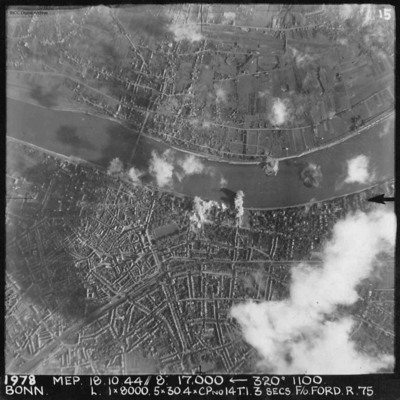
Bonn
A vertical aerial photograph of Bonn during an operation. The river Rhine is seen through the centre of the image. There are bomb explosions along the river with some cloud and shadow nearby. The majority is very clear, detailing the Kennedy bridge…
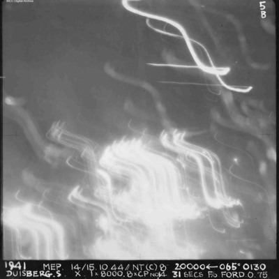
Duisberg
A vertical aerial photograph of Duisberg taken during a night operation. The lower half of the image is obscured by anti-aircraft fire. The top half has no clear detail. annotated '1941 MEP 14/15.10.44// NT (C) 8” 20000 [arrow] 065[degrees] 0130…
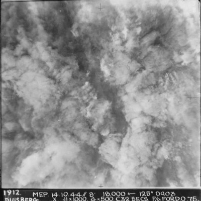
Duisberg
A vertical aerial photograph taken during the bombing of Duisberg. The entire image is obscured by explosions and smoke. Annotated '1912 MEP 14.10.44// 8” 18000 [arrow] 125[degrees] 0903 DUISBERG. X 11 x 1000. 4x500. C32 SECS. F/O FORD. O.75'.
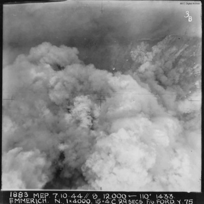
Emmerich
A vertical aerial photograph of Emmerich during an operation.The ground detail is obscured by explosions but the Rhine is visible at the top of the image. Annotated '1883 MEP 7.10.44// 8 12,000 [arrow] 110[degrees] 1433 EMMERICH. N. 1 x 4000. 15x4.C…
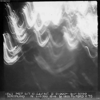
Dortmund
A vertical aerial photograph of Dortmund during an operation at night. No detail on the ground is visible and half the image is obscured by anti-aircraft fire. Annotated '1863 MEP 6/7.10.44// NT. 8” 21,000 [arrow] 310[degrees] 2030 DORTMUND. N. 1…
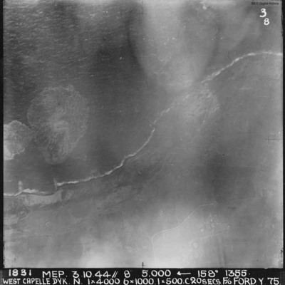
West Capelle Dyk N
A vertical aerial photograph of the Westkapelle Dyke, Vlissingen. The coastline can be seen but little on the ground. annotated '1831 MEP 3.10.44// 8” 5,000 [arrow] 158[degrees] 1355. WEST CAPELLE DYK. N. 1 x 4000. 6x1000. 1x500.C 20 SECS. F/O…
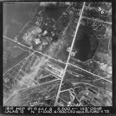
Calais
A vertical aerial photograph of Calais. The canal, Canal des Pierrettes, is visible and runs left to right, parallel to Rue Hoche and a marshalling yard. The yard services Les Fontinettes train station. Annotated '1810 MEP 27.9.44// 8” 5,500…
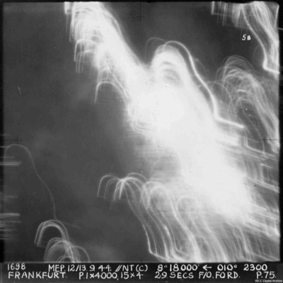
Frankfurt
A vertical aerial photograph of Frankfurt. The image was taken at night and half is obscured by anti-aircraft fire. Almost nothing can be seen on the ground. annotated '1698 MEP 12/13.9.44// NT (C) 8” 18,500 [arrow] 010[degrees] 2300. FRANKFURT. P…
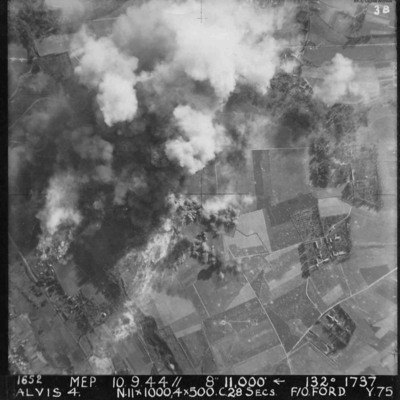
Alvis 4 target area
Vertical aerial photograph of Alvis, at Montvilliers, Le Havre. The centre section of the image is obscured by explosions. Annotated '1652 MEP 10/13.9.44// 8” 11,000 [arrow] 132[degrees] 1737 ALVIS 4. N.11x1000, 4x500 C.28 SECS. F/O FORD. Y.75'.
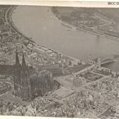
Cologne bomb damage
Three photographs of Cologne Cathedral and damaged bridge over the Rhine.
Tags: aerial photograph; bombing; Cook’s tour
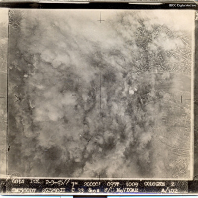
Cologne
Most of target obscured by smoke and dust. Captioned '6014 PCK 2-3-45// 7" 20000' 095t 1009 COLOGNE Z 8MC500DT 8GP250IT C 33 Secs F/O McVICAR A/102
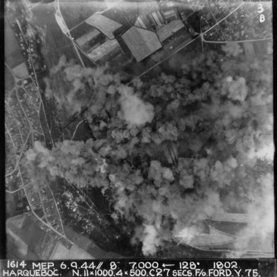
Harqueboc
Vertical aerial photograph of Harqueboc, Le Havre. Street patterns can be seen to the left and top right of the photograph, located north-west of Harfleur. Annotated '1614 MEP 6.9.44// 8” 7,000 [arrow] 128[degrees] 1802 HARQUEBEC. N.11x1000, 4x500…
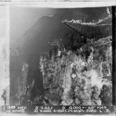
Le Havre
A vertical aerial photograph of Le Havre during bombing operations. The land is mainly obscured by explosions but breakwaters and docks are visible. Digue Augustin Normand is shown at the top of the image, with Bassin de la Manche and Le Havre port…
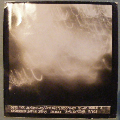
Worms
Target completely obscured by markers/cloud. Captioned '5977 PCK 21/22-2-45 //NT(C)8" 18000' 049T 20.42 WORMS R 1HC2000DN 6CP14 2CP15 26 secs F/O McVICAR K/102'.
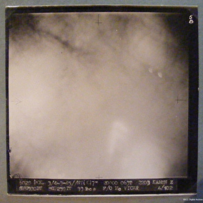
Kamen
Target completely obscured by smoke/dust/cloud. Captioned '6028 PCK 3/4-3-45//NT(C)7" 20000 063T 2303 KAMEN Z 8M0500DT 8GT250IT 33Secs F/O McVICAR A/102'
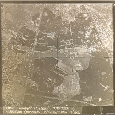
Nürnberg-Langwasser
A target aerial photograph of Nürnberg-Langwasser, adjacent to Moorenbrunn, Nuremberg. Bomb craters are visible throughout.
Captioned 'PCK. 11-4-45//7" 16000' NURNBURG. M. 10ANM64IN 6MO500DT. F/O McVICAR. E/102.'
Captioned 'PCK. 11-4-45//7" 16000' NURNBURG. M. 10ANM64IN 6MO500DT. F/O McVICAR. E/102.'
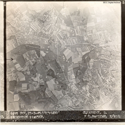
Osnabruck
A target aerial photograph of Osnabruck with numerous bomb craters visible.
Captioned '6195 PCK. 25-3.45//8" 16200' OSNABRUCK. Q. 1HC2000IN 11X15CP. F/O McVICAR. X/102
Captioned '6195 PCK. 25-3.45//8" 16200' OSNABRUCK. Q. 1HC2000IN 11X15CP. F/O McVICAR. X/102
RCAF Rivers
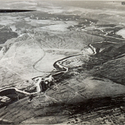
Six photographs of RCAF Rivers, No 1 Air Navigation School. First, third, fourth and fifth are from the air. The second is of a Harvard alongside a hangar and the sixth is of a row of Cornell aircraft and an Anson in the background.
Tags: aerial photograph; Anson; Cornell; Harvard; RCAF Rivers; runway; training
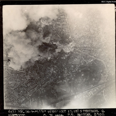
Sterkrade
Target partially obscured by cloud and dust. Captioned '6172 PCK 24-3-45 //8" 16300 100T 13 181/2 STERKRADE Q [?] C 31secs F/O McVICAR. X 102'.
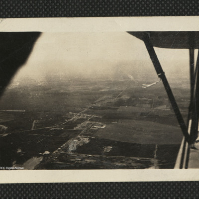
Aerial view of Nova Scotia countryside
An aerial view of Canadian countryside from a biplane. The wings can be seen on the right side of the image. On the reverse 'The Fleet takes me over Canada's vast countryside. Stanley EFTS July 42'.
Tags: aerial photograph; aircrew; training
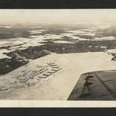
Scoudouc Airfield
An oblique image of Scoudouc airfield. Taken in low sun the hangars cast long shadows. About six aircraft are outside. On the reverse 'Ross my Instructor does a half roll & we get Scoudouc slap bang in the lens. That's Shooting Feb 42'.
Tags: aerial photograph; hangar; training
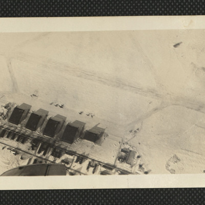
Moncton Airfield
An oblique aerial photograph of Moncton airfield in the snow. Seven hangars and many aircraft are visible. On the reverse 'We see Moncton 'Drome from the air. A marvellous sight. Dec 42'.
Tags: aerial photograph; hangar; RCAF Moncton; training
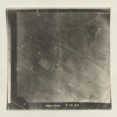
Goole
A sequence of three vertical aerial photographs of a dockyard area. The docks are at the edge of a River Ouse and running into this is the Dutch river. The images are captioned 'Millard 7.10.93' and '1, 2 and 3'. Millard is the bomb aimer.
Tags: aerial photograph
Lincoln Cathedral and the city
An aerial oblique view of Lincoln Cathedral and the city. St.Giles school and the residential areas surrounding it can be seen to the left of the photograph. Lincoln Cathedral and Castle are visible in the direct centre, with Lincoln Crown Court…
Tags: aerial photograph

