Browse Items (680 total)
- Conforms To is exactly "Geolocated"
Sort by:
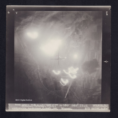
Molbis
Target photograph of Molbis. Mainly obscured by light streaks, balls of light and bomb explosions. Visible area mainly rural, no detail clearly visible. Captioned '6V', '5B', '5069. SKELL.7/8.4.45//NT(C)7" 16200' 080° 2302 MOLBIS.D.…
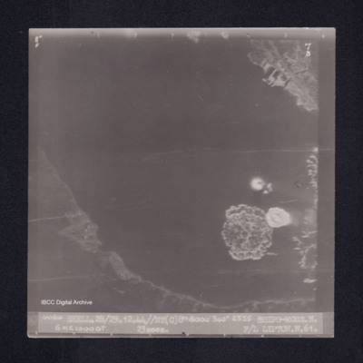
Ships-Moss
Target photograph of Shiping off Moss. Coastal area, bay or estuary, small area showing quays and docks, larger area showing coast line, but mainly water. Bomb explosions in water. Captioned '8°F', '7B', '4064 SKELL.28/29.12.44//NT(C)8" 8000' 340°…
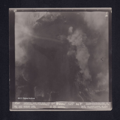
Dam-Heimbach
Target photograph of the Heimbach Dam. Partially obscured by cloud smoke and dust. No detail clearly visible. Captioned '8°F', '5B', '3931 SKELL.11.12.44.// 8" 9000' 125° 1437 DAM-HEIMBACH.T. 14 MC 1000 DT. C 25secs. F/L BARTLETT.T.61'. On the…
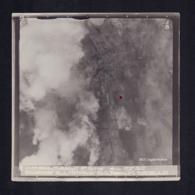
Rollencourt
Target photograph of Rollencourt. Red dot centre right. Partially obscured by cloud, visible area rural, field patterns and bomb explosions visible. Captioned '5°F', 5B', '2439 SKELL.31.8.44// 8" 14000' [arrow] 172° 1812 ROLLENCOURT…
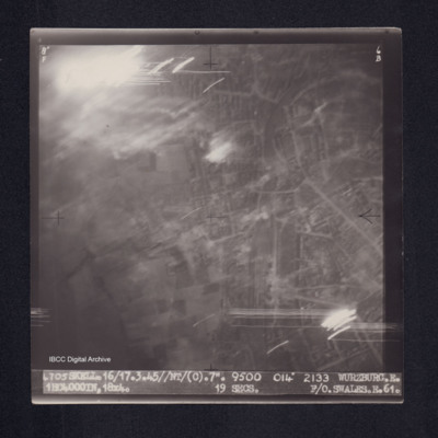
Wurzburg
Target photograph of Wurzburg. Urban area, some light streaks, no clear detail visible. Captioned '8°F', '6B', '4705 SKELL.16/17.3.45//NT/(C).7". 9500 014° 2133 WURZBURG.E. 1HC4000IN,18X4. 19secs. F/O.SWALES.E.61.' On the reverse ' F/O. SWALES.…
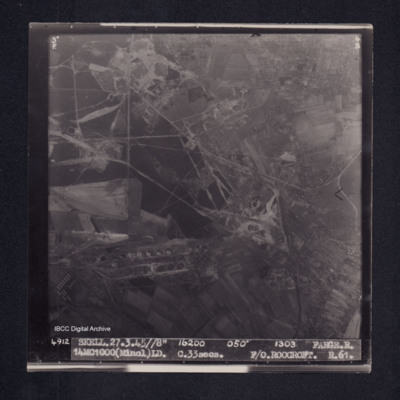
Farge
Target photograph of Farge. Partly rural and wooded but with industrial structures including oil storage tanks. Roads and field patterns visible. Captioned '3[degree]s F', '4B', '4912 Skell.27.3.45//8" 16200 050° 1303 FARGE.R. 14MC1000(Minol)LD.…
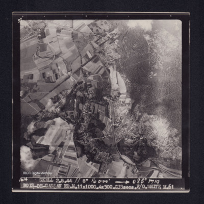
Bois-de-Cassan
Target photograph of Bois-de- Cassan. Rural area, roads, woods, field patterns and houses clearly visible. Captioned '3°F', '4B', '1614 SKELL. 2.8.44 // 8" 16000' [arrow] 085° 1719 BOIS-DE-CASSAN RD.M.11X1000.4X500.C33secs.F/O. WHITE. M.61'. On the…
Ladbergen
Target photograph of Ladbergen. Mainly rural area with fields covered in snow and the Dortmund-Ems Canal visible. Captioned ‘5’ 4121 SKELL. 1.1.45//8” 11750 ‘040°’ 1119 LADBERGEN. C 14MC1000DT, LD. C28secs. F/L.GREENFIELD.C.61. On the…
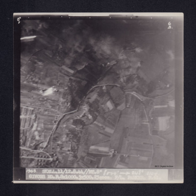
Givors
Target photograph of Givors. Rural area with field patterns, a dense wood and sparse settlements. Captioned ‘8°F’, '6B 1963. SKELL.11/12.8.44//NT.8” 8000’ [arrow] 048° 0104. GIVORS RD.F. 8x1000. 3x500. 23secs. F/L PARKER F. 61. On…
Farge
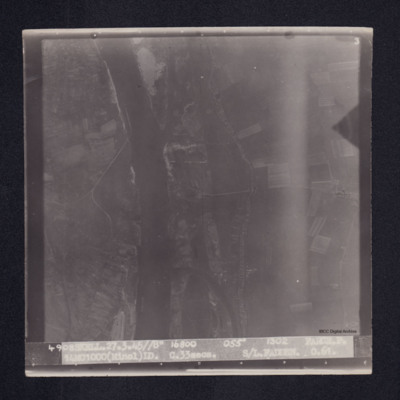
Target photograph of Farge. Partly rural and wooded with both banks of the Weser, roads settlements and field patterns visible. Captioned ‘3’, ‘4908 SKELL. 27.3.45/8” 16800 055’ 1302 FARGE.P. 14MC1000(Minol)ID. C.33secs. S/L…
Calais
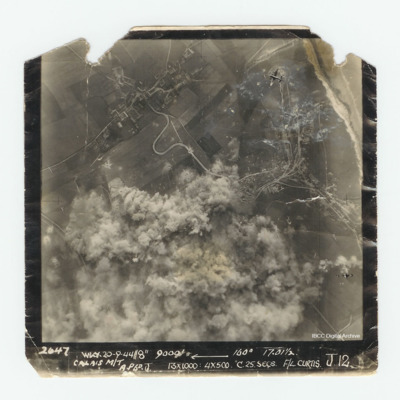
Target photograph of Calais. Much of the photograph is obscured by explosions. In the top right corner is a Lancaster. Captioned '2647 WKY 20-9-44//8" 9000' [arrow] 160° 17.01 1/2 Calais M/T A.P6 D. J 13x1000:4x500 C.25.secs. F/L Curtis J.12.'.
Dusseldorf
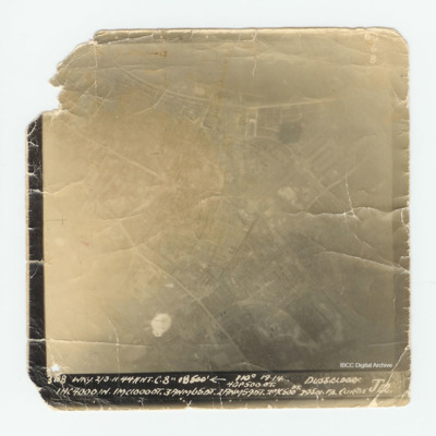
Target photograph of Dusseldorf with much of the detail over exposed. Captioned 'Captioned ' 60 6 B 3198 WKY. 2/3.11.44 // NT C'. 8" 18500' [arrow] 110° 19.14 Dusseldorf 4GP 500 OT. 1 HC 4000 1N.1MC10000T.3ANM650T. 2ANM590T.2MC 500 DT. 29 sec F/L…
Wangerooge
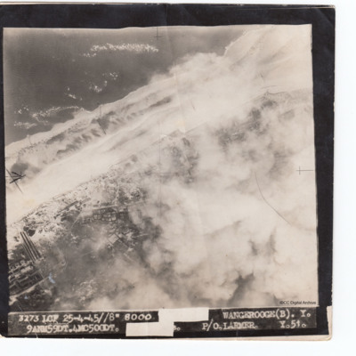
Target photograph of Wangerooge with coastline running middle left to top right. Buildings below with clouds or bomb explosions obscuring bottom right. Captioned '3273 LCF 25-4-45//8" 8000 [censored] Wangerooge(B). Y. 9AMN59DT.4MC500DT [censored],…
Tours airfield
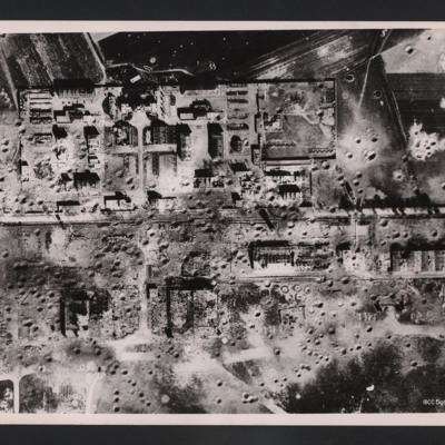
Vertical aerial photograph of an area showing severely destroyed buildings and large craters appearing throughout. A road is going through the middle of the buildings and the area is surrounded by fields, also covered with craters.
On the reverse…
On the reverse…
RAF attack on Salbris explosive works and depot
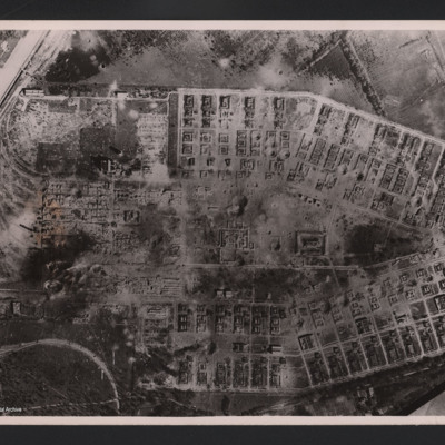
Aerial vertical photograph of two long rows of destroyed buildings around a central space with two destroyed individual buildings and a damaged roadway system. The area is surrounded by fields but at the left hand side of the photograph two main…
RAF attack on Salbris explosive works and depot
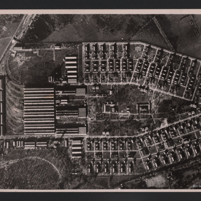
Vertical aerial photograph of an area of industrial buildings with a network of roads throughout and a main railway station on the left, where marshalling yards and train tracks are clearly visible. Many buildings of varying size and a wall is going…
Ardouval
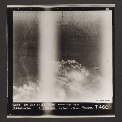
Vertical aerial photograph of bombing of Ardouval. The bottom half of the image is partially obscured by bomb explosions. Captioned '5656 BIN 25-7-44 //8 14000' [arrow] 125° 0843 Ardouval S 11x1000 4x500 c 30 secs P/O Lester T. 460'.
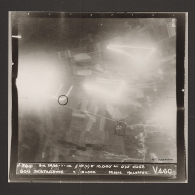
Bois Desjardins
A vertical aerial photograph identified as Bois Desjardins. Much of the image is obscured by bright lights. Captioned '5691 BIN. 25/26-7-44 //NT(C) 8" 10.000' [arrow] 070° 0253 Bois Desjardins Y. 18x500. 19 secs. P/O. Lester. V 460'.
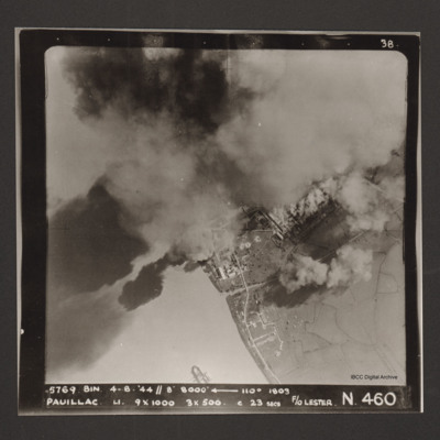
Pauillac
A vertical aerial photographs of Pauillac. Cloud and smoke obscures about half of the image. There is a small ship floating on the river. Captioned '5769 BIN 4-8-44 //8 8000' [arrow] 110° 1803 Paulliac. Li. 9x1000 3x500 c 23 secs F/O Lester. N 460'.
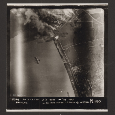
Pauillac
A vertical aerial photograph of Pauillac. At the top an industrial area is on fire with much smoke and bomb craters visible. In the river a ship is lying on its side. Captioned '5789 BIN 5-8-44 //8 8000' [arrow] 110° 1907 Paulliac Li 9x1000 3x500 c…
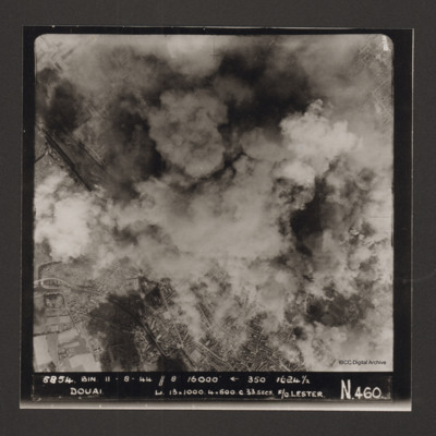
Douai
Vertical aerial photograph of Douai. In the lower half the centre of the town is visible but above that cloud and explosions obscure much of the rest. Captioned '5854 BIN 11-8-44 //8 16000' [arrow] 350° 1624 1/2 Douai Li…
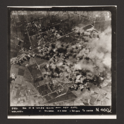
Volkel
Vertical aerial photograph of the bombing of Volkel airfield. The right hand side, centre of the image is obscured by bomb explosions and smoke. Captioned '5921. BIN 15-8-44 //8 16000' [arrow] 097° 1203 1/2 Volkel Li 13x1000 4x500 c 32 secs F/O…
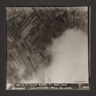
Raimbert
Vertical aerial photograph of Raimbert V-2 storage site. The bottom right of the image is obscured by cloud.
Captioned '6051 Bin. 31-8-44//8" 8,800'
Captioned '6051 Bin. 31-8-44//8" 8,800'
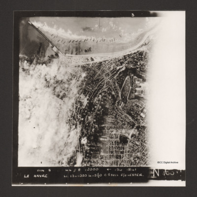
Le Havre
Vertical aerial photograph of Le Havre. The left side of the image (the port area) is obscured by bomb explosions. Several ships are aground on the beach. Captioned 'BIN 5-8-44 //8 12000' [arrow] 150 1841 Le Havre Li 13x1000 4x500 c5secs F/O Lester N…
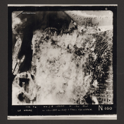
Le Havre
Vertical aerial photograph of Le Havre. Much of the centre of the photograph is obscured by explosions and smoke.
Captioned 'Captioned 'BIN 5-8-44 //8 12000' [arrow] 150 1841 Le Havre Li 13x1000 4x500 c5secs F/O Lester N 460'.
Captioned 'Captioned 'BIN 5-8-44 //8 12000' [arrow] 150 1841 Le Havre Li 13x1000 4x500 c5secs F/O Lester N 460'.

