Browse Items (120 total)
- Conforms To is exactly "Geolocated (cumulative polygon)"
Sort by:
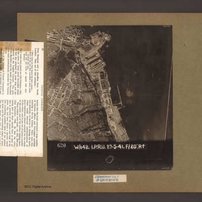
Scharnhorst and Gneisenau
An aerial vertical photograph of a coastline lined with docks and buildings. At the top and inlet with docks and town buildings to its left. Below a peninsular are three docks pointing down and left. A large warship is moored in the bottom dock. Just…
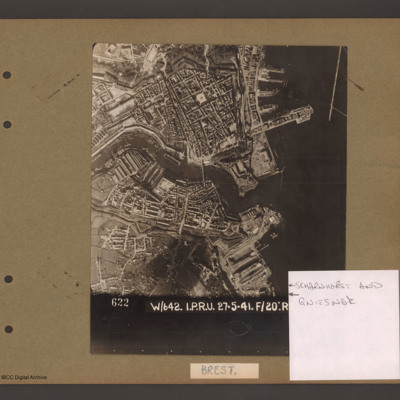
Scharnhorst and Gneisenau
Aerial vertical photograph showing a coastal town with docks on the coast and a river running through the middle. On the right open water with a breakwater in the top right corner pointing down. Above the river on the four large jetties point into…
St Leu d'Esserent
Six aerial photographs of St Leu d'Esseent.
Photo 1 is a vertical target photograph with tunnels, railway and landing quay marked.
Photo 2 is a vertical aerial photograph taken during the operation. It is captioned '1962 TLP 5-8-44//8" 15000…
Photo 1 is a vertical target photograph with tunnels, railway and landing quay marked.
Photo 2 is a vertical aerial photograph taken during the operation. It is captioned '1962 TLP 5-8-44//8" 15000…
St Leu d'Esserent
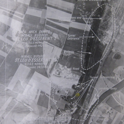
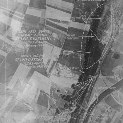
Four photographs of St. Leau d'Esserent.
Photo 1 is a target aerial photograph with areas to be bombed. Tunnel entrances, constructions, excavations, railway and a landing quay are marked.
Photo 2 is a vertical aerial photograph taken during the…
Photo 1 is a target aerial photograph with areas to be bombed. Tunnel entrances, constructions, excavations, railway and a landing quay are marked.
Photo 2 is a vertical aerial photograph taken during the…
St Leu d'Esserent
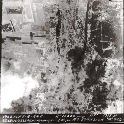
A vertical aerial photograph of St Leu d'Esserent V-1 site during an operation.
The caption reads '1962 TLP 5-8-44 // 8" 15000 --> 117° 1315:30 St Leu d'Esserent A(9x1000)(4x500)f30sec P/O Johnston "A" 420'
The second image is identical.
The caption reads '1962 TLP 5-8-44 // 8" 15000 --> 117° 1315:30 St Leu d'Esserent A(9x1000)(4x500)f30sec P/O Johnston "A" 420'
The second image is identical.
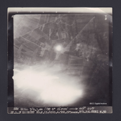
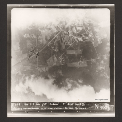
St. L. D'Esserent
Target photograph of Saint-Leu-d'Esserent. Partially obscured by light streaks. Road and field patterns visible, but no clear detail. Captioned '5°F', '7B', '1231 SKELL 7/8.7.44 //NT 8" 15000' [arrow] 015° 0117 ST.L.D'ESSERENT…
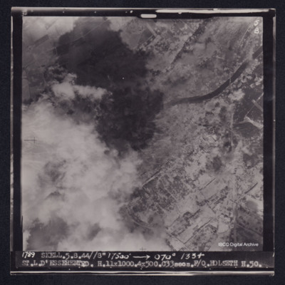
St. L. D'Esserent
Target photograph of Saint-Leu-d'Esserent. Railway bridge crossing river Oise top right. Left side of photograph partially obscured by smoke and dust, very many craters. Captioned '5F', '5B', '1789 SKELL. 5.8.44//8" 17500' [arrow] 070° 1334…
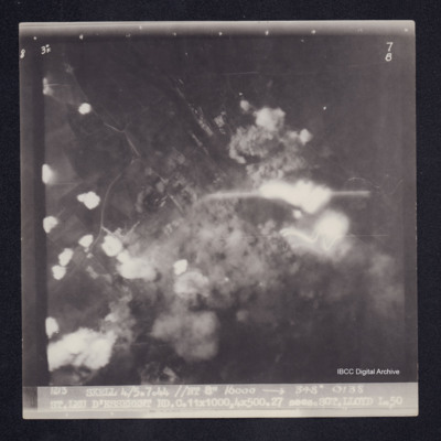
St. Leu D'Esserent
Target photograph of Saint-Leu-d'Esserent. Rural area, centre of photograph obscured by smoke and dust and a small area of light streaks. Roads visible. Captioned 3° F', '7B', '1213 SKELL 4/5.7.44 //NT 8" 16000 [arrow] 348° 0138 ST.LEU D'ESSERENT…
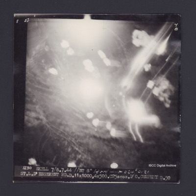
St.L.D'Esserent
Target photograph of Saint-Leu-d'Esserent. Obscured by smoke, dust and light streaks. Captioned '5°F', '7B', '1230 SKELL 7/8.7.44 //NT 8" 14000' [arrow] 024° 0121 ST.L.D'ESSERENT RD.D.11X1000,4X500.C25secs.P/O CURPHEY D.50'. On the reverse…
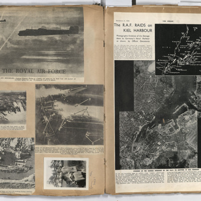
Targets
Left page: top, two flying Whitley aircraft passing over the Dutch coast.
Middle left, aerial view of Hamburg docks.
Middle right, bombing targets and fires in Gelsenkirchen.
Bottom left, bombing of Boulogne harbour.
Bottom right, a woman…
Middle left, aerial view of Hamburg docks.
Middle right, bombing targets and fires in Gelsenkirchen.
Bottom left, bombing of Boulogne harbour.
Bottom right, a woman…
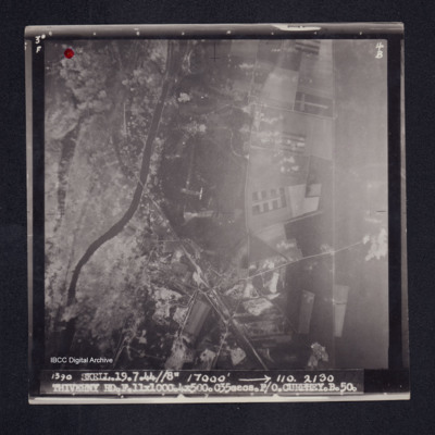
Thiverny
Target photograph of Thiverny. Red dot top left corner, Lancaster visible in centre. Rural area both banks of river Oise, roads and field patterns visible with craters, smoke and dust on left third of photograph. Captioned '3°F', '4B', '1390…
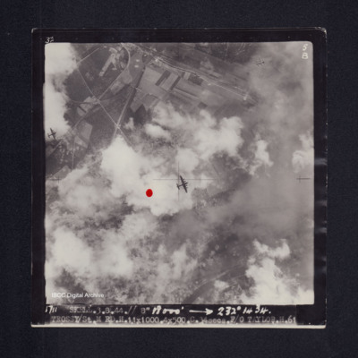
Trossy St Maximin
Target photograph of Trossy St Maximin. Red dot left of centre. Three Lancasters flying below. River Oise bottom right. Partially obscured by cloud smoke and dust but bomb explosions, bomb craters roads and field patterns visible. Captioned '3°F',…
Trossy St Maximin
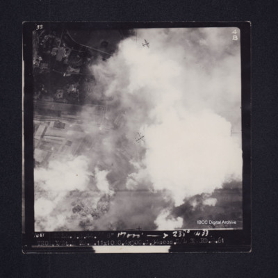
Vertical aerial photograph over Trossy St Maximin. The top and bottom sections are largely obscured by cloud and bomb explosions. Two Lancasters are visible, one directly below and one diving away in the bottom left corner of the…
Trossy St Maximin
Target photograph of Trossy St Maximin. Majority of photograph obscured by smoke and dust, in area not obscured roads, woods and field boundaries clearly visible. Two Lancasters flying below also visible. Captioned '3°F', '4B', '1681 SKELL.3.8.44.//…
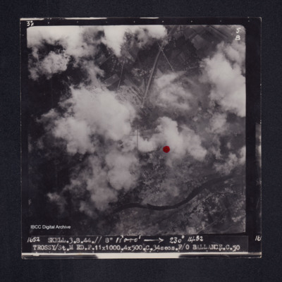
Trossy St Maximin
Target photograph of Trossy St Maximin. Both banks of the river Oise visible although partially obscured by smoke or cloud, red dot just right of centre. Very many craters. Captioned '3°F', '5B', '1652 SKELL.3.8.44// 8" 18000' [arrow] 230° 1432…
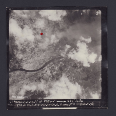
Trossy St Maximin
Target photograph of Trossy St Maximin. Red dot just left and higher than centre. Rural area, river Oise running across photograph, some smoke and dust, many craters. Captioned '3°F', '5B', '1723 SKELL.3.8.44.// 8" 17500' [arrow] 239° 1432…
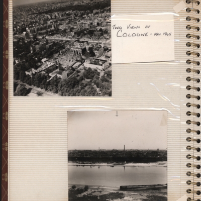
Two views of Cologne - May 1945
Top - oblique aerial photograph of a city with roads running left to right, the nearest one being tree lined and many damaged buildings
Bottom - oblique aerial photograph with the river Rhine running left to right and buildings including chimneys…
Bottom - oblique aerial photograph with the river Rhine running left to right and buildings including chimneys…
Tags: aerial photograph; bombing; Cook’s tour
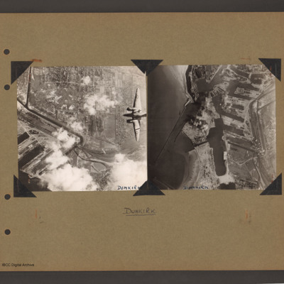
Ventura over Dunkirk and Dunkirk docks
On the left an aerial vertical photograph of town, canal and docks. A canal zigzags from top left down, right and the left back towards dockyard in the bottom left. A town with dwellings and industrial areas lies mostly to the right of canal. The…
Tags: aerial photograph; bombing; target photograph; Ventura
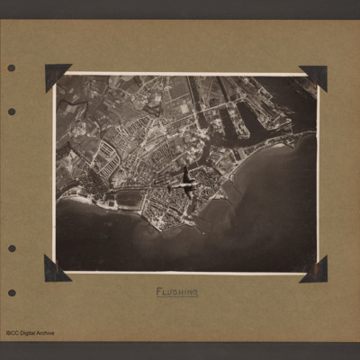
Ventura over Flushing
Aerial vertical photograph of coastline with town and docks. Coastline runs from mid left to right with a broad peninsular in the centre on which is a large town with docks. There are five jetties/piers running out into the sea. There is a Ventura…
Tags: aerial photograph; bombing; Ventura
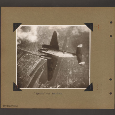
Ventura over Ijmuiden
Aerial vertical photograph of Ventura flying over canals and town. A Ventura coded YH of 21 squadron flies from right to left. Below is a canal which splits into a number of channels and a branch goes up into the town on the left side. Town buildings…
Tags: 21 Squadron; aerial photograph; Ventura

