Browse Items (35 total)
- Tags: RAF Driffield
- Type is exactly "Photograph"
Sort by:
Navigation log, plotting map and target photograph for operation to Foret de Nieppe.
This is the crews sixth operation, three plotting sheets, part of a plotting map, a sheet of paper with his air miles calculations and a target photograph.
The photograph shows a rural area, an area of forest top left third of the photograph. A…
The photograph shows a rural area, an area of forest top left third of the photograph. A…
Navigation log, plotting map and target photograph for operation to Les Catelliers
This is the crews fourth operation, two navigation log sheets, part of a plotting map and a target photograph.
The photograph is mainly obscured by flares, rural area some bomb explosions visible. The caption for the target photograph '1975 DRF.…
The photograph is mainly obscured by flares, rural area some bomb explosions visible. The caption for the target photograph '1975 DRF.…
Navigation log, plotting map and target photograph for operation to Mare-sur-On
This is the crews eighth operation, three navigation log sheets, part of a plotting map and a target photograph. The photograph has a group of flares in the centre, some bomb explosions are visible. Caption of the target map '329…
Nordstern
The three navigation sheets give details of the planned routes out and back as well as observations and events during the operation. The map plots the routes to be flown.
Note from the Navigation Officer 'Satisfactory. Why not use 40[degree] method…
Note from the Navigation Officer 'Satisfactory. Why not use 40[degree] method…
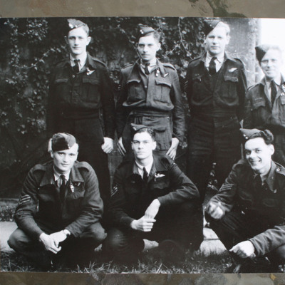
Seven aircrew
Seven airmen wearing battledress with brevet and side caps, three squatting in front and four standing behind. Pilot is middle front. Three versions of the same image, on the reverse 'Driffield 1944, Back L to R, P Brett (W.Op), J Christensen (R/G),…
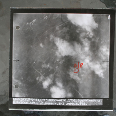
Soesterberg
Target photograph showing airfield with smoke from bomb explosions. Aiming pint in annotated in red ink. Captioned 'DRF.3-9-44//7"18000 >120.1731.Soersterberg.R.9x1000.4x500.C.34secs.F/S Jubb.R.462'.
This item was sent to the IBCC Digital Archive…
This item was sent to the IBCC Digital Archive…
Sterkade
Operation 26 for the crew. Three navigation log sheets showing the route to be taken and the observations made throughout the operation. The plotting map shows the coasts of England and Holland and the route to Sterkrade.
The target photograph…
The target photograph…
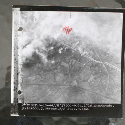
Sterkrade
Target photograph showing built up area in top half with road and railway running left to right. Smoke from bomb explosions top left. Captioned '2630 DRF.6-10-44//8"17500 >094.1716.Sterkrade. R.16x500.C.34 secs.F/S Jubb.R.462.'.
This item was sent…
This item was sent…
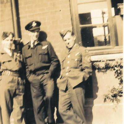
Three aircrew
Three men standing leaning against a brick building all with hands in pockets. Man on the left wears battledress and side cap. An officer in the centre wearing battledress with half brevet and peaked cap. Sergeant on the right wears tunic with half…
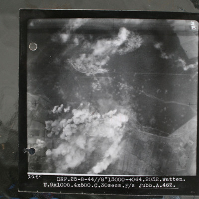
Watten V2 bunker
Target photograph showing forest area in top half with smoke from bomb explosions. Many craters are visible in this wooded area. Cleared area where tracks converge in this wooded area top centre, just edged by clouds. Bunker itself is just below and…

