Browse Items (750 total)
- Tags: target photograph
Sort by:
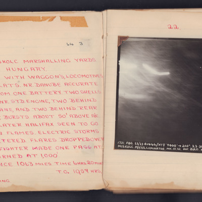
Miskolc
A target photograph for an operation to Miskolc Marshalling Yards. No ground detail is visible, it is dark or obscured by light. The photograph is annotated 'A12' and captioned:
'1701. FOG. 22/23 AUG 44 // NT 8" 9000' ->200° 23.30.
MISKOLC.…
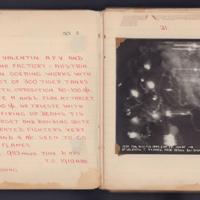
St Valentin
A target photograph for an operation to St. Valentin AFV and Tank Factory in Austria. Light trails and smoke obscure most of the ground but some roads are visible. It is annotated 'A5' and captioned:
'1678. FOG .20/21 AUG 1944. // NT. F8. 10400'.…
'1678. FOG .20/21 AUG 1944. // NT. F8. 10400'.…
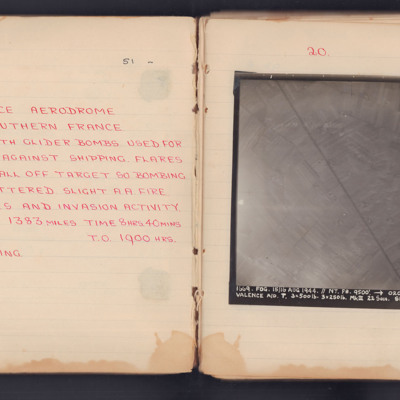
Valence Aerodrome Southern France
Target photograph for an operation to Valance Aerodrome. A road is visible, running diagonally top to bottom, surrounded by fields. The photograph is annotated 'A4' and captioned:
'1669. FOG. 15/16 AUG 1944. //NT. F8. 9500'. -> 020° 23.38.
VALENCE…
'1669. FOG. 15/16 AUG 1944. //NT. F8. 9500'. -> 020° 23.38.
VALENCE…
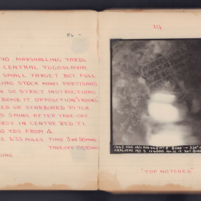
Kraljevo Marshalling Yards
Target photograph for an operation to Kraljevo. Apart from some light and smoke in the central lower part, much of the ground detail is clear. At top centre is the circular 'Square of Serbian Warriors', with a residential area below. The Ibar river…
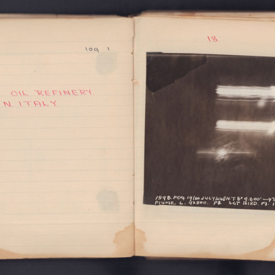
Fiume Oil Refinery
A target photograph for an operation to Fiume. No detail is visible on the ground and there are three streaks of light. It is annotated 'A4' and captioned:
'1598. FOG. 19/20 JULY 44 // NT 8" 9,800' ->305° 2249.
FIUME. L. 9x500. P8. SGT BIRD. M.…
'1598. FOG. 19/20 JULY 44 // NT 8" 9,800' ->305° 2249.
FIUME. L. 9x500. P8. SGT BIRD. M.…
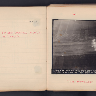
Milan Marshalling Yards N. Italy
A target photograph for an operation to Milan. Some roads are visible and Target Indicators have been laid across, what appears to be, several railway tracks. The photograph is annotated 'A4' and captioned:
'1524. FOG. 10/11 July 44 // NT8" 6200'…
'1524. FOG. 10/11 July 44 // NT8" 6200'…
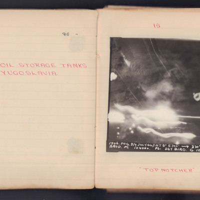
Brod Oil Storage Tanks
Two target photographs for separate operations to Brod in former Yugoslavia.
1st photograph: Darkness, smoke, light trails and Flak bursts hide much of the ground detail but some roads can be seen. It is annotated 'A4' and captioned:
'1506. FOG.…
1st photograph: Darkness, smoke, light trails and Flak bursts hide much of the ground detail but some roads can be seen. It is annotated 'A4' and captioned:
'1506. FOG.…
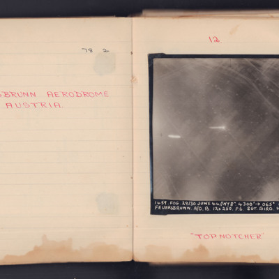
Feuersbrunn Aerodrome Austria
Two target photographs taken on separate operations to Feuersbrunn in Austria.
First photograph shows the grass field but no runways stand out. Vehicle tracks and small bomb craters can be seen. It is annotated 'A4' and captioned:
'1459 FOG. 29/30…
First photograph shows the grass field but no runways stand out. Vehicle tracks and small bomb craters can be seen. It is annotated 'A4' and captioned:
'1459 FOG. 29/30…
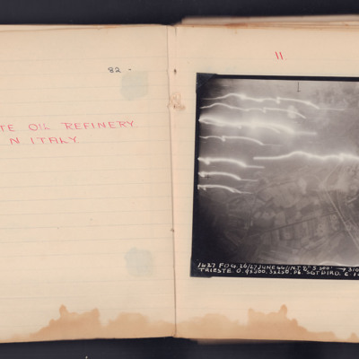
Trieste Oil Refinery
Target photograph taken on an operation to Trieste of the Zaule area, with the Gaslini works and the railway lines. The roads and field pattern are clearly visible.
The photograph is annotated 'A4' and is captioned:
'1637 FOG. 26/27 JUNE 44 // N.T…
The photograph is annotated 'A4' and is captioned:
'1637 FOG. 26/27 JUNE 44 // N.T…
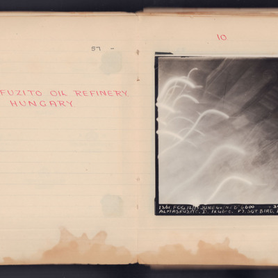
Almasfuzito Oil Refinery Hungary
A target photograph taken during an operation to Almasfuzito. The left and bottom of the image are obscured by light trails and glare. To the right and upper areas the refinery and roads can be seen. It is annotated 'A4' and captioned:
'1361. FOG.…
'1361. FOG.…
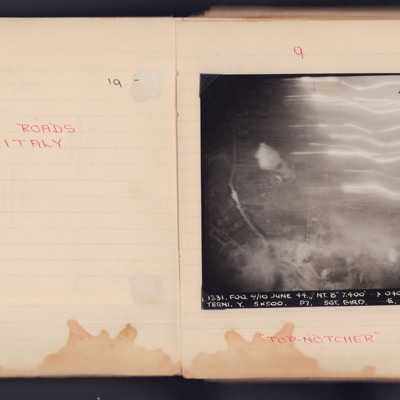
Terni Roads
A vertical aerial photograph taken during an operation. Underneath is written "Top Notcher".
It is captioned '1331.Fog. 9/10 June 44. // NY. 8" 7,400' -> 040° 0243. Terni. Y. 5x500. P7. Sgt. Bird/ E. 104.'
It is captioned '1331.Fog. 9/10 June 44. // NY. 8" 7,400' -> 040° 0243. Terni. Y. 5x500. P7. Sgt. Bird/ E. 104.'
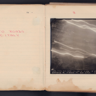
Orvieto Roads
A vertical aerial photograph taken during an operation. Much of the detail in the middle and top is obscured by light flashes.
It is captioned '1293. Fog.6/7 June 44. // NT 8" 7,100' -> 030°0139 Orvieto. D. 1x4000. P7. Sgt Bird. D. 104'.
It is captioned '1293. Fog.6/7 June 44. // NT 8" 7,100' -> 030°0139 Orvieto. D. 1x4000. P7. Sgt Bird. D. 104'.
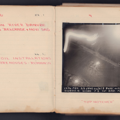
Mining in River Danube Between Belgrade & Novi Sad
A vertical aerial photograph taken during an operation. The top left of the image is obscured by light flashes but the river and both banks are clear. Under the photograph is written "Top Notcher".
It is captioned '1254. Fog. 2/3 June 44 // NT 8"…
It is captioned '1254. Fog. 2/3 June 44 // NT 8"…
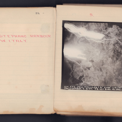
Santo Stefano Harbour
A vertical aerial photograph taken during an operation. The top left of the image is obscured by explosions and light flashes but much ground detail is visible on the image.
It is captioned '1211. Fog. 28/29 May 44 // N.T. 8" 9000' -> 135° 00.12…
It is captioned '1211. Fog. 28/29 May 44 // N.T. 8" 9000' -> 135° 00.12…
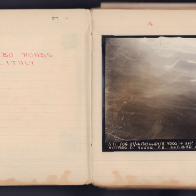
Viterbo Roads
A vertical aerial photograph taken during an operation. Most of the top of the image is obscured by light flashes.
It is captioned '1171 Fog 25/26 May 44 // NT 8" 9000' -> 330° 00.33 Viterbo. D.9x500 P8. Sgt Bird L 104'.
It is captioned '1171 Fog 25/26 May 44 // NT 8" 9000' -> 330° 00.33 Viterbo. D.9x500 P8. Sgt Bird L 104'.
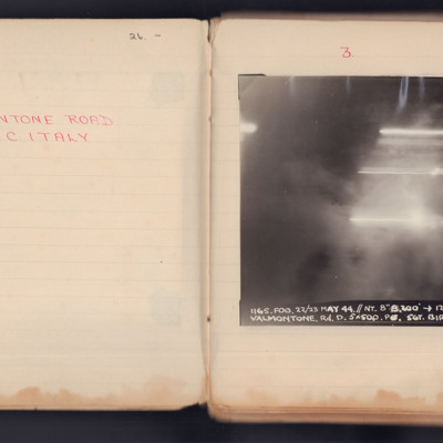
Valmontone Road
A vertical aerial photograph taken during an operation. No detail is visible of the ground, the image is obscured by explosions and light flashes.
It is captioned '1165. Fog.22/23 May 44 // NT 8" 8200 -> 120° 23.26 Valmontone. Rd. D 5 x 500 PO Sgt…
It is captioned '1165. Fog.22/23 May 44 // NT 8" 8200 -> 120° 23.26 Valmontone. Rd. D 5 x 500 PO Sgt…
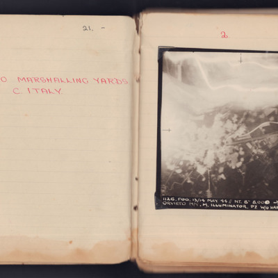
Orvieto Marshalling Yards
A vertical aerial photograph taken during an operation at Orvieto. The left and top are obscured by explosions and anti-aircraft flashes.
It is captioned '1126. Fog. 13/14 May 44 // NT. 8" 8.000-> 160° 23.18 1/2 Orvieto M/Y M. Illuminator. P7 W/O…
It is captioned '1126. Fog. 13/14 May 44 // NT. 8" 8.000-> 160° 23.18 1/2 Orvieto M/Y M. Illuminator. P7 W/O…
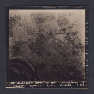
Ludwigshafen
A vertical target photograph of Ludwigshafen, orientated with the south west at the top. In the lower left corner is a bend in the River Rhine and the entrance to Kaiserworthhafen docks. Just visible at the bottom edge is the end of Luitpoldhafen…
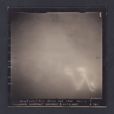
Neuss
An aerial photograph of cloud-covered Neuss, near Düsseldorf. The cloud obscures all detail and all that can be seen through the cloud is a large glow, probably from the ground, and the wavy trace of a flare.
The photograph is captioned:
'1814…
The photograph is captioned:
'1814…
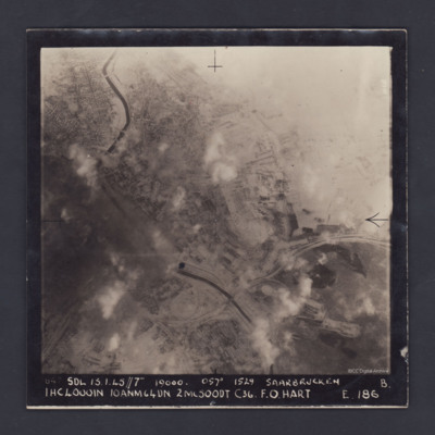
Saarbrucken
A vertical aerial photograph of the centre of Saarbrücken, orientated with south-east at the top and clearly showing the River Saar. Cloud and/or smoke covers parts of the town but residential areas, the railway and other details can still be seen.…
Rheydt
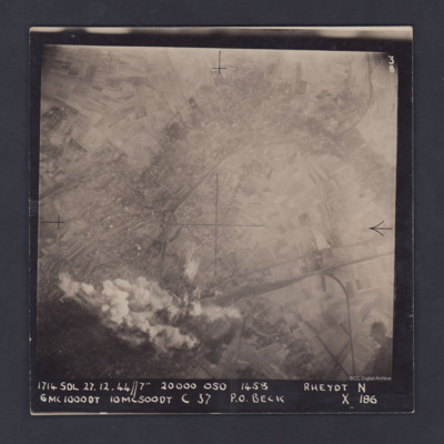
A vertical aerial photograph of Rheydt, near Mönchengladbach. The railways clearly stand out, one entering the image at lower right, branching out into a marshalling yard and another sweeping in from the upper right corner of the image. The centre…
Trier
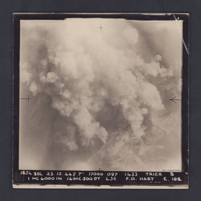
A vertical aerial photograph taken during a bombing operation at Trier. Much of the detail is obscured by bomb explosions but in the bottom right corner are fields and roads.
It is captioned :
'1654 SDL 23.12.44 // 7" 17000 097 1433 Trier B
1…
It is captioned :
'1654 SDL 23.12.44 // 7" 17000 097 1433 Trier B
1…
Vohwinkel
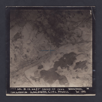
A vertical aerial photograph of Vohwinkel, near Wuppertal, orientated so that the top edge is roughly south. The multi-track railway is obvious and runs from the lower left corner to a large marshalling yard at the mid-right edge. A branch line joins…
Bocholt
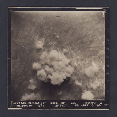
A vertical aerial photograph of Bocholt. On the left side is the distinctive diamond shape of Friedhof Bocholt cemetery and on the middle left edge is the artificial lake, the Bocholter Aasee. The upper left quarter of the image shows open…
Hangelar
A vertical aerial photograph of Hangelar (Bonn) airfield taken during a bombing operation. The image is orientated with south-east at the top edge. A large, bright glare obscures most of the ground detail but the River Seig is visible, meandering…

