Browse Items (161 total)
- Tags: reconnaissance photograph
Sort by:
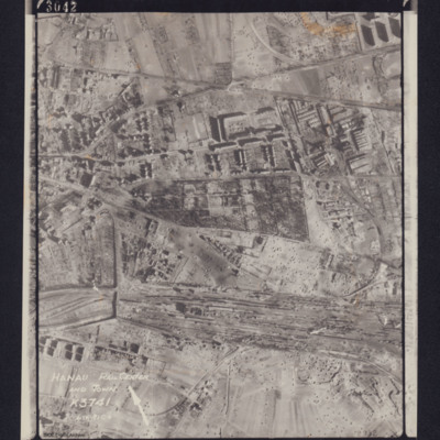
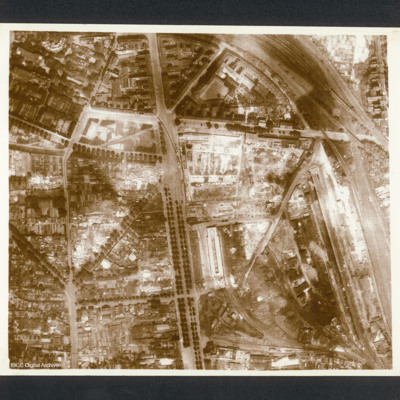
Hanau Rail Center and Town
Photograph of railway yard, captioned 'Hanau Rail Center and Town, K3741 Dist 91C+', includes directional arrow. Bottom right caption: 2932. Top caption: '3042 106G.4272.14.FEB.45 F/36"//540 SQDN←'.
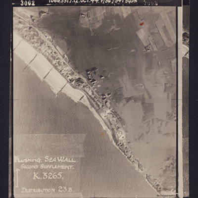
Flushing Sea Wall
Photograph shows the breached sea wall at Flushing, captioned 'Flushing Sea Wall, Second supplement, K3265, Distribution 23B'. Caption at top of photograph: '3002 106G3317.12.OCT.44 F/36"//541 SQDN'.
Reverse has stamp 'Intelligence section RAF…
Reverse has stamp 'Intelligence section RAF…
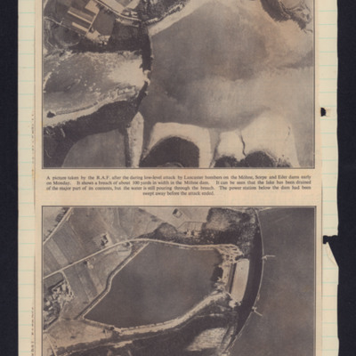
Mohne dam breached
Two photographs. Top showing Mohne dam breached in the centre with lake on the rights. Bottom photograph shows the dam before the attack.
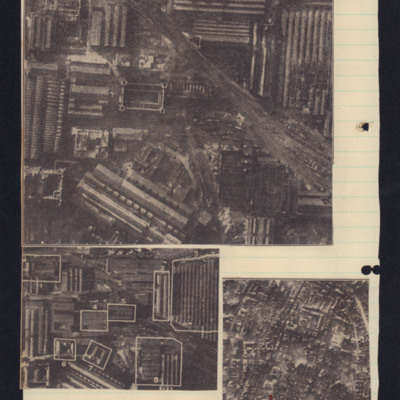
Essen: heaviest blow at German war industry
Three photograph cuttings with text cutting at bottom. Photograph 1 shows multiple industrial buildings with railway lines running top left to bottom right. There is damage to roof of buildings on the right. Photograph 2 shows Krupps works before the…
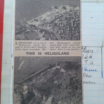
Heligoland Cutting
A newspaper cutting showing Heligoland before and after it was bombed by Lancasters.
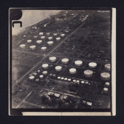
Sarnia oil refinery and St Clair River
Two low angle oblique aerial photographs of Sarnia oil refinery on the St Clair River. Photograph 1 is mostly storage tanks; photograph 2 is of tanks and production facilities.
Identification kindly provided by Richard Evans of the Finding the…
Identification kindly provided by Richard Evans of the Finding the…
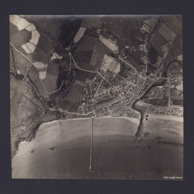
Ramsey
Vertical aerial photograph of Ramsey, Isle of Man. Queen’s Pier is in centre of photograph, with Sulby River and Ramsey Harbour to the right. On the reverse is handwritten 'B/A Allen Nav Beyak 15/5/43'.
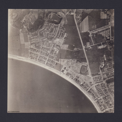
Llandudno
Vertical aerial photograph of Llandudno and Llandudno Bay taken during training operations. Craig-Y-Don Paddling Pool is the oval feature at left end of North Shore beach. Main road running top to bottom is Conway Road. Llandudno railway station and…
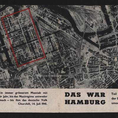
Das War Hamburg
Propaganda leaflet featuring an aerial vertical photograph of Hamburg after a Royal Air Force operation. Buildings are either completely destroyed or gutted, light falling through the gaping windows. Text describes fronts closing in, the Royal Air…
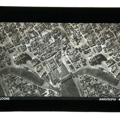
Cologne 1943
Aerial photographs taken from directly above showing damaged buildings, the railway station, rail bridge over the Rhine and the cathedral. Captioned 'Cologne, AMPS/767/92 4-7-43'.
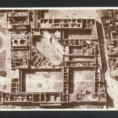
Munich Residenz
Reconnaissance photograph showing the Munich Residenz gutted. Captioned between pages 66-67 of 1956 Memoir '[underlined] Munich [/underlined] after 5 Group of Bomber Command raid 24th April 1944 [written vertically down left hand side of page]'. On…
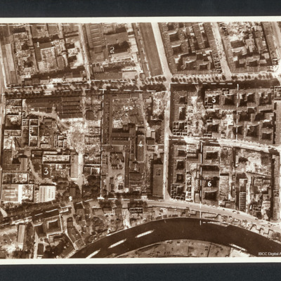
Berlin
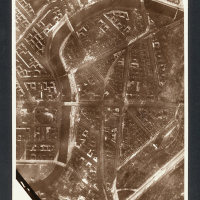
Reconnaissance photograph showing a city with river at the bottom (part of Charlottenburg and Moabit district). Annotated with divisions into numbered areas. Captioned between pages 56-57 of 1956 Memoir '“BERLIN”, after raid in 1944, 1. Machine…
Berlin
Reconnaissance photograph showing central Berlin area (Moabit district- north of the Tiergarten ) Spree river curving from bottom left to top then top right with buildings and roads. Left centre is Hansa Platz.
Captioned between pages 51-52 of…
Captioned between pages 51-52 of…
Eder Dam
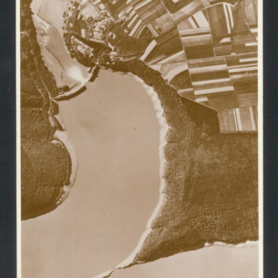
Reconnaissance photograph showing lake on left with breached dam half way up on left. Farmland fields top right. Captioned between page 47-48 of 1956 Memoir '[heading] 617 Squadron [/heading]
[caption - written vertically on LHS of page presumably…
[caption - written vertically on LHS of page presumably…
Mohne Dam
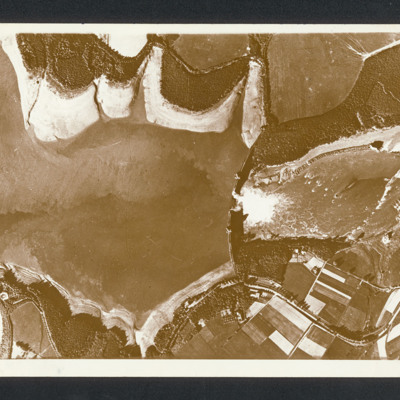
Reconnaissance photograph with lake on the left and a dam middle with breach with water flowing through. Captioned between pages 46-47 of 1956 Memoir [written vertically on LHS of page presumably for landscape orientation of photo] 'Mohne Dam. The…
Genoa
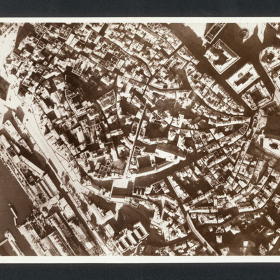
Reconnaissance photograph photograph showing city centre with port bottom left.. Captioned between pages 35-36 of 1956 Memoir '“Genoa Italy” Damage in Ansaldo fitting out yard after raids in late 1942 [written down left hand side of page]'. On…
Cologne
Reconnaissance photograph photograph of city centre with major road running top to bottom and railway lines on right side. Captioned in 1956 Memoir between pages 26-27 'Cologne after first 1,000 Bomber raid 1942'. On the reverse 'Cologne, C2550'.
Rostock
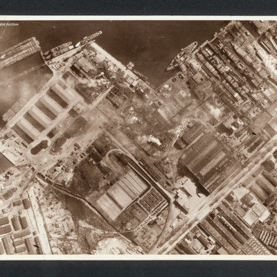
Reconnaissance photograph showing at top a port area (Naptun Shipbuilding Yards) with several ships docked. Water at top and built up area of port and industrial buildings below. Some fires visible. Captioned between pages 22-23 of 1956 Memoir…
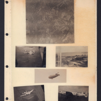
Places, Good Will tour Lancasters and airship
Top - reconnaissance photograph of town on left with roads and open countryside on right.
Middle left - Air-to-air view of formation of four Lancasters in light paint scheme over open countryside. The tail plane of aircraft from which photo…
Middle left - Air-to-air view of formation of four Lancasters in light paint scheme over open countryside. The tail plane of aircraft from which photo…
Cologne
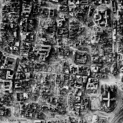
A vertical photograph taken of the destruction of Cologne. Almost every building has been destroyed. The cathedral is in the bottom right corner. Submitted with caption: 'The results of bombing on the centre of the German city of Cologne, February…
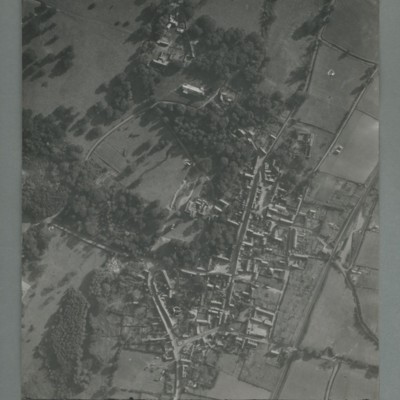
Little Walsingham
Reconnaissance photograph of a village surrounded by open fields. A main road runs top centre to bottom. The image is orientated with south at the top. Captioned '0020, OCU331, 006519Sep55.1445Z, 20"Can/50 F/O JONES, RESTD'. On the reverse…
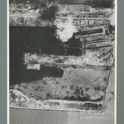
Le Havre
Reconnaissance photograph showing a damaged port area with a basin orientated left right with a pier in the centre. Caption 'Le Havre K2491(IMMED)'. On the reverse 'Date 11.7.44, Unit WS, Neg No. G103, 51:53'. Dock area has been heavily bombed, with…
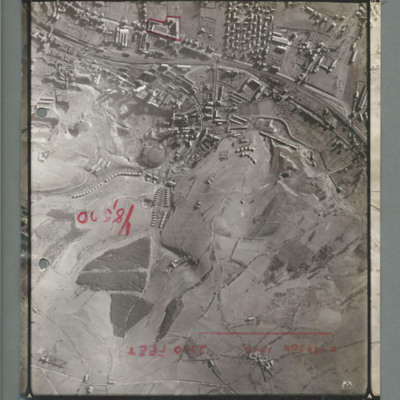
La Ricamerie factory
Reconnaissance photograph showing built up area at the top with railway line running left to right, There is a red line surrounding a small industrial area top slightly to the left of centre. There is a scale marked showing 2000 ft and 'Y8,520'…
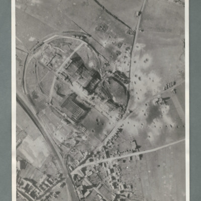
Aircraft factory at Albert
Reconnaissance photograph showing a railway line bottom left and an industrial area circled by a road in the centre. There are a number of craters to the right side of the industrial area. On the reverse 'Secret, Con G.412'
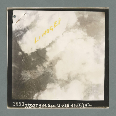
Limoges
Reconnaissance photograph showing buildings on the left through a gap in clouds. Captioned 'Limoges' On the bottom '2053, J/307.544 Sqdn. 13.Feb.44, //F/14"'. On the reverse 'K144'.

