Browse Items (754 total)
- Tags: target photograph
Sort by:
Szombathely
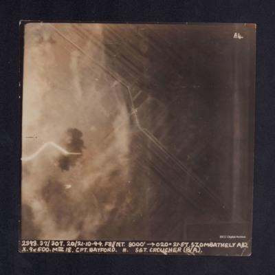
A vertical aerial photograph taken during the bombing of Szombathely aerodrome. The left side of the image is obscured by explosions and smoke. It is captioned ' 2393. 37/307. 20/21.10.44. F8//NT.8000' -->020°. 21.57.Szombathely A/D. X. 9x500. MkIII…
Szombathely
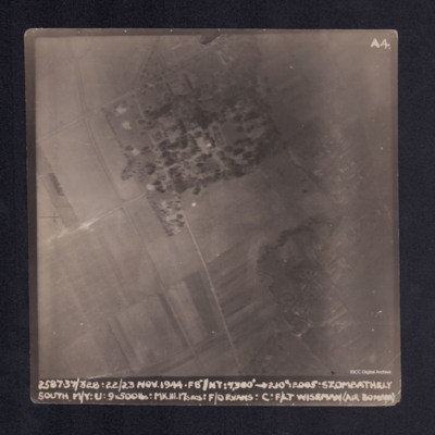
A vertical aerial photograph taken during the bombing of Szombathely South marshalling yard. Fields and a wood are visible with connecting grid of road. It is captioned ' 2. 37/328. 22/23 NOV.44. F8"//NT.7300' -->210°. 2005 . Szombathely South M/Y.…
Target photograph
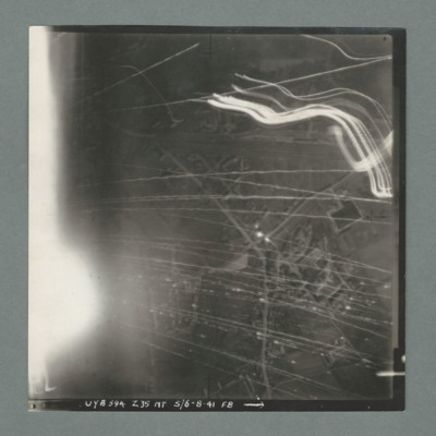
Target photograph showing a small built up area with road running bottom centre right to top right. Numerous tracer lines and flares. Caption 'UYB 594, Z35, NT, 5/6.8.41, F8'.
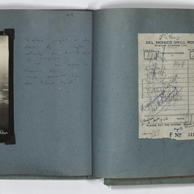
Target photograph and receipt
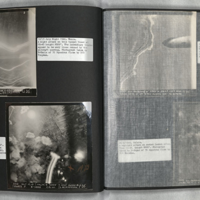
LH page target photograph caption ' 4231. EWS. 29/30.8.44//nr?8" 12000 230(degrees) 0200 Stettin U 1 X 4000 7 X 4 6 X 30 28secs F/L Josey U 103'. Handwritten caption 'Taken right at the start of a night attack on Baltic port of STETTIN.
TIs can…
TIs can…
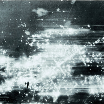
Target photograph of Hannover
Image shows multiple explosions/fires in the Sudstadt district of Hannover and a Lancaster silhouetted well below bottom left.
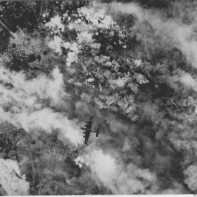
Target photograph with Halifax flying below
Target photograph showing bomb explosions and smoke. Just below the centre a Halifax flying below from right to left. Parts of town are visible on the left. Two versions of the same image. This is a reverse image of related item.
This item was…
This item was…
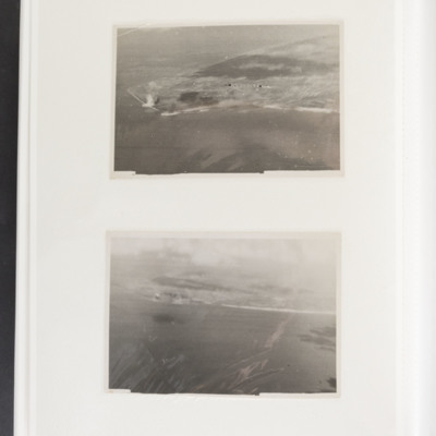
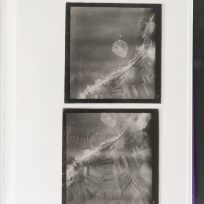
Target photographs
Top land juts out from right to centre left, Bomb explosions visible left centre on coast. Bottom coastline runs from left to right centre, sea at bottom. Bomb explosions visible left side on coast.
Target photographs
Top - coast runs top right to bottom left with sea to the left. Bomb explosion visible in sea at centre image. Bottom - enlarged version of top picture.
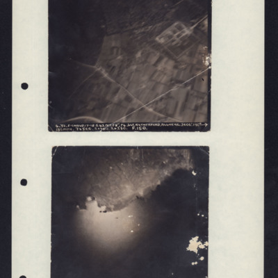
Target Photos, Alghero and Pantelleria
Photo 1 is Alghero, Italy taken at 3000'. It shows a rectangular compound, fields and roads. Caption: '4.Y2.F-CHAUD.17-18.5.43.NT.F8". P4.SGT.RUTHERFORD.ALGERO.3000'.190→180MPH.7x500.2xSBCS.2x250. F.150.'
Photo 2 is Pantelleria taken from 7000'…
Photo 2 is Pantelleria taken from 7000'…
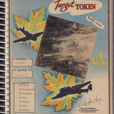
Target Token Emden
A card with an aerial photograph taken during an operation. The target was Emden and the crew members are listed.
‘F/O Potter
F/O Rutherford
F/O Mjolsness
F/O Reid
Sgt Taylor
Sgt Tuer
Sgt Searle’
‘F/O Potter
F/O Rutherford
F/O Mjolsness
F/O Reid
Sgt Taylor
Sgt Tuer
Sgt Searle’
Tags: 6 Group; aerial photograph; aircrew; bombing; Halifax; target photograph
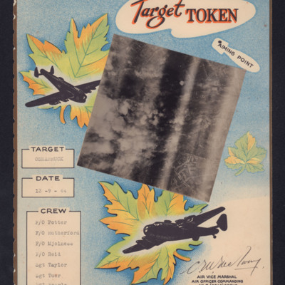
Target Token Osnabruck
A card with a target photograph of an operation at Osnabruck. The crew is listed.
‘F/O Potter
F/O Rutherford
F/O Mjolnese
F/O Reid
Sgt Taylor
Sgt Tuer
Sgt Searle’
‘F/O Potter
F/O Rutherford
F/O Mjolnese
F/O Reid
Sgt Taylor
Sgt Tuer
Sgt Searle’
Tags: 6 Group; aerial photograph; aircrew; bombing; target photograph
Tatoi
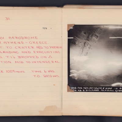
A target photograph taken during an operation to Tatoi Aerodrome, near Athens, Greece. The lower half of the image is obscured by light but hangars and buildings can be seen at the top. The photograph is annotated 'A4' in the top left corner and is…
Tatoi aerodrome
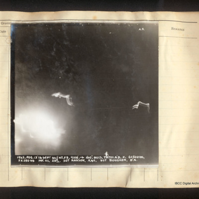
Vertical aerial photograph of Tatoi aerodrome. No detail is visible. The image is dark with explosions in the bottom left corner and ant-aircraft tracer. Captioned 'A4 1945. FOG.13/14 Sept 44//NT. F8. 9100' [arrow] 160°. 0013. Tatoi A/D. 6x500lbs,…
Tatoi aerodrome
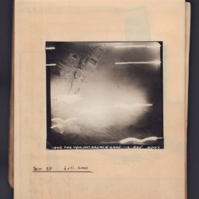
Target photograph showing some buildings top left and flares across the bottom. Captioned '1846.Fog, 13/14 Sep 44, NT 8", 6400ft,→ 090 degrees. 0007'. Annotated 'Tatoi A/D 6 x TI flares'.
Terni Roads
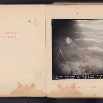
A vertical aerial photograph taken during an operation. Underneath is written "Top Notcher".
It is captioned '1331.Fog. 9/10 June 44. // NY. 8" 7,400' -> 040° 0243. Terni. Y. 5x500. P7. Sgt. Bird/ E. 104.'
It is captioned '1331.Fog. 9/10 June 44. // NY. 8" 7,400' -> 040° 0243. Terni. Y. 5x500. P7. Sgt. Bird/ E. 104.'
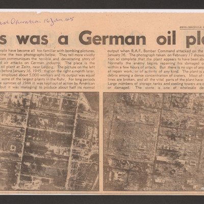
This was a German oil plant
Shows the effects of an operation that destroyed the synthetic oil plant at Zeitz. Captioned 'My last operation 16 Jan. 45'.
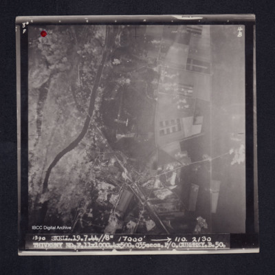
Thiverny
Target photograph of Thiverny. Red dot top left corner, Lancaster visible in centre. Rural area both banks of river Oise, roads and field patterns visible with craters, smoke and dust on left third of photograph. Captioned '3°F', '4B', '1390…
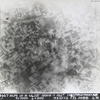
Tirlemont airfield
Target photograph taken during daylight attack on Tirlemont (Goetsenhoven) airfield. Patchwork of fields with aircraft dispersal hardstands to left and right of explosions and smoke centred on airfield itself. Village of Bost is to the bottom left…
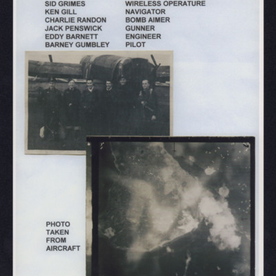
Tirpitz
Top - six aircrew standing in line behind a Lancaster, Captioned 'Crew from left to right, Sid Grimes wireless operator, Ken Gill navigator, Charlie Randon bomb aimer, Jack Penswick gunner, Eddy Barnett engineer, Barney Gumbley pilot'.
Bottom target…
Bottom target…
Tirpitz
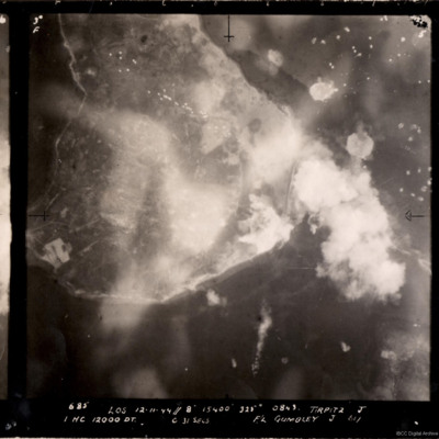
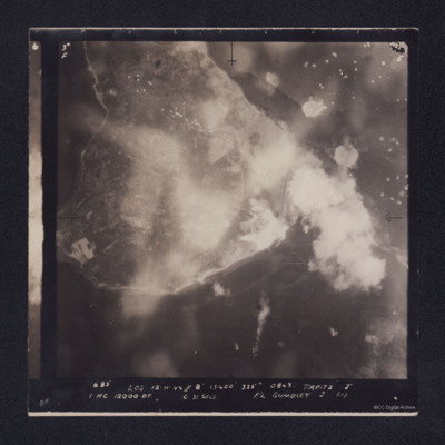
A vertical aerial photograph of the bombing of the Tirpitz. Much of the image is obscured by smoke and explosions. Tirpitz can be seen right of centre. Anti-aircraft fire can be seen to the top of the photograph. Three bomb explosions in the water…
Tirpitz
Target photograph showing shoreline, with smoke obscuring the island of Hakøya within Tromsø fjord. Battleship Tirpitz can be seen just right of centre through smoke. Three water-spouts from earlier explosions above and to the right. Anti-aircraft…
Tours
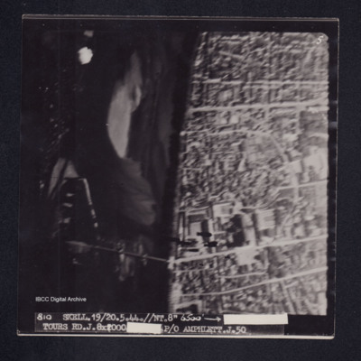
Target photograph of Tours. River Loire running top to bottom, road bridge across river and Saint-Gatien de cathedral visible. Captioned '5'', '810 SKELL.19/20.5.44.//NT.//8" 6500' [arrow] [censored] TOURS RD.J.8X2000 [censored]P/O AMPHLETT.J.50'. On…
Tours
Photo 1 is a vertical aerial photograph of Tours. The city is visible but there are incendiary tracks blotting out much of the detail.
Photo 2 is a vertical aerial photograph taken during the bombing of Tours. Explosions can be seen and a…
Photo 2 is a vertical aerial photograph taken during the bombing of Tours. Explosions can be seen and a…
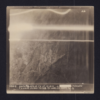
Trento
Vertical aerial target photograph of Trento. Some ground details, mainly roads, are visible as is open countryside. In the upper part are several light trails from ordnance. It is captioned:
2829 104/90. 8/9-APR-45. F8". NT.//9,500'.→[redacted]…
2829 104/90. 8/9-APR-45. F8". NT.//9,500'.→[redacted]…

