Browse Items (1442 total)
- Tags: aerial photograph
Sort by:
Hamm
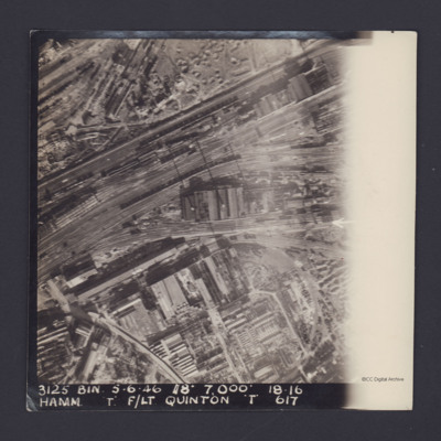
A vertical aerial photograph of Hamm. The right side is obscured by light. It is captioned '3125 Bin 5.6.46 //8" 7000' 18.16 Hamm 'T' F/Lt Quinton 'T' 617'.
On the reverse 'On loan P&R Darby Woodhall Spa'.
On the reverse 'On loan P&R Darby Woodhall Spa'.
Hamm
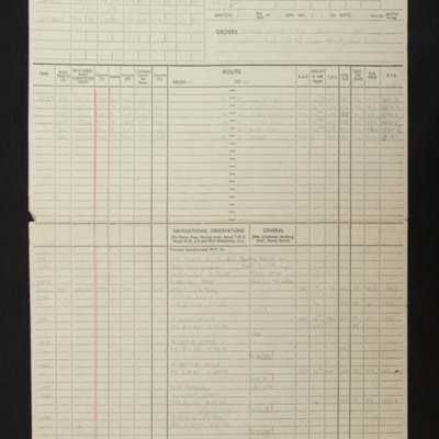
Navigational computation for an operation to Hamm. Also included is a vertical aerial photograph taken during the bombing operation.
Hamm
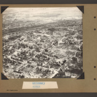
Aerial inclined photograph showing city landscape in the lower two thirds with open country beyond. In the foreground a square grid of roads surrounded by multistory buildings. Many buildings are damaged or without roofs and a large number have been…
Tags: aerial photograph; bombing; Cook’s tour
Hamm and Brest
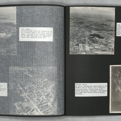
Photograph one is an oblique aerial photograph of Hamm, showing extensive damage and bomb craters throughout.
Photograph two is a vertical aerial photograph of Brest naval base and ports, with numbered annotation.
Photograph two is a vertical aerial photograph of Brest naval base and ports, with numbered annotation.
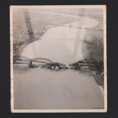
Hamm Railway bridge
In the foreground is the destroyed Südbrücke Hamm railway bridge with four spans over the Rhine. The Düsseldorf suburb of Hamm is partially visible. The Südbrücke is in the distance, also destroyed.
Identification kindly provide by Mariano…
Identification kindly provide by Mariano…
Tags: aerial photograph; bombing
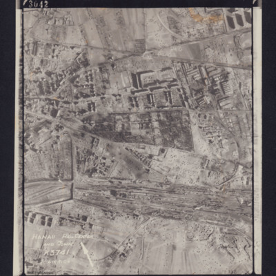
Hanau Rail Center and Town
Photograph of railway yard, captioned 'Hanau Rail Center and Town, K3741 Dist 91C+', includes directional arrow. Bottom right caption: 2932. Top caption: '3042 106G.4272.14.FEB.45 F/36"//540 SQDN←'.
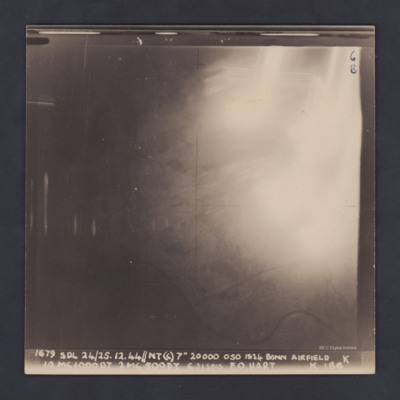
Hangelar
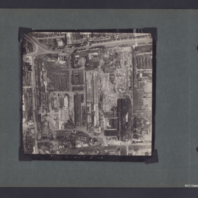
A vertical aerial photograph of Hangelar (Bonn) airfield taken during a bombing operation. The image is orientated with south-east at the top edge. A large, bright glare obscures most of the ground detail but the River Seig is visible, meandering…
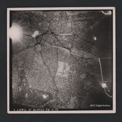
Hannover
Vertical aerial photograph of Hannover. The image is largely clear with only one flare in the top left. Street patterns and buildings are clearly visible. Captioned ‘2. J (Z6) 12 NT 26-27/1/42 F/8” [arrow] TX’
Hanomag factory
A vertical aerial photograph of South West Hanover, delimited by Bückeburger Allee and Friedrich-Ebert-Straße. Captioned '(T) Ched 23.5.45//7" J 218'. On the reverse 'Crown Copyright Reserved' and 'Hanover'.
Identification kindly provided by…
Identification kindly provided by…
Hanover
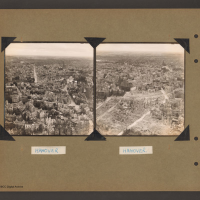
On the left an oblique aerial photograph of a city. In the foreground many multistory buildings some showing signs of damage or missing roofs and a a few having been reduced to rubble. On the right a railway runs along the side with a multi-platform…
Tags: aerial photograph; bombing; Cook’s tour
Harburg
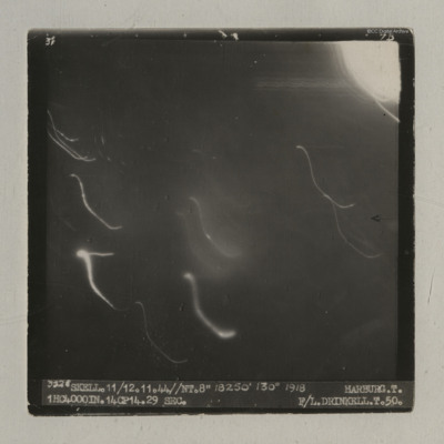
A vertical aerial photograph of an operation at Harburg. Very little detail is visible on the ground but there are several light flashes.
It is captioned '3528 Skell. 11/12.11.44//NT.8" 18250' 130° 1918 Harburg. T. 1HC4000IN.14CP14. 29 sec. F/L…
It is captioned '3528 Skell. 11/12.11.44//NT.8" 18250' 130° 1918 Harburg. T. 1HC4000IN.14CP14. 29 sec. F/L…
Harqueboc
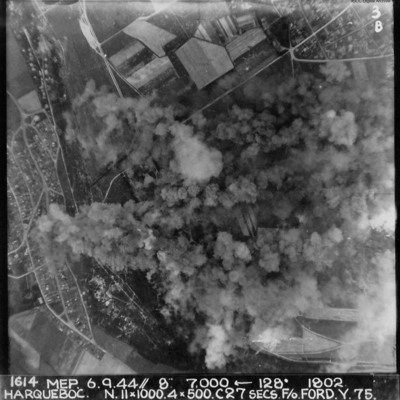
Vertical aerial photograph of Harqueboc, Le Havre. Street patterns can be seen to the left and top right of the photograph, located north-west of Harfleur. Annotated '1614 MEP 6.9.44// 8” 7,000 [arrow] 128[degrees] 1802 HARQUEBEC. N.11x1000, 4x500…
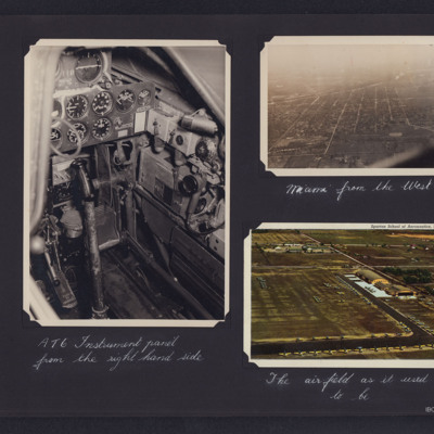
Harvard Instrument panel, Miami and airfield
Three photographs from an album.
#1 is a view of a Harvard instrument panel.
#2 is an aerial view of Miami from the west.
#3 is an aerial view of the airfield, captioned 'The airfield as it used to be'.
#1 is a view of a Harvard instrument panel.
#2 is an aerial view of Miami from the west.
#3 is an aerial view of the airfield, captioned 'The airfield as it used to be'.
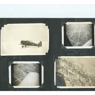
Harvard, Regina and Weyburn
Four photographs from an album. Photo 1 is a Harvard parked on the snow with its engine running, captioned 'Off to Work'. Photo 2 and 3 are oblique aerial photographs centred on Victoria Park in Regina, captioned 'I wonder why they built it. Photo 4…
Tags: aerial photograph; aircrew; Harvard; training
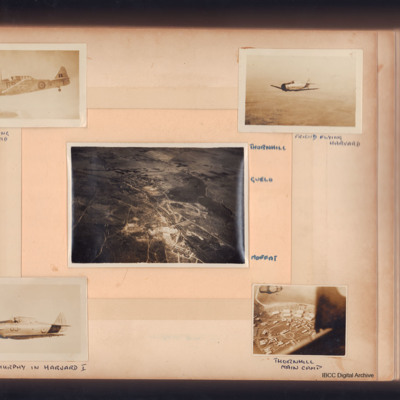
Harvards at Thornhill
Five photographs, first Harvard in flight, captioned 'Self flying Mk IIa Harvard'. Second, Harvard in flight captioned 'Friend flying Harvard'.
Third, aerial view of three small towns captioned, 'Thornhill Gwelo Moffat'. Fourth, aerial view,…
Third, aerial view of three small towns captioned, 'Thornhill Gwelo Moffat'. Fourth, aerial view,…
Tags: aerial photograph; Harvard; training
Heacham
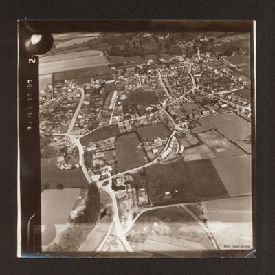
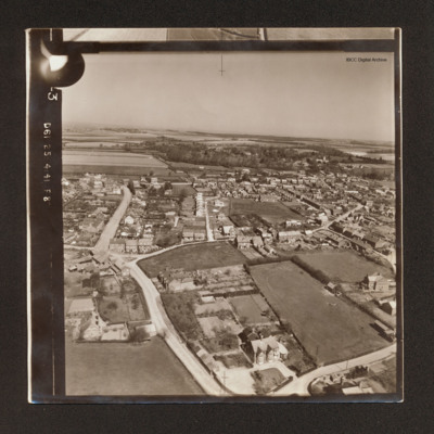
Oblique aerial photograph of Heacham surrounded by fields and with woods in the distance.
Tags: aerial photograph
Heacham
Oblique aerial photograph of Heacham with houses along roads. In the background open fields and woods.
Tags: aerial photograph
Heacham
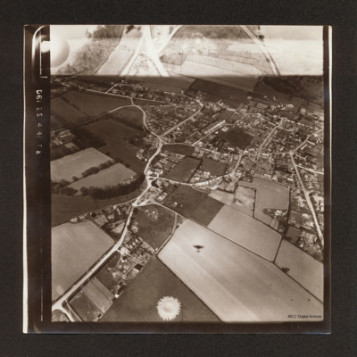
Oblique aerial photograph of Heacham surrounded by fields. There is the shadow of a Hampden one quarter way up from centre bottom. There is part of another exposure at the top.
Tags: aerial photograph; Hampden
Headington School
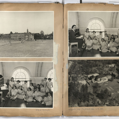
Left page; top, view across tennis courts to Headington School, Headington road, Headington, Oxford.
Bottom, a group of 13 girls and a teacher taken in the main assembly hall of Headington school.
Right page: top a group of 13 children and a…
Bottom, a group of 13 girls and a teacher taken in the main assembly hall of Headington school.
Right page: top a group of 13 children and a…
Tags: aerial photograph
Heavy Damage After Big Allied Air Attack on Naples
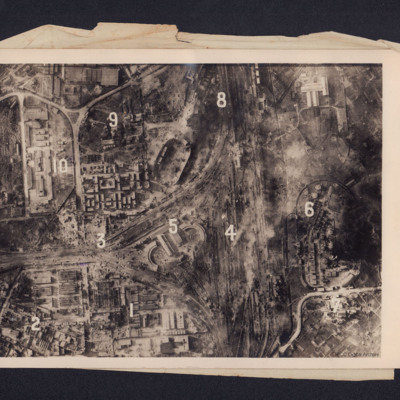
A reconnaissance photograph showing bomb damage to an industrial area of Naples centred on railway marshalling yard. Extensive bomb craters and damage to the railway yards and surrounding buildings is visible throughout. Ten numbers are marked on the…
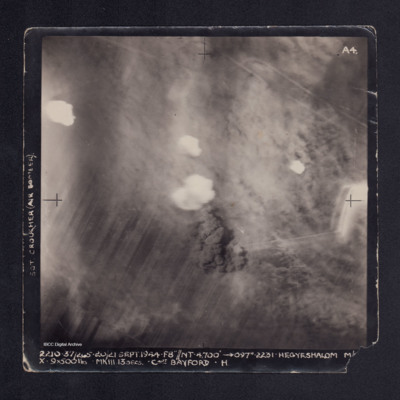
Hegyeshalom
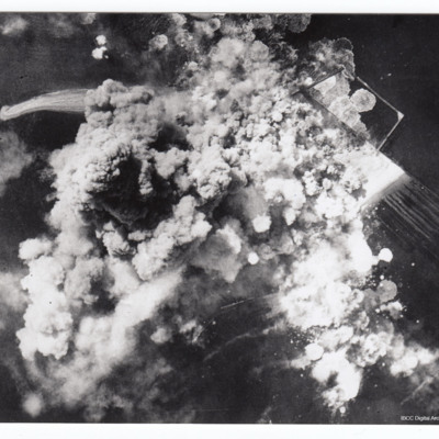
A vertical aerial photograph taken during the bombing of Hegyeshalom. Most of the image is obscured by bomb explosions and smoke. It is captioned 'SGT CROUCHER (AIR BOMBER) on LH side and at bottom: '2210. 37/265. 20/21 Sept 1944. F8"//NT.…
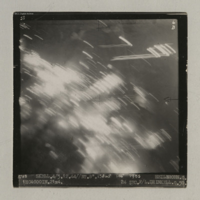
Heilbronn
A vertical aerial photograph of Heilbronn taken during an operation. A canal is visible in the centre running op to bottom but most of the image is obscured by light flashes.
It is captioned '3725 Skell. 4/5.12.44//NT. 8". 13800' 146° 1935…
It is captioned '3725 Skell. 4/5.12.44//NT. 8". 13800' 146° 1935…
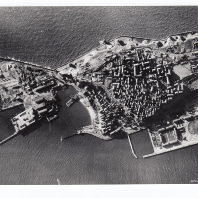
Helgoland
Reconnaissance photograph of Helgoland with port facilities visible.
Additional information about this item was kindly provided by the donor.
Additional information about this item was kindly provided by the donor.
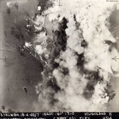
Helgoland
A vertical aerial photograph of the attack on Heligoland island. Most of the island is obscured by bomb explosions. Submitted with caption; “Actual photo taken over Heligoland submarine pens during 1000 bomber raid April 1945.”
The image is…
The image is…
Helgoland
Target photograph of Helgoland. Explosions cover almost the whole frame, with some port facilities visible top right.

