Browse Items (1442 total)
- Tags: aerial photograph
Sort by:
Flushing
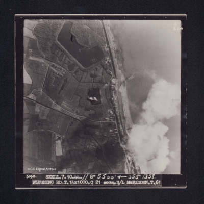
Target photograph of Flushing. Crossing coast line, craters, lakes, disturbed water, roads and field boundaries clearly visible. Captioned '11B2ND', '3190. SKELL. 7.10.44.// 8" 5500' [arrow] 055° 1358. FLUSHING RD.T.14X1000.C 21 secs.S/L…
Flushing
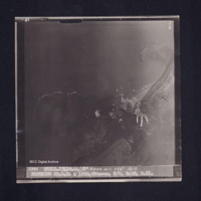
Target photograph of Flushing. Crossing coast line but mainly water, bomb explosions and disturbed water visible but no clear detail. Captioned '8°F', '5B', '3394 SKELL.23.10.44//8" 4000 [arrow] 148° 1613 FLUSHING RD.D.14 X 1000.C20secs. F/O. BAIN.…
Flushing
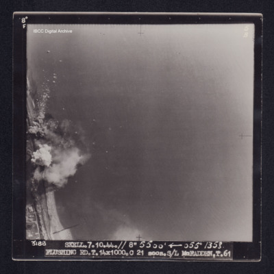
Target photograph of Flushing. Crossing coastline, bomb explosions, airborne debris clearly visible. Captioned '8° F', '5B]', '3188 SKELL.7.10.44.// 8" 5500' [arrow] 055° 1358 FLUSHING RD.T.14X1000.C 21 secs.S/L McFADDEN.T.61'. On the reverse 'S/L…
Flushing
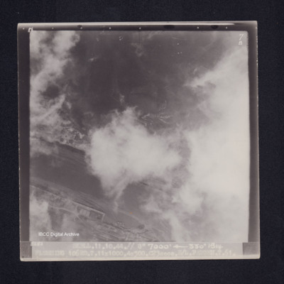
Target photograph of Flushing. Port area, partially obscured by cloud but quays and a ship are visible. Caption '8°F', '7B', '3282 SKELL.11.10.44.// 8" 7000' [arrow] 330° 1514 FLUSHING 106RD.T.11X1000.4X500.C23secs.S/L FADDEN.T.61.'. On the reverse…
Flushing
A vertical aerial photograph of Flushing taken during an operation. Bomb bursts can be seen in the centre of the image. The coastline is clearly visible.
It is captioned '3389 Skell 23.10.44//8"/ 4000
It is captioned '3389 Skell 23.10.44//8"/ 4000
Flushing
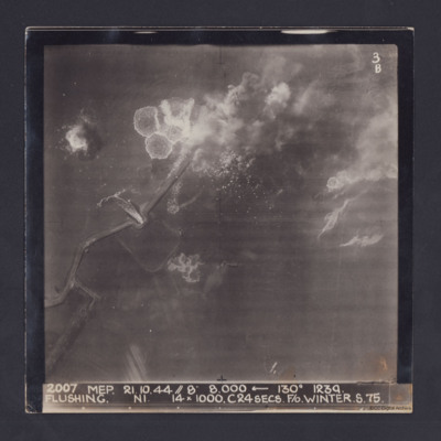
Target photograph taken during an operation to Flushing, Netherlands. Several bomb splashes in the water and smoke from explosions on the ground. Water is flowing through the sea wall at one point. The photograph is captioned:
2007 MEP 21.10.44 //…
2007 MEP 21.10.44 //…
Flushing
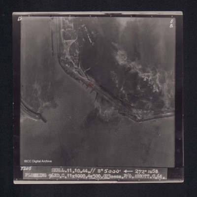
Target photograph of Flushing. Port area, breakwater, docks, quays, bomb explosions and disturbed water visible. Captioned '8°F', '5B', '3205 SKELL.11.10.44.// 8" 5000' [arrow] 272° 1458 FLUSHING 96RD.C.11X1000.4X500.C23secs.F/O ABBOTT.C.61.'. On…
Flushing
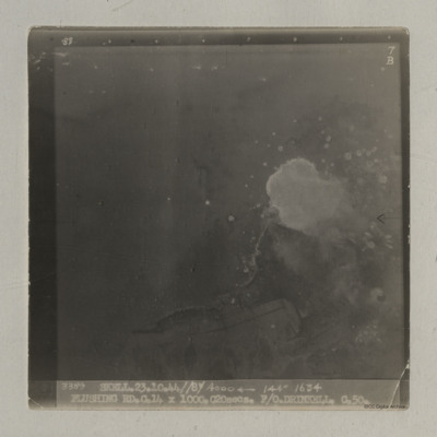
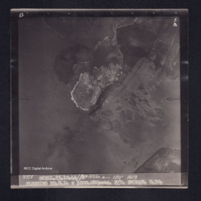
Target photograph of Vlissingen. No land just disturbed water. Captioned '8°F', '5B', '3378 SKELL.23.10.44//8" 4250' [arrow] 150° 1619 FLUSHING RD.U.14X1000.C20secs. F/O ENDEAN.U.50.' On the reverse '[underlined] F/O ENDEAN…
Flushing
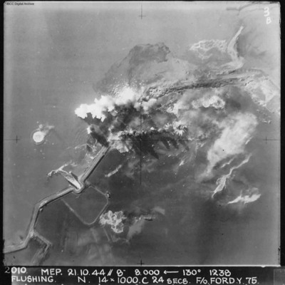
A vertical aerial photograph of Flushing (Vlissingen) during an operation. Explosions can be seen on the coastal dyke. The No. 4 Commando bunker and Uncle Beach is nearby, in the bottom left of the image. Annotated '2010 MEP 21.10.44// 8” 8,000…
Flushing
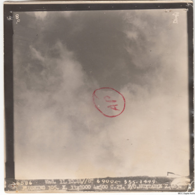
A vertical aerial photograph of Flushing. Much of the image is obscured by cloud. The aimimg point has been annotated with a circle and 'AP'.
The image is captioned '6586 Wad.11.10.44//8" 6900
The image is captioned '6586 Wad.11.10.44//8" 6900
Flushing
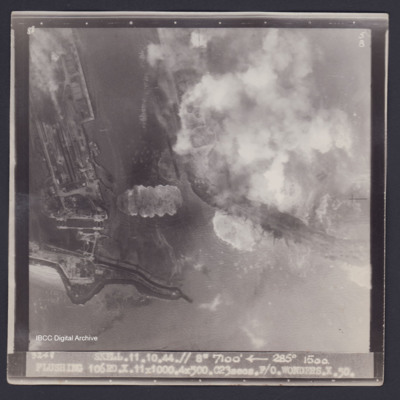
Target photograph of Flushing. Partially obscured by smoke and dust. Port area, locks, quays, docks and moored ships clearly visible. Disturbed water from bomb explosions. Captioned '8°F', '5B', '3248 SKELL.11.10.44.// 8" 7100' [arrow] 285° 1500.…
Flushing
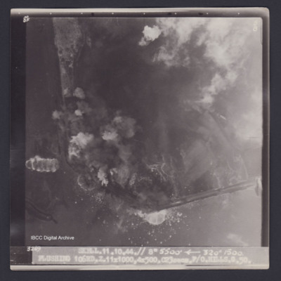
Target photograph of Flushing. Partially obscured by smoke and dust. Coastal area, little detail visible, disturbed water from bomb explosions. Captioned '8°F', '5B', '3269 SKELL.11.10.44.// 8" 5500' [arrow] 320° 1500. FLUSHING 106RD.…
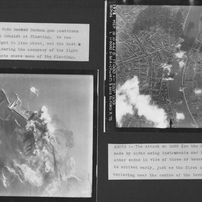
Flushing and Bonn
Two vertical aerial photographs from an album. Photo 1 is of Flushing where a dyke was breached. Some flooding is visible according to the caption. Photo 2 is of Bonn showing in the city in great detail at the start of the attack. it is annotated…
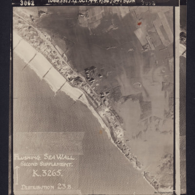
Flushing Sea Wall
Photograph shows the breached sea wall at Flushing, captioned 'Flushing Sea Wall, Second supplement, K3265, Distribution 23B'. Caption at top of photograph: '3002 106G3317.12.OCT.44 F/36"//541 SQDN'.
Reverse has stamp 'Intelligence section RAF…
Reverse has stamp 'Intelligence section RAF…
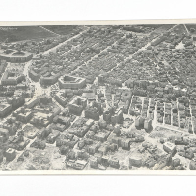
Foggia
Oblique aerial photograph of part of the town showing Palazzo degli Uffici Statali with Palazzo degli Studi further out. In the upper left corner is an area of open ground while in the right upper corner there is a large arrangement of buildings.…
Tags: aerial photograph
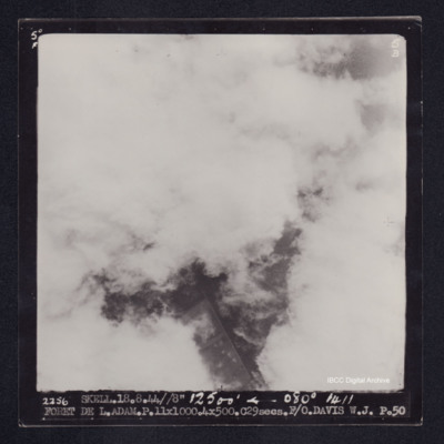
Foret de L. Adam
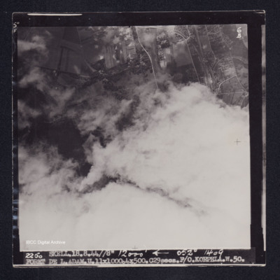
Target photograph of Forêt de L'Isle-Adam. Almost completely obscured by cloud, little detail. Captioned '5°F', '5B', '2256 SKELL.18.8.44//8" 12500' [arrow] 080° 1411 FORET DE L.ADAM.P.11X1000.4X500.C.29secs.F/O.DAVIS W.J. P.50'. On the reverse…
Foret de L. Adam
Target photograph of Forêt de L'Isle-Adam. Mainly obscured by cloud, area visible is open country. Railway junction, sidings and craters are visible. Captioned '5°F', '6B', '2250 SKELL.18.8.44//8" 12000' [arrow] 052° 1409 FORET DE…
Foret de L'Adam
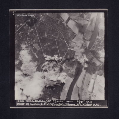
Target photograph of Foret de L'Adam. River Oise running top to bottom right side of photograph, railway running close to river, road bridge across rive. Bomb explosions with smoke and dust obscure bottom left of photograph. Road network in forest…
Foret de L'Isle Adam
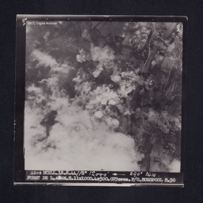
Target photograph of Forêt de L'Isle-Adam. Road rail bridge over river Oise top right, bottom left obscured by cloud with smoke and dust, bomb explosions and craters visible. Captioned '5°F', '5B', '2208 SKELL. 18.8.44 //8" 12000' [arrow] 090°…
Foret du Croc
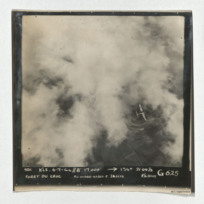
A vertical aerial photograph of Foret du Croc. Most of the image is obscured by cloud. A Lancaster is visible in a clear patch under which road patterns are visible. It is captioned '901 KLS 6-7-44//8" 17,000' -->134° 21.00 1/2 Foret du Croc…
Foret Du Neippe
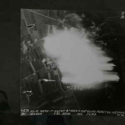
Night target photograph showing roads and glare in centre. Captioned '4271 HLM.28/29-7-44//NT8" 10000 >150.0400.Foret Du Neippe. B1. 18x500 c21secs F/S Jubb M76'.
This item was sent to the IBCC Digital Archive already in digital form. No better…
This item was sent to the IBCC Digital Archive already in digital form. No better…
Formation over Amsterdam and Queen Whilhelmina's Palace
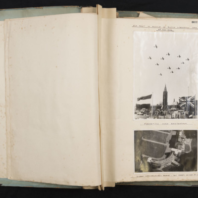
Photograph 1 is of 12 Lancasters over Amsterdam. In the fore ground is a Dutch flag and a Union Jack. There are various buildings behind. It is captioned 'Fly Past in honour of Dutch Liberation Day 4th May 1946.' and underneath 'Formation over…
Tags: 35 Squadron; aerial photograph; Lancaster
Fort Montagu Hotel, Nassau
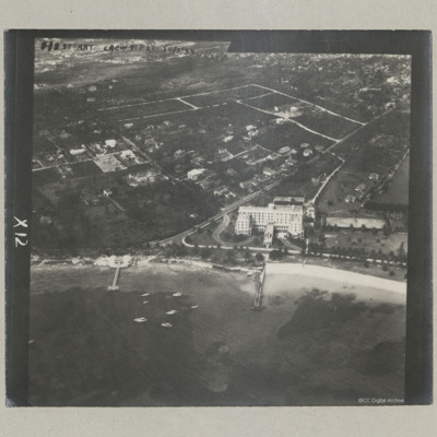
An oblique aerial photograph of a large hotel, now demolished, at the east end of Nassau close to Fort Montagu.
It is annotated 'F/S Stuart Crew 9 C21 30/3/44'.
It is annotated 'F/S Stuart Crew 9 C21 30/3/44'.
Tags: aerial photograph
Fourteen Mitchells in Flight
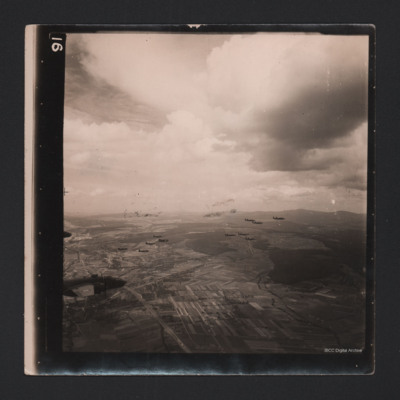
An air-to-air photograph of 14 B-25 Mitchells in flight. They are flying over a cultivated valley, set between low hills.
Tags: aerial photograph; B-25
Frankfurt
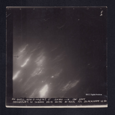
Target photograph of Frankfurt. No detail visible. Diagonal light streaks. Captioned '5B', 221 SKELL. 18/19-3-44//NT. 5" 20700 [arrow] 190° 2207 FRANKFURT. U. 1X4000 14X4 10X30 31 SECS. F/L BLACKHAM U.50.' On the reverse '[underlined] F/LT BLACKHAM…

