Browse Items (680 total)
- Conforms To is exactly "Geolocated"
Sort by:
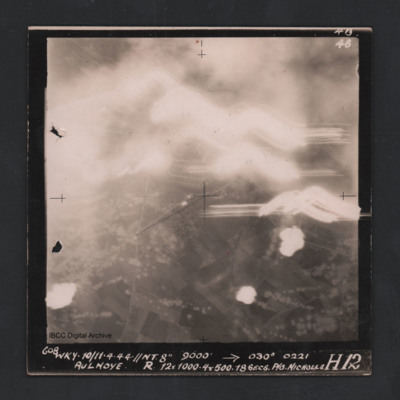
Aulnoye
Vertical aerial photograph of Aulnoye. The image is largely obscured by cloud or fires and anti-aircraft fire. The bottom half has roads and an urban area surrounded by fields. Captioned ‘608 WKY 10/11.4.44 //NT 8” 9000 [arrow] 030° 0221 …
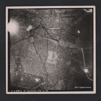
Hannover
Vertical aerial photograph of Hannover. The image is largely clear with only one flare in the top left. Street patterns and buildings are clearly visible. Captioned ‘2. J (Z6) 12 NT 26-27/1/42 F/8” [arrow] TX’
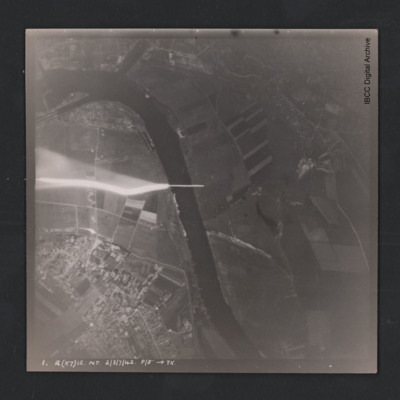
Hemelingen
Vertical aerial photograph of Bremen Hemelingen. The image is largely clear with only one flare in the centre left. A large river bisects the image and in the top are docks. Street patterns and buildings are clearly visible. At the bottom it is…
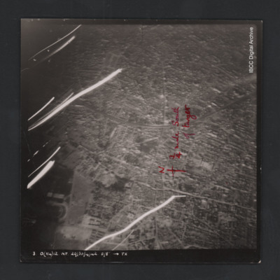
Colombes
Vertical aerial photograph of Colombes, France. The image is largely clear, only a few lines of tracer are visible with street patterns and buildings clearly visible. Bottom left a large stadium is partly visible. Annotated on the image is a north…
Rouen
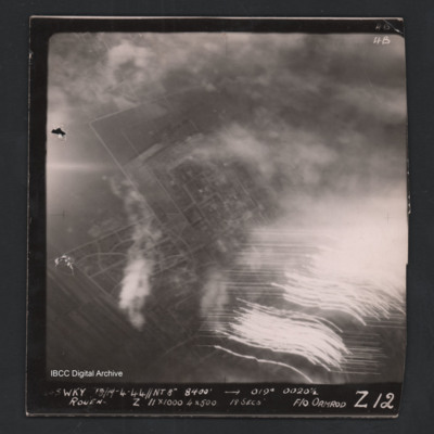
Vertical aerial photograph of Rouen. Street patterns are visible but most of the image is obscured by flares or anti-aircraft fire. Captioned at top right ‘4B 4B’. Captioned along the bottom ‘[undecipherable] Wky 18/19-4-44 //NT 8” 8400’…
Gennevilliers
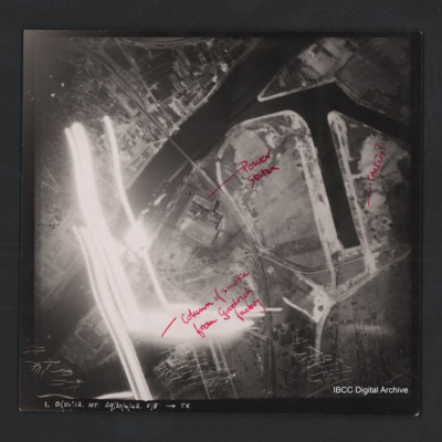
Vertical aerial photograph of Gennevilliers. The image is of factories and dockyards. Annotated ‘Column of smoke from Goodrich factory’, ‘Power station’ and ‘Craters?’ Captioned ‘1. O (X4) 12 NT 29/30/4/42 F/8” [arrow] TX’. On the…
Rostock
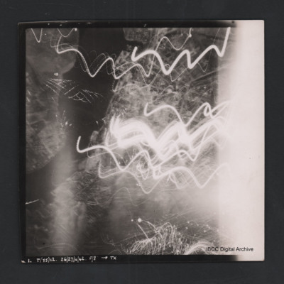
Vertical aerial photograph of Rostock. Most detail is obscured by anti-aircraft fire. The Unterwarnow and the Altstadt are partially visible. Captioned ‘1. T(Y5) 12 NT 26/27/4/42 F/8” [arrow] TX’.
Mailly-le-Camp
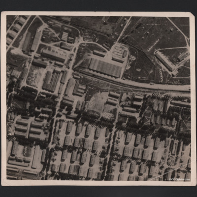
Aerial photograph of large military camp, showing it before and after bombing. A railway line runs in from the right centre of the photograph and terminates in upper centre, having split into three lines. There is a train in situ on the main line.…
Gilze Rijen
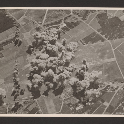
Oblique aerial photograph of an Gilze Rijen airfield. Runways going from bottom middle to top and left to middle. A large number of bomb explosion visible in the centre of the airfield with one string of bombs offset to the left running bottom to…
88 and 226 Squadron aerial photographs
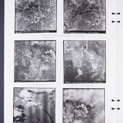
Photograph 1 and 2 are sequential vertical aerial photographs of the marshalling yards at Arras. They are partly obscured by smoke. They are numbered 5018 and 5017 and captioned 'RS 636 88 30.APR44//D14" → 10,000'Z'. Captioned: '30 April 1944,…
Colombelles steel works, Arnhem, and Breskens fort
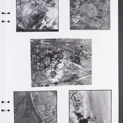
Photograph 1 is of a vertical of Colombelles steel works marshalling yard. Much of the ground is obscured by cloud and bomb explosions. There is a Boston with invasion stripes in the top half of the image. It is annotated '5018 F342 134 22 Jun 44…
First Grand Slam drop
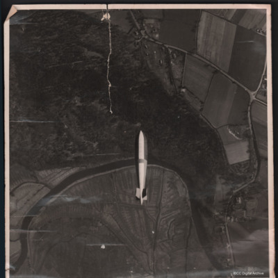
In the centre a Grand Slam bomb. Below a bend in the river Avon with woods to the top, open ground below and Criddlestyle on the right. Bomb was dropped on Ashley Walk Range.
Additional information about this item has been kindly provided by the…
Additional information about this item has been kindly provided by the…
Tags: bombing; Grand Slam
St. Cyr
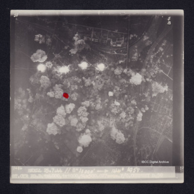
Target photograph of St. Cyr, urban area, street patterns visible although largely obscured by smoke and dust from bomb explosions. Two sets of railway tracks from top right corner, four bomb explosions and many bomb craters. A red dot is visible on…
J/Laroche
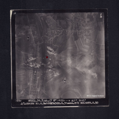
Target photograph of Laroche - Migennes. Largely rural but with built up area along canal that runs top to bottom on left side of photograph and also across the top third, street patterns clearly visible. Railway with extensive sidings runs alongside…
Le Havre
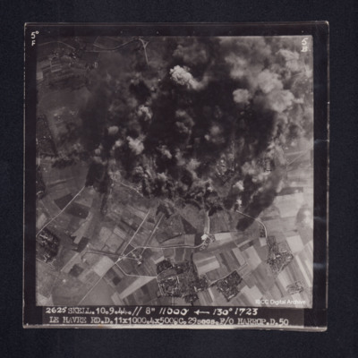
Target photograph of Le Havre. Rural area, centre of photograph obscured by smoke and dust, craters and one dropping bomb visible. Captioned '5° F', '5B', '2625 SKELL. 10.9.44. // 8" 11000' [arrow] 130° 1723, LE HAVRE RD. D. 11x1000. 4x500. …
Boulogne
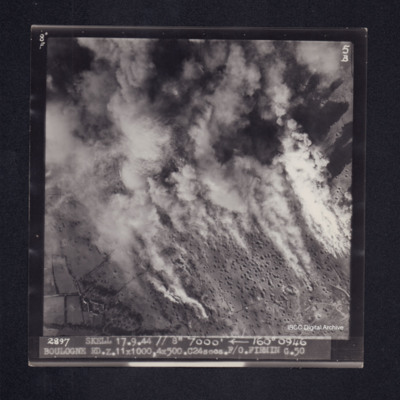
Target photograph of Boulogne. Rural area, smoke and dust obscures much of the photograph, many craters visible. Captioned '8° F', '5B', 2897 SKELL 17.9.44 // 7000' [arrow] 160° 0946 BOULOGNE RD. Z. 11x1000, 4x500. C24secs. F/O FIRMIN G. …
Bergueneuse
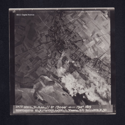
Target photograph of Bergueneuse. Mainly rural, houses visible either side of road, some smoke and dust, craters visible. Captioned '5° F', '5B', '2478 SKELL. 31.8.44. //8" 13000' [arrow] 190° 1819, BERGUENEUSE RD. W. 11X1000. 4X500. C. …
Gilze-Rijen
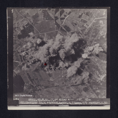
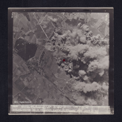
Target photograph of Gilze-Rijen. Runway running top to bottom of photograph, taxyways visible as are craters and bomb explosions. Centre of photograph obscured by smoke and dust. Red dot centre left. Captioned '3°F', '5B', '2084 SKELL. 15.8.44. …
Foret de L'Adam
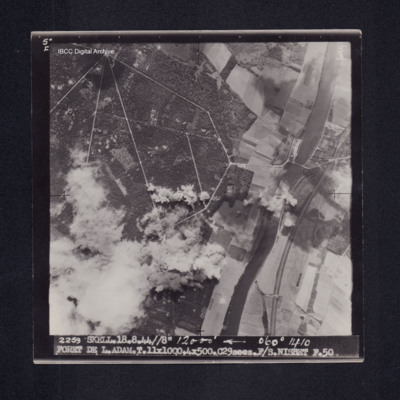
Target photograph of Foret de L'Adam. River Oise running top to bottom right side of photograph, railway running close to river, road bridge across rive. Bomb explosions with smoke and dust obscure bottom left of photograph. Road network in forest…
Gilze-Rijen
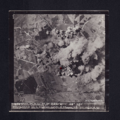
Target photograph of Gilze-Rijen. End of a runway lower centre together with taxyways, centre of photograph obscured by bomb explosions, dust and smoke. Craters visible. Red dot lower centre. Captioned '3°F', '6B', '2138 SKELL. 15.8.44. //. 8"…
Foret de L'Isle Adam
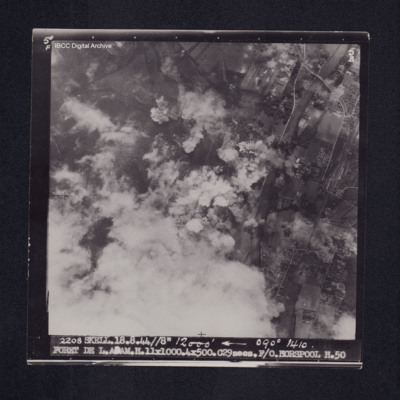
Target photograph of Forêt de L'Isle-Adam. Road rail bridge over river Oise top right, bottom left obscured by cloud with smoke and dust, bomb explosions and craters visible. Captioned '5°F', '5B', '2208 SKELL. 18.8.44 //8" 12000' [arrow] 090°…
Le Havre
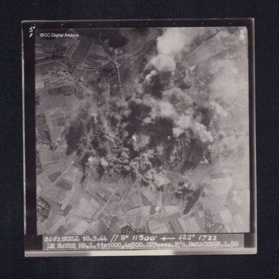
Target photograph of Le Havre. Rural area, centre of photograph obscured by smoke and dust, craters visible. Captioned '5°F', '5B', '2652 SKELL 10.9.44 // 8" 11500' [arrow] 122° 1722 LE HAVRE RD. L. 11X1000. 4X500. C29secs. F/S McEACHEARN. L.…
Boulogne
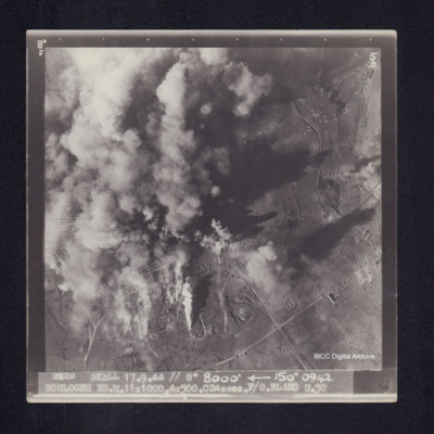
Target photograph of Boulogne. Left side of photograph obscured by smoke and dust, visible area is rural. Many bomb craters. Captioned '8°F', '5B', '2820 SKELL 17.9.44 // 8" 8000' [arrow] 150° 0942. BOULOGNE RD. U. 11X1000. 4X500. C24secs. F/O…
Gilze-Rijen
Target photograph of Gilze-Rijen. End of runway visible just below red dot, taxyways visible. Much of right side of photograph obscured by bomb explosions, smoke and dust. visible area rural. Captioned '3°F', '5B', '2141 SKELL. 15.8.44. //. 8"…
Boulogne
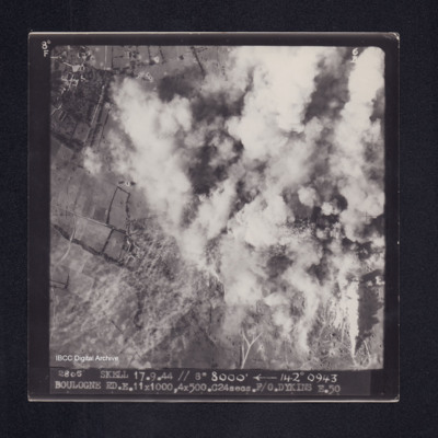
Target photograph of Boulogne. Top right half of photograph obscured by smoke, visible area rural, many craters. Captioned '8°F', '6B', '2805 SKELL 17.9.44 // 8" 8000' [arrow] 142° 0943 BOULOGNE RD. E. 11X1000, 4X500. C24secs. F/O. DYKINS …

