Browse Items (120 total)
- Conforms To is exactly "Geolocated (cumulative polygon)"
Sort by:
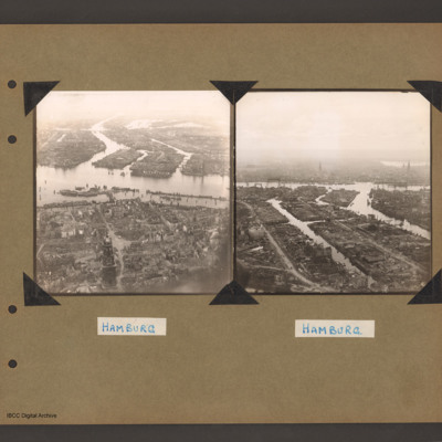
Hamburg
Oblique aerial photograph of Hamburg showing bombing damage. In the foreground are patches of trees and buildings that are not damaged. In the middle is the river and behind are the docks. Captioned 'Hamburg'.
Tags: aerial photograph; bombing
Hamburg
On the left an aerial inclined photograph of a city on two sides of a river. The river flows from centre right to left with three inlets leading to two waterways on the far side. The whole land area is covered with buildings with some in the…
Tags: aerial photograph; bombing; Cook’s tour
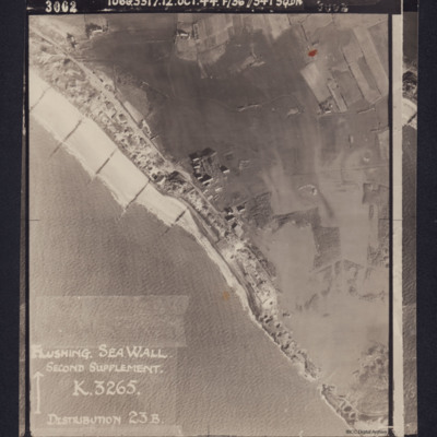
Flushing Sea Wall
Photograph shows the breached sea wall at Flushing, captioned 'Flushing Sea Wall, Second supplement, K3265, Distribution 23B'. Caption at top of photograph: '3002 106G3317.12.OCT.44 F/36"//541 SQDN'.
Reverse has stamp 'Intelligence section RAF…
Reverse has stamp 'Intelligence section RAF…
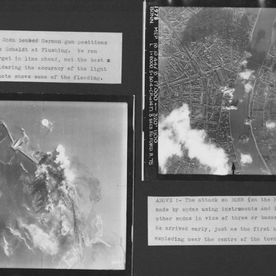
Flushing and Bonn
Two vertical aerial photographs from an album. Photo 1 is of Flushing where a dyke was breached. Some flooding is visible according to the caption. Photo 2 is of Bonn showing in the city in great detail at the start of the attack. it is annotated…
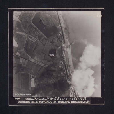
Flushing
Target photograph of Flushing. Crossing coast line, craters, lakes, disturbed water, roads and field boundaries clearly visible. Captioned '11B2ND', '3190. SKELL. 7.10.44.// 8" 5500' [arrow] 055° 1358. FLUSHING RD.T.14X1000.C 21 secs.S/L…
Flushing
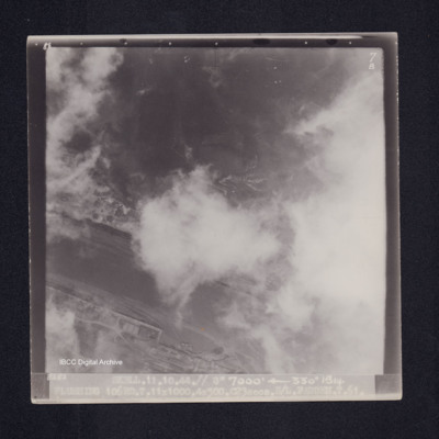
Target photograph of Flushing. Port area, partially obscured by cloud but quays and a ship are visible. Caption '8°F', '7B', '3282 SKELL.11.10.44.// 8" 7000' [arrow] 330° 1514 FLUSHING 106RD.T.11X1000.4X500.C23secs.S/L FADDEN.T.61.'. On the reverse…
Flushing
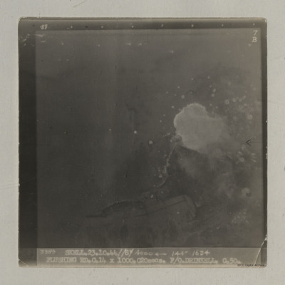
A vertical aerial photograph of Flushing taken during an operation. Bomb bursts can be seen in the centre of the image. The coastline is clearly visible.
It is captioned '3389 Skell 23.10.44//8"/ 4000
It is captioned '3389 Skell 23.10.44//8"/ 4000
Flushing
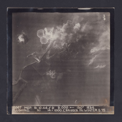
Target photograph taken during an operation to Flushing, Netherlands. Several bomb splashes in the water and smoke from explosions on the ground. Water is flowing through the sea wall at one point. The photograph is captioned:
2007 MEP 21.10.44 //…
2007 MEP 21.10.44 //…
Flushing
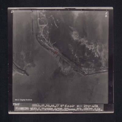
Target photograph of Flushing. Port area, breakwater, docks, quays, bomb explosions and disturbed water visible. Captioned '8°F', '5B', '3205 SKELL.11.10.44.// 8" 5000' [arrow] 272° 1458 FLUSHING 96RD.C.11X1000.4X500.C23secs.F/O ABBOTT.C.61.'. On…
Flushing
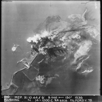
A vertical aerial photograph of Flushing (Vlissingen) during an operation. Explosions can be seen on the coastal dyke. The No. 4 Commando bunker and Uncle Beach is nearby, in the bottom left of the image. Annotated '2010 MEP 21.10.44// 8” 8,000…
Flushing
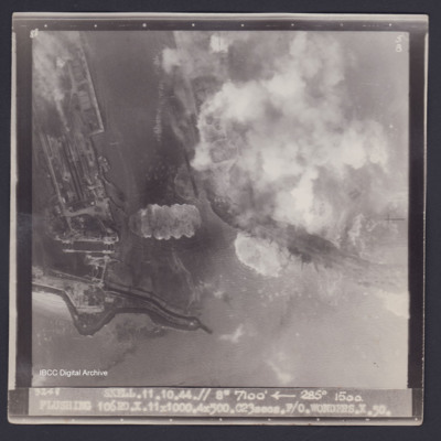
Target photograph of Flushing. Partially obscured by smoke and dust. Port area, locks, quays, docks and moored ships clearly visible. Disturbed water from bomb explosions. Captioned '8°F', '5B', '3248 SKELL.11.10.44.// 8" 7100' [arrow] 285° 1500.…
Flushing
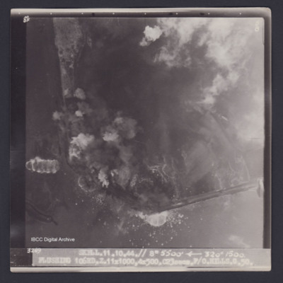
Target photograph of Flushing. Partially obscured by smoke and dust. Coastal area, little detail visible, disturbed water from bomb explosions. Captioned '8°F', '5B', '3269 SKELL.11.10.44.// 8" 5500' [arrow] 320° 1500. FLUSHING 106RD.…
Essen, Krupps
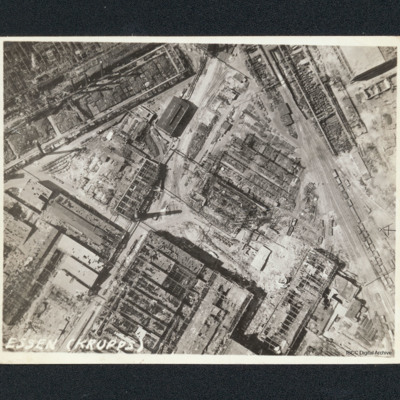
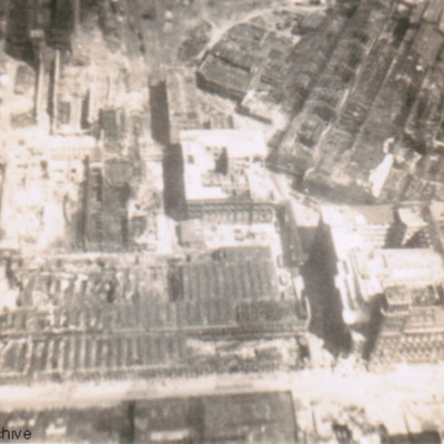
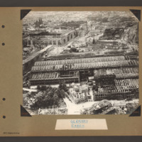
Vertical aerial photograph of bombed workshops. It is captioned 'Essen (Krupps)'. Majority of buildings shown are damaged or severely damaged, many are entirely without roofs. One smaller building to upper centre with a clerestory roof appears…
Essen and Cologne
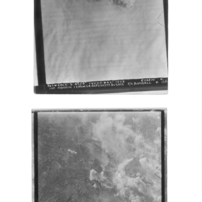
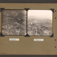
Photo 1 is a vertical aerial photograph captioned Essen but it is 100% cloud covered. At the top are explosions and a Lancaster at a lower level. Caption '3424 KRN 11-3-45//8" 19000 042° 1505 ESSEN K I.H.C. 4000IN. 12ANM.64.4GP.250.DT.C.36 SECS …
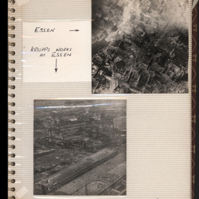
Essen (Krupps Works) Cooks tour
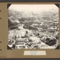
Oblique aerial photograph of an industrial area with much bomb damage. Submitted with caption 'Essen (Krupps Works) Cooks tour'.
Tags: aerial photograph; bombing; Cook’s tour
Essen
An oblique aerial photograph of Essen, photograph shows damage to buildings, submitted with caption; “Bomb damage to Essen.”
Tags: aerial photograph; bombing; Cook’s tour
Essen
Aerial inclined photograph showing snow covered, mostly industrial landscape. In the foreground multistory town buildings with some showing signs of damage. One quarter way up, just left of centre is a church with damaged tower and roof. Beyond this…
Tags: aerial photograph; bombing; Cook’s tour
Essen
Aerial inclined photograph showing industrial buildings in a city landscape. At the bottom long factory buildings go from left to right with areas of damaged roofs on the nearside. Above this area another damaged industrial complex is orientated…
Tags: aerial photograph; bombing; Cook’s tour
Essen
On the left an aerial inclined photograph showing a city landscape with many multistory buildings. In the foreground several scattered damaged multistory buildings surrounded by rubble. In the centre buildings are more contiguous and intact but…
Tags: aerial photograph; bombing; Cook’s tour
Essen
Top - reconnaissance photograph of a city with many damaged buildings. Captioned 'Essen'. Submitted with description 'Aerial "Cook's tour" view of Essen May 45. May 1945'.
Bottom - oblique aerial photograph of industrial site with many damaged…
Bottom - oblique aerial photograph of industrial site with many damaged…
Tags: aerial photograph; bombing; Cook’s tour
Essen
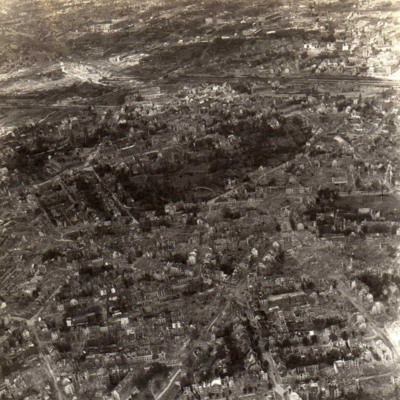
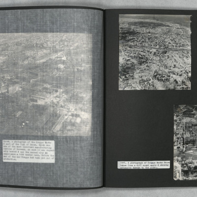
Two oblique aerial photographs of Essen. Extensive bomb damage is visible in both images. Photograph one details indecipherable road networks. Photograph two is taken at a different angle and shows Krupps Works, Essen.
Tags: aerial photograph; bombing; Cook’s tour
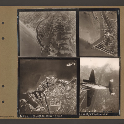
Dunkirk, Den Helder, Vlissingen and Ventura over Ijmuiden
Top left an aerial vertical photograph of Dunkirk docks. A river runs from the sea bottom centre in a curve to top centre. Docks with moles and basins are to the right and the town is to the left of the river.
Top right an aerial vertical…
Top right an aerial vertical…
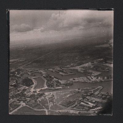
Dunkirk Dockyard
Oblique aerial photograph of Dunkirk docks. Incomplete hulls of two oil tankers at bottom right, likely to be La Saône and La Seine. Extensive damage visible in the bottom left corner.
Identification kindly provided by Gareth Hughes, Christopher…
Identification kindly provided by Gareth Hughes, Christopher…
Tags: aerial photograph
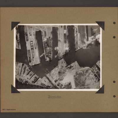
Dunkirk docks
Aerial vertical photograph of docks. Along the top four moles below which an interconnected water way. Below is land with a narrow water passage slanting down towards the centre bottom. The moles and land have various scattered dockyard…
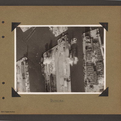
Dunkirk docks
Aerial vertical photograph of docks. Three moles extend from the bottom to just over half way up. The right hand mole is covered with dockyard installations, the other two are mostly bare. Bomb impacts are visible in the water between the right hand…


