Browse Items (161 total)
- Tags: reconnaissance photograph
Sort by:
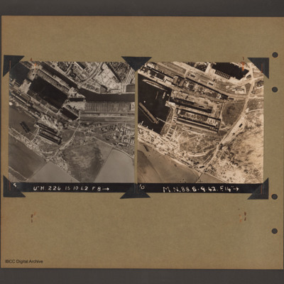
Le Havre docks
On the left an aerial vertical photograph of docks. A waterway runs from top left downward before turning horizontal across to the right. At the bend there is a narrow channel leading to a basin to the left. Below this is a further basin with a barge…
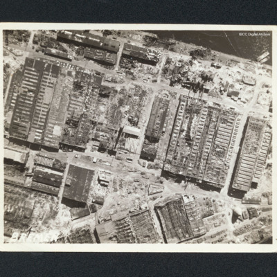
IJmuiden
Vertical aerial photograph of a bombed harbour area near the the Visserhaven. The majority is damaged buildings.
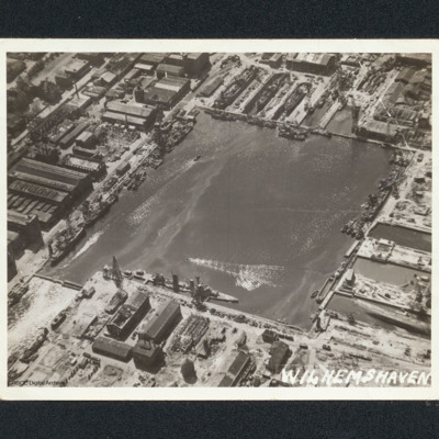
Wilhelmshaven docks
Oblique aerial photograph of a square dock area with several naval vessels. There are dry docks at the top. The majority of the workshop are undamaged. It is captioned 'Wilhemshaven' [sic].
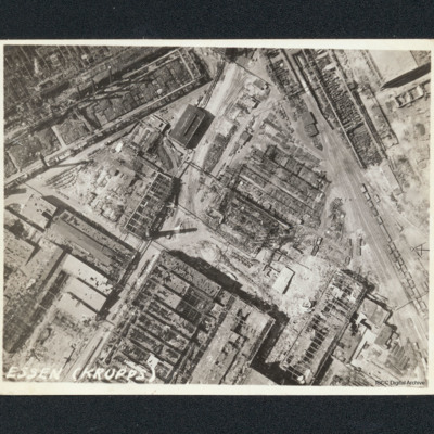
Essen, Krupps
Vertical aerial photograph of bombed workshops. It is captioned 'Essen (Krupps)'. Majority of buildings shown are damaged or severely damaged, many are entirely without roofs. One smaller building to upper centre with a clerestory roof appears…
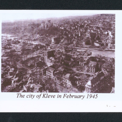
The city of Kleve in February 1945
Oblique aerial of a damaged city. In the centre is a river and a low hill. In the distance are undamaged buildings. Captioned 'The city of Kleve in February 1945'.
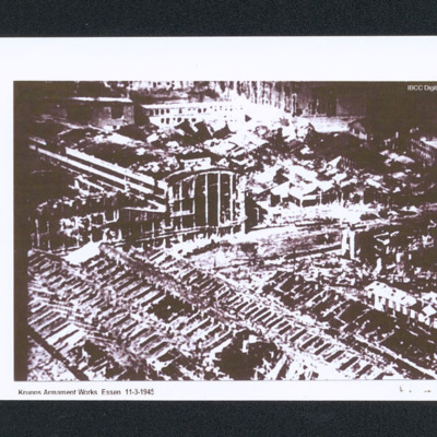
Krupps, Essen
Oblique aerial of bomb damage to the Krupps workshops. Captioned 'Krupps Armament Works Essen 11-3-1945'.
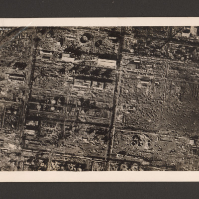
Royal Air Force destroys German synthetic oil plant
Reconnaissance photograph of a destroyed synthetic oil plant. On the left side within a grid a large number of damaged oil tanks, manufacturing buildings and installations. On the right three destroyed oil tanks at the bottom and a large number of…
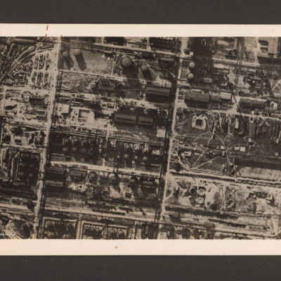
Royal Air Force destroys German synthetic oil plant
Reconnaissance photograph of a German synthetic oil plant. Within a grid pattern a large number of oil tanks, buildings, pipeline and oil manufacturing installations. A railway runs along the bottom. On the reverse 'R.A.F. destroys German synthetic…
Royal Air Force Bomber Command attacks on enemy communications
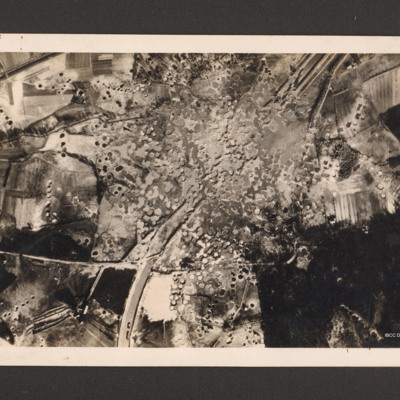
Reconnaissance photograph showing the Mitelland Canal at Gravenhorst running from top right to centre bottom. A large area in the centre is completely covered with craters and the canal has disappeared. To the right bottom a large wooded area and to…
Remagen bridge
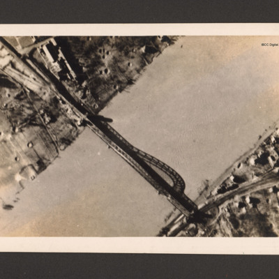
Reconnaissance photograph of bridge. A river runs bottom left to top right and a metal arch bridge from top left to bottom right. There are a few buildings in the top left along with bomb craters. Ther are a few buildings and a railway line at the…
F/Bomb Depot at St. Leu d'Esserent
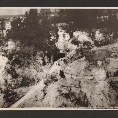
Low level oblique aerial photograph of a narrow road leading from the bottom left up a valley to the centre where it meets the square entrance to a tunnel in a hillside. To the left of the valley and above the entrance are trees.
Brest docks
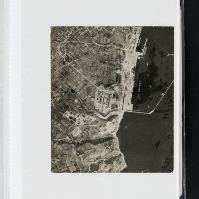
An vertical aerial photograph of Brest docks. Annotated 'S/M Shelters'.
Helgoland
Reconnaissance photograph of Helgoland with port facilities visible.
Additional information about this item was kindly provided by the donor.
Additional information about this item was kindly provided by the donor.
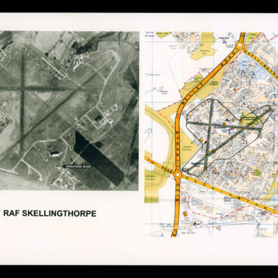
RAF Skellingthorpe
On the left a reconnaissance photograph of RAF Skellingthorpe marked with runway directions and operations blocked indicated by an arrow. On the right a colour map of the Birchwood section of Lincoln with airfield boundary and runways drawn over.
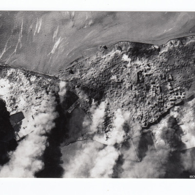
Heligoland
Reconnaissance photograph of Heligoland after bombing, with most buildings and port facilities destroyed and large plumes of smoke from fires.
Additional information about these items was kindly provided by the donor.
Additional information about these items was kindly provided by the donor.
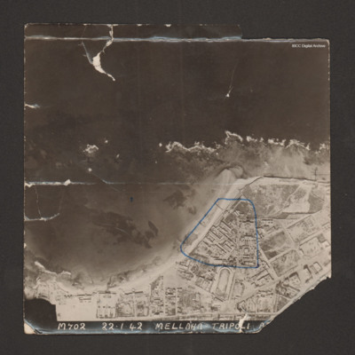
Tripoli (motor transport dump)
Reconnaissance photograph with a shoreline running from bottom left to middle right with sea at top and land below. Buildings cover the land; military storehouses near Via Cannizzaro e Via Giuseppe Colombo are outlined in blue. Captioned 'M702…
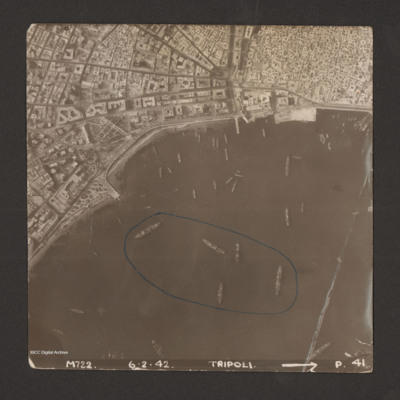
Tripoli
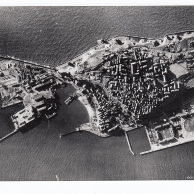
Reconnaissance photograph of harbour area. There are many ships, some of them identified as Anna Maria, Ariosto, Atlas, Bengasi, Beppe, Bosforo, Delia, and Pisani. Five ships have been enclosed by blue line. There is a breakwater along right side.…
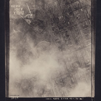
Reconnaissance photograph, post bombing, of Brux industrial plant, Czechoslavakia
Reconnaissance photograph of heavily industrialised area. Approximately one third of the area is obscured by cloud. There is considerable cratering across the area, and extensive damage to the industrial buildings and railway is visible. Caption in…
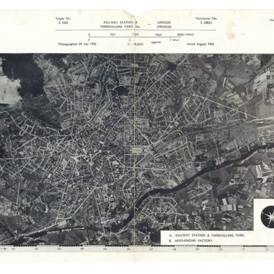
Limoges railway station and marshalling yard
A reconnaissance photograph showing a large town with a river running from lower left to right. Just right of centre is a railway station with marshalling yard. A further marshalling yard is on the right side Both marshalling yards are indicated by…
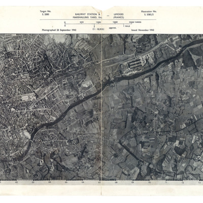
Limoges railway station and marshalling yard
A reconnaissance photograph showing a large town with a river running from lower left to top right. A station and marshalling yard are in the middle of the left half and a further marshalling yard and the aero-engine factory are on the upper right…
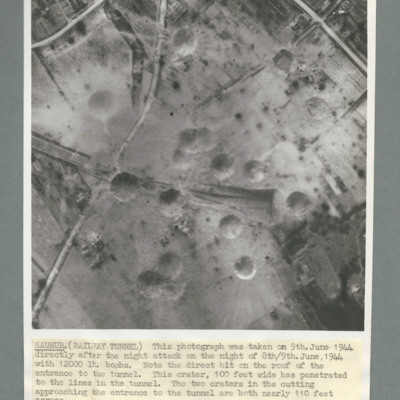
Saumur railway tunnel
Reconnaissance photograph of Saumur tunnel entrance and surrounding area taken on 9 June 1944 after attach with 12,000 lb bombs. Description notes direct hit on roof of entrance to tunnel and two other 100 foot craters on the approach to tunnel. On…
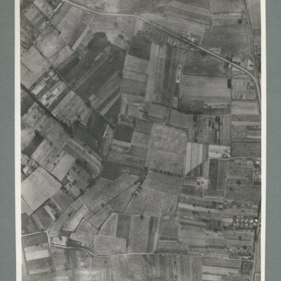
Saumur region
Reconnaissance photograph showing open countryside with road running top left to right and another from bottom left to right. On the reverse '15.6.44, WS G 80, 51:92/25'.
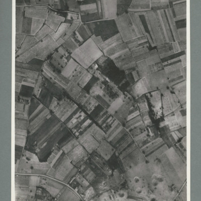
Saumur railway tunnel
Reconnaissance photograph showing mostly open countryside. Bottom right shows entrance to railway tunnel with large crater and other craters to the right. On the reverse '15.6.44, WS, G79, 51:92/20'.
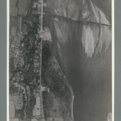
Saumur railway bridge
Reconnaissance photograph showing river running top to bottom on right and rail bridge running from right to left with entrance to tunnel top left. A road runs down the riverbank from top to bottom. Large crater visible on road just below bridge.…
Saumur railway bridge and tunnel
Reconnaissance photograph showing road running top to bottom on the right side. To the right a river. Top right a railway bridge with rail line running into a tunnel just left of road. To the left of the road a built up area. A crater is visible on…

