Browse Items (681 total)
- Conforms To is exactly "Geolocated"
Sort by:
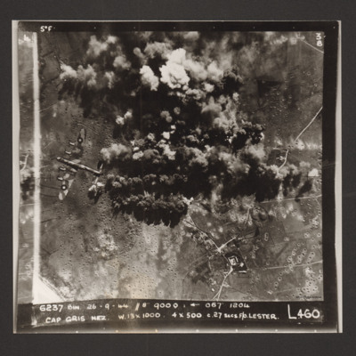
Cap Gris Nez
A daylight target photograph of Cap Gris Nez. Much of the target is obscured by smoke and explosions and the ground is pock marked with craters. On the left middle is a Lancaster. Captioned '6237 Bin 26-9-44 (date) //8" 9000' [arrow] 067° 1204 Cap…
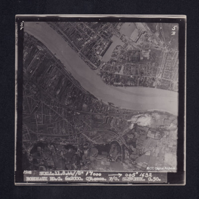
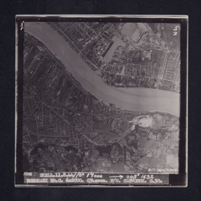
Bordeaux
Target photograph of Bordeaux showing both banks of the River Garonne with submarine pens in docks. Northern districts are visible. Target area clear with no clouds. No bomb bursts seen. Captioned ‘3° F’, ‘5B’, ‘1918 SKELL. 11.8.44 // 8”…
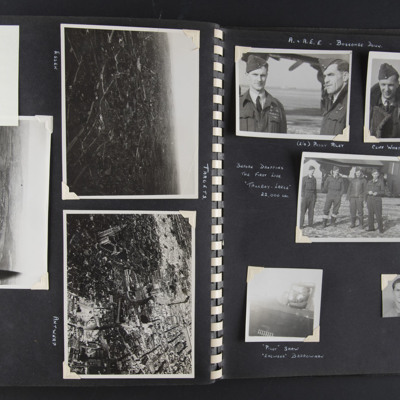
Targets and A&AEE Boscombe Down
Left page title 'Targets'
Top left - a note 'got to here'. Top right - an aerial oblique view of a city-scape with some large buildings and some damage visible. Captioned 'Essen' on the reverse 'Essen'.
Middle - an aerial oblique view of a…
Top left - a note 'got to here'. Top right - an aerial oblique view of a city-scape with some large buildings and some damage visible. Captioned 'Essen' on the reverse 'Essen'.
Middle - an aerial oblique view of a…
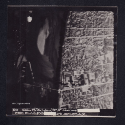
Tours
Target photograph of Tours. River Loire running top to bottom, road bridge across river and Saint-Gatien de cathedral visible. Captioned '5'', '810 SKELL.19/20.5.44.//NT.//8" 6500' [arrow] [censored] TOURS RD.J.8X2000 [censored]P/O AMPHLETT.J.50'. On…
Rennes
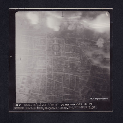
Target photograph of Rennes. Smoke and light streaks partially obscure top quarter of photograph. Railway marshalling yard top centre, prison just below it. Captioned '7B', '859 SKELL 8/9.6.44 //NT 8" 7000' [arrow] 087 0139 RENNES RD.T.2X1000,…
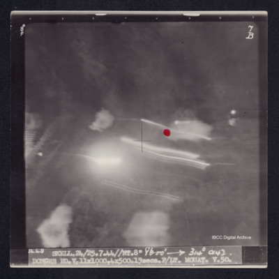
Donges
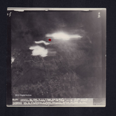
Target photograph of Donges. Light streaks and red dot just above centre of photograph. Captioned '5°F', '8B', '1450 SKELL.24/25.7.44//NT.8" 10750' [arrow] 315° 0143 DONGES RD.E.11X1000.4X500.22secs.F/LT FLINT.E.50.' On the reverse '[underlined]…
Orleans
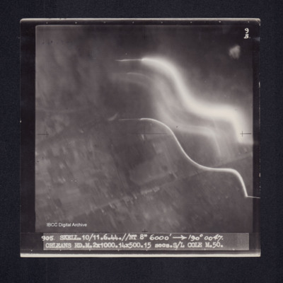
Target photograph of Orleans. Partially obscured by smoke and light streaks. Captioned '9B', '905 SKELL.10/11.6.44.//NT 8" 6000' [arrow] 190° 0047. ORLEANS RD.M.2X1000.14X500.15 secs.S/L COLE M.50.' On the reverse 'ORLEANS. S/L COLE 10/11.6.44'.…
Rouen
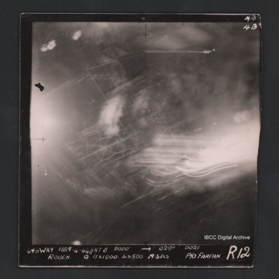
Vertical aerial photograph of Rouen. Street pattern just visible but most of the image is obscured by bombs, smoke and anti-aircraft fire. Captioned at top right ‘4B 4B’. Captioned '646 WKY 18/19.4.44 // NT 8” 9000’ [arrow] 029° 0021 Rouen Q…
Bergueneuse
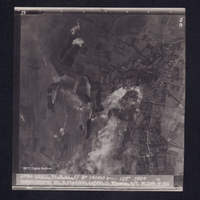
Target photograph of Bergueneuse. Rural area, many craters visible. Captioned '5°F', '5B', '2490 SKELL.31.8.44.// 8" 14000' [arrow] 122° 1824 BERGUENEUSE RD.B.11X1000.4X500.C.30secs.S/L FLINT.T.50'. On the reverse '[underlined] S/L FLINT 31.8.44.…
Wilhelmshaven
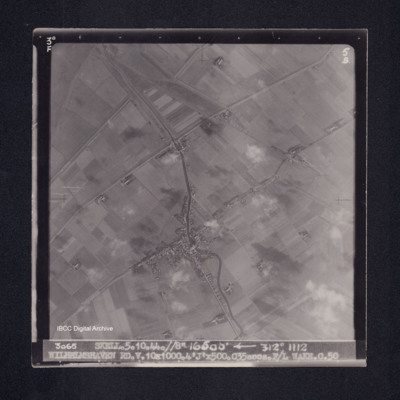
Target photograph of Caroliniensel and Harlesiel on the Harle river. Captioned '3°F', '5B', '3065 SKELL.5.10.44.//8" 16500' [arrow] 312° 1112 WILHELMSHAVEN RD.V.10X1000.4'J'X500.C35secs.F/L WAKE.C.50' On the reverse '[underlined] F/LT WAKE 5.10.44.…
BG Leopold
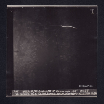
Target photograph of Bourg Leopold. Very dark photograph, appears to be urban area, one light streak. Captioned '7B', 795 SKELL.11/12.5.44.//NT 8" 15000' [arrow] 183° 0023 BG LEOPOLD RD.T.1X4000.6X1000.8X500.26secsP/O MILLIKIN T.50'. On the reverse…
Rly. Mrshlg Yds-Nantes
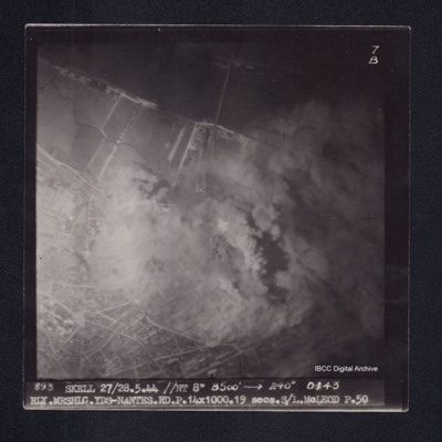
Target photograph of Nantes railway marshalling yards. Partially obscured by smoke and dust, river Loire and bridge visible. Lower third of photograph urban area, street patterns visible. Captioned '7B', '893 SKELL 27/28.5.44 //NT 8" 8500' [arrow]…
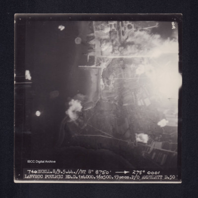
Lanveoc Poulmic
Target photograph of Lanveoc Poulmic. Coastline with piers and quays clearly visible. Partially obscured by light, but bomb explosions on land and water are visible. Captioned '8B', '740 SKELL.8/9.5.44.//NT 8" 8750' [arrow] 275° 0001 LANVEOC POULMIC…
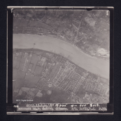
Bordeaux
Target photograph of Bordeaux. River Garonne from left to right in photograph, both banks clearly visible. Upper bank largely rural with some buildings following the roads. Lower bank more industrialised, piers visible. Captioned '3°F', '5B', '1991…
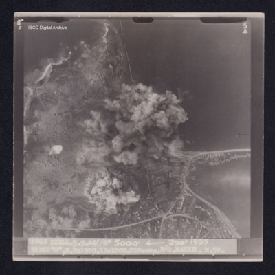
Brest
Target photograph of Camaret-sur-Mer. Coast line with base of breakwater with small boats clearly visible. Upper part of photograph open country, many craters, lower right more industrialised. Centre partially obscured by smoke and dust. Captioned…
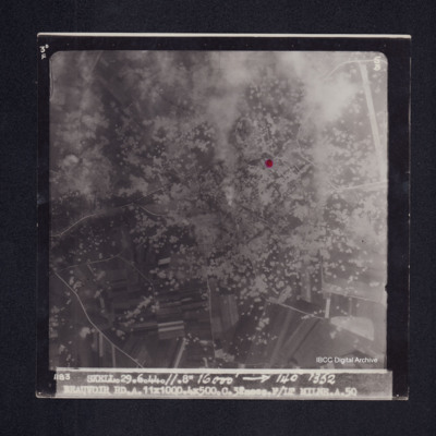
Beauvoir
Target photograph of Beauvoir between Bonnières and La Croix Tempex. Open country, roads visible, very many craters, and an airfield top right. Red dot right of centre, some smoke and dust. Captioned '3°F', '5B', '1183 SKELL.29.6.44.//.8" 16000'…
Donges
Target photograph of Donges. Little detail visible, red dot just right of centre. Light streaks and small number of explosions. Captioned '8°F', '7B', '1449 SKELL.24/25/7.44//NT.8" 8600' [arrow] 314° 0142 DONGES RD.V.11X1000,4X500.19secs.F/LT…
Bordeaux
Target photograph of Bordeaux. Both banks of river Garonne with basins, docks submarine pens, and moored ships clearly visible. Industrial area with roads and railways visible. Captioned '3°F', '5B', '1918 SKELL.11.8.44//8" 17000 [arrow] 005° 1632…
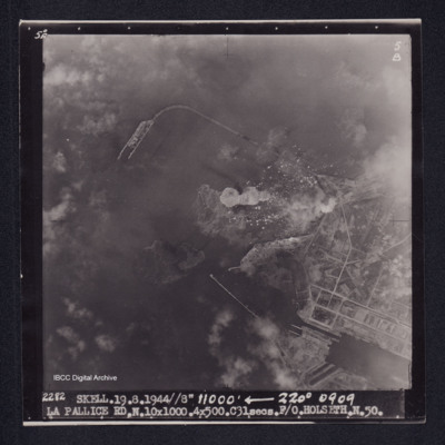
La Pallice
Target photograph of La Pallice. Port area, breakwaters, quays, docks and roads clearly visible. some smoke and disturbed water from bomb explosions. Captioned '5°F', '5B', '2282 SKELL.19.8.44//8" 11000' [arrow] 220° 0909 LA PALLICE…
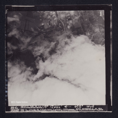
Foret de L. Adam
Target photograph of Forêt de L'Isle-Adam. Mainly obscured by cloud, area visible is open country. Railway junction, sidings and craters are visible. Captioned '5°F', '6B', '2250 SKELL.18.8.44//8" 12000' [arrow] 052° 1409 FORET DE…
Rheydt
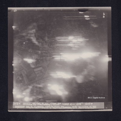
Target photograph of Rheydt. Large area obscured by light streaks but roads and open spaces in an urban area visible. Captioned '5°F', '6B', '2524 Skell.19/20.9.44//NT.8" 11000 [arrow] 015° 2154 RHEYDT RD.S.1X2000.12'J'X500.21secs.F/O MARRIS.O.50'.…
Boulogne
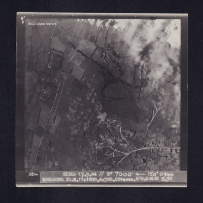
Target photograph of Boulogne. Rural area, top right obscured by smoke and dust from bomb explosions, roads and many bomb craters visible. Captioned '8°F', '5B', '2814 Skell 17.9.44 // 8" 7000' [arrow] 150° 0944 BOULOGNE…
Brest
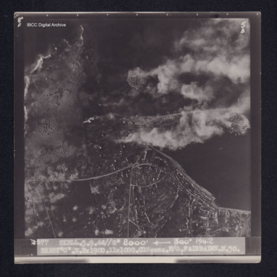
Target photograph of Camaret-sur-Mer. Port area with quays a breakwater and moored boats clearly visible. Roads and industrial area lower right. In open country on left, many craters visible. Disturbed water from a bomb explosion. Captioned '8°F',…
B. De Cassan
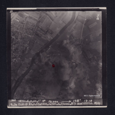
Target photograph of Bois de Cassan. Both banks of river Oise visible, rural area. Red dot left of centre, much of photograph obscured by smoke and dust, but roads and field patterns clearly visible. Captioned '3°F', '5B', '1862 SKELL.6.8.44.// 8"…
Beauvoir
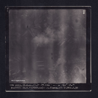
Target photograph of Beauvoir. Rural area, end of runway, taxiway and craters visible lower right. Captioned '5°F', '4B', '1159 SKELL.29.6.44.//.8" 17000' [arrow] 120° 1347 BEAUVOIR RD.K.11X1000.4X500.C.32secs.P/O OLIVER.M.50'. On the reverse…

