Browse Items (52 total)
- Tags: RAF Mepal
- Type is exactly "Photograph"
Sort by:
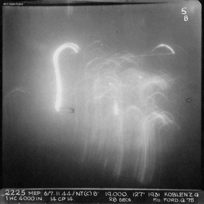
Koblenz
A vertical aerial photograph of Koblenz during a night operation. The centre of the image is obscured by anti-aircraft fire. No detail is visible on the ground. Annotated '2225 MEP 6/7.11.44/NT(C)8” 19,000. 127[degrees] 1931 KOBLENZ Z.Q IHC 4000 IN…
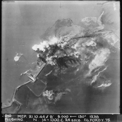
Flushing
A vertical aerial photograph of Flushing (Vlissingen) during an operation. Explosions can be seen on the coastal dyke. The No. 4 Commando bunker and Uncle Beach is nearby, in the bottom left of the image. Annotated '2010 MEP 21.10.44// 8” 8,000…
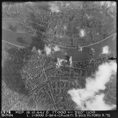
Bonn
A vertical aerial photograph of Bonn during an operation. The river Rhine is seen through the centre of the image. There are bomb explosions along the river with some cloud and shadow nearby. The majority is very clear, detailing the Kennedy bridge…
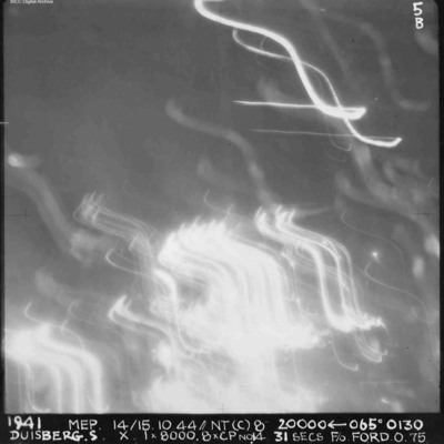
Duisberg
A vertical aerial photograph of Duisberg taken during a night operation. The lower half of the image is obscured by anti-aircraft fire. The top half has no clear detail. annotated '1941 MEP 14/15.10.44// NT (C) 8” 20000 [arrow] 065[degrees] 0130…
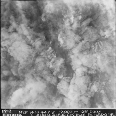
Duisberg
A vertical aerial photograph taken during the bombing of Duisberg. The entire image is obscured by explosions and smoke. Annotated '1912 MEP 14.10.44// 8” 18000 [arrow] 125[degrees] 0903 DUISBERG. X 11 x 1000. 4x500. C32 SECS. F/O FORD. O.75'.
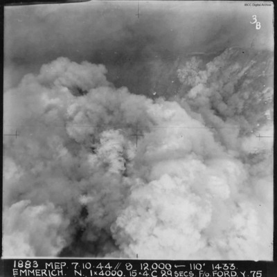
Emmerich
A vertical aerial photograph of Emmerich during an operation.The ground detail is obscured by explosions but the Rhine is visible at the top of the image. Annotated '1883 MEP 7.10.44// 8 12,000 [arrow] 110[degrees] 1433 EMMERICH. N. 1 x 4000. 15x4.C…
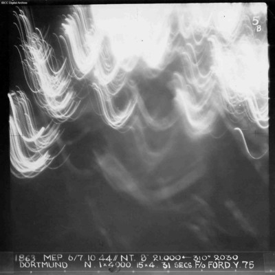
Dortmund
A vertical aerial photograph of Dortmund during an operation at night. No detail on the ground is visible and half the image is obscured by anti-aircraft fire. Annotated '1863 MEP 6/7.10.44// NT. 8” 21,000 [arrow] 310[degrees] 2030 DORTMUND. N. 1…
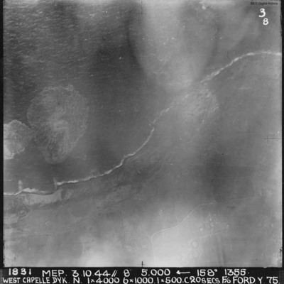
West Capelle Dyk N
A vertical aerial photograph of the Westkapelle Dyke, Vlissingen. The coastline can be seen but little on the ground. annotated '1831 MEP 3.10.44// 8” 5,000 [arrow] 158[degrees] 1355. WEST CAPELLE DYK. N. 1 x 4000. 6x1000. 1x500.C 20 SECS. F/O…
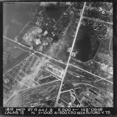
Calais
A vertical aerial photograph of Calais. The canal, Canal des Pierrettes, is visible and runs left to right, parallel to Rue Hoche and a marshalling yard. The yard services Les Fontinettes train station. Annotated '1810 MEP 27.9.44// 8” 5,500…
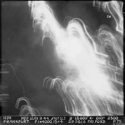
Frankfurt
A vertical aerial photograph of Frankfurt. The image was taken at night and half is obscured by anti-aircraft fire. Almost nothing can be seen on the ground. annotated '1698 MEP 12/13.9.44// NT (C) 8” 18,500 [arrow] 010[degrees] 2300. FRANKFURT. P…
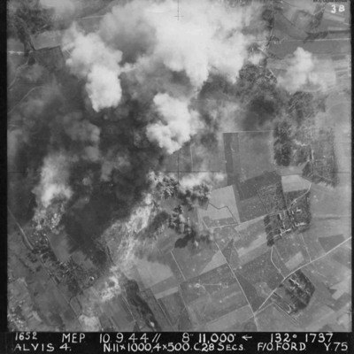
Alvis 4 target area
Vertical aerial photograph of Alvis, at Montvilliers, Le Havre. The centre section of the image is obscured by explosions. Annotated '1652 MEP 10/13.9.44// 8” 11,000 [arrow] 132[degrees] 1737 ALVIS 4. N.11x1000, 4x500 C.28 SECS. F/O FORD. Y.75'.
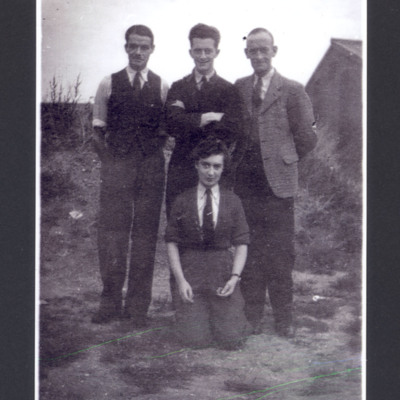
Muriel Blake and three civilians
Muriel Blake kneeling on the ground with three civilian men standing behind her. On the reverse 'Armstrong Sidley[sic] Mech RAF Mepal 1944'.
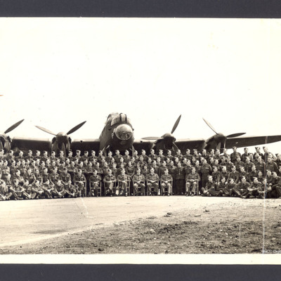
Flight Photo of crews with Lancaster at RAF Mepal
Large group photo of airmen and ground crew arranged in front of Lancaster 'P'. On the reverse 'RAF Mepal 1944 Sport & General Press Agency, Limited, London'.
Tags: aircrew; ground crew; Lancaster; RAF Mepal
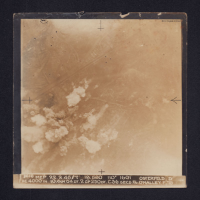
Osterfeld
Target photograph of Osterfeld (Oberhausen-Sterkrade). Roads and buildings are visible as are the Rhine-Herne Canal and railway running from centre left to upper right. Smoke can be seen in the lower left quadrant of the image and there is some glare…
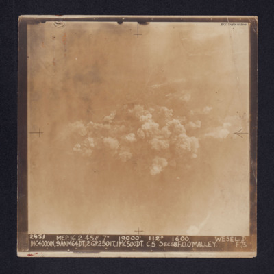
Wesel
Target photograph of Wesel. Some roads and railway tracks can be seen in the upper half while at the centre there are several plumes of smoke. The whole area is covered by thin cloud.
It is captioned: "2952 MEP. 16.2.45//7" 19,000' 112º 1600 WESEL.…
It is captioned: "2952 MEP. 16.2.45//7" 19,000' 112º 1600 WESEL.…
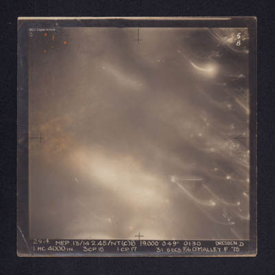
Dresden
Target photograph of Dresden. No ground details are visible but the glare from fires on the ground are visible through the smoke. There are some bright spots and trails of light on the right. It is annotated "5B" and captioned: "2914. MEP.…
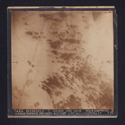
Koln-Gremberg
A target photograph of snow covered Koln-Gremberg. In the upper, right quadrant are some marshalling yards and the River Rhine, partially obscured by cloud. In the upper and lower left quadrants is a main railway line. At upper centre is an area of…
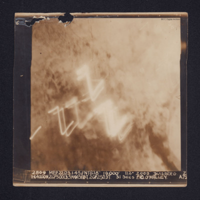
Duisberg
A target photograph of Duisburg. Cloud or smoke obscures the ground and there are several light trails in the centre of the photograph.
It is annotated "5B" and captioned: "2809 MEP. 22/23.1.45//NT(C)8" 19,000' 112º 2009 DUISBERG [sic]. Z…
It is annotated "5B" and captioned: "2809 MEP. 22/23.1.45//NT(C)8" 19,000' 112º 2009 DUISBERG [sic]. Z…
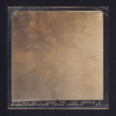
Krefeld
Target photograph of Krefeld. Cloud, smoke and glare obscures all ground detail.
It is annotated: "3B" and captioned: "2735 MEP. 11.1.45//7" 20,000' 130º 1514 KREFELD A 1HC4000IN, 12MC500DT, 4GP250DT. C.37SECS F/S O'MALLEY K.75.".
Also a…
It is annotated: "3B" and captioned: "2735 MEP. 11.1.45//7" 20,000' 130º 1514 KREFELD A 1HC4000IN, 12MC500DT, 4GP250DT. C.37SECS F/S O'MALLEY K.75.".
Also a…
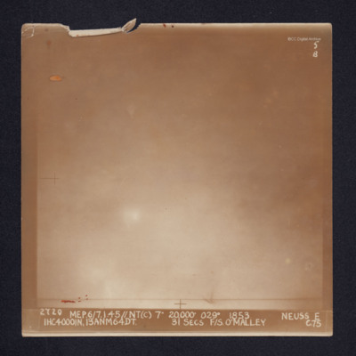
Neuss
Target photograph of Neuss. Glare and cloud obscures all ground detail. It is annotated "5B" and captioned: "2720 MEP.6/7.1.45//NT(C) 7" 20,000' 029º 1853. NEUSS E 1HC4000IN, 13ANM64DT. 31 SECS. F/S. O'MALLEY C.75".
Vohwinkel
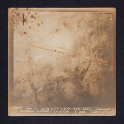
Target photograph of Vohwinkel. Smoke and glare obscures most of the ground and only the vague outlines of some ground features are visible.
It is annotated: "5B" and captioned: "2659 MEP 1/2.1.45//NT(C)7' 19,500. 360º 1944 VOHWINKEL K 1HC4000IN.…
It is annotated: "5B" and captioned: "2659 MEP 1/2.1.45//NT(C)7' 19,500. 360º 1944 VOHWINKEL K 1HC4000IN.…
Vohwinkel
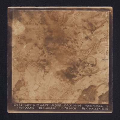
Target photograph of Vohwinkel. In the lower right quadrant rail tracks and sidings are visible, alongside which is a distinctive complex of roads and buildings. The buildings and streets of Gräfrath can be seen at the centre left of the image while…
Sigen
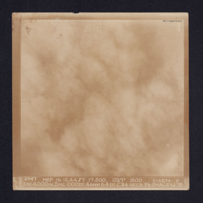
Target photograph of Siegen. Cloud or smoke obscures all ground detail. It is annotated "3B" and captioned: "2547 MEP. 16.12.44//7" 17,500. 027º 1500 SIGEN [sic]. F 1HC4000IN. 5MC1000DT. 4ANM64DT. C34 SECS. F/S O'MALLEY. J.75
Oberhausen
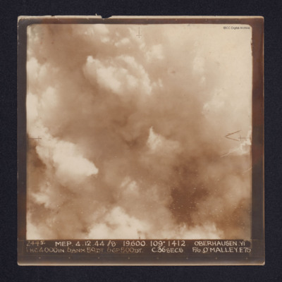
A target photograph of Oberhausen. Cloud or smoke obscures the ground. There are some small smoke trails at centre left.
It is annotated "5B" and captioned: "2445. MEP. 4.12.44 //8 19,600. 109º 1412 OBERHAUSEN,YI 1 HC4000IN. 6ANM 50DT. 6GP500DT.…
It is annotated "5B" and captioned: "2445. MEP. 4.12.44 //8 19,600. 109º 1412 OBERHAUSEN,YI 1 HC4000IN. 6ANM 50DT. 6GP500DT.…
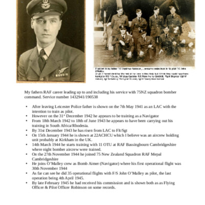
Septimus Robinson service history
A brief history of Septimus Robinson's RAF career.

