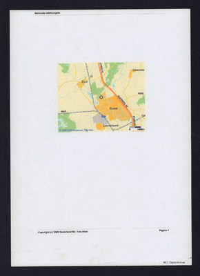
Crash site of Lancaster ED945 near 's-Hertogenbosch
Title
Crash site of Lancaster ED945 near 's-Hertogenbosch
Description
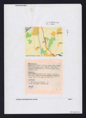
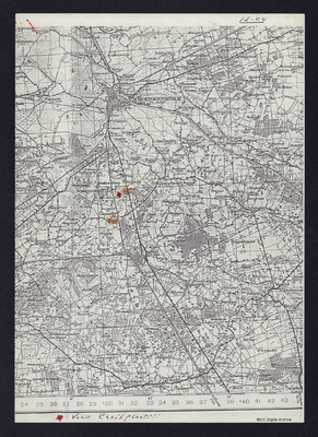
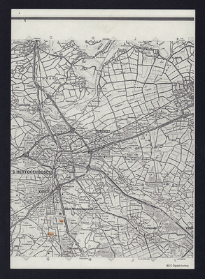
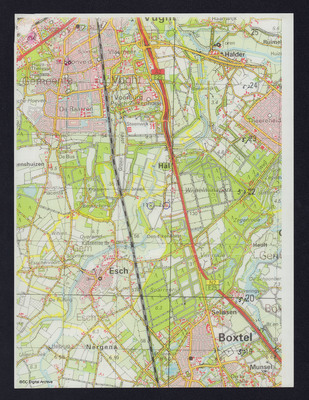
Five maps of varying scales showing the location of the crash site of ED945 near 's-Hertogenbosch. Second map has added text with map type, reference with impact point for aircraft and location of Mr Olislager's farmhouse.
Language
Format
Five maps and text
Publisher
Rights
This content is available under a CC BY-NC 4.0 International license (Creative Commons Attribution-NonCommercial 4.0). It has been published ‘as is’ and may contain inaccuracies or culturally inappropriate references that do not necessarily reflect the official policy or position of the University of Lincoln or the International Bomber Command Centre. For more information, visit https://creativecommons.org/licenses/by-nc/4.0/ and https://ibccdigitalarchive.lincoln.ac.uk/omeka/legal.
Contributor
Identifier
CBanksMD-170830-01
Transcription
. = Crash Site
O = Farm
[underlined] Map-reference. [/underlined]
Netherlands, scale 1 : 50 000. Series :M733. Sheet:
45’s Hertogenbosch West. Edition: 7-TDN 1988.
Gridzone Designation : 31U. 100 000 m square identification: FT.
[underline] Map-detail. {/underlined]
200% enlarged section of red. Scale 1:25 000 91mm =25m). Position impactpoint /FT0 59652169.
(Appr. East 5° 19’, North 51° 38’ 10”.)
[underlined]Lokations.- [sic] [/underlined]
1. Impactpoint a/c ED945. [inserted] o [/inserted]
2. Mr. Olislagers’ farmhouse. [inserted] o [/inserted]
[inserted] Joop [/inserted]
9
[page break]
[inserted] Ver 17: Crashplaats!! [/inserted]
Collection
Citation
“Crash site of Lancaster ED945 near 's-Hertogenbosch,” IBCC Digital Archive, accessed July 27, 2024, https://ibccdigitalarchive.lincoln.ac.uk/omeka/collections/document/9243.
Item Relations
This item has no relations.

