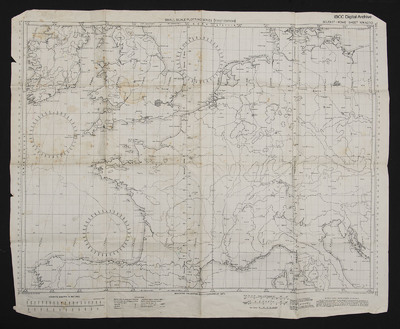
Small Scale Plotting Chart (First Edition)
Title
Small Scale Plotting Chart (First Edition)
Sheet NW42/10
Description
A chart used for navigation, covering Belfast-Rome at 1:2000000
Language
Format
One printed chart
Publisher
Rights
This content is available under a CC BY-NC 4.0 International license (Creative Commons Attribution-NonCommercial 4.0). It has been published ‘as is’ and may contain inaccuracies or culturally inappropriate references that do not necessarily reflect the official policy or position of the University of Lincoln or the International Bomber Command Centre. For more information, visit https://creativecommons.org/licenses/by-nc/4.0/ and https://ibccdigitalarchive.lincoln.ac.uk/omeka/legal.
Identifier
CEdwardsF-180314-02
Collection
Citation
“Small Scale Plotting Chart (First Edition),” IBCC Digital Archive, accessed July 27, 2024, https://ibccdigitalarchive.lincoln.ac.uk/omeka/collections/document/22723.
Item Relations
This item has no relations.

