Browse Items (691 total)
- Conforms To is exactly "Geolocated"
Sort by:
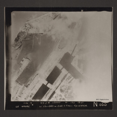
Le Havre
Vertical aerial photograph of the dock area at Le Havre. The right side of the image is obscured by cloud or smoke. Captioned 'BIN 5-8-44 //8 12000' [arrow] 150 1841 Le Havre Li 13x1000 4x500 c5secs F/O Lester N 460'.
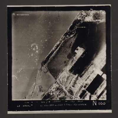
Le Havre docks
Vertical aerial photograph of Le Havre showing end of breakwater around dock area. Numerous bomb craters visible throughout together with damaged or destroyed dockside buildings. Warship in dock lower right. Rectangular structure to top left of…
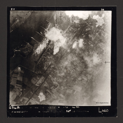
Emmerich
Vertical aerial photograph of Emmerich. The Rhine is at the top left. Some smoke and explosions are visible next to the Rhine River.
Captioned '6348 [undecipherable] 1000 [undecipherable] Emmerich [undecipherable] L460'.
Captioned '6348 [undecipherable] 1000 [undecipherable] Emmerich [undecipherable] L460'.
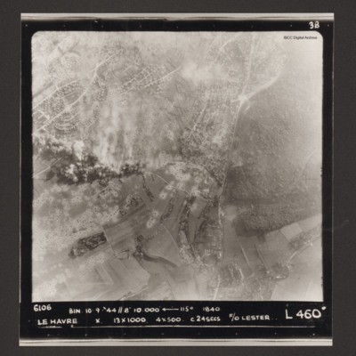
Le Havre
Vertical aerial photograph of Le Havre. There are large numbers of bomb craters and smoke and explosions. Captioned '6106 BIN 10-9-44 //8 10000' [arrow] 115° 1840 Le Havre X 13x1000 4x500 c 24 secs F/O Lester L 460'.
Szekesfehervar
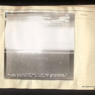
Vertical aerial photograph of Szekesfehervar. In the lower half some street detail is visible but all of the top half is obscured by bright light and tracers. Captioned 'A4 1989 40/4. 19 Sept 44 F8"//NT. 9100' [arrow] 049°. 2046. Szekesfehervar.T.…
Brescia
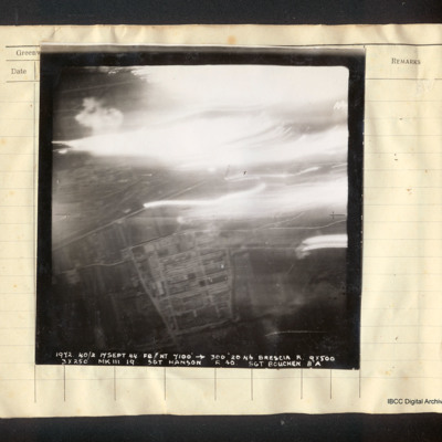
Vertical aerial photograph of Brescia. In the lower half the Breda works and the railway line are visible; the top half is obscured by tracers, explosions and bright lights. Captioned '1972 40/2 17 Sept 44 F8//NT 7100' [arrow] 300° 2046 Brescia R.…
Novi Pazar roads
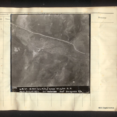
Vertical aerial photograph of a road and a river, some small explosions in the centre. Captioned '2356 40/29. 18.Nov'44 F/8//9000' [arrow] 1430. R.R. Novi Pazar Rds Sgt Hanson Sgt Boughen B/A'.
Podgorica
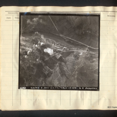
Vertical aerial photograph of Podgorica. The image is very clear apart from explosions and fires on the left side, a mainly industrial area. A river flows left to right with a road bridge and several roads. Captioned '22.30 40/22. 6. Nov '44…
Matesevo-Kolasin road
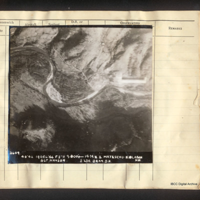
Vertical aerial photograph of Matesevo-Kolasin Road. The Tapa river meanders through the centre of the image. Adjacent is flatter land but to the top and bottom are hills. A road partly follows the river. Captioned '2609. 40/42 19 Dec '44 F8 // 9000'…
Podgorica-Klopot roads
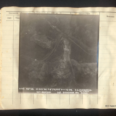
Vertical aerial photograph of the roads between Podgorica and Klopot. A river meanders across the centre, round a rock ridge. It is followed in part by a road. Captioned '2528 40/38 15 Dec '44 f8"//4,000' [arrow] 16.08 Z.Z Podgorica-Klopot Roads Sgt…
Ponte della Priula
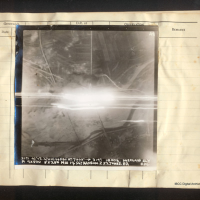
Vertical aerial photograph of the Ponte della Priula area. The centre is obscured by bright light and tracers. The Piave river meanders across the lower half of the image; the strada statale 13 Pontebbana and the Venezia – Udine railway line are…
Dobolj railway bridge
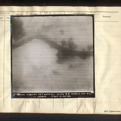
Vertical aerial photograph of the railway line near Doboj and the Bosna river. There are some explosions. Captioned '2740/52 5 Jan 45 F8"// 8000° [arrow] 11.00 1/2 R.R. Dobolj Rly Bdg. Sgt. Hanson. F/Sgt Jones B/A'.
Salcano railway bridge
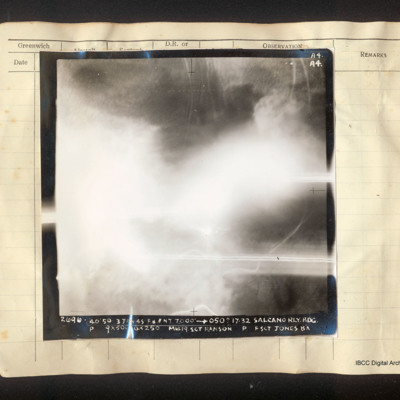
Vertical aerial photograph of the Salcano railway bridge, most of the frame is obscured by cloud. There is a road on the right side and some railway lines at the top. Captioned 'A4 A4 2696 40/50 3 Jan 45 F8//NT 7000' [arrow] 050° 17.32 Salcano Rly.…
Udine marshalling yards
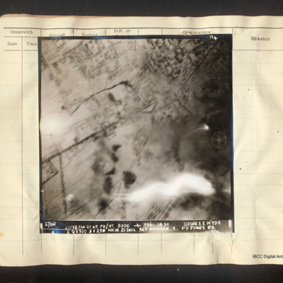
Vertical aerial photograph of Udine marshalling yards, centered on Porta Aquileia. The image is clear with the exception of an explosion in the lower right. Detail of the town and roads is visible. Captioned 'A4 2760 40/54 Jan 20 45 F8/NT 8000'…
Uzice
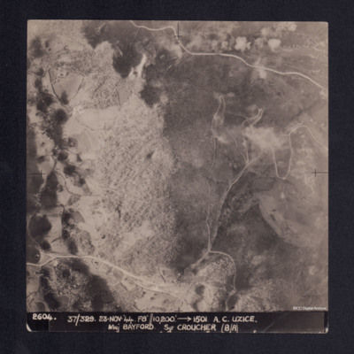
A vertical aerial photograph showing a hill, roads and some settlement in a valley. It is captioned '2604. 37/329 23.Nov.44 F8//10,200' --> 1501 A.C. UZICE. Maj BAYFORD Sgt CROUCHER (B/A)'
Bologna
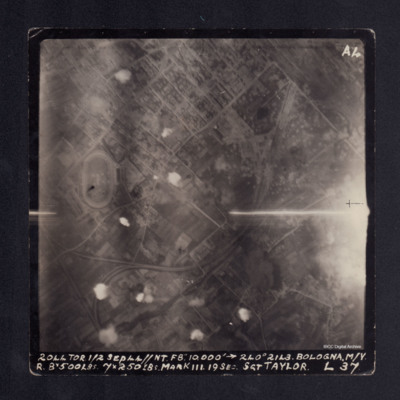
A vertical aerial photograph taken during bombing of Bologna. There are several small bomb explosions and anti-aircraft fire. The photograph is captioned '2044 TOR 1/2 Sep 44//NT F8" 10,000' -->240° 2143 BOLOGNA. M/Y R 8x500lbs 7x250lbs Mark III. 19…
Marseilles
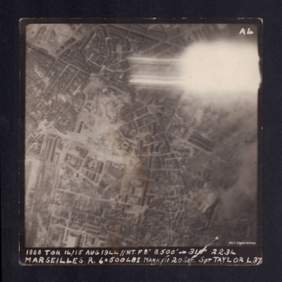
A vertical aerial photograph taken during the bombing of Marseilles. The top right corner is obscured by a flash. It is captioned '1888 TOR 14/15 AUG 1944 //NT.F8" 8,500' --> 310° 2234 MARSEILLES R. 6x500lbs Mark III 20 sec Sgt TAYLOR L37'.
San Benedetto Pontoon Bridge
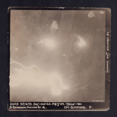
A vertical aerial photograph of the San Benedetto pontoon bridge. Most of the image is obscured by anti-aircraft fire. It is captioned '2249. 37/275. 30/1 Oct 44. F8"//NT.7500' --> S. BENEDETTO PONTOON BR.Q. Cpt BAYFORD. P. Sgt CROUCHER (Air…
Ficarolo Pontoon Bridge
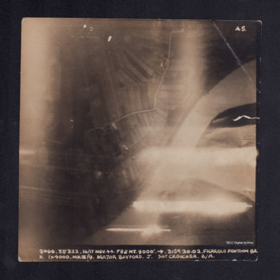
A vertical aerial photograph taken during the bombing of Ficarolo pontoon bridge. Some of the image is obscured by anti-aircraft fire. It is captioned '2466 37/322. 16/17 Nov. 44. F8//NT. 9000' --> 315°. 20.02 FICAROLO PONTOON BR. H. 1 x 4000. Mk…
Uzice
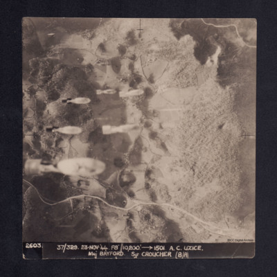
Four vertical aerial photographs taken during the bombing of Uzice, numbered 2603, 2604, 2605 and 2606. On 2603 bombs are seen dropping. Bomb explosions obscure part of the image. It is captioned '2603/2604/2605/2606. 37/329 23.Nov.44 F8//10,200'…
Rimini
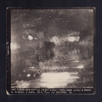
A vertical aerial photograph taken during the bombing of Rimini. Most of the image is obscured by bomb explosions and anti-aircraft fire. It is captioned 'Sgt CROUCHER (AIR BOMBER)' on LH side. At bottom: '2187.37/263. 18/19 Sept.44.F8"//NT.…
Kraljevo
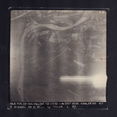
A vertical aerial photograph of Kraljevo taken during bombing operations at the marshalling yards . The right side is partly obscured by anti-aircraft fire but main roads and the river are clearly visible. It is captioned '1849. TOR. 10/11 AUG…
Podgorica
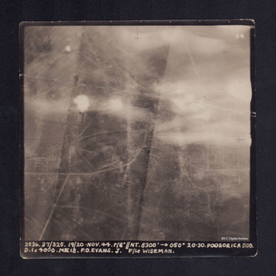
A vertical aerial photograph of Podgorica taken during bombing operations. The top half is largely obscured by anti-aircraft fire. Street patterns are visible. It is captioned '2536. 37/325. 19/20. Nov. 44. F/8"//NT. 8300' -->050° 20.30 Podgorica…
Podgorica
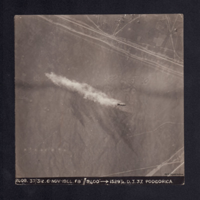
A sequence of nine vertical aerial photographs taken during the bombing of Podgorica. They are numbered 2408 to 2416. The first image shows a single bomb being dropped.
It is captioned '2408. 37/312 6. Nov. 1944. F8"//9,400' --> 1529½ D.J. 37.…
It is captioned '2408. 37/312 6. Nov. 1944. F8"//9,400' --> 1529½ D.J. 37.…
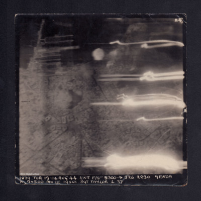
Genoa
A vertical aerial photograph taken during bombing of Genoa. The right side has several flashes of anti-aircraft fire. Street patterns, docks and buildings are visible. It is captioned '1879. TOR 13-14 Aug 44 //NT F/8" 8300 -->326 2230 Genoa K 9 x 500…

