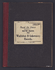
RAF notebook
Title
RAF notebook
Description
Includes: tables of fighters, multi-engine bombers, as well as national aircraft markings, drawings of aircraft, meteorology notes. Continues with notes on preparation/completion and disposal of form 2330 by RAF for flights in Great Britain and flights outside British territorial waters.
Coverage
Language
Format
Sixteen page notebook with handwritten notes, drawings and diagrams
Publisher
Rights
This content is available under a CC BY-NC 4.0 International license (Creative Commons Attribution-NonCommercial 4.0). It has been published ‘as is’ and may contain inaccuracies or culturally inappropriate references that do not necessarily reflect the official policy or position of the University of Lincoln or the International Bomber Command Centre. For more information, visit https://creativecommons.org/licenses/by-nc/4.0/ and https://ibccdigitalarchive.lincoln.ac.uk/omeka/legal.
Identifier
MRosserLV745193-190517-16
Transcription
[inserted] Rosser 74519[deleted number] SGT. ROSSER [/inserted]
[underlined] FORM 620 [/underlined]
Royal Air Force.
NOTE BOOK
FOR
Workshop & Laboratory Records.
T.4771. Wt. 13685. 175,000 Bks. 5/39. W. & S. Ltd. (212427M).
[page break]
[blank page]
[page break]
[underlined] AIRCRAFT IDENTIFICATION [/underlined]
[underlined] FIGHTERS [/underlined]
[Table of British, French, German and Italian Fighter Aircraft]
[page break]
[blank page]
[page break]
MULTI-ENGINED BOMBERS
[Table of British, French, German and Italian Bomber Aircraft]
[page break]
[underlined] Camoflage [sic] [/underlined]
[underlined] German [/underlined] Upper surface of fuselage a dark olive green, varying in intensity.
Under surfaces usually light pale blue or lead black.
(Trainers) Silver and light blue
(Coastal) All yellow
[underlined] French [/underlined] Upper and side surfaces similar to our own.
Under surfaces light blue-grey
(Trainers) All silver
[page break]
ITALIAN
[Drawings x 2]
FRENCH
[Drawings x 2]
GERMAN
[Drawings x 2]
BRITISH
[Drawings x 2]
[page break]
[blank page]
[page break]
[Drawings x 4 with text]
[page break]
[blank page]
[page break]
[Drawings x 3]
[page break]
[blank page]
[page break]
[Drawings x 3]
[page break]
[blank page]
[page break]
[Drawings x 3]
[page break]
[blank page]
[page break]
[underlined] METEOROLOGY [/underlined] { Study and knowledge of the movements and behaviour of the Air.
[inserted] frames. [/inserted] [circled 1]
[underlined] The Atmosphere [/underlined] – The surrounding layer of air. It moves with the Earth as though fixed to the Earth’s axis. It is a mixture of gases, becoming very rarified at 30 miles high. The mixed gases show no appreciable variation except for water vapour i.e. excepting the polution [sic] from factory chimneys etc. Water vapour found in the atmosphere is largely due to evaporation and condensation. The transportation process of vapour by evaporation is dependent on pressure and temperature.
Water vapour is lighter than air, if air containing same is lighter than other the air pressure is affected. W.V. is the most important factor in the weather.
[underlined] Millibar [/underlined] – Name for unit of atmospheric pressure.
(Pressure exerted on area of one sq. centimetre by force of 1.000 degrees).
[underlined] Approx. Rate of decrease in pressure [/underlined] – One millibar in 30 feet. (actually 27.9’)
[underlined] Approx. Normal Lapse rate [/underlined] i.e. Fall of temperature with increased height. 3° per thousand feet. { High lapse will indicate good visibility as hot air rising carries with it smoke [indecipherable word] etc.
[underlined] Inversion of temp. [/underlined] – Increase of temperature with height.
[underlined] Adiabatic [/underlined] – Portion of air without gain or loss of temperature except within itself.
[page break]
[circled 2]-. [underlined] WIND. VERTICAL CURRENTS – BOMPINESS. [/underlined]
1. Wind flow over the earth’s surface is not entirely horizontal, due to ascending and descending currents.
[underlined] Ascending currents. [/underlined] [underlined] 1. DYNAMIC UP-CURRENTS. [/underlined]
a) Caused by obstructions such as a ridge of hills.
b) [underlined] If obstruction is at right angles [/underlined] to wind direction some of air is forced to pass over summit producing upward current on [deleted word] windward side and downward current on leaward [sic] side.
Actual height of disturbance depends on lapse rate. If inversion exists at some height above hill [indecipherable word] vertical moution [sic] is possible if cold air resting on earth is almost stationary and warm air above alone moves. These conditions occur most frequently in winter in the quiet conditions associated with an anticyclone.
c) [underlined] Hill with steep slopes [/underlined] – tendency for stationary eddies on windward and leeward sides – wind blowing down the hill on the windward side and up the hill on the leeward side. Between main upward or downward current and the return current [indecipherable word] to the [indecipherable word] – a region of dead air will exist.
Such eddies are persistent so long as the lapse rate is less than the dry adiabatic and the wind speed is less than 20 m.p.h. If lapse rate or wind exceeds these values, the wind flow over hill becomes generally turbulent and the more definite eddies are difficult to distinguish.
d) [underlined] Wind flow over cliffs with a steep face [/underlined] is more turbulent than in the case of a hill. The eddies may persist for a considerable distance to leeward causing dangerous flying conditions. An example of a disturbance of this kind is found in the wind current over the Rock of Gibraltar.
[Diagrams x 3 with text]
[underlined] 2. THERMAL UP-CURRENTS [/underlined] – vertical currents produced by heatting [sic] of earth’s surface by the sun. on a fine summer day, if little wind, ground rapidly becomes heated causing air at lower levels to approach the unstable adiabatic state. Air streams this flow upwards from ground and if air is sufficiently moist a cumulus cloud forms at the top of each rising column. As cloud forms & grows a powerful circulation develops within it, drawing the air from lower levels. In thunderstorms ascending currents of the order of 30 m.p.h. are not uncommon and the speed required to maintain a hailstorm of 1 inch diameter is about 50 m.p.h.
[underlined] 3. FRONTAL UP-CURRENTS [/underlined] Most powerful up-currents which are independent of nature of surface below. Due to inter-action of air masses [indecipherable word], being of different thermal structure produce disturbed conditions along the boundaries where they meet. Most important is the cold front of a depression, along which in northern latitudes, the cold northerly or north-easterly winds of polar origin in the order of definition undercut the warmer South-westerly winds on the southern side. Most inducing vertical currents occur in line squalls and more particularly in thunderstorms which are [indecipherable word] in A.P. [indecipherable words] 21 & 22.
[underlined] 4. FRICTIONAL UP-CURRENTS [/underlined] In coastal regions when wind blows from the seas up-currents are produced by surface friction. Owing to the increased friction which occurs in the transition from sea to land the wind experiences a strong retardation or decrease in velocity. This decrease is compensated by a [indecipherable word] ascending current over the coast often producing noticeable [indecipherable word]. The upward current is reinforced if there is high ground bordering the coast.
[page break]
[circled 3]
[underlined] Pressure [/underlined] – Due to weight of overlying air. Decrease depends on temperature. Higher temperature – less dense air & slower rate of decreased pressure upwards.
[underlined] Temperature of Air. [/underlined] Heat radiated from ground heated by sun’s rays. Usually decreases with height.
[underlined] Heating due to compression [/underlined]
This is adiabatical and the heating is purely dynamic.
If a sample of air is compressed the temperature rises, if expanded the temperature decreases.
Dynamical change is important for its great connection with the formation of cloud and rain.
Dynamical cooling is the rate of which rising air loses temperature.
[underlined] Vertical temperature gradient [/underlined]
In still air temp falls off at rate of 1° Far for every 300’.
General temp. lapse in ascending air is 1° Far for every 185’.
[underlined] Temp. Inversions. [/underlined]
Occasionally air increases in temperature with height.
This does not necessarily commence near the ground.
[underlined] Dew Point [/underlined] – That temp. at which unsaturated air becomes saturated.
[underlined] Humidity [/underlined] – [underlined] Absolute [/underlined] – Actual water vapour content per particle of air.
[underlined] Relitive [sic] [/underlined] – Defined as ratio of actual amount of water vapour present in a given sample of air to the amount of water vapour the same particle of air could hold if saturated at the same temperature.
[underlined] Measurement of relative humidity [/underlined] – (Example – wet & dry thermometer) – when wet temperature is nearing the dry temperature then the air is nearly saturated and fog or mist is probable.
[page break]
[circled 4]
[underlined] LOCAL WINDS INDEPENT OF GENERAL PRESSURE DISTRIBUTION [/underlined]
[underlined] 1. ANABATIC:- [/underlined] On clear day air on hills being warmed more than air over the valleys at same height, tends to rise. Air flows up the valleys to take place of the rising air. Such an airflow is called the Anabatic Wind.
[underlined] 2. KATABATIC:- [/underlined] On clear night ground becomes cooled by radiation to sky and air in contact with ground subsequently becomes cooler. In undulating country air on side of hill, being colder then the free air at the same height above the valley, tends to flow down the slope under gravity causing local wind. The direction of this wind (KATABATIC) is determined by slope of hill and may bear no relation to general pressure distribution. Under favourable conditions speed may cause that of gradient wind, especially if previous gradient tails to augment the influence of the hill.
[underlined] 3. LAND AND SEA BREEZES. [/underlined] During the day the land surface near coast becomes hotter than surface of sea. Air over land consequently becomes warmer than that over sea and as warm air is lighter than cold air, pressure over land becomes relatively low. Therefore a tendency for air to flow from sea to land exists. This is called ‘Sea Breeze. Since an accumulation of air over land is not possible a compensating return current at higher levels must result. In the British Isles the sea breeze never exceeds 10 – 15 mph. and is mainly is feature of quiet summer weather. Strength of sea breezes declines rapidly at 500 ft. and is inappreciable at 1,000 ft & the return current is not strong enough to affect air navigation. In low latitudes development of sea breeze is much more pronounced. It may extend to several thousand feet reaching a strength of 30 mph., penetrating a long way inland. Air in this case of a katabatic wind, a a [sic] sea-breeze may bear no relation to general pressure distribution. At night conditions are reversed. Land surfaces becoming colder than the sea, the surface wind then tending to blow from land to sea and in quiet weather persists till the morning but with a relatively small velocity.
[page break]
[circled 5]
[underlined] Weather Chart. [/underlined] (Synoptic chart) Made up of observations taken simultaneously which are brought together and shown in the form of symbols on same.
[underlined] Isobars [/underlined] – (Drawn at intervals of 2 millibars) A line drawn on a weather chart which represents the same barometric pressure throughout that line. (to the nearest 1/10 millibar) Those given on an English Chart are reduced to mean sea level pressure.
[underlined] Buys Ballots Law. [/underlined] If standing with back to Northern hemisphere, pressure is lower on left hand than right – reversed if back is to Southern hemisphere.
[underlined] Wind [/underlined] Movement of air from high to low pressure. Speed of same is dependent on distance between the two different pressures.
[underlined] Gradient Wind. [/underlined] Wind at 1500 feet.
Isobars show direction of wind at 1500 feet i.e. wind follows isobars at that height but at Earth’s surface wind turns towards area of low pressure.
The deviation of the surface wind as compared to that at 1500’ is due to friction with the Earth’s surface, this produces eddies, gustiness or turbulence. If there were no turbulence i.e. no friction, the wind would blow as a steady current with uniform speed and direction. It is also affected by temperature and extends to a greater height in the day than at night.
[page break]
[circled 6]
[underlined] TYPES OF CLOUD [/underlined]
[Table]
Amount of cloud always estimated in tenths. A clear sky no tenths. 10/10 represents overshadowed sky. 9/10 = sky almost overcast but a few openings.
5 methods of measuring height.
1/. Altimeter
2/. Theodolite
3/. Pilot balloon method devised by Theodolite, rising at 500’ for 3 mins
4/. Conformation with mountains of known altitude.
5/. Searchlight observation at night.
[underlined] Visibility [/underlined]
Is denoted by a code figure & letter code figure from 0 – 9. 0 = Dence fog. 1. Thick fog. 2. Fog. 3. Moderate fog. 4. Mist or Haze. 5. Poor visibility. 6. Moderate visibility. 7 & 8. Moderate Visibility. 9. Very good visibility. Nos. 0 & 1 denoted by [indecipherable word] ‘F’. Nos. 2 & 3 small ‘f’. 4 = ‘n’ or ‘z’. 5 & 6 also ‘n’ ‘o’ or ‘z’ ‘o’.
[page break]
[circled 7]
HIGH CLOUD {
1. [underlined] CIRRUS [/underlined] (CI.) – Detached clouds, delicate & fibrous appearance, no shading, mostly white in colour – milky appearance.
‘Mare’s tails with tufted ends, often at height [underlined] 30,000’ [/underlined]).
2. [underlined] CIRROSTRATUS (CIST.) [/underlined] – Thin whitish veil, does not blur outlines of sun or moon, but gives rise to halos. Uniform sheet – very high – approx. 30.000’.
3. [underlined] CIRROCUMULUS (CICU) [/underlined] The Mackerel Sky. Highest form of cloudlets in waves. Height 20.000 – 25.000’. Cirriform layer composed of small white flakes or of very small globular masses, no shadows, arranged in groups or lines or ripples resembling sand on the sea-shore.
MEDIUM CLOUD {
4. [underlined] ALTOCUMULUS (ACU.) [/underlined] Layer of large cloudlets in waves at middle height. Smaller elements of regular arranged layer fairly small and thin, with or without shading.
5. [underlined] ALTOSTRATUS (AST.) [/underlined] Sheet at middle height – 10.000 - 25.000’. Striated or fibrous veil, grey or bluish colour. Like thick CIST. but without halo phenomenon.
LOW CLOUD {
6. [underlined] STRATOCUMULUS (STCU) [/underlined] Layers of clouds in irregular order [underlined] below 7.000’ [/underlined]. Patches in globular masses. Smallest of regularly arranged elements fairly large, often soft and grey, with darker parts.
Low as 500’ or high as 5.000’
7. [underlined] NIMBUS (NU.) [/underlined] Shapeless cloud-base below 7.000’, rain falling.
CLOUDS WITH [indecipherable words] {
8. [underlined] CUMULUS (CU.) [/underlined] Detached cloud with flat base at mean height 4.500’, domed at top at mean height 6.000 ft. Thick with vertical development. 1.000’ – 8.000’.
9. [underlined] CUMULONIMBUS (CUMB.) [/underlined] Thunder cloud. Heavy masses with great vertical development forming mountains or towers, upper parts have fibrous texture and often spreading out in shape of an anvil. 1.000’ – 8.000’.
10. [underlined] STRATUS. (ST.) [/underlined] (LOW CLOUD) Level sheet of low cloud; below 3.000 ft. Resembles fog but does not set on ground. Sometimes is practically almost down to the surface.
[page break]
[circled 7A]
[underlined] FOG. [/underlined]
The most important element from aviation point of view.
[underlined] Causes [/underlined]:- 1/. Condensation of water vapour in surface layers of atmosphere
2/. Smoke or dust held in suspension in the air.
4/. [sic] Combination of water vapour and smoke.
[underlined] Definition of Fog [/underlined] – the condition of atmospheric obscurity in which objects at distance of 1 kilometre (1,000 yds.) are not visible. Should visibility exceed 1 kilometre and is less than 2 kilometres the obscuration is called ‘mist’ or ‘haze’ according to whether it is caused by condensed water particles or by solid matter i.e. dust or smoke.
[underlined] Condensation of water vapour [/underlined] in surface layers is caused by the cooling of air below its dew point, this may be due to:- a) cooling of surface of ground or sea which is communicated to air above it b) by drift of air over surface which is colder than itself c) by the mixing of two currents of air with different temperatures and humidities. In first [deleted] case [/deleted] & second cases an inversion is formed in lower layers of air which effectively prevents the air from rising bodily, but mixing due to slight turbulence may convey the cooling and condensation upwards through surface layers. For effective formation of fog the wind must be light in order to allow air near ground to become sufficiently cooled; there must also be sufficient moisture in the air for the cooling to produce condensation. The wetness of the ground therefore has a bearing on the likelihood of occurrence of fog.
[underlined] Fogs occur [/underlined] chiefly in autumn and winter over the ground, most frequently on calm, clear nights, reaching maximum intensity, normally, in the early morning 1 – 2 hrs after sunrise and dispersing before mid-day. At sea they are characteristic of spring and summer, usually formed by the passage of a current of air from a large land mass or from tropical regions, over the sea which, at this season is relatively cold. Over English Channel the usually occur with warm South-West winds. In undulating country fog may occur at all seasons due to the drifting of low cloud over high ground. High ground near sea suffers most in this respect.
[page break]
[circled 8]
11. [underlined] ALTOCUMULUS CENTICULARIS. [/underlined] (MEDIUM CLOUD) Almond-shaped banks of cloudlets at the altocumulus level.
12. [underlined] ALTOCUMULUS CASTELLATUS. [/underlined] (WITH VERTICAL DEVELOPEMENT [sic]) Little miniature cumulus rising in many heads from a more or less compact layer of altocumulus.
13. [underlined] FRACTOCUMULUS. (FRCO.) [/underlined] (LOW CLOUD) A string of ragged cumulus.
[underlined] NOTE. [/underlined] [underlined] HIGH CLOUDS. [/underlined] – with mean lower level of 20.000 ft., mean upper level 40.000.
[underlined] MIDDLE OR MEDIUM CLOUDS. [/underlined] – with mean upper level of 20.000 ft. mean lower level of 6.500 ft.
[underlined] LOW CLOUDS [/underlined] – with mean upper level of 6.500 ft., mean lower level close to ground.
Heights given here are for temperate latitudes and refer, not to sea-level, but to the general level of the land in the region.
In certain cases there may be large departures from the given heights, especially as regards CIRRUS, the upper level of which may be 50.000’ or more in the tropics but the lower level of which may be as little as 10.000’ in temperate latitudes, and in polar regions almost as low as the surface.
[underlined] Relationship between Isobars and Wind. [/underlined] – given by Buys Ballot’s Law, so named because first laid down by Prof. Buys Ballot.
[Drawing and text x 2)
Angle ‘A’ is very varied and is the angle between the surface wind and wind at 1500’. Over the sea angle is reduced. Closer together isobars – the stronger the wind i.e. gradient is steeper – as with close contour lines. Speed of wind is proportionate to the pressure gradient.
[page break]
[underlined] METEOROLOGICAL REPORT – FORM 2330 (FRONT FACE) [/underlined]
Pilot contemplating a cross country flight of more than 100 mls. must first fill in a form 2330 from the meteorological report posted in the pilots’ room.
[Form]
[page break]
[circled 9]
[underlined] Effect rotation of earth has on wind [/underlined]
Cause of Wind. – Gravitational force from high to low pressure. Air would move in a direct line of force from high to low pressure were it not for the rotation of the earth causing friction between land and air. Earth rotates around its axis – a body in the Northern hemisphere is moved to the right, in the S. hemisphere to the left – known as [underlined] Geostrophical & cyclostrophic. [/underlined]
Effect of surface pressure accounts for
Greater the surface friction the greater will be the deflection of the wind from the direction of the isobars – this accounts for deflection being least over the sea.
Surface wind not only differs with direction of isobars but in speed as well – this is known as the [underlined] dional [sic] variation [/underlined] of wind – caused by surface wind disturbing air at 1500’. 1500’ wind gives some of its energy to surface wind therefore surface wind increases in speed. After sunset surface wind speed decreases, 1500’ wind increases. Surface Wind direction vears [sic] by day & back during night.
[underlined] Gusts & Squalls. [/underlined] – [underlined] SEE PAGE 224. [/underlined]
[underlined] Gustiness [/underlined] – 2 distinct causes.
1. Mechanical effect of irregularities over ground.
2. Turbulence of Thermal origin, connected with lapse rate.
[underlined] Difference in Gusts & Squalls. [/underlined] – [underlined] Gust [/underlined] – sudden increase in speed of wind not lasting for more than a few seconds.
[underlined] Squall [/underlined] – increase of wind lasting for many minutes and speed of wind dies down normally.
[underlined] Land and sea breezes. [/underlined] Caused by sun shining on land, air rises from land – air from sea rushes to land. Opposite during night. Indian monsoons are nothing more than land and sea breezes.
[underlined] Katabatic & Anabatic Winds. [/underlined]
[page break]
[underlined] METEOROLOGICAL REPORT – FORM 2330 (BACK FACE) [/underlined]
[Form and text]
[page break]
[underlined] ICE ACCRETION [/underlined]
[underlined] FOUR TYPES [/underlined]
1. Equivalent to hoar frost
2. Equivalent to rime
3. Midway between rime and glaze.
4. Equivalent to glaze.
[underlined] Conditions of forming [/underlined]
1. Quick descents from cold to warm layer
2. Flying in AltoCum. or Alto. Stratus clouds.
3. Cum. Or Cum. Nimb. clouds.
4. In conditions of temp. inversion usually associated with a front.
[underlined] Notes. [/underlined]
To avoid ice accretion keep clear of moisture in visible form – cloud, fog, rain etc., and avoid altitudes at which the temp. is between 8° Far & 32° Far.
[underlined] MET. INFORMATION IN WAR TIME [/underlined]
[underlined] COLLECTION OF WEATHER REPORTS [/underlined]
Peace time method of collection & transmission of weather Reports by W/T not used in war time. War time method by teleprinter – cipher could have been used but not practical because long delay in decoding.
[underlined] ORGANISATION. [/underlined]
[Diagram]
As far as possible each group station is in a particular geographical Region. In this way the Central Station (Met. Office at A.M.) can receive from, and send to, all group stations, weather reports, which in turn are collected from and sent to the sub-stations. Before French capitulation British and French stations exchanged weather reports.
[page break]
[Table]
[page break]
[underlined] PREPARATION, COMPLETION & DISPOSAL OF FORM 2330 BY R.A.F. [/underlined]
1) For flights in Gt. Britain
2) For flights outside British Territorial Waters.
N.B. On all flights of over 100 mls. from a base – form 2330 must be carried by each aircraft.
[underlined] 1. Flights in Gt. Britain [/underlined]
[underlined] Preparation [/underlined] – Most service stations have a qualified Met. forecaster on duty; when a flight is contemplated requiring a form 2330 the forecaster will be told the route, and approximate time of flight. The pilot then prepares and checks it by ringing up a Group Station.
When { a) There is no forecaster on duty / (b) There is no Met. office at the station } information is obtained from Group Station by:- { a. The Met Office / b. The Duty Pilot } It is the Pilot’s responsibility to fill in his own form 2330 from information posted in the ‘crews’ room.
On the form the Pilot should give:-
1/. General weather conditions on flight.
2/. Visibility.
3/. Cloud heights – amounts and types
4/. Winds at specified heights – usually Ground Level. 2.000’ – 6.000’ – 10.000’ – 14.000’
5/. Freezing levels and heights at which there is no danger of severe ice accretion.
6/. In addition Barometric pressure M.S.C. at base & stations en route.
In certain cases the Met. Officer will prepare form 2330.
1. [underlined] COMPLETION ON FLIGHT. [/underlined]
1. Navigator makes periodic observations, usually every 25 miles and enters them on back of form 2330.
2. Observations include:- a) G.M. Time of observation b) Position of A/c. c) Height d) Temperature e) Cloud amounts & types above & below A/C f) Any other necessary remarks.
[page break]
[blank page]
[page break]
[underlined] DISPERSAL [/underlined]
On return to base form 2330 is handed in to Met. Officer by the Navigator. Information thereon is then phoned or teleprinted to Group Station which in turn sends it on to Control station.
The forms at each station are collected & forwarded at the end of each month. If A/c lands at a different base the Met officer at the landing base informs its own group station and forwards form 2330 to A/c’s own base & information thereon is disposed of as above.
On special flights the Met. information is usually issued by group station.
(2) [underlined] FLIGHTS OUTSIDE BRITISH TERRITORIAL WATERS. [/underlined]
Procedure as in ‘[circled 1]’ but with following exceptions:-
i) For Operational Flights Group prepares Met and it is transmitted to Sub. stations by Teleprinter.
ii) To prevent weather information falling into enemy hands the following are omitted from form 2330.
a) Particulars of base & Squadron No.
b) Barometric pressure at base & points on route.
c) Weather information collected on route is only written down when returning from scene of operation i.e. when enemy action has ceased.
N.B) Barometric pressure at base & at scene of operation are committed to memory by the pilot & must not, in any event be written down.
[underlined] DISPOSAL [/underlined]
Disposal is as in ‘[circled 1]’ but forms 2330 are collected & sent to Group immediately by dispatch rider and not at the end of the month.
Collection
Citation
“RAF notebook,” IBCC Digital Archive, accessed November 14, 2024, https://ibccdigitalarchive.lincoln.ac.uk/omeka/collections/document/36703.
Item Relations
This item has no relations.