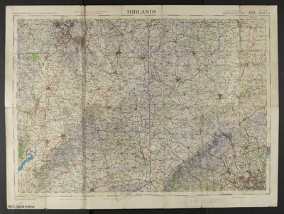
Midlands, Air Chart, Sheet 8
Title
Midlands, Air Chart, Sheet 8
Description
Ordnance Survey air chart of the Midlands, scale 1/4 inch to one mile, sheet 8. A triangular route has been marked on in blue chinagraph.
Creator
Date
1942
Coverage
Language
Type
Format
One colour chart
Publisher
Rights
This content is available under a CC BY-NC 4.0 International license (Creative Commons Attribution-NonCommercial 4.0). It has been published ‘as is’ and may contain inaccuracies or culturally inappropriate references that do not necessarily reflect the official policy or position of the University of Lincoln or the International Bomber Command Centre. For more information, visit https://creativecommons.org/licenses/by-nc/4.0/ and https://ibccdigitalarchive.lincoln.ac.uk/omeka/legal.
Identifier
CWhittleGG-160822-010025
Collection
Citation
Great Britain. Ordnance Survey, “Midlands, Air Chart, Sheet 8,” IBCC Digital Archive, accessed July 22, 2024, https://ibccdigitalarchive.lincoln.ac.uk/omeka/collections/document/18209.
Item Relations
This item has no relations.

