Browse Items (161 total)
- Tags: reconnaissance photograph
Sort by:
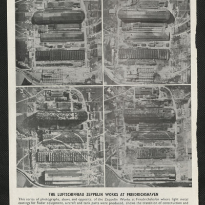
Zepplin works at Friedrichshaven
Four photographs captioned 'The Luftschiffbau Zepplin works at Friedrichshafen'. They show the same area over a period of time beginning in February 1943 and shows the works being camouflaged and eventually destroyed by bombing. The second page of…
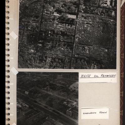
Zeitz oil refinery
Top - reconnaissance photograph of a almost totally destroyed industrial facility. A few buildings towards the top of the photograph appear intact. Captioned 'Zeitz oil refinery. Submitted with description 'Aerial photo of Zeltz [sic] oil refinery…
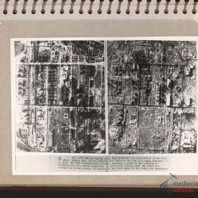
Zeitz Braunkohle-Benzin synthetic oil plant
Vertical aerial photographs showing on the left an industrial area with roads and buildings and on the right the same area with most of the structures destroyed. Explanatory text underneath 'Zeitz. The left hand photograph shows this synthetic oil…
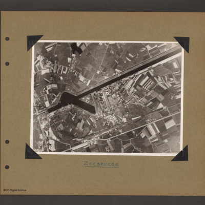
Zeebrugge
Aerial vertical photograph of canal and dock basin. A canal runs from top right to centre left. At the left end is a basin runing from the canal towards the bottom right. To the right of the basin is an industrial area. Below the industrial area…
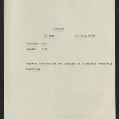
Wizernes, Edward King's 21st operation of his tour
Six items, Edward's very brief description of the operation, his navigation plot, the expected H2S return over the target. Two press clipping, captioned 'The result of Bomber Commands 12,000 lb bomb attacks on one of the Enemy's V.2 rocket sites'.…
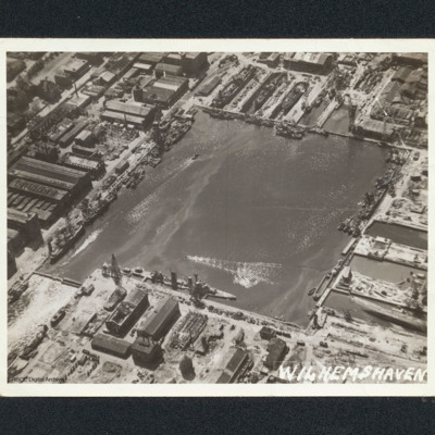
Wilhelmshaven docks
Oblique aerial photograph of a square dock area with several naval vessels. There are dry docks at the top. The majority of the workshop are undamaged. It is captioned 'Wilhemshaven' [sic].
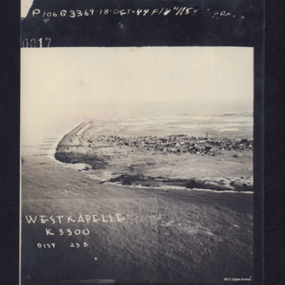
Westkapelle
Photograph shows coastline with breached sea wall, captioned 'WESTKAPELLE K3300, Dist 23B, 0017 106G3369.18 Oct .44 F/8".115 Degrees'. Reverse, captioned 'Oblique Westkapelle Netherlands'.
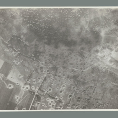
Watten
Reconnaissance photograph showing open countryside with fields. Road runs top left to middle right and another from middle to bottom. The whole bottom half of the image is covered with craters. On the reverse 'WATTEN. THE WHOLE TARGET AREA HAS BEEN…
Vlissingen
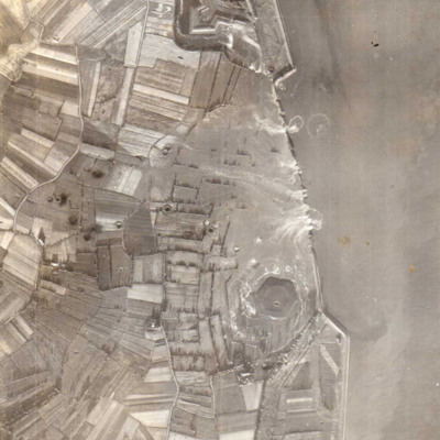
A vertical aerial photograph showing several new breaches in the sea defences with areas of land in process of being flooded. Submitted with caption; “Sea wall broken at Flushing.” Fort Rammekens is at the top of the photograph, with village of…
Vallo-Taneberg oil refinery
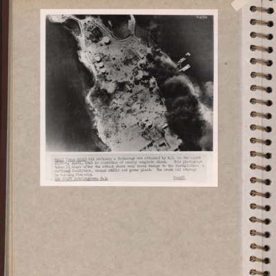
Reconnaissance photograph of an oil refinery on a peninsular with large plume of smoke from damaged oil tanks upper right area. Oslofjord is to the left with Prinds Christians Batterie just visible on the edge top left. Explanatory note underneath…
Valenciennes, Edward King's 16th operation of his tour
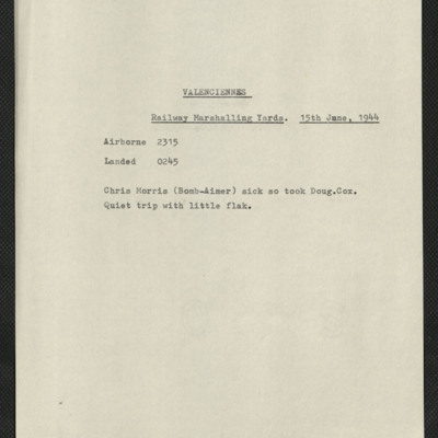
Five items, Edward's brief description of the operation their bomb aimer was sick so took replacement, quiet trip. Edward's navigation plot, and an indication of the H2S plot when over the target. There are two press clippings, the first has a…
Vaires marshalling yard
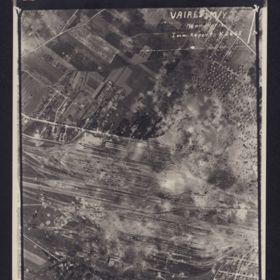
Photograph of a marshalling yard. Inverted caption: 'VAIRES M/Y Near Paris Imm Report K2665' includes directional arrow pointing north. Caption at top of photograph: '4063 106G.1316.8.JULY.44. F/36"//542SQDN←'.
Two reconnaissance photographs, northern Europe, 1944
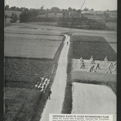
Two press cuttings. The first is captioned 'Frenchman waves to allied reconnaissance plane' and shows a road with two figures, one of them waving, the road running through small farmed fields, trees and more fields in the background.
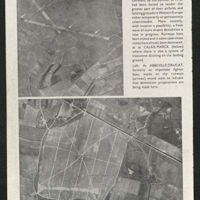
The second is…
The second is…
Two air to ground photographs
A press cutting captioned 'Retreat from the coast' taken in the summer of 1943 shows two coastal airfields Calaise/Marck and Abbeville/Drucat indicating that the Germans had started rendering their coastal airfields temporarily unserviceable.
Tripoli (motor transport dump)
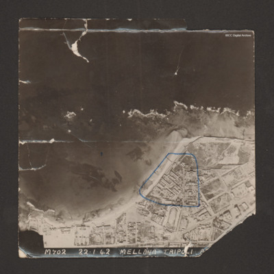
Reconnaissance photograph with a shoreline running from bottom left to middle right with sea at top and land below. Buildings cover the land; military storehouses near Via Cannizzaro e Via Giuseppe Colombo are outlined in blue. Captioned 'M702…
Tripoli
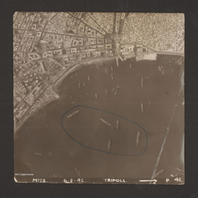
Reconnaissance photograph of harbour area. There are many ships, some of them identified as Anna Maria, Ariosto, Atlas, Bengasi, Beppe, Bosforo, Delia, and Pisani. Five ships have been enclosed by blue line. There is a breakwater along right side.…
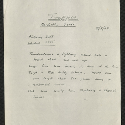
Trappes, Edward King's 14th operation of his tour
Six items, Edward's description of the operation to the railway centre, commenting on the thunderstorms encountered, his navigation plot, the expected H2S plot of the target with their track marked, a press cutting captioned 'Wrecked locomotives at…
Tours airfield
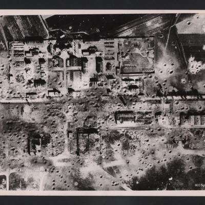
Vertical aerial photograph of an area showing severely destroyed buildings and large craters appearing throughout. A road is going through the middle of the buildings and the area is surrounded by fields, also covered with craters.
On the reverse…
On the reverse…
Tirpitz and armoured vehicles
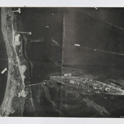
Two reconnaissance photographs. The first is low level of the Tirpitz moored stern on to the land. Jetty connects stern to land. Several other jetties are present and various smaller boats are moored or moving. Booms are seen above Tirpitz. Several…
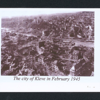
The city of Kleve in February 1945
Oblique aerial of a damaged city. In the centre is a river and a low hill. In the distance are undamaged buildings. Captioned 'The city of Kleve in February 1945'.
Targets
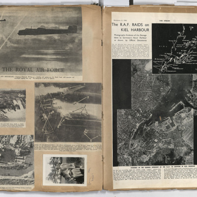
Left page: top, two flying Whitley aircraft passing over the Dutch coast.
Middle left, aerial view of Hamburg docks.
Middle right, bombing targets and fires in Gelsenkirchen.
Bottom left, bombing of Boulogne harbour.
Bottom right, a woman…
Middle left, aerial view of Hamburg docks.
Middle right, bombing targets and fires in Gelsenkirchen.
Bottom left, bombing of Boulogne harbour.
Bottom right, a woman…
Stettin
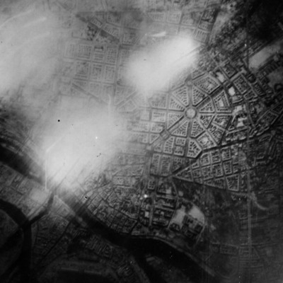
Reconnaissance photograph of Stettin. Urban area shown with the Centrum being clearly visible right of centre with roads radiating out. The West Oder river is to the middle left to bottom right of the photograph and parkland lower right above the…
St Leu D'Esserent
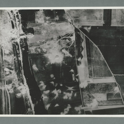
Reconnaissance photograph showing a wooded area running top to bottom on the left with a road, railway to its left. On the right two roads run from the bottom joining top centre. There are a large number of craters to the left of the river and top…
St Leu D'Esserent
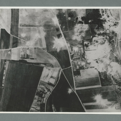
Reconnaissance photograph showing open countryside with fields. Road railway runs top right to bottom right. Road runs from bottom centre/right and splits, one going top top centre and the other to top left. There are a large number of craters on…
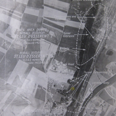
St Leu d'Esserent
Six aerial photographs of St Leu d'Esseent.
Photo 1 is a vertical target photograph with tunnels, railway and landing quay marked.
Photo 2 is a vertical aerial photograph taken during the operation. It is captioned '1962 TLP 5-8-44//8" 15000…
Photo 1 is a vertical target photograph with tunnels, railway and landing quay marked.
Photo 2 is a vertical aerial photograph taken during the operation. It is captioned '1962 TLP 5-8-44//8" 15000…

