Browse Items (1537 total)

  • Tags: aerial photograph

PBarfootW1624.jpg
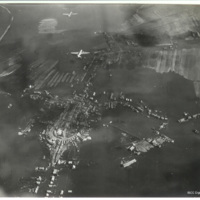
Oblique aerial photograph of the village of Nieuwerkerk on the island of Schouwen-Duiveland. The church of Johanneskerk and its surrounding road is visible in the centre but the surrounding buildings, streets and farmland are flooded. Over the…

PBarfootW1625.jpg
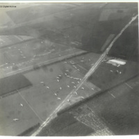
Oblique aerial photograph of glider landing zone LZ-S at Arnhem looking south. Numerous Horsas are scattered over six large fields and some are in a wood. Two in the left foreground have collided. The railway embankment runs left to right just beyond…

PBarfootW1626.jpg
Oblique aerial photograph of glider landing zone LZ-S at Arnhem with Horsas scattered across four fields with a well defined track crossing from bottom left to top right (A12) and the railway embankment upper left running to top right.

The photo…

PBarfootW1632.jpg
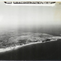
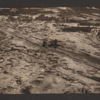
Oblique aerial photograph of a Cap Gris Nez. Beaches, dunes, fields and field boundaries can be seen with some buildings. Area behind beaches is covered in bomb craters. Captioned '6002 AC18 Earls Colne. 24 Mar 1945//K20 6 1/2'.

Identification…

PBarfootW1633.jpg
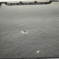
Oblique aerial photograph of Rockall islet, with rock centre of photograph. Captioned: '6012. AC26. Earls Colne 10 Apr’45//K20 6 1/2'.

The description of this item is partially based on information provided by the donor. This item was sent to…

PBarfootW1636.jpg
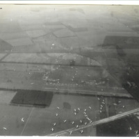
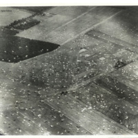
Oblique aerial photograph taken during the drop showing a field and wood landscape covered with parachutes, the majority discarded and the rest open as paratroopers land. Identified as west of Wolfheze in the area known as Drop Zone ‘X’. The…

PBarfootW1637.jpg
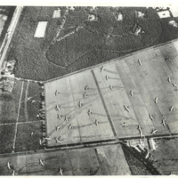
Reconnaissance photograph of gliders which have landed in a field, showing skid marks. The majority of the gliders are Horsa's, with three of the larger Hamilcar gliders visible in the field to the right. This is drop zone Z for Operation Market…

PBarfootW1638.jpg
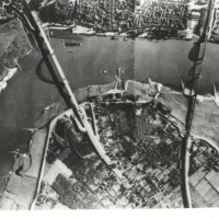
Reconnaissance photograph of a bend in the Waal river at Nijmegen, spanned by two cantilever bridges. The Waalbrug road bridge to the left and the Snelbinder rail bridge to the right. There are docks along river bank and jetties on the opposite side.…

PBarfootW1644.jpg
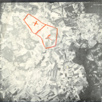
Reconnaissance photograph taken at high altitude showing fields and woods with Rambouillet and the Jardin Anglais in the top right-hand corner. The settlements of Gazeran, Saint-Hilarion, Orcemont and Orphin are also visible. Two areas are outlined…

PBoldyDA15010081.jpg
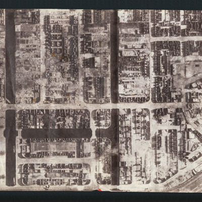
Aerial inclined photograph of a built up area, with a rectangular grid plan of streets. A large open space is visible in the top-right quadrant.

PCluettAV1517.jpg
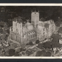
Aerial oblique photograph of Lincoln Cathedral, low angled, taken at very low altitude, camera pointing north east. Minster Yard, Priory Gate, Exchequer Gate are visible, no pedestrians or traffic visible except a bus, trees in full leaf, a group of…

MCluettAV120946-150515-180001.jpg
Propaganda leaflet featuring an aerial vertical photograph of Hamburg after a Royal Air Force operation. Buildings are either completely destroyed or gutted, light falling through the gaping windows. Text describes fronts closing in, the Royal Air…

PGreenLC1606.jpg
Oblique aerial photograph taken at low altitude of the canal and sluice gate in centre. Surrounding area is covered in bomb craters with occasional vehicle track. The canal, mainly drained and with no vessels visible, runs from top left to bottom…

PGreenLC1608.jpg
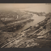
Oblique aerial photograph taken at low level showing port facilities, buildings, rail sidings and several vessels. The port is Bremerhaven. In the centre two waterways separated by a spur of land covered with dockyard buildings and cranes. On the…

PBubbGJ16010047.jpg
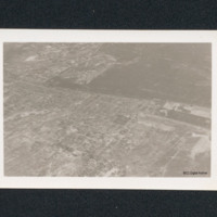
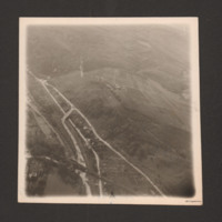
Oblique aerial photograph of river valley with roads, railways and at bottom left, a open area of water. At lower right one road runs from middle left to bottom centre which splits into three from two junctions. Railway line runs along road and…

PBubbGJ16010051.jpg
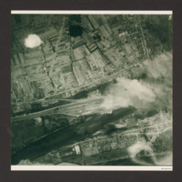
Two aerial photographs.
The first is a target photograph taken at high level. Bombs are visible falling to centre left. A railway is seen running left to right in the bottom half, with marshalling yard in the centre. Below the railway is a river…

PBubbGJ16010054.jpg
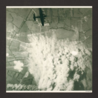
Target photograph shows extensive smoke from explosions obscuring the main part of the photograph. The surrounding view is of a rural area with fields and several converging minor roads. A Lancaster is visible top centre going from left to right.…

PBubbGJ16010057.jpg
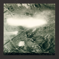
Target photograph of Nevers railway yards. Flak burst or photoflash obscures middle of photograph. Railway sidings and three roundhouses can be seen together with main railway line running from lower left to top right surrounded by built-up areas and…

PBubbGJ1602.jpg
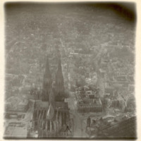
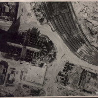
Oblique aerial photograph of Köln cathedral and surrounding area all showing heavy bomb damage. Photograph is looking west with railway station in the right hand corner.

PBaileyHH1608.jpg
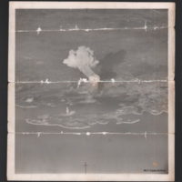
Oblique aerial photograph of the harbour of Pula in Croatia centered on Otočić Sveti Andrija. The photograph focus is poor and has been folded several times resulting in horizontal tear marks cross the image. A big smoke cloud is rising from an…

PBaggJG1612-1.jpg
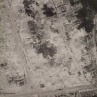
Aerial reconnaissance photograph of Caen showing heavy bombing damage. A few gutted buildings are still standing and the roads have been cleared of debris. No traffic visible.

Additional information about this item has been kindly provided by the…

PBaggJG1613-1.jpg
Low altitude aerial reconnaissance photograph showing damage to and around Cologne cathedral: the railway station is partially visible on the right with extensive damage to canopy and some track damage. Rubble has been cleared, several tramcars can…

PBaggJG1611-1.jpg
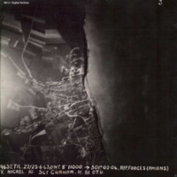
Target photograph showing coastal village of Ault, just south of the Somme estuary. Coastline and beach can be seen, with village to the left with roads radiating out into countryside. Captioned '3, 9637.TIL.22/23.6.43//NT.8" 11000: 301.02.04.…
Output Formats

atom, dc-rdf, dcmes-xml, json, omeka-xml, rss2