Browse Items (1413 total)
- Tags: aerial photograph
Sort by:
Wizernes
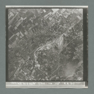
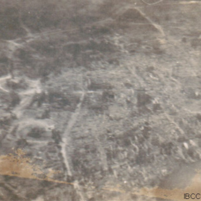
Target photograph showing open countryside with fields and roads. In the centre is a large area with many craters. Caption '242, W.S., 24.6.44, 8", 17300, 1`12 degrees, R., R., 617'. On the reverse '51:96/26'.
Wizernes
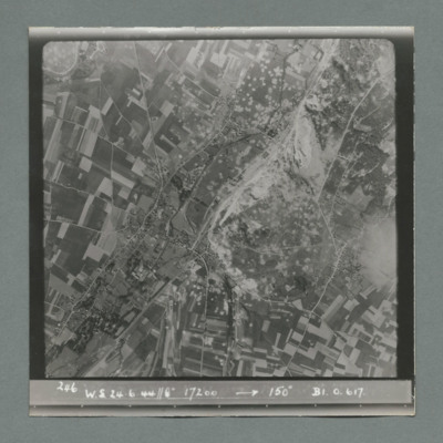
Target photograph showing open countryside with fields and roads. In the centre a large area with many craters. Caption '246, W.S., 24.6.44, 8", 17200, 150 degrees, B1, O, 617'. On the reverse '51:96/28'.
Winnipeg
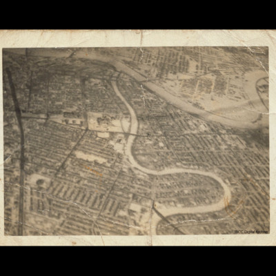
Oblique aerial photograph of central Winnipeg looking due east with the Red River meandering top left to middle right and the Assiniboine River meandering from bottom centre to top centre joining it. The Trans Canada Highway runs top left to bottom…
Tags: aerial photograph
Winnipeg
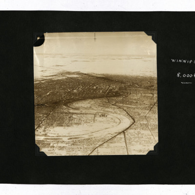
Four oblique aerial photographs.
Photo 1 and 2 are views of the snowy city, captioned 'Winnipeg 8,000 ft'.
Photo 3 is a view of houses, captioned 'Winnipeg 1,000' ft. There is also a ticket from the Winnipeg Electric Company.
Photo 4 is a snowy…
Photo 1 and 2 are views of the snowy city, captioned 'Winnipeg 8,000 ft'.
Photo 3 is a view of houses, captioned 'Winnipeg 1,000' ft. There is also a ticket from the Winnipeg Electric Company.
Photo 4 is a snowy…
Tags: aerial photograph; training
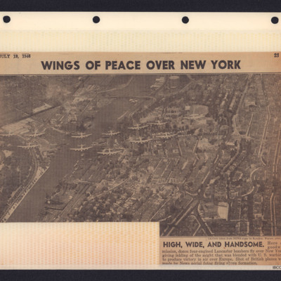
Wings of Peace over New York
Newspaper cutting with photograph showing 12 Lancasters over New York City. 'High, Wide, and Handsome. Here on goodwill mission, dozen four-engined Lancaster bombers fly over New York giving inkling of the might that was blended with U.S. warbirds to…
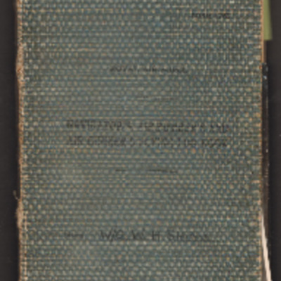
William Shaw’s navigator’s, air bomber’s and air gunner’s flying log book
Navigator’s, air bomber’s and air gunner’s flying log book for W H Shaw, wireless operator, covering the period from 26 November 1943 to 16 February 1947. Detailing his flying training, operations flown and post war flying with 37 Squadron, 168…
Tags: 37 Squadron; aerial photograph; Air Gunnery School; aircrew; Anson; B-24; bombing; C-47; Dominie; Heavy Conversion Unit; Operational Training Unit; Oxford; Proctor; RAF Abu Sueir; RAF Aqir; RAF Evanton; RAF Shallufa; RAF Yatesbury; target photograph; training; Wellington; wireless operator; wireless operator / air gunner; York
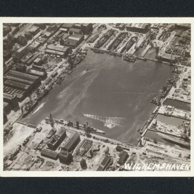
Wilhelmshaven docks
Oblique aerial photograph of a square dock area with several naval vessels. There are dry docks at the top. The majority of the workshop are undamaged. It is captioned 'Wilhemshaven' [sic].
Wilhelmshaven
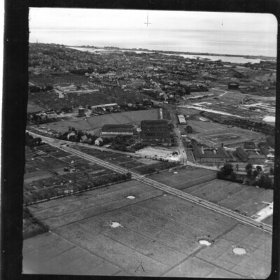
An oblique aerial photograph of a Wilhelmshaven. In the foreground are fields with bomb craters with Ebkeriege-Kaserne then the town behind. In the distance are docks with naval vessels and the North Sea.
Identification kindly provided by Andrew…
Identification kindly provided by Andrew…
Tags: aerial photograph
Wilhelmshaven
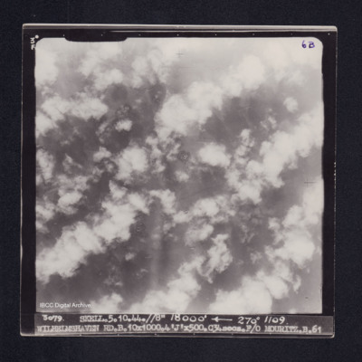
Target photograph of Wilhelmshaven. Completely obscured by cloud, smoke, dust and bomb explosions. Captioned '3°F', '6B', '3079 SKELL.5.10.44.//8" 18000' [arrow] 270° 1109 WILHELMSHAVEN RD.B.10X1000.4'J'X500.C34secs.F/O MOURITZ.B.61'. On the…
Wilhelmshaven
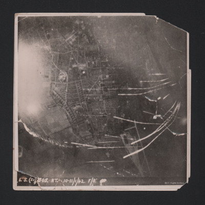
Target photograph showing built up area of Wilhelmshaven. Photograph is orientated with north to the left. Ems-Jade-Kanal is running from top to middle right of photograph. Railway goods yard towards bottom. Streaks of light and anti-aircraft fire…
Wilhelmshaven
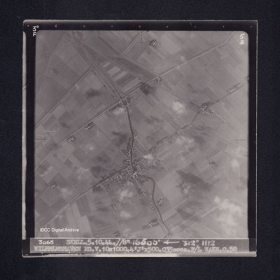
Target photograph of Caroliniensel and Harlesiel on the Harle river. Captioned '3°F', '5B', '3065 SKELL.5.10.44.//8" 16500' [arrow] 312° 1112 WILHELMSHAVEN RD.V.10X1000.4'J'X500.C35secs.F/L WAKE.C.50' On the reverse '[underlined] F/LT WAKE 5.10.44.…
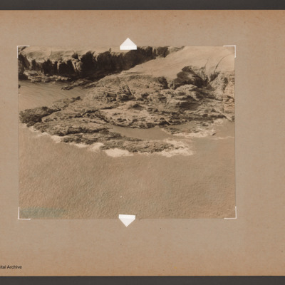
Wick coastline
Oblique aerial photograph of a rocky headland near Wick.
Identification kindly provided by Andy Macdonald and Geoff Everitt of the Unidentified photos of the British Isles Group.
Identification kindly provided by Andy Macdonald and Geoff Everitt of the Unidentified photos of the British Isles Group.
Tags: aerial photograph
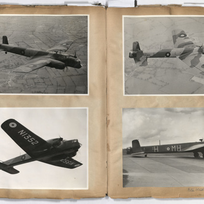
Whitleys
Left page: top, left and right, Whitley NI352 in flight above fields.
Bottom left, a view of Whitley NI352 in flight from below.
Bottom right, Whitley H MH on a runway with chocks under the front wheels, annotated 'Bob's Whitley MH H'.
Bottom left, a view of Whitley NI352 in flight from below.
Bottom right, Whitley H MH on a runway with chocks under the front wheels, annotated 'Bob's Whitley MH H'.
Tags: 51 Squadron; aerial photograph; Whitley
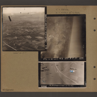
What is it?
Top left - oblique aerial photograph of open countryside with fields and a few woods, dotted with farms. Many dark 'blots' which could be anti-aircraft fire bursts. Captioned 'A03 FEL 21.12.42//M8:1000 J.p.48'. Top right - oblique aerial photograph -…
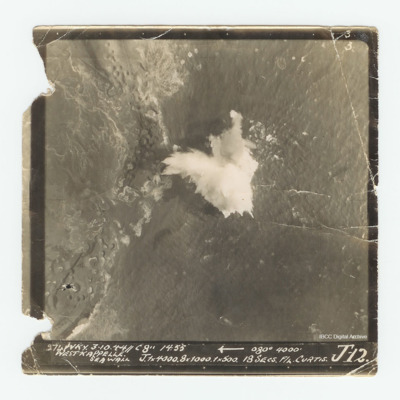
Westkappelle
Target photograph of the Westkappelle seawall. Captioned Captioned '3 3 274 WKY. 3.10.44//C 8" 14:55 [arrow] 080° 4000' West Kappelle Sea Wall J. 1x4000. 8x1000. 1x500. 18 secs F/L Curtis J 12.'.
Westkapelle Dyke and Dortmund
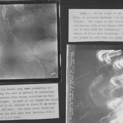
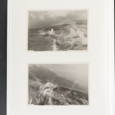
Two target photographs from an album.
Photo 1 is Westkapelle dyke which was bombed to flood Walchern Island, which was below sea level.
Photo 2 is a night attack on Dortmund, most of the image obscured by anti-aircraft fire and target indicators.
Photo 1 is Westkapelle dyke which was bombed to flood Walchern Island, which was below sea level.
Photo 2 is a night attack on Dortmund, most of the image obscured by anti-aircraft fire and target indicators.
Westkapelle
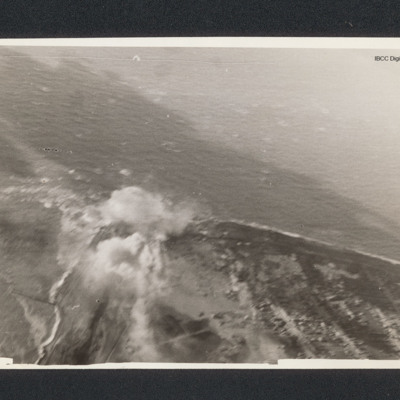
Target photograph of a coastline running from bottom right to centre left then bottom left. There is a bomb explosion centre left.
Westkapelle
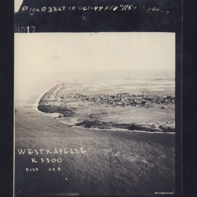
Photograph shows coastline with breached sea wall, captioned 'WESTKAPELLE K3300, Dist 23B, 0017 106G3369.18 Oct .44 F/8".115 Degrees'. Reverse, captioned 'Oblique Westkapelle Netherlands'.
Westkapelle
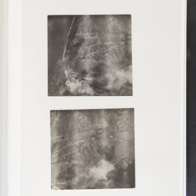
Top - coastline curving from top left to bottom centre. Some bomb explosions are visible bottom left on coast. Bottom - open ground with a built up area centre left. Bomb explosions bottom right quadrant.
Westkapelle
Top - coastline curving from top left to centre left and then bottom centre. Bomb explosions visible in centre just inland of coast. Bottom - coastline juts out from bottom to centre with bomb explosion on coastline at centre.
Tags: aerial photograph; bombing
West Essen
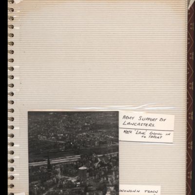
Bottom - oblique aerial photograph of town with railway running left to right through middle. Captioned 'Unknown town'. Submitted with description 'Oblique "Cook's tour" aerial photo of unknown town.'.
This is West Essen, the photo is taken…
This is West Essen, the photo is taken…
Tags: aerial photograph; bombing; Cook’s tour
West Capelle Dyk N
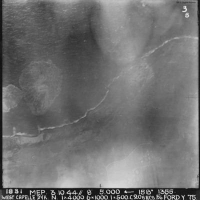
A vertical aerial photograph of the Westkapelle Dyke, Vlissingen. The coastline can be seen but little on the ground. annotated '1831 MEP 3.10.44// 8” 5,000 [arrow] 158[degrees] 1355. WEST CAPELLE DYK. N. 1 x 4000. 6x1000. 1x500.C 20 SECS. F/O…
West Bromwich
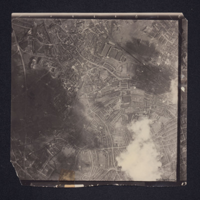
A vertical aerial photograph of West Bromwich. Canals and railway branches are clearly visible.
Identification kindly provided by Richard Evans of the Unidentified photos of the British Isles Group.
Identification kindly provided by Richard Evans of the Unidentified photos of the British Isles Group.
Tags: aerial photograph
Wesel Cooks tour
Oblique aerial photograph of a city with much bomb damage. Submitted with caption 'Wesel Cooks tour'. Willibrordi Cathedral is to far left centre.
Tags: aerial photograph; bombing; Cook’s tour

