Browse Items (33 total)
- Temporal Coverage is exactly "1944-10-03"
Sort by:
Walcheren
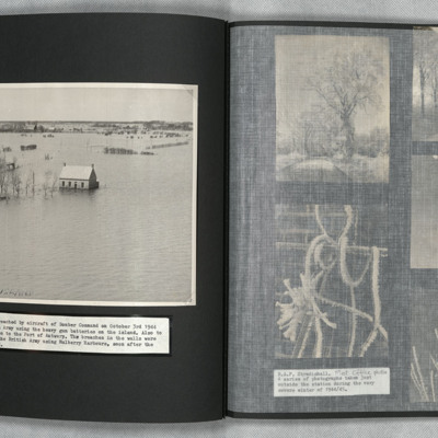
An oblique aerial photograph of a flooded landscape. The sea walls had been breached to stop the German Army using heavy gun batteries.
Tags: aerial photograph; bombing
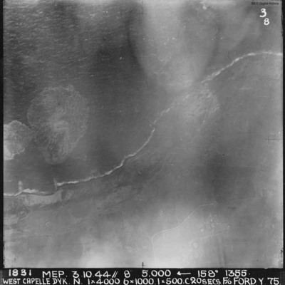
West Capelle Dyk N
A vertical aerial photograph of the Westkapelle Dyke, Vlissingen. The coastline can be seen but little on the ground. annotated '1831 MEP 3.10.44// 8” 5,000 [arrow] 158[degrees] 1355. WEST CAPELLE DYK. N. 1 x 4000. 6x1000. 1x500.C 20 SECS. F/O…
Westkapelle
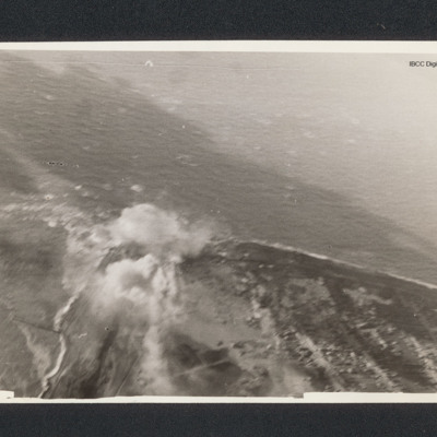
Target photograph of a coastline running from bottom right to centre left then bottom left. There is a bomb explosion centre left.
Westkapelle
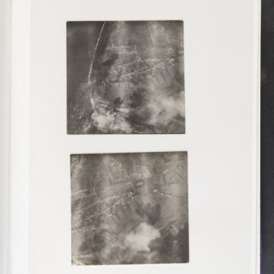
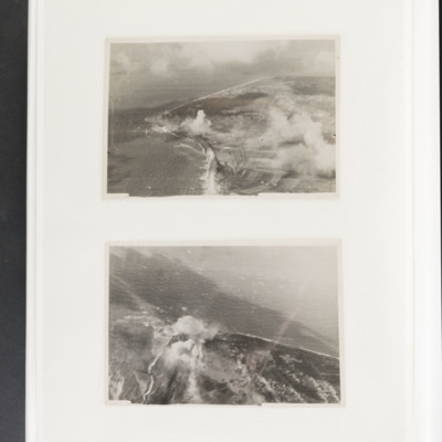
Top - coastline curving from top left to bottom centre. Some bomb explosions are visible bottom left on coast. Bottom - open ground with a built up area centre left. Bomb explosions bottom right quadrant.
Westkapelle
Top - coastline curving from top left to centre left and then bottom centre. Bomb explosions visible in centre just inland of coast. Bottom - coastline juts out from bottom to centre with bomb explosion on coastline at centre.
Tags: aerial photograph; bombing
Westkapelle Dyke and Dortmund
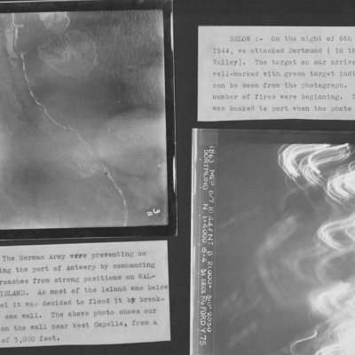
Two target photographs from an album.
Photo 1 is Westkapelle dyke which was bombed to flood Walchern Island, which was below sea level.
Photo 2 is a night attack on Dortmund, most of the image obscured by anti-aircraft fire and target indicators.
Photo 1 is Westkapelle dyke which was bombed to flood Walchern Island, which was below sea level.
Photo 2 is a night attack on Dortmund, most of the image obscured by anti-aircraft fire and target indicators.
Westkapelle, October 3, 1944
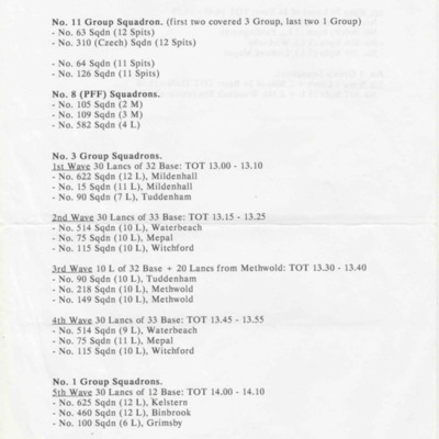
A battle order for the attack on Westkapelle, Vlissingen. It covers the fighter support, Pathfinders and the bomber squadrons and bases involved.
Tags: 1 Group; 100 Squadron; 101 Squadron; 103 Squadron; 105 Squadron; 109 Squadron; 115 Squadron; 12 Squadron; 149 Squadron; 15 Squadron; 166 Squadron; 218 Squadron; 3 Group; 300 Squadron; 460 Squadron; 514 Squadron; 550 Squadron; 576 Squadron; 582 Squadron; 617 Squadron; 622 Squadron; 625 Squadron; 626 Squadron; 75 Squadron; 90 Squadron; bombing; Lancaster; Mosquito; Pathfinders; RAF Binbrook; RAF Elsham Wolds; RAF Faldingworth; RAF Grimsby; RAF Kelstern; RAF Kirmington; RAF Ludford Magna; RAF Mepal; RAF Methwold; RAF Mildenhall; RAF North Killingholme; RAF Tuddenham; RAF Waterbeach; RAF Wickenby; RAF Witchford; RAF Woodhall Spa; Spitfire
Westkappelle
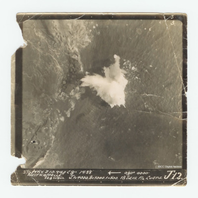
Target photograph of the Westkappelle seawall. Captioned Captioned '3 3 274 WKY. 3.10.44//C 8" 14:55 [arrow] 080° 4000' West Kappelle Sea Wall J. 1x4000. 8x1000. 1x500. 18 secs F/L Curtis J 12.'.

