Browse Items (74 total)

  • Spatial Coverage is exactly "Netherlands--Walcheren"

CCuthillCR-180818-010005.jpg
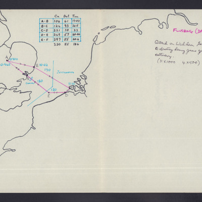
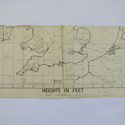
Outline map of England and north west Europe. Shows route to Flushing. Day operation. Notes include some navigation data (heading/distance/time table). Attack on Walcheren Island to breach sea and to destroy heavy guns defending the Scheldt Estuary.…

SPerryWRP1317696v60011.pdf
A short history of 106 Squadron. Covers formation in world war one. Reformed in 1938 with Hinds and Battles. Equipped with Hampden at beginning of the war. Initially a advanced training unit. Became operational in September 1940. Describes early…

SWeirG19660703v110004-0014.jpg
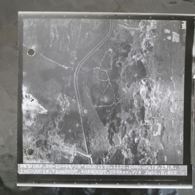
Target photograph of open heathland with canalised ditch running top to bottom. The ditch has tracks either side and several crossing points. Craters are visible, particularly in lower left with one row crossing ditch with one crater visible within…

SWeirG19660703v110004-0001.jpg
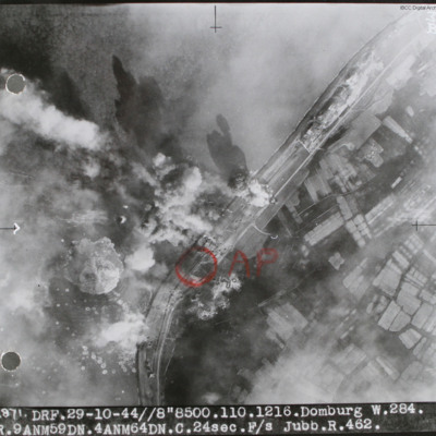
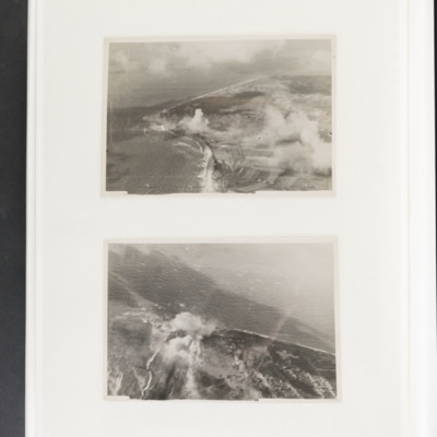
Target photograph of sea wall with sea on left and land on right. Many bomb explosions visible. Annotated with aiming point in red ink. Captioned '2871 DRF 29-10-44//8"8,500. 110.1216. Domburg W.284, R.9 ANM59DN.4AMN64DN.C.24sec.F/S Jubb.R.462'.…

SWeirG19660703v100015.jpg
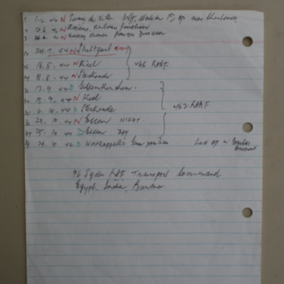
List of twelve operations from 1 June 1944 to 29 October 1944.

This item was sent to the IBCC Digital Archive already in digital form. No better quality copies are available.

NWeedenRC170409-040006.jpg
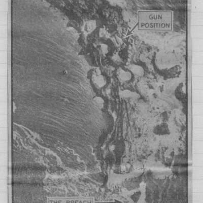
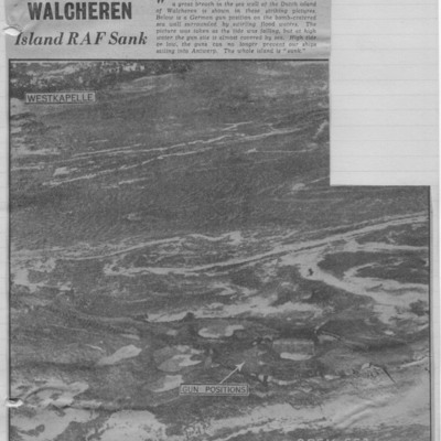
Article with b/w photograph of shoreline with flooded craters marked as 'gun positions'. Breach indicated by arrow. Explanatory text explains photo shows sea water swirling through breach made by RAF blockbusters in dyke guarding island of Walcheren.

Tags:

NWeedenRC170409-040005.jpg
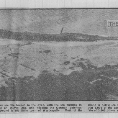
Photograph of shoreline with 'breach' indicated by arrow and shows flooded area. Text explains that the photograph shows breach in dyke with sea rushing in. Germans report 6000 of garrison trapped by floods.

NWeedenRC170409-040004.jpg
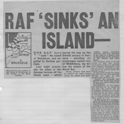
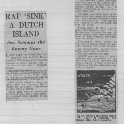
Article with small map and text explaining that the whole of a German fortress on island of Walcheren off the Dutch coast lay below the waters of the north sea. The RAF used 12,000 lb bombs to breach the sea wall.

Tags:

NWeedenRC170409-040003.jpg
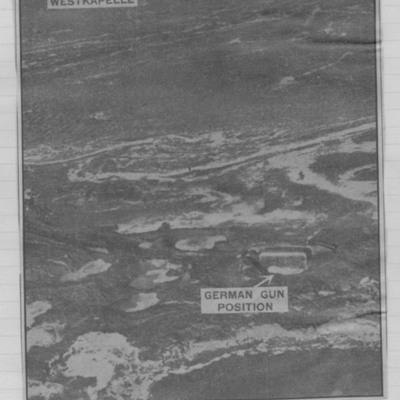
Article with b/w photograph showing shoreline with water filled cratered gun positions. In the distance top a village. Explanatory text explains that photograph showed results of RAF blasting of the sea wall near Westkapelle on island of Walcheren.

Tags:

NWeedenRC170409-040002.jpg
Describes damage after RAF 12,000 lb bombs used to breach sea wall on island of Walcheren. Sea engulfed German guns and defence posts. Area 1000 yards by 700 yards flooded. Map shows area.

NWeedenRC170409-040001.jpg
Photograph of flooded craters on shoreline with village at top. Explanatory text describes what happened after RAF 12,000-pounders tore breach in sea wall of Dutch island of Walcheren.

Tags:

MPotterPL1878961-150914-24.jpg
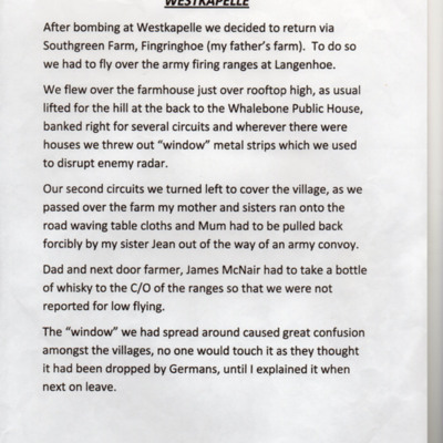
Account of return from an operation to Westkapelle when they flew over authors father's farm and local village where they threw out window.

MPotterPL1878961-150914-07.pdf
Starts with account of operation to Paris on 3 May 1944 when attacked by Me 109 and writes of crew actions. Continues with list of operations giving details of target, anti-aircraft fire, flight time, some bomb loads, events, results. From 3 August…

PEleyNJ1620.jpg
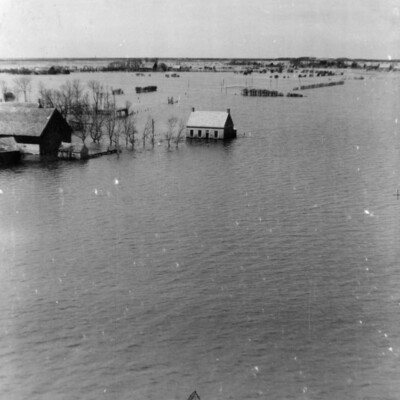
A very low level oblique aerial photograph of Walchern Floods, shows buildings partially submerged in water, submitted with caption; “Part of Holland flooded by Germans at Walchern.”

MFordTA1585520-170411-32.jpg
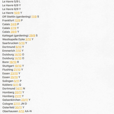
A list of 35 operations undertaken by Terry Ford. It includes dates and aircraft used.

MFordTA1585520-170411-18.jpg
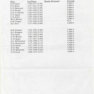
A list of aircrew, times of take off and landings and altitude flown for 75 squadron. 21 Lancasters attacked the dyke at Westkapelle.

SFordTA1585520v20028-0001.jpg
A planning chart from Mepal to Westkapelle. On the front are calculations and on the reverse a sketch of the target.

PFordTA17040007.jpg
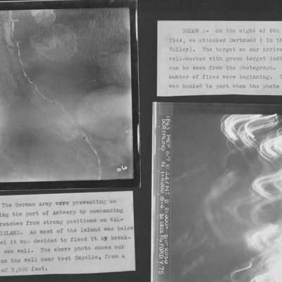
Two target photographs from an album.
Photo 1 is Westkapelle dyke which was bombed to flood Walchern Island, which was below sea level.
Photo 2 is a night attack on Dortmund, most of the image obscured by anti-aircraft fire and target indicators.

PFordTA17030006.jpg
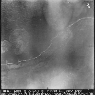
A vertical aerial photograph of the Westkapelle Dyke, Vlissingen. The coastline can be seen but little on the ground. annotated '1831 MEP 3.10.44// 8” 5,000 [arrow] 158[degrees] 1355. WEST CAPELLE DYK. N. 1 x 4000. 6x1000. 1x500.C 20 SECS. F/O…

PThomasAF20040027.jpg
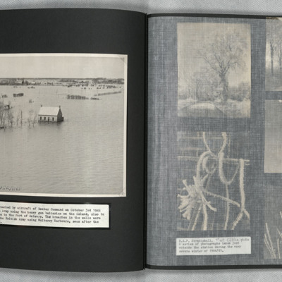
An oblique aerial photograph of a flooded landscape. The sea walls had been breached to stop the German Army using heavy gun batteries.

Five Group Newsletter, number 27, October 1944. Includes a foreword by the Air Officer Commanding, and features about operations, gardening, signals, tactics, air bombing, navigation, this month's bouquets, radar navigation, training, second thoughts…

PGrundyAF1534.jpg
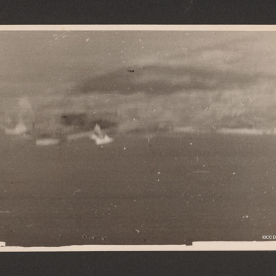
Target photograph of bomb explosion on a coastline running across image. On the reverse '192 Squadron, Attack on Walcheren, Oct 1944'.

PGrundyAF1515.jpg
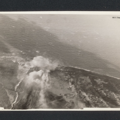
Target photograph of a coastline running from bottom right to centre left then bottom left. There is a bomb explosion centre left.

PGrundyAF15010040.jpg
Top - coastline curving from top left to centre left and then bottom centre. Bomb explosions visible in centre just inland of coast. Bottom - coastline juts out from bottom to centre with bomb explosion on coastline at centre.

PGrundyAF15010039.jpg
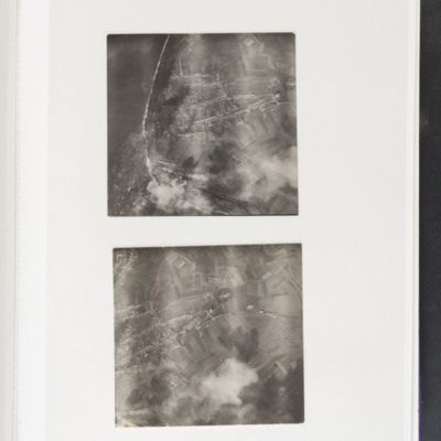
Top - coastline curving from top left to bottom centre. Some bomb explosions are visible bottom left on coast. Bottom - open ground with a built up area centre left. Bomb explosions bottom right quadrant.
Output Formats

atom, dc-rdf, dcmes-xml, json, omeka-xml, rss2