Browse Items (7 total)
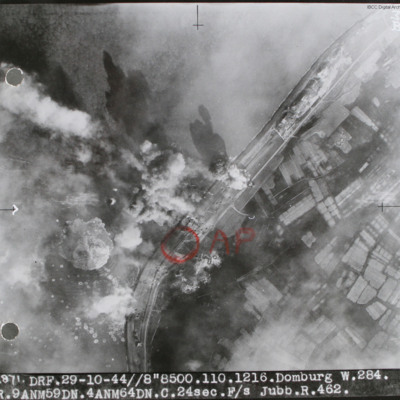
- Spatial Coverage is exactly "Netherlands--Domburg"
Was it all a Dream
Tags: 1 Group; 103 Squadron; 166 Squadron; 1660 HCU; 1667 HCU; 4 Group; 5 Group; 576 Squadron; 8 Group; 83 OTU; Advanced Flying Unit; Air Observers School; aircrew; Anson; B-17; Bolingbroke; bomb aimer; bombing; Bombing and Gunnery School; briefing; Distinguished Flying Cross; flight engineer; Gee; ground personnel; H2S; Halifax; Halifax Mk 2; Halifax Mk 3; Halifax Mk 5; Heavy Conversion Unit; Initial Training Wing; lack of moral fibre; Lancaster; Lancaster Finishing School; Lincoln; Lysander; Master Bomber; medical officer; memorial; mid-air collision; military living conditions; military service conditions; mine laying; Mosquito; Oboe; Operational Training Unit; Pathfinders; perception of bombing war; prisoner of war; promotion; RAF Acaster Malbis; RAF Bicester; RAF Binbrook; RAF Blyton; RAF Brampton; RAF Cosford; RAF Elsham Wolds; RAF Hawarden; RAF Hemswell; RAF Kimbolton; RAF Kirmington; RAF Llandwrog; RAF Lossiemouth; RAF Moreton in the Marsh; RAF Paignton; RAF Penrhos; RAF Peplow; RAF Sandtoft; RAF Scampton; RAF St Athan; RAF Swinderby; RAF Worksop; RAF Wyton; Scarecrow; searchlight; superstition; Tiger force; training; Wellington; Women’s Auxiliary Air Force
Harry Whittaker's flying log book
Tags: 148 Squadron; 156 Squadron; 158 Squadron; 1652 HCU; 17 OTU; 19 OTU; 35 Squadron; 635 Squadron; Advanced Flying Unit; air gunner; aircrew; Anson; Blenheim; bomb aimer; bombing; Botha; crash; Goodwill tour of the United States (1946); Halifax; Hampden; Heavy Conversion Unit; Lancaster; Magister; Normandy campaign (6 June – 21 August 1944); Operation Dodge (1945); Operational Training Unit; Pathfinders; RAF Downham Market; RAF Dumfries; RAF Graveley; RAF Kinloss; RAF Lissett; RAF Marston Moor; RAF Silverstone; RAF Stradishall; RAF Upwood; RAF Warboys; tactical support for Normandy troops; training; Wellington; Whitley
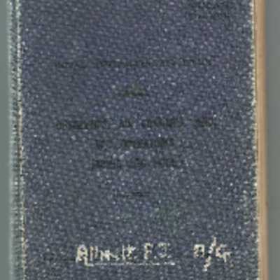
Frank J Allnutt’s RAAF observer’s air gunner’s and W/T operator’s flying log book
Tags: 1662 HCU; 27 OTU; 625 Squadron; air gunner; aircrew; Battle; bombing; Bombing and Gunnery School; bombing of Luftwaffe night-fighter airfields (15 August 1944); Halifax; Halifax Mk 2; Halifax Mk 5; Heavy Conversion Unit; Initial Training Wing; Lancaster; Lancaster Finishing School; Normandy campaign (6 June – 21 August 1944); Operational Training Unit; Oxford; RAF Blyton; RAF Hemswell; RAF Ingham; RAF Kelstern; RAF Lichfield; tactical support for Normandy troops; training; Wellington
Ernest Cutts’ air gunner's flying log book
Tags: 1652 HCU; 27 OTU; 466 Squadron; 467 Squadron; air gunner; Air Gunnery School; aircrew; Battle; bombing; Halifax; Halifax Mk 2; Halifax Mk 3; Heavy Conversion Unit; Lancaster; Lancaster Mk 1; Lancaster Mk 3; Me 410; Operation Dodge (1945); Operational Training Unit; Oxford; RAF Driffield; RAF Lichfield; RAF Marston Moor; RAF Metheringham; training; Wellington


