Browse Items (50 total)
- Spatial Coverage is exactly "France--Tours"
Operational notes
Tags: 514 Squadron; 582 Squadron; 7 Squadron; aircrew; anti-aircraft fire; bombing; bombing of the Juvisy, Noisy-le-Sec and Le Bourget railways (18/19 April 1944); Bombing of Trossy St Maximin (3 August 1944); flight engineer; Heavy Conversion Unit; Lancaster; Lancaster Mk 2; Lancaster Mk 3; Martinet; Master Bomber; missing in action; navigator; Normandy campaign (6 June – 21 August 1944); Operational Training Unit; Pathfinders; pilot; RAF Little Staughton; RAF Warboys; RAF Waterbeach; tactical support for Normandy troops; training; V-1; V-weapon; Window
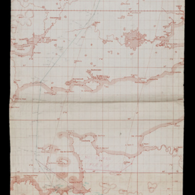
Navigation chart - operation number 19 (Tours)
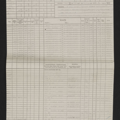
Navigation log - Op No 19 (Tours)
Time out for war
Tags: 1 Group; 12 Squadron; 1653 HCU; 1656 HCU; 3 Group; 50 Squadron; 576 Squadron; 84 OTU; Advanced Flying Unit; aircrew; Anson; bombing of the Boulogne E-boats (15/16 June 1944); bombing of the Le Havre E-boat pens (14/15 June 1944); Bombing of Trossy St Maximin (3 August 1944); Cook’s tour; coping mechanism; crewing up; Distinguished Flying Cross; faith; Gee; H2S; Halifax; Halifax Mk 2; Heavy Conversion Unit; Initial Training Wing; Lancaster; Lancaster Finishing School; Master Bomber; military living conditions; military service conditions; mine laying; navigator; Nissen hut; Normandy campaign (6 June – 21 August 1944); Operation Dodge (1945); Operational Training Unit; Pathfinders; RAF Chedburgh; RAF Desborough; RAF Fiskerton; RAF Halfpenny Green; RAF Hemswell; RAF Lindholme; RAF Methwold; RAF Sturgate; RAF Torquay; RAF Waddington; RAF Wickenby; Stirling; tactical support for Normandy troops; target indicator; training; V-1; V-2; V-weapon; Wellington
Transcript of interview with Allan Edgar
Tags: 1 Group; 49 Squadron; 83 Squadron; air gunner; aircrew; anti-aircraft fire; bomb aimer; bombing; Bombing of Mailly-le-Camp (3/4 May 1944); crash; crewing up; Distinguished Flying Cross; flight engineer; Fw 190; ground personnel; He 111; Heavy Conversion Unit; Hurricane; Lancaster; Lancaster Finishing School; Lincoln; mess; navigator; Operational Training Unit; pilot; RAF Fiskerton; RAF Silverstone; RAF Syerston; RAF Turweston; RAF Winthorpe; RAF Wittering; RAF Woodbridge; Spitfire; Stirling; target indicator; training; Wellington; wireless operator / air gunner; Women’s Auxiliary Air Force
Last of the Tail Gun Charlies - Ronald Carter's Biography
At the age of 17, Ronald volunteered to join the Royal Air Force in November 1942. After basic training, Ronald was selected for gunnery and wireless operator training, becoming…
Tags: 44 Squadron; air gunner; aircrew; anti-aircraft fire; bale out; bombing; Bombing of Mailly-le-Camp (3/4 May 1944); bombing of Nuremberg (30 / 31 March 1944); bombing of the Creil/St Leu d’Esserent V-1 storage areas (4/5 July 1944); bombing of Toulouse (5/6 April 1944); Caterpillar Club; crewing up; mine laying; Normandy campaign (6 June – 21 August 1944); prisoner of war; RAF Dunholme Lodge; RAF Ringway; RAF Waddington; Stalag 3A; Stalag Luft 7; tactical support for Normandy troops; the long march; training; wireless operator / air gunner
Tribute to a Pathfinder captain
Tags: 156 Squadron; aerial photograph; aircrew; anti-aircraft fire; bombing of Dresden (13 - 15 February 1945); bombing of Luftwaffe night-fighter airfields (15 August 1944); bombing up; crewing up; debriefing; Distinguished Flying Cross; Distinguished Service Order; fear; flight engineer; ground personnel; H2S; Halifax; Lancaster; Lancaster Finishing School; Master Bomber; Me 110; military service conditions; Mosquito; Normandy campaign (6 June – 21 August 1944); Oboe; Pathfinders; perimeter track; pilot; promotion; RAF Hemswell; RAF Lindholme; RAF Upwood; RAF Warboys; searchlight; superstition; tactical support for Normandy troops; target indicator; target photograph; training; V-1; V-weapon; Women’s Auxiliary Air Force
Evidence in Camera Vol 3 No 9
Harry Parkins' flight engineer log book
Tags: 148 Squadron; 1657 HCU; 199 Squadron; 50 Squadron; 576 Squadron; 630 Squadron; aircrew; Anson; bombing; bombing of Helgoland (18 April 1945); bombing of the Juvisy, Noisy-le-Sec and Le Bourget railways (18/19 April 1944); bombing of the Pas de Calais V-1 sites (24/25 June 1944); Bombing of Trossy St Maximin (3 August 1944); C-47; flight engineer; Heavy Conversion Unit; Ju 88; Lancaster; Lancaster Finishing School; Lincoln; mid-air collision; Normandy campaign (6 June – 21 August 1944); Operation Dodge (1945); Operation Manna (29 Apr – 8 May 1945); RAF East Kirkby; RAF Fiskerton; RAF Hemswell; RAF Scampton; RAF Shawbury; RAF Stradishall; RAF Sturgate; RAF Syerston; RAF Upwood; RAF Waddington; RAF Wigsley; Stirling; tactical support for Normandy troops; training; V-3; V-weapon
Tom Jones’ navigator’s, air bomber’s and air gunner’s flying log book
Tags: 1657 HCU; 622 Squadron; 7 Squadron; aircrew; anti-aircraft fire; B-24; bombing; bombing of the Normandy coastal batteries (5/6 June 1944); C-47; flight engineer; Heavy Conversion Unit; Lancaster; Lancaster Mk 1; Lancaster Mk 3; mine laying; Normandy campaign (6 June – 21 August 1944); Oxford; Pathfinders; RAF Dishforth; RAF Mildenhall; RAF Nutts Corner; RAF Oakington; RAF Riccall; RAF Stradishall; RAF Warboys; Stirling; tactical support for Normandy troops; target indicator; training; V-1; V-weapon; York
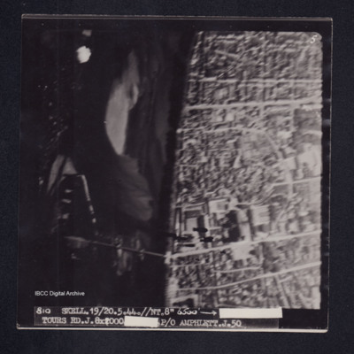
Tours
Pilot Officer A Baker's log book
John Chatterton's pilot's flying log book
Tags: 1660 HCU; 44 Squadron; 57 Squadron; 630 Squadron; 81 OTU; Advanced Flying Unit; aircrew; bombing; bombing of Nuremberg (30 / 31 March 1944); bombing of the Juvisy, Noisy-le-Sec and Le Bourget railways (18/19 April 1944); bombing of Toulouse (5/6 April 1944); Flying Training School; Halifax; Harvard; Heavy Conversion Unit; Lancaster; Lancaster Finishing School; Lincoln; Meteor; mine laying; Normandy campaign (6 June – 21 August 1944); Operation Dodge (1945); Operational Training Unit; Oxford; pilot; RAF Dunholme Lodge; RAF East Kirkby; RAF Sleap; RAF Swinderby; RAF Syerston; RAF Tilstock; Stearman; Tiger Moth; training; Whitley
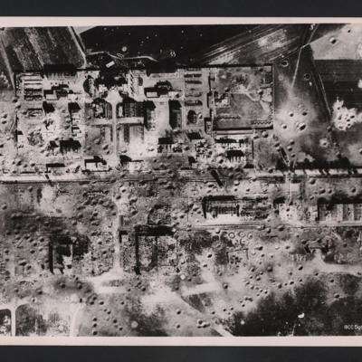
Tours airfield
On the reverse…
Arthur Atkins’ flying log book for pilots
Tags: 1662 HCU; 1667 HCU; 27 OTU; 625 Squadron; Advanced Flying Unit; aircrew; Anson; bombing; Flying Training School; Halifax; Halifax Mk 2; Halifax Mk 5; Heavy Conversion Unit; Lancaster; Lancaster Finishing School; Lancaster Mk 1; Lancaster Mk 3; Normandy campaign (6 June – 21 August 1944); Operational Training Unit; Oxford; pilot; RAF Andover; RAF Blyton; RAF Church Broughton; RAF Gamston; RAF Hemswell; RAF Kelstern; RAF Lichfield; RAF Sandtoft; RAF Westcott; tactical support for Normandy troops; Tiger Moth; training; V-1; V-weapon; Wellington
Ronald Mathers pilots flying log book. One
Tags: 1660 HCU; 1661 HCU; 17 OTU; 9 Squadron; Advanced Flying Unit; air gunner; aircrew; Anson; bomb aimer; bombing; Bombing of Mailly-le-Camp (3/4 May 1944); bombing of Nuremberg (30 / 31 March 1944); Flying Training School; Heavy Conversion Unit; Lancaster; navigator; Operational Training Unit; Oxford; pilot; RAF Bardney; RAF Castle Donington; RAF Morton Hall; RAF Shawbury; RAF Silverstone; RAF Swinderby; RAF Sywell; RAF Turweston; RAF Winthorpe; Stearman; Stirling; Tiger Moth; training; Wellington; wireless operator
Alan Payne’s South African Air Force observers or air gunners log book
Tags: 1661 HCU; 1665 HCU; 17 OTU; 620 Squadron; 630 Squadron; 85 OTU; Advanced Flying Unit; aircrew; Anson; bombing; Bombing of Mailly-le-Camp (3/4 May 1944); bombing of Nuremberg (30 / 31 March 1944); Botha; C-47; Halifax; Heavy Conversion Unit; Ju 88; Lancaster; Me 109; navigator; Operational Training Unit; Oxford; prisoner of war; RAF Aqir; RAF Dumfries; RAF East Kirkby; RAF Husbands Bosworth; RAF Llandwrog; RAF Saltby; RAF Silverstone; RAF Torquay; RAF Turweston; RAF Winthorpe; training; Wellington
Harold Blow’s pilots flying log book
Tags: 11 OTU; 1661 HCU; 17 OTU; 29 OTU; 9 Squadron; Advanced Flying Unit; aircrew; bombing; bombing of Kassel (22/23 October 1943); bombing of Nuremberg (30 / 31 March 1944); bombing of Toulouse (5/6 April 1944); Flying Training School; Harvard; Heavy Conversion Unit; Lancaster; Manchester; Meteor; mid-air collision; Operational Training Unit; Oxford; pilot; RAF Bardney; RAF Bishops Court; RAF Bruntingthorpe; RAF Carlisle; RAF Church Fenton; RAF Finningley; RAF Little Rissington; RAF Shawbury; RAF Silverstone; RAF Sywell; RAF Tangmere; RAF Winthorpe; Stearman; Tiger Moth; training; Wellington
Arthur Atkinson’s observers and air gunners flying log book
Tags: 14 OTU; 1661 HCU; 17 OTU; 61 Squadron; Advanced Flying Unit; Air Gunnery School; aircrew; Anson; bombing; bombing of the Creil/St Leu d’Esserent V-1 storage areas (4/5 July 1944); bombing of the Juvisy, Noisy-le-Sec and Le Bourget railways (18/19 April 1944); bombing of the Normandy coastal batteries (5/6 June 1944); bombing of the Pas de Calais V-1 sites (24/25 June 1944); bombing of Toulouse (5/6 April 1944); Dominie; Heavy Conversion Unit; Lancaster; Lancaster Finishing School; Normandy campaign (6 June – 21 August 1944); Operational Training Unit; Oxford; Proctor; RAF Coningsby; RAF Halfpenny Green; RAF Husbands Bosworth; RAF Silverstone; RAF Skellingthorpe; RAF St Athan; RAF Stormy Down; RAF Syerston; RAF Winthorpe; RAF Yatesbury; Stirling; tactical support for Normandy troops; training; Wellington; wireless operator
Peter Hazeldene's Log book
Tags: 106 Squadron; 14 OTU; 16 OTU; 1654 HCU; 57 Squadron; air gunner; aircrew; Anson; B-17; Battle; bombing; Bombing and Gunnery School; bombing of Cologne (30/31 May 1942); Bombing of Mailly-le-Camp (3/4 May 1944); bombing of the Normandy coastal batteries (5/6 June 1944); bombing of the Pas de Calais V-1 sites (24/25 June 1944); Hampden; Heavy Conversion Unit; Lancaster; Lancaster Finishing School; Lysander; mine laying; Normandy campaign (6 June – 21 August 1944); Operational Training Unit; Oxford; RAF Coningsby; RAF East Kirkby; RAF Finningley; RAF Husbands Bosworth; RAF Polebrook; RAF Syerston; RAF Upper Heyford; RAF West Freugh; RAF Wigsley; Stirling; tactical support for Normandy troops; training; Wellington; wireless operator / air gunner
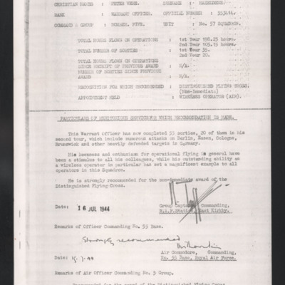
Recommendation for Honours and Awards
George Alexander Mackie’s pilots flying log book. Two
Tags: 11 OTU; 1651 HCU; 214 Squadron; aircrew; animal; arts and crafts; B-17; B-24; bombing; bombing of the Creil/St Leu d’Esserent V-1 storage areas (4/5 July 1944); C-47; Flying Training School; Heavy Conversion Unit; Initial Training Wing; military living conditions; mine laying; Normandy campaign (6 June – 21 August 1944); Operational Training Unit; Oxford; pilot; RAF Chedburgh; RAF Downham Market; RAF Nutts Corner; RAF Oulton; RAF Prestwick; RAF Sculthorpe; RAF Stoney Cross; RAF Tempsford; RAF Waterbeach; Stirling; training
Donald Chinery’s flying log book for observers and air gunners
Tags: 16 OTU; 1651 HCU; 17 OTU; 196 Squadron; 61 Squadron; Advanced Flying Unit; air gunner; Air Gunnery School; aircrew; bombing; Bombing of Mailly-le-Camp (3/4 May 1944); bombing of Nuremberg (30 / 31 March 1944); bombing of the Juvisy, Noisy-le-Sec and Le Bourget railways (18/19 April 1944); bombing of the Normandy coastal batteries (5/6 June 1944); bombing of the Pas de Calais V-1 sites (24/25 June 1944); bombing of the Watten V-2 site (19 June 1944); Cook’s tour; Heavy Conversion Unit; Me 109; mid-air collision; Normandy campaign (6 June – 21 August 1944); Operational Training Unit; RAF Barford St John; RAF Barrow in Furness; RAF Coningsby; RAF Finningley; RAF Llandwrog; RAF Newmarket; RAF Silverstone; RAF Skellingthorpe; RAF Turweston; RAF Waterbeach; RAF Witchford; tactical support for Normandy troops; training
J Millar’s navigator’s, air bomber’s and air gunner’s flying log book
Tags: 1657 HCU; 61 Squadron; 620 Squadron; air gunner; Air Gunnery School; aircrew; Blenheim; bombing; Bombing of Mailly-le-Camp (3/4 May 1944); bombing of Nuremberg (30 / 31 March 1944); bombing of the Juvisy, Noisy-le-Sec and Le Bourget railways (18/19 April 1944); bombing of the Normandy coastal batteries (5/6 June 1944); bombing of the Pas de Calais V-1 sites (24/25 June 1944); bombing of the Watten V-2 site (19 June 1944); Heavy Conversion Unit; Lancaster; Me 109; Normandy campaign (6 June – 21 August 1944); RAF Coningsby; RAF Leicester East; RAF Newmarket; RAF Pembrey; RAF Skellingthorpe; RAF Stradishall; Stirling; tactical support for Normandy troops; training; Wellington
John Mitchell flying log book. Two
Tags: 1653 HCU; 1661 HCU; 19 OTU; 207 Squadron; 7 Group; aircrew; Anson; Cook’s tour; forced landing; Heavy Conversion Unit; Lancaster; Lancaster Mk 3; Lysander; Operational Training Unit; pilot; Proctor; RAF Abingdon; RAF Kinloss; RAF Langar; RAF North Luffenham; RAF Spilsby; RAF Swinderby; RAF Ternhill; RAF Winthorpe; training; Whitley; wireless operator; wireless operator / air gunner

