Browse Items (6 total)
- Spatial Coverage is exactly "Europe--Scheldt River"
Hastie DFC: The Life and Times of a Wartime Pilot
Tags: 1 Group; 100 Group; 101 Squadron; 157 Squadron; 2 Group; 214 Squadron; 223 Squadron; 3 Group; 4 Group; 6 Group; 8 Group; 85 Squadron; 88 Squadron; air gunner; aircrew; anti-aircraft fire; B-17; B-24; B-25; bale out; Beaufighter; Bismarck; Botha; C-47; Chamberlain, Neville (1869-1940); Churchill, Winston (1874-1965); crash; crewing up; Distinguished Flying Cross; entertainment; evacuation; Flying Training School; Gee; Gneisenau; Goldfish Club; ground personnel; H2S; Halifax; Harris, Arthur Travers (1892-1984); Harvard; He 111; Heavy Conversion Unit; Hitler, Adolf (1889-1945); Hudson; Hurricane; Initial Training Wing; Ju 88; Lancaster; love and romance; Martinet; Me 109; Me 110; mine laying; Mosquito; Mussolini, Benito (1883-1945); navigator; Nissen hut; Oboe; Operational Training Unit; Oxford; Pathfinders; pilot; Proctor; radar; RAF Banff; RAF Catfoss; RAF Catterick; RAF Chedburgh; RAF Cranwell; RAF Dishforth; RAF Farnborough; RAF Horsham St Faith; RAF Kinloss; RAF Leuchars; RAF Lichfield; RAF Lyneham; RAF Manston; RAF North Coates; RAF Oulton; RAF Padgate; RAF Prestwick; RAF Riccall; RAF Silloth; RAF South Cerney; RAF St Eval; RAF Thornaby; RAF Thorney Island; RAF Windrush; RAF Woodbridge; Roosevelt, Franklin Delano (1882-1945); Scharnhorst; Spitfire; sport; Stirling; Swordfish; Tiger Moth; Tirpitz; training; V-1; V-2; V-weapon; Whitley; Window; wireless operator; Women’s Auxiliary Air Force
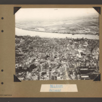
Antwerp
Tags: aerial photograph
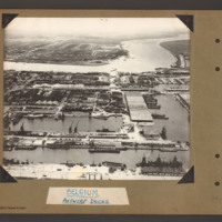
Antwerp Docks
Tags: aerial photograph
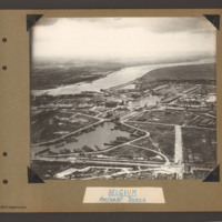
Antwerp Docks
Tags: aerial photograph

