Browse Items (67 total)
- Conforms To is exactly "Pending geolocation"
Sort by:
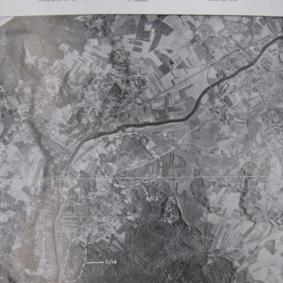
Noball Targets
A vertical aerial reconnaissance photograph of Bois de Cassan and Foret de l'Isle Adam with two target areas marked.
Tags: aerial photograph; bombing
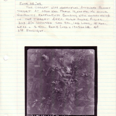
Gorenflos
A vertical aerial photograph taken during an operation at Gorenflos. The centre of the image is obscured by explosions.
Above is captioned with details of the operation.
The photograph is captioned '2656.LMG.25.6.44// 8" 12600 -->135° 0900…
Above is captioned with details of the operation.
The photograph is captioned '2656.LMG.25.6.44// 8" 12600 -->135° 0900…
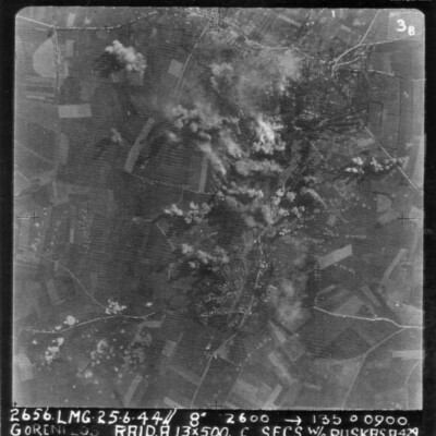
Gorenflos
A vertical aerial photograph of an attack on Gorenflos V-1 base. Rows of bomb craters and explosions can be seen.
The image is annotated '26565. LMG. 25.6.44// 8" 12600 --135° 0900 Goenflos Raid .A. 13x500 c secs W/O Puskas .A.429'
The image is annotated '26565. LMG. 25.6.44// 8" 12600 --135° 0900 Goenflos Raid .A. 13x500 c secs W/O Puskas .A.429'
Tags: 429 Squadron; aerial photograph; aircrew; bombing; pilot; RAF Leeming; target photograph; V-1; V-weapon
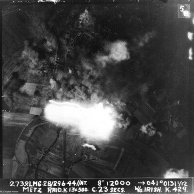
Metz
A vertical aerial photograph of Metz taken during a bombing operation. Much of the image is obscured by explosions.
It is annotated '2739.LMG. 28/29.6.44 // NT 8" 12000 --> 041°0131 1/12 Metz Raid. K. 13x 500 c.23 secs W/O Irish . K.429.'
It is annotated '2739.LMG. 28/29.6.44 // NT 8" 12000 --> 041°0131 1/12 Metz Raid. K. 13x 500 c.23 secs W/O Irish . K.429.'
Lancaster 'VR-V'
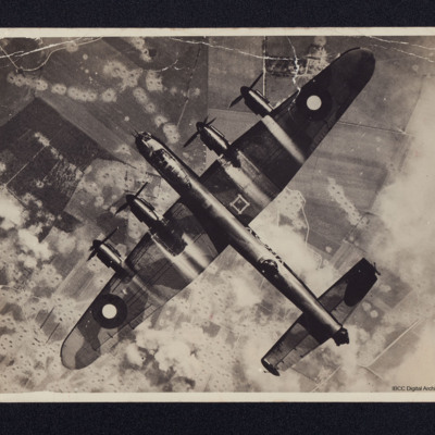
A full frame vertical aerial photograph of a Lancaster flying over a heavily bombed V-1 site.
On the reverse 'KB745 VR-V 419 Sqn Middleton St Geo attacking V1 site July 1944.
Lost 5/10/44 crashed into high ground on Op to Norway'
On the reverse 'KB745 VR-V 419 Sqn Middleton St Geo attacking V1 site July 1944.
Lost 5/10/44 crashed into high ground on Op to Norway'
Tags: 419 Squadron; crash; Lancaster; RAF Middleton St George; V-1; V-weapon
Gorenflos V-1 base
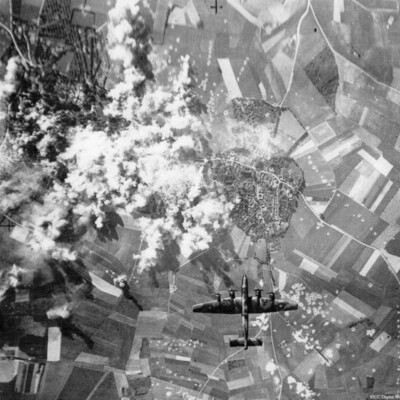
A vertical aerial photograph taken during a bombing operation. A Halifax is directly underneath heading towards a town. To the left of the town are numerous bomb explosions. Bomb craters can be see in the fields, some in lines and others in…
Tags: aerial photograph; bombing; Halifax; V-1; V-weapon
First Flight
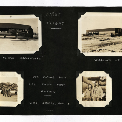
19 photographs from an album.
Photo 1 is an Anson viewed from the port/rear, captioned 'The "Flying Greenhouse" '.
Photo 2 is three Ansons outside a hangar, captioned 'Warming Up'.
Photo 3 is three airmen standing at the front of an Anson,…
Photo 1 is an Anson viewed from the port/rear, captioned 'The "Flying Greenhouse" '.
Photo 2 is three Ansons outside a hangar, captioned 'Warming Up'.
Photo 3 is three airmen standing at the front of an Anson,…
McDonald Views
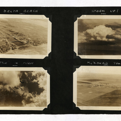
Four photographs from an album.
Photo 1 is a low level aerial oblique of a small township with a dammed lake, captioned 'Delta Beach'.
Photo 2 is of towering clouds, captioned 'Storm Up!'.
Photo 3 is a Battle in flight.
Photo 4 is a low level…
Photo 1 is a low level aerial oblique of a small township with a dammed lake, captioned 'Delta Beach'.
Photo 2 is of towering clouds, captioned 'Storm Up!'.
Photo 3 is a Battle in flight.
Photo 4 is a low level…
Tags: aerial photograph; Battle
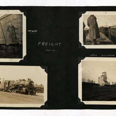
Canadian Railways and RCAF Rivers
Eight b/w photographs from an album.
Photo 1 is an airman on a freight wagon ladder, captioned 'Arthur'.
Photo 2 is an airman standing on the roof of a freight wagon.
Photo 3 is a steam engine.
Photo 4 is a grain elevator at the side of the…
Photo 1 is an airman on a freight wagon ladder, captioned 'Arthur'.
Photo 2 is an airman standing on the roof of a freight wagon.
Photo 3 is a steam engine.
Photo 4 is a grain elevator at the side of the…
Tags: aircrew; navigator; RCAF Rivers; training
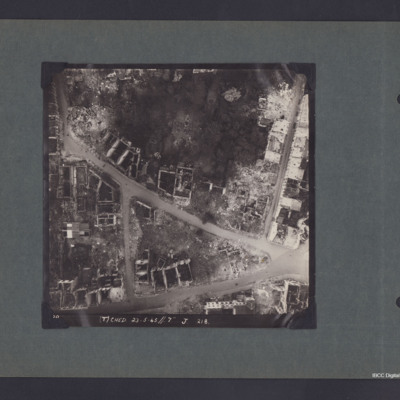
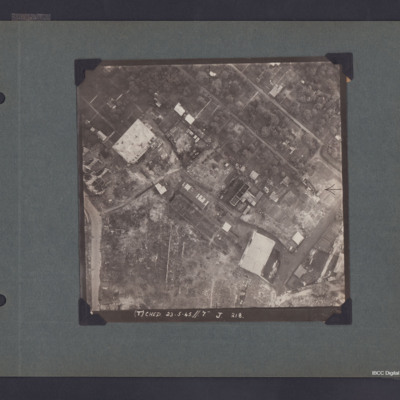
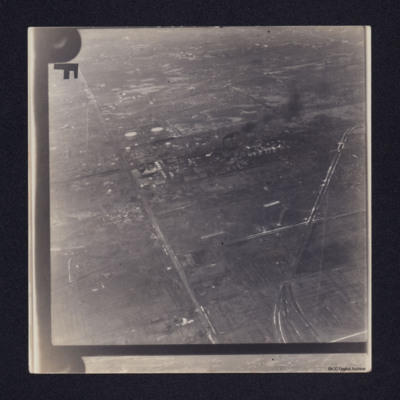
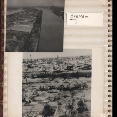
Bremen Industrial Area
A vertical aerial photograph of Bremen.
The photo is captioned '(T) Ched 23.5.45//7" J 218'.
On the reverse 'Crown Copyright Reserved' and 'Bremen'.
The photo is captioned '(T) Ched 23.5.45//7" J 218'.
On the reverse 'Crown Copyright Reserved' and 'Bremen'.
Hamburg Residential and Industrial Area
Vertical aerial photograph of part of Hamburg showing bomb damage. Two large buildings and some smaller ones remain standing while most have been either destroyed completely or gutted. The upper, right area appears to be residential, though few…
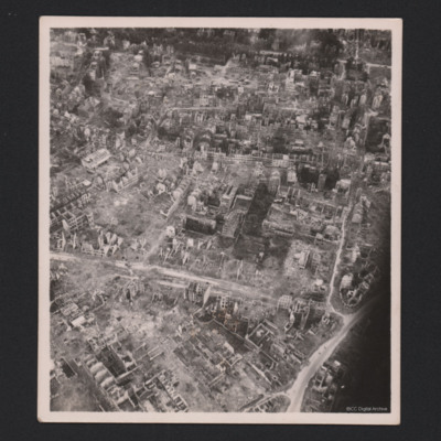
Dortmund
Three photographs of Dortmund residential areas. Only skeletons of buildings are remaining.
Identification kindly provided by Ludger Keiser of the Finding the location WW1 & WW2 Facebook group.
Identification kindly provided by Ludger Keiser of the Finding the location WW1 & WW2 Facebook group.
Tags: aerial photograph; bombing; Cook’s tour
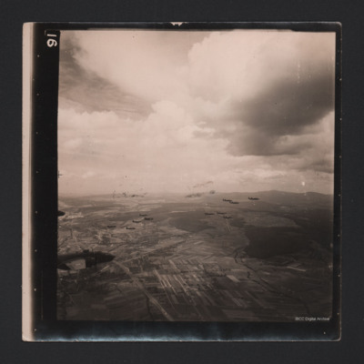
Fourteen Mitchells in Flight
An air-to-air photograph of 14 B-25 Mitchells in flight. They are flying over a cultivated valley, set between low hills.
Tags: aerial photograph; B-25
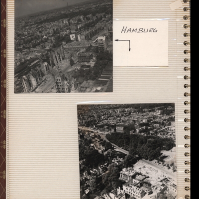
Hamburg
Top - oblique aerial photograph of a city with many damaged buildings. Captioned 'Hamburg'.
Bottom - oblique aerial photograph of a city showing park in centre and main roads running bottom right to left. Damaged buildings in foreground. Both…
Bottom - oblique aerial photograph of a city showing park in centre and main roads running bottom right to left. Damaged buildings in foreground. Both…
Tags: aerial photograph; bombing; Cook’s tour
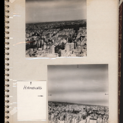
Hamburg
Top - oblique aerial photograph of a city showing damaged multi-storey buildings. Captioned 'Hamburg'.
Bottom - oblique aerial photograph of a city showing damaged multi-storey buildings at the bottom. Both submitted with description 'Oblique…
Bottom - oblique aerial photograph of a city showing damaged multi-storey buildings at the bottom. Both submitted with description 'Oblique…
Tags: aerial photograph; bombing; Cook’s tour
Bremen
Top - oblique aerial photograph of Bremen port with river Weser to the left running bottom to top with dock to the right. Pier in between has extensive railway sidings to the left, warehouses in the middle are mainly without roofs but cleared of…
Tags: aerial photograph; bombing; Cook’s tour
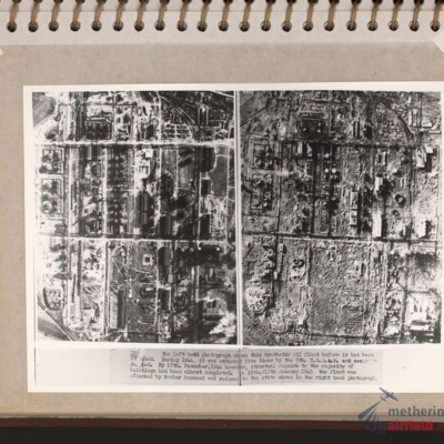
Zeitz Braunkohle-Benzin synthetic oil plant
Vertical aerial photographs showing on the left an industrial area with roads and buildings and on the right the same area with most of the structures destroyed. Explanatory text underneath 'Zeitz. The left hand photograph shows this synthetic oil…
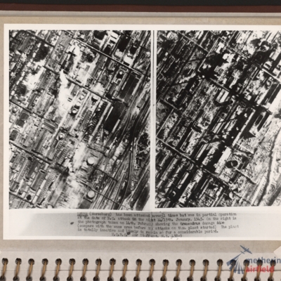
Leuna synthetic oil plant
Side by side reconnaissance photographs showing an industrial area with buildings, roads and towards the right, some railway sidings. This industrial area is orientated from lower left to top right. Chimney smoke is seen on the left hand photograph.…
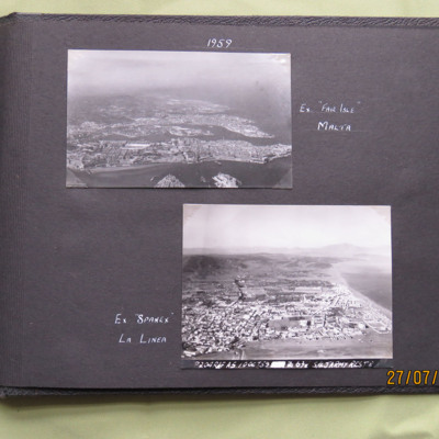
Malta and La Linea, 1959
Two oblique aerial photographs .
Photo 1 is of Valetta, captioned 'Ex "Fair Isle" Malta'.
Photo 2 is La Linea, captioned ' Ex "Spanex" La Linea'. Annotated on the image is 'P204 RAF A5 10 Oct 59 Z 678 S/L Jarmy Rest D'.
This item was sent to the…
Photo 1 is of Valetta, captioned 'Ex "Fair Isle" Malta'.
Photo 2 is La Linea, captioned ' Ex "Spanex" La Linea'. Annotated on the image is 'P204 RAF A5 10 Oct 59 Z 678 S/L Jarmy Rest D'.
This item was sent to the…
Tags: aerial photograph
Bomb damage
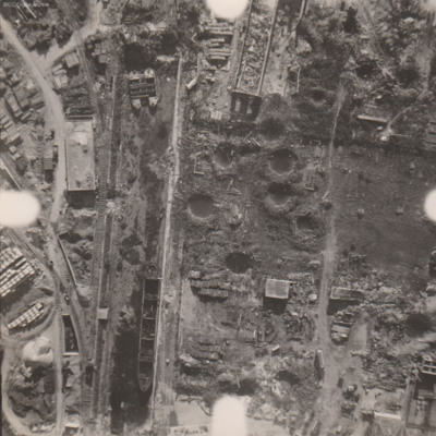
Reconnaissance photograph at low level of goods yard with significant bomb damage with craters and destroyed buildings throughout. A drained canal runs top to bottom with large barge aground against quay and another smaller pair tied together at top.…
Juvisy
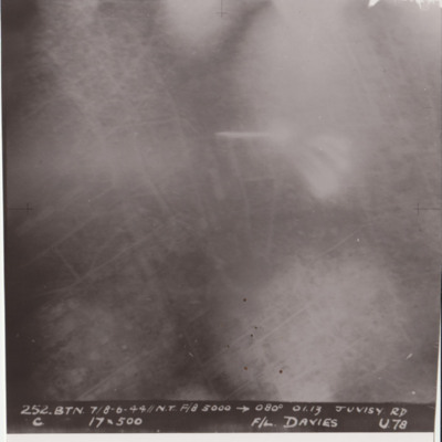
Target photograph shows glare and explosions. Built up area roads are faintly visible. Captioned '252.BTN 7/8-6-44//NT F/8, 5000, 080 degrees, 01.13, JUVISY RD, C, 19x500, F/L DAVIES, U78'. Submitted in folder titled 'U-Uncle Target Images'.
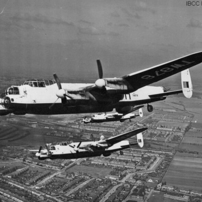
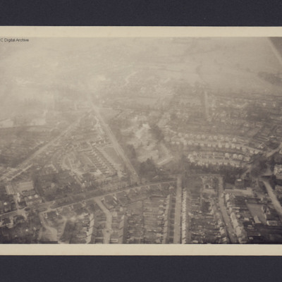
Three Lancasters in formation over Fairlop, Ilford, Essex
Three Lancasters (leader registration 'TW878') airborne in echelon formation. Below is a town and open countryside
Tags: 35 Squadron; Lancaster

