Browse Items (66 total)
- Conforms To is exactly "Pending geolocation"
Sort by:
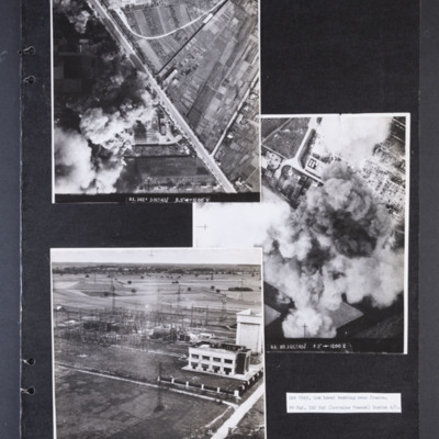
Low level bombing over Orleans
Photograph 1 is a vertical aerial photograph of a transformer and switching station at Orleans. Most of it is obscured by bomb explosions and smoke. A wide road runs diagonally across the image. Captioned 'R1.342F 3 OCT 43//…
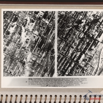
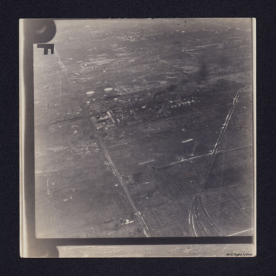
Leuna synthetic oil plant
Side by side reconnaissance photographs showing an industrial area with buildings, roads and towards the right, some railway sidings. This industrial area is orientated from lower left to top right. Chimney smoke is seen on the left hand photograph.…
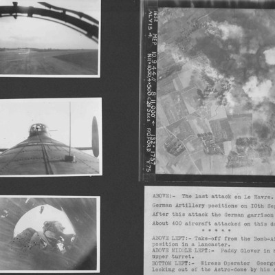
Le Havre and Terry Ford's crew
Four photographs from an album.
Photo 1 is a view during take off from the bomb aimer's station.
Photo 2 is air gunner Paddy Glover in his mid-upper turret.
Photo 3 is wireless operator George Tredinnick looking out of the astro-dome.
Photo 4 is…
Photo 1 is a view during take off from the bomb aimer's station.
Photo 2 is air gunner Paddy Glover in his mid-upper turret.
Photo 3 is wireless operator George Tredinnick looking out of the astro-dome.
Photo 4 is…
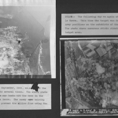
Le Havre
Two vertical aerial photographs from an album.
Photo 1 is bombing of the centre of Le Havre.
Photo 2 is taken on the next day and German Army positions on the outskirts were attacked.
Photo 1 is bombing of the centre of Le Havre.
Photo 2 is taken on the next day and German Army positions on the outskirts were attacked.
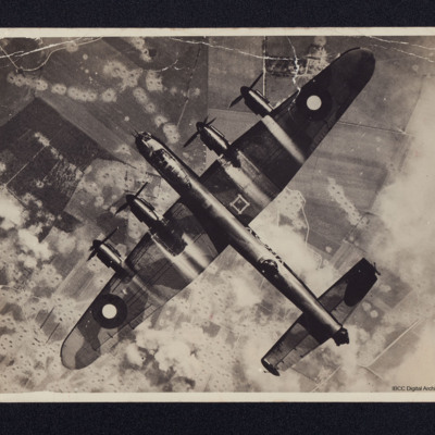
Lancaster 'VR-V'
A full frame vertical aerial photograph of a Lancaster flying over a heavily bombed V-1 site.
On the reverse 'KB745 VR-V 419 Sqn Middleton St Geo attacking V1 site July 1944.
Lost 5/10/44 crashed into high ground on Op to Norway'
On the reverse 'KB745 VR-V 419 Sqn Middleton St Geo attacking V1 site July 1944.
Lost 5/10/44 crashed into high ground on Op to Norway'
Tags: 419 Squadron; crash; Lancaster; RAF Middleton St George; V-1; V-weapon
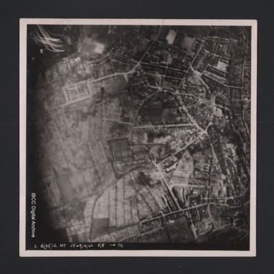
Kiel
Vertical aerial photograph of an urban area at the top and right hand side. Street patterns and parks are clearly visible. At the bottom it is captioned ‘1. R(X5) 12 NT 28/29/4/42 F/8” [arrow] TX’.
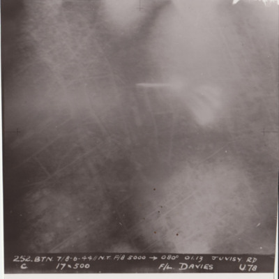
Juvisy
Target photograph shows glare and explosions. Built up area roads are faintly visible. Captioned '252.BTN 7/8-6-44//NT F/8, 5000, 080 degrees, 01.13, JUVISY RD, C, 19x500, F/L DAVIES, U78'. Submitted in folder titled 'U-Uncle Target Images'.
Headington School
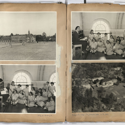
Left page; top, view across tennis courts to Headington School, Headington road, Headington, Oxford.
Bottom, a group of 13 girls and a teacher taken in the main assembly hall of Headington school.
Right page: top a group of 13 children and a…
Bottom, a group of 13 girls and a teacher taken in the main assembly hall of Headington school.
Right page: top a group of 13 children and a…
Tags: aerial photograph
Hamilcar gliders near Wesel
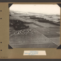
Aerial inclined photograph showing open countryside with fields, woods and occasional buildings. In the bottom left is a field containing a large number of gliders gathered and parked close together in a corner at the far end. There are a number of…
Tags: aerial photograph; Cook’s tour; Hamilcar
Hamburg Residential and Industrial Area
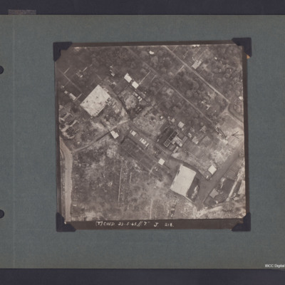
Vertical aerial photograph of part of Hamburg showing bomb damage. Two large buildings and some smaller ones remain standing while most have been either destroyed completely or gutted. The upper, right area appears to be residential, though few…
Hamburg
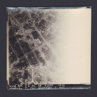
A vertical aerial photograph of Hamburg. The right half of the image is obscured by light.
It is captioned '3128 Bin 5.6.46 //8" 4000 19.01 Hamburg 'T' F/Lt Quinton 'T' 617'.
On the reverse 'On Loan P&R Darby Woodhall Spa'.
It is captioned '3128 Bin 5.6.46 //8" 4000 19.01 Hamburg 'T' F/Lt Quinton 'T' 617'.
On the reverse 'On Loan P&R Darby Woodhall Spa'.
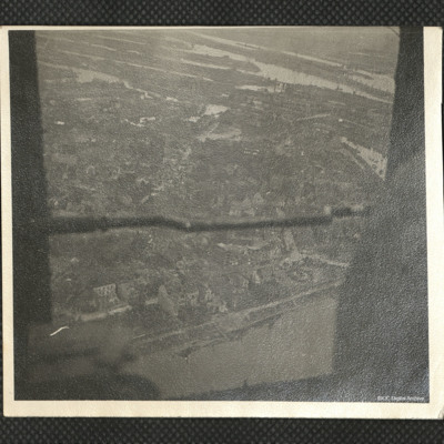
Hamburg
An oblique aerial photograph. Docks, warehouses and houses are visible.
Identification kindly provided by members of 'Finding the location WW1 & WW2' Facebook group.
Identification kindly provided by members of 'Finding the location WW1 & WW2' Facebook group.
Tags: aerial photograph; Cook’s tour
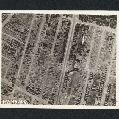
Hamburg
Vertical aerial photograph of Hamburg. Most of the buildings are destroyed with only shells remaining. Captioned 'Hamburg'.
Tags: aerial photograph; bombing
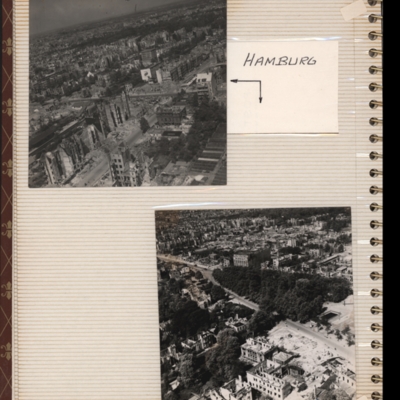
Hamburg
Top - oblique aerial photograph of a city with many damaged buildings. Captioned 'Hamburg'.
Bottom - oblique aerial photograph of a city showing park in centre and main roads running bottom right to left. Damaged buildings in foreground. Both…
Bottom - oblique aerial photograph of a city showing park in centre and main roads running bottom right to left. Damaged buildings in foreground. Both…
Tags: aerial photograph; bombing; Cook’s tour
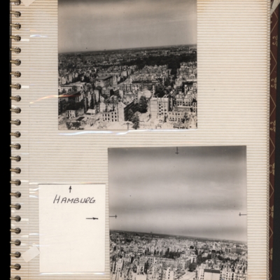
Hamburg
Top - oblique aerial photograph of a city showing damaged multi-storey buildings. Captioned 'Hamburg'.
Bottom - oblique aerial photograph of a city showing damaged multi-storey buildings at the bottom. Both submitted with description 'Oblique…
Bottom - oblique aerial photograph of a city showing damaged multi-storey buildings at the bottom. Both submitted with description 'Oblique…
Tags: aerial photograph; bombing; Cook’s tour
Gorenflos V-1 base
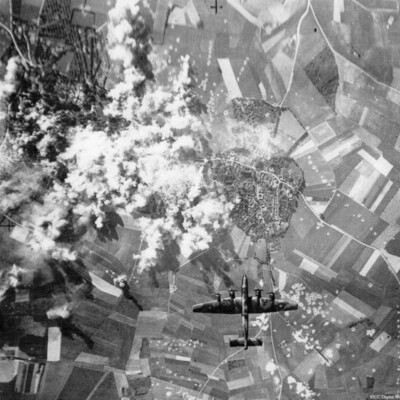
A vertical aerial photograph taken during a bombing operation. A Halifax is directly underneath heading towards a town. To the left of the town are numerous bomb explosions. Bomb craters can be see in the fields, some in lines and others in…
Tags: aerial photograph; bombing; Halifax; V-1; V-weapon
Gorenflos
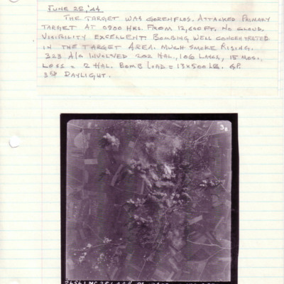
A vertical aerial photograph taken during an operation at Gorenflos. The centre of the image is obscured by explosions.
Above is captioned with details of the operation.
The photograph is captioned '2656.LMG.25.6.44// 8" 12600 -->135° 0900…
Above is captioned with details of the operation.
The photograph is captioned '2656.LMG.25.6.44// 8" 12600 -->135° 0900…
Gorenflos
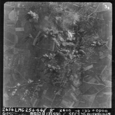
A vertical aerial photograph of an attack on Gorenflos V-1 base. Rows of bomb craters and explosions can be seen.
The image is annotated '26565. LMG. 25.6.44// 8" 12600 --135° 0900 Goenflos Raid .A. 13x500 c secs W/O Puskas .A.429'
The image is annotated '26565. LMG. 25.6.44// 8" 12600 --135° 0900 Goenflos Raid .A. 13x500 c secs W/O Puskas .A.429'
Tags: 429 Squadron; aerial photograph; aircrew; bombing; pilot; RAF Leeming; target photograph; V-1; V-weapon
Freilassing
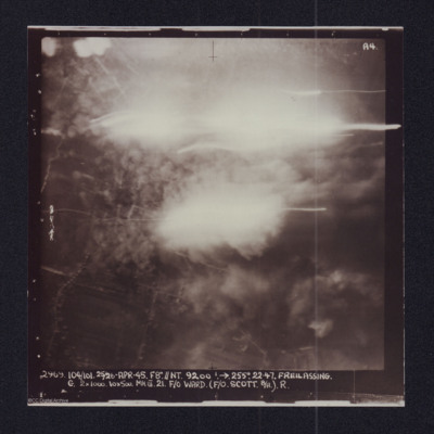
Target photograph showing explosions. Captioned '2969 104/101, 25/26 Apr 45, F8//NT 9200 ft, >255 degrees.22.47 Freilassing, G 2x1000, 10x500 Mk III 21 F/O Ward (F/O Scott B/A) R'. Two versions of the same image.
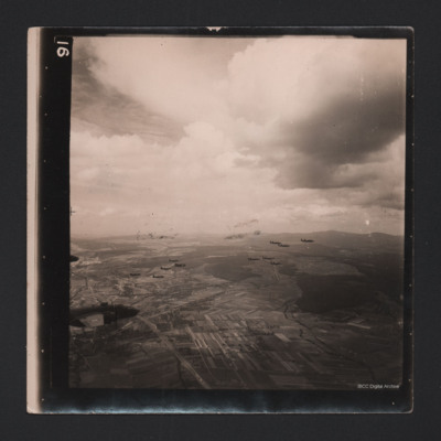
Fourteen Mitchells in Flight
An air-to-air photograph of 14 B-25 Mitchells in flight. They are flying over a cultivated valley, set between low hills.
Tags: aerial photograph; B-25
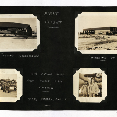
First Flight
19 photographs from an album.
Photo 1 is an Anson viewed from the port/rear, captioned 'The "Flying Greenhouse" '.
Photo 2 is three Ansons outside a hangar, captioned 'Warming Up'.
Photo 3 is three airmen standing at the front of an Anson,…
Photo 1 is an Anson viewed from the port/rear, captioned 'The "Flying Greenhouse" '.
Photo 2 is three Ansons outside a hangar, captioned 'Warming Up'.
Photo 3 is three airmen standing at the front of an Anson,…
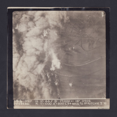
Duisberg
Target photograph taken on an operation to Duisberg. Left hand side is obscured by smoke or cloud and several bomb explosions can be seen. The Rhine river runs across the image, just below half height and there is built up area towards top of…
Dortmund
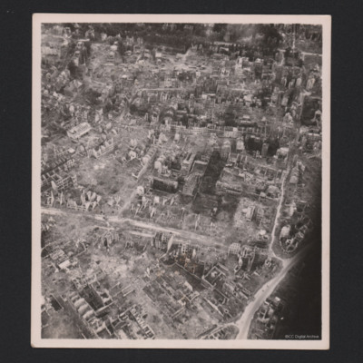
Three photographs of Dortmund residential areas. Only skeletons of buildings are remaining.
Identification kindly provided by Ludger Keiser of the Finding the location WW1 & WW2 Facebook group.
Identification kindly provided by Ludger Keiser of the Finding the location WW1 & WW2 Facebook group.
Tags: aerial photograph; bombing; Cook’s tour
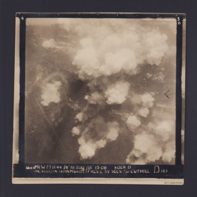
Cologne
Target photograph for an operation to Cologne. It shows clouds of smoke rising up from several locations on the ground. Residential areas and roads are visible, as are some bomb craters in the fields. It is annotated '3B' and captioned:
'[…
'[…

