Browse Items (680 total)
- Conforms To is exactly "Geolocated"
Sort by:
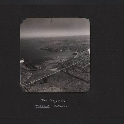
The Objective Midland Ontario
High angle aerial oblique photograph of Midland Ontario. It is on the lakeside and on the left can be seen grain elevators. In the middle and right an industrial area with a large building and docks. Behind this is an urban area.
Tags: aerial photograph; training
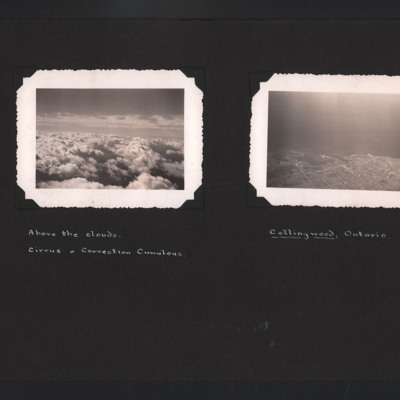
Above the Clouds and Collingwood
The first photograph is an aerial photograph looking at cirrus and convection cumulous clouds. Captioned ' Above the clouds. Cirrus & Convection Cumulous'. The second is a low angle aerial photograph of Collingwood, Ontario. The town and its docks…
Tags: aerial photograph
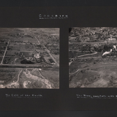
Goderich
The first photograph is a low oblique aerial view of a quarry and industrial buildings. In the foreground is a railway siding with freight trucks. In the background are houses. Captioned 'The Salt of the Earth'. The second photograph has a steam…
Tags: aerial photograph
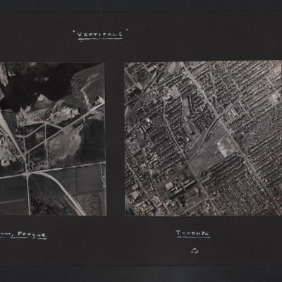
Verticals
The vertical aerial photograph is of a dam under construction. It is largely completed but the reservoir has not formed behind the dam. Captioned 'The Dam, Fergus'. The second is a vertical aerial photograph of Toronto. The street pattern is a grid…
Tags: aerial photograph
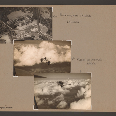
Buckingham Palace and three Hawker Harts
An aerial oblique photograph of Buckingham Palace showing the front and the Victoria Memorial. Captioned 'Buckingham Palace, London'.
The second and third photographs are of three Royal Air Force Hawker Harts flying above broken clouds. Captioned…
The second and third photographs are of three Royal Air Force Hawker Harts flying above broken clouds. Captioned…
Tags: aerial photograph
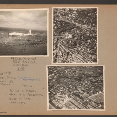
Mosquito over Singapore, Cathay Building and temple
Photograph 1 is an inflight port side view of a Mosquito. It is flying over many small boats at the edge of the city. Captioned '84 sqdn (Mosquitoe) P.R.U. Seletar Singapore 1946.
Photograph 2 is an oblique aerial photograph of the centre of…
Photograph 2 is an oblique aerial photograph of the centre of…
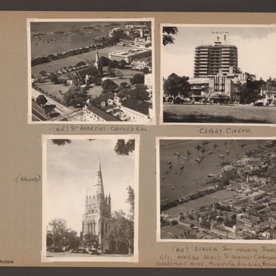
Singapore cathedral, cinema and dockside
Photograph 1 is an oblique aerial photograph of the cathedral, captioned '(Air) St Andrews Cathedral'.
Photograph 2 is a ground view of the cathedral, captioned '(Ground)'
Photograph 3 is the cinema, captioned 'Cathay Cinema see 16 top tight from…
Photograph 2 is a ground view of the cathedral, captioned '(Ground)'
Photograph 3 is the cinema, captioned 'Cathay Cinema see 16 top tight from…
Tags: aerial photograph
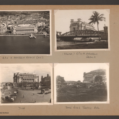
Singapore GPO and Anderson bridge
Photograph 1 is an oblique aerial photograph of a large building, captioned 'G.P.O. & Anderson bridge (air)'
Photograph 2 and 3 are ground views of the building captioned '(Ground) GPO & Anderson bridge'
Photograph 4 is the GPO building with boats…
Photograph 2 and 3 are ground views of the building captioned '(Ground) GPO & Anderson bridge'
Photograph 4 is the GPO building with boats…
Tags: aerial photograph
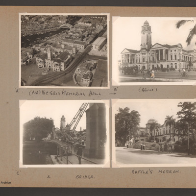
Singapore Victoria Memorial, bridge and Raffle's Museum
Photograph 1 is the Victoria Memorial Hall from the air, captioned '(Air) Victoria Memorial Hall'
Photograph 2 is the Hall from the ground, captioned '(ground)'.
Photograph 3 is the Hall and a bridge, captioned '& bridge'.
Photograph 4 is a…
Photograph 2 is the Hall from the ground, captioned '(ground)'.
Photograph 3 is the Hall and a bridge, captioned '& bridge'.
Photograph 4 is a…
Tags: aerial photograph
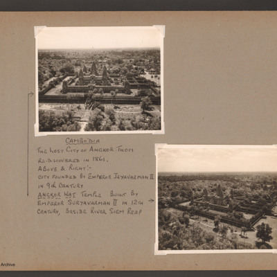
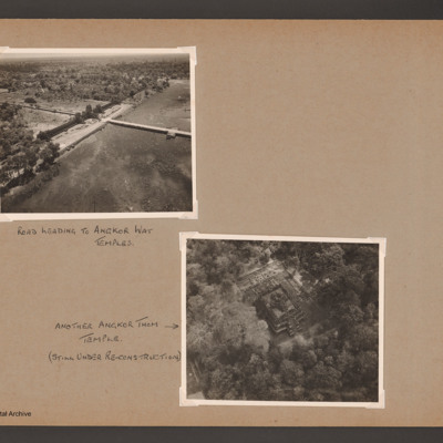
Cambodia Angkor Thom
Oblique aerial photographs of the lost city of Angkor Thom. Captioned 'Cambodia The lost city of Angkor Thom re-discovered in 1861. Above & right:- City founded by Emperor Jayavarman II in 9th century. Angkor Wat temple built by Emperor Suryavarman…
Tags: aerial photograph
Angkor Thom
Photograph 1 is an oblique of a road across a lake captioned 'Road leading to Angkor Wat temples'.
Photograph 2 is a near vertical view of a temple captioned 'Another Angkor Thom temple (still under re-construction)'.
Photograph 3 and 4 are two…
Photograph 2 is a near vertical view of a temple captioned 'Another Angkor Thom temple (still under re-construction)'.
Photograph 3 and 4 are two…
Tags: aerial photograph
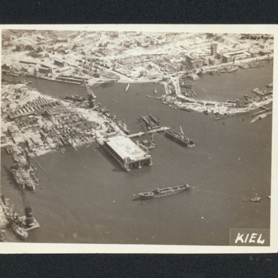
Kiel
Aerial oblique photograph of bomb damage of shipyards at Kiel. Many damaged buildings and workshops. Large covered dock is undamaged, as are several cranes.. Captioned 'Kiel'.
Tags: aerial photograph; bombing
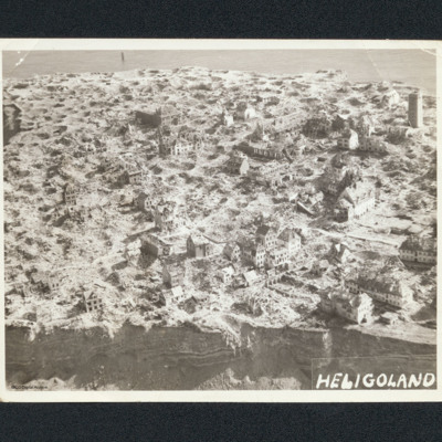
Heligoland
Aerial oblique photograph of Heligoland showing damaged buildings and bomb craters. In the foreground are cliffs. Captioned 'Heligoland'.
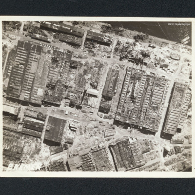
IJmuiden
Vertical aerial photograph of a bombed harbour area near the the Visserhaven. The majority is damaged buildings.
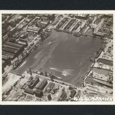
Wilhelmshaven docks
Oblique aerial photograph of a square dock area with several naval vessels. There are dry docks at the top. The majority of the workshop are undamaged. It is captioned 'Wilhemshaven' [sic].
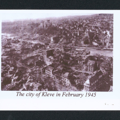
The city of Kleve in February 1945
Oblique aerial of a damaged city. In the centre is a river and a low hill. In the distance are undamaged buildings. Captioned 'The city of Kleve in February 1945'.
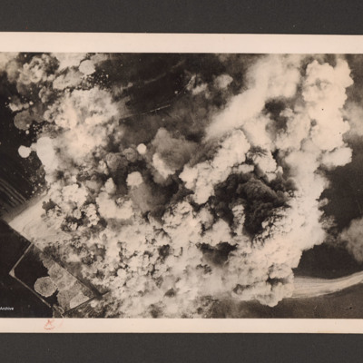
Heligoland under attack
Target photograph showing a very large number of bomb explosions covering most of the image. On the reverse 'Heligoland 18.4.45. The airfield under intense R.A.F. Bomber Command attacks, 27 April 1945'.
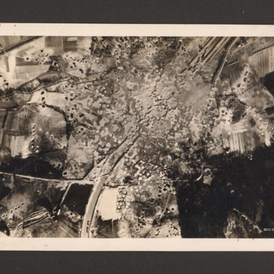
Royal Air Force Bomber Command attacks on enemy communications
Reconnaissance photograph showing the Mitelland Canal at Gravenhorst running from top right to centre bottom. A large area in the centre is completely covered with craters and the canal has disappeared. To the right bottom a large wooded area and to…
Remagen bridge
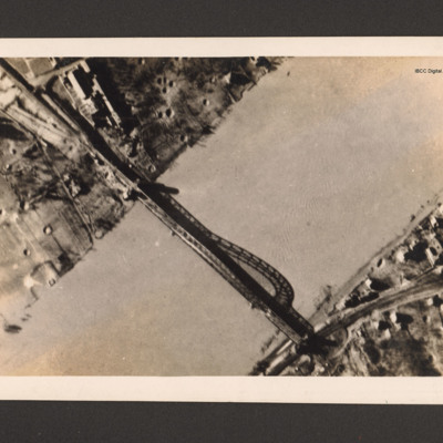
Reconnaissance photograph of bridge. A river runs bottom left to top right and a metal arch bridge from top left to bottom right. There are a few buildings in the top left along with bomb craters. Ther are a few buildings and a railway line at the…
Dortmund-Ems canal at Ladbergen
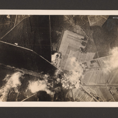
Target photograph showing the Canal running from middle left to bottom right. A road runs from two thirds way up left side and crosses the canal in the bottom right quarter before running to bottom edge. There are minor roads and open country and…
Argenteuil
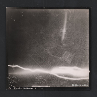
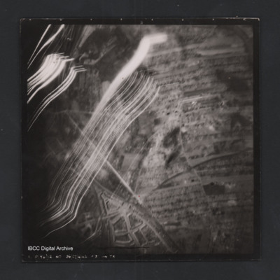
Vertical aerial photograph of Argenteuil. Street pattern and buildings are visible, the cemetery is in the bottom-right corner. Anti-aircraft fire along bottom of photograph.Captioned ‘A O (x4) 12 NT 29/30/4/42 F/8” [arrow] TX
Romorantin-Pruniers aerodrome
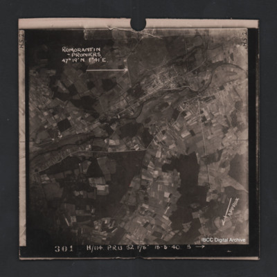
Vertical aerial photograph of Romorantin-Pruniers aerodrome, identified with text ‘Romorantin-Pruniers 46° 19’N 1°41E’. The remainder of the photograph is rural with small villages except for the airfield area which has many buildings. An…
Rostock
Vertical aerial photograph of a railway junction. At the bottom is Rostock urban area. Anti-aircraft trace fire obscures part of the left side. Captioned ‘1. P(Y6) 12 NT 26/27/4/42 F/8” [arrow] TX’, on the reverse 2500’ W of old…

