Browse Items (680 total)
- Conforms To is exactly "Geolocated"
Sort by:
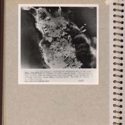
Vallo-Taneberg oil refinery
Reconnaissance photograph of an oil refinery on a peninsular with large plume of smoke from damaged oil tanks upper right area. Oslofjord is to the left with Prinds Christians Batterie just visible on the edge top left. Explanatory note underneath…
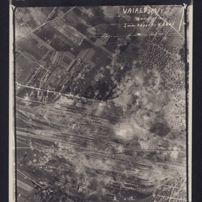
Vaires marshalling yard
Photograph of a marshalling yard. Inverted caption: 'VAIRES M/Y Near Paris Imm Report K2665' includes directional arrow pointing north. Caption at top of photograph: '4063 106G.1316.8.JULY.44. F/36"//542SQDN←'.
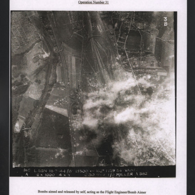
Vaires marshalling yard
Target photograph showing railways running top to bottom with marshalling yard centre right. Bomb explosions over yard. A Lancaster is visible bottom left flying to the left. Titled 'Vaires marshalling yard (14 miles east of Paris) 18 July 1944,…
Uzice
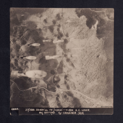
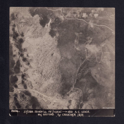
Four vertical aerial photographs taken during the bombing of Uzice, numbered 2603, 2604, 2605 and 2606. On 2603 bombs are seen dropping. Bomb explosions obscure part of the image. It is captioned '2603/2604/2605/2606. 37/329 23.Nov.44 F8//10,200'…
Uzice
A vertical aerial photograph showing a hill, roads and some settlement in a valley. It is captioned '2604. 37/329 23.Nov.44 F8//10,200' --> 1501 A.C. UZICE. Maj BAYFORD Sgt CROUCHER (B/A)'
Udine Signal Square and Control Tower
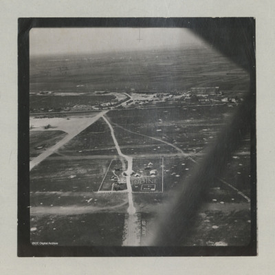
Oblique aerial views of the signal square and control tower at Udine airfield. Two C-47s can be seen on the hard standing. Airfield marking reads "LIGHT AIRCRAFT".
In the background, the 'caserma avieri', the 'Voisin' hangars, the main road, and the…
In the background, the 'caserma avieri', the 'Voisin' hangars, the main road, and the…
Tags: aerial photograph; C-47; control tower; hangar; RAF Udine; taxiway
Udine marshalling yards
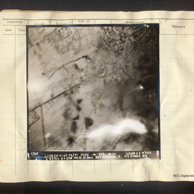
Vertical aerial photograph of Udine marshalling yards, centered on Porta Aquileia. The image is clear with the exception of an explosion in the lower right. Detail of the town and roads is visible. Captioned 'A4 2760 40/54 Jan 20 45 F8/NT 8000'…
Two Lancasters over Chelsea
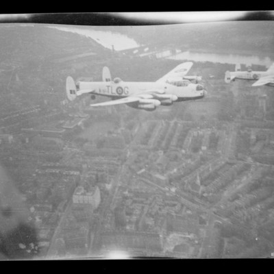
Air-to-air view of two Lancasters, TL-G and TL-P in light paint scheme over Chelsea. At the top, the Thames with bridges and Battersea.
Tags: 35 Squadron; Lancaster
Trossy St Maximin
Target photograph of Trossy St Maximin. Partially obscured by cloud, smoke and dust. Runway intersection and many bomb craters clearly visible. Also visible are bomb explosions, roads, woods, field boundaries and a Lancaster flying below. Captioned…
Tripoli (motor transport dump)
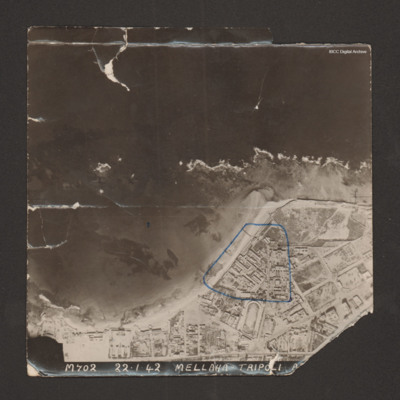
Reconnaissance photograph with a shoreline running from bottom left to middle right with sea at top and land below. Buildings cover the land; military storehouses near Via Cannizzaro e Via Giuseppe Colombo are outlined in blue. Captioned 'M702…
Tripoli
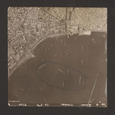
Reconnaissance photograph of harbour area. There are many ships, some of them identified as Anna Maria, Ariosto, Atlas, Bengasi, Beppe, Bosforo, Delia, and Pisani. Five ships have been enclosed by blue line. There is a breakwater along right side.…
Trip to India
Top left - view from air of river with city on far side and bridge in the centre. Captioned 'Ganges river at Cawnpore, India, March 1946'. [actually downstream from Cawnpore (Kanpur) at Allahabad (Prayagraj)]. Top right - view along the top of the…
Tags: York
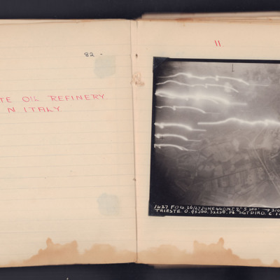
Trieste Oil Refinery
Target photograph taken on an operation to Trieste of the Zaule area, with the Gaslini works and the railway lines. The roads and field pattern are clearly visible.
The photograph is annotated 'A4' and is captioned:
'1637 FOG. 26/27 JUNE 44 // N.T…
The photograph is annotated 'A4' and is captioned:
'1637 FOG. 26/27 JUNE 44 // N.T…
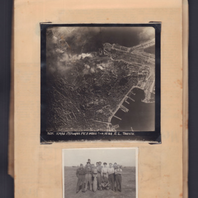
Trieste and airmen with bomb
Top - target photograph of a large port city with land to the left side and port with piers bottom right. Bomb explosions top centre. Captioned '2625 104/61, 17 Feb 45, F8, 14200ft→ , 15.16 1/2. E.L. Trieste'.
Bottom - eleven airmen round a…
Bottom - eleven airmen round a…
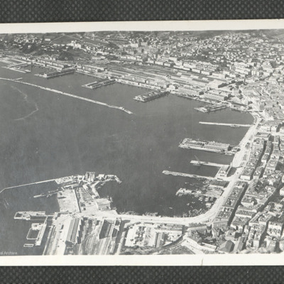
Trieste
A clear oblique aerial photograph of Trieste ports, orientated with the NE at the upper edge. In the upper part of the photograph are the railway marshalling yard and quays of Porto Vecchio, together with the long breakwater. In the right hand area…
Tags: aerial photograph
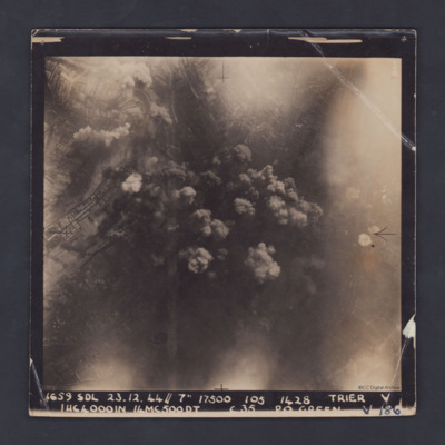
Trier
A vertical aerial photograph taken during a bombing operation at Trier. Some industrial buildings can be seen on the left. Details in the central area are obscured by smoke from explosions.
The photograph is captioned:'1659 SDL 23.12.44 // 7" 17500…
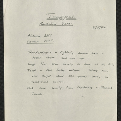
Trappes, Edward King's 14th operation of his tour
Six items, Edward's description of the operation to the railway centre, commenting on the thunderstorms encountered, his navigation plot, the expected H2S plot of the target with their track marked, a press cutting captioned 'Wrecked locomotives at…
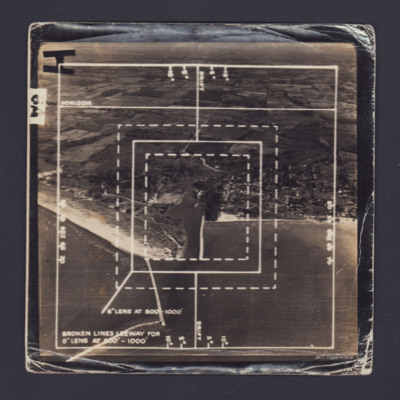
Training aerial photographs
Two oblique aerial photographs with fields of view marked for 8" lens. #1 The image shows the coastline of Port Burwell, Ontario, Canada. #2 has similar marks but less annotation and shows fields. On the reverse of both 'On loan P&R Darby…
Tags: aerial photograph; aircrew; bomb aimer; training
Tours airfield
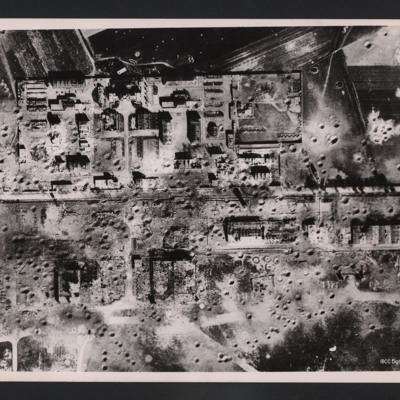
Vertical aerial photograph of an area showing severely destroyed buildings and large craters appearing throughout. A road is going through the middle of the buildings and the area is surrounded by fields, also covered with craters.
On the reverse…
On the reverse…
Tours
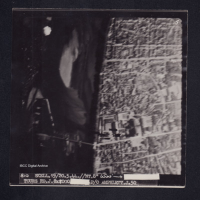
Target photograph of Tours. River Loire running top to bottom, road bridge across river and Saint-Gatien de cathedral visible. Captioned '5'', '810 SKELL.19/20.5.44.//NT.//8" 6500' [arrow] [censored] TOURS RD.J.8X2000 [censored]P/O AMPHLETT.J.50'. On…
Tours
Photo 1 is a vertical aerial photograph of Tours. The city is visible but there are incendiary tracks blotting out much of the detail.
Photo 2 is a vertical aerial photograph taken during the bombing of Tours. Explosions can be seen and a…
Photo 2 is a vertical aerial photograph taken during the bombing of Tours. Explosions can be seen and a…
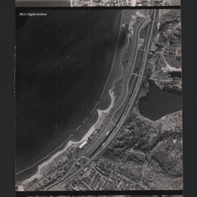
Toronto shore
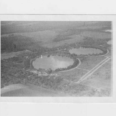
A vertical aerial photograph of a town at the edge of a bay. Parallel with the bay there is the Gardiner expressway and railway. In the bay are u-shaped structures. At the bottom there are between the road and the coast are holiday structures and the…
Tags: aerial photograph
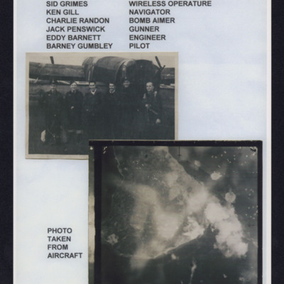
Tirpitz
Top - six aircrew standing in line behind a Lancaster, Captioned 'Crew from left to right, Sid Grimes wireless operator, Ken Gill navigator, Charlie Randon bomb aimer, Jack Penswick gunner, Eddy Barnett engineer, Barney Gumbley pilot'.
Bottom target…
Bottom target…

